and occasionally rides a bike.
A word of warning. The walk descriptions are not detailed enough to guide you - please take a map. The batteries never run out, and you always have a signal. Oh, And don't take left or right as gospel!

Monday, January 23, 2012

Aldwincle - Islip - Aldwincle

About 6 and a half to 7 miles. Led by Gordon. With Norma, Karen, Sue, Kate, Terry and me. Carol and Ian and Phil part of the way. Fine, mostly sunny, pretty dry underfoot, and flat. Map and details


We started the walk near the Pear Tree Farm tea-shop, walking along the main street, past the church, heading north on the Wadenhoe Road. 
A house called Onicle, corroboration of old local pronunciation!
Another house was called Ealda Nene, which means Old Nene. A few hundred yards past the last house we took a footpath on our right, north-east towards the Nene. We turned right when it joined the Nene Way, and headed south, parallel to the road, behind the houses.  
The Onicle Troll?
Rather than following the Nene Way right into Aldwincle, we kept walking ahead on the path. This emerges at the eastern end of the village, and we walked along a minor road to a lay-by, where we met the Nene Way and followed it into Titchmarsh Local Nature reserve.


The walk took us between the two large lakes - the trout fishery on the right hand side of our route was deserted.  We followed the Nene Way as far as Islip Mill, then walked a little further to a sluice near a new housing development. There is plenty of grass near the river for a pleasant snack stop.
We retraced our steps to the Mill, crossed the bridge and took the footpath on the left, which crosses parkland and emerges into Islip through the yard of the Rose and Crown pub.


We turned right and followed the road which becomes Ridge road, above the valley where the lakes and river lie.
Downhill slightly and back to the LNR, this time on the western side of the trout fishery. We continued straight on until the path met the junction of Lowick Lane and Lowick Road. Both Aldwincle churches are visible from here.  I thought one was Wadenhoe, but on closer examination of the map, I proved myself quite wrong.
Shortly after the junction we took a footpath to the right across a couple of fields to reach the Pear Tree Farm tea-shop where we had lunch.


A few pics from a previous walk  October 2008
John Dryden's birthplace - 1631

Orla the Harris hawk

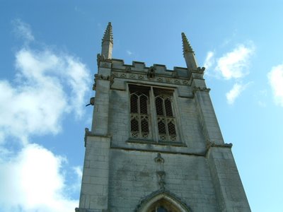
All Saints Church, Aldwincle

The walk also covers some of the same ground as this one from Thrapston to Barnwell Sept 2nd 2011.

Map and details

2 comments:

Harry said...

Dryden's birthplace looks a fine, solid place and that's a handsome hawk. Does it answer to commands in Gaelic?

aliqot said...

We saw the hawk a few years ago, but someone else mentioned it more recently. Unfortunately I couldn't remember the Gaelic for 'Who's a pretty girl then.'