and occasionally rides a bike.
A word of warning. The walk descriptions are not detailed enough to guide you - please take a map. The batteries never run out, and you always have a signal. Oh, And don't take left or right as gospel!

Saturday, January 26, 2019

Kings Cliffe, Bulwick , Blatherwycke, Kings Cliffe

Thursday 24 January, with Eddie and Maureen. 8 and a half miles, but it seemed longer, and quite demanding.

A dull day, quite cold, with ice underfoot at the start, and a chill wind. 

We set off from Wood Lane n Kings Cliffe and crossed the main road to walk downhill along Orchard Lane. We passed the footpath alongside the allotments and followed the road uphill to Morehay Lane, which is just a track, where we turned right. we eventually came to a place where a permissive path was marked. In retrospect we would probably have done better to follow that route. With the help of the map and my phone app we made our way over several rather muddy fields, arriving at a trig point, all of 85 meters high. 
 we were bale to find our way, but the paths and underfoot conditions were not good here.


The summit trig point, at the dizzying height of 85 meters above sea level...
I'm not sure we'd have found this without the phone app..there were alternative routes. 
After the trig point we aimed for the corner of Briary Wood, then the corner of Hostage Wood, then the smaller Bushey Wood, all the while walking across fields in a southerly direction. 
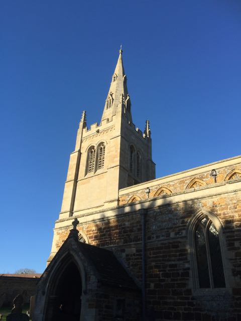
A small hiccup around the deserted building, but we found the path and headed slightly north of west towards Bulwick, going past Cadge Wood, then heading down. we turned left along the road into the village, and made for hot chocolate or coffee and fruit cake at the Pickled Village in Bulwick, to recover some energy. 

We left Bulwick along the path beside the church, keeping left and going north east to Blatherwycke.  The later section of the walk was more sheltered,and pleasanter walking, close to the Willow Brook, but had a dozen stiles, some of them were very awkward, quite high and the wood was slippery today.  At least one seems to be broken.

Along the Willow Brook, not far from the lake we saw a pair of black swans and a pair of white ones. By this time my phone battery was low, so no photos!  Just before Alders Farm there was a track to the left, but we continued to the farmyard and on. Eventually we crossed the brook and made our way back to Kings Cliffe via the path near the allotments.

Tuesday, January 22, 2019

Exton, Greetham, Fort Henry again

Monday 21 January, with Eddie and Kate. 7 miles, sunny, cold but not windy.
Route as on two recent walks. Most of the chickens were either inside or had been moved further on.  Coffee pause at the golf club - again! 


Lunch at the Orchard Cafe in Welland Vale Garden  centre, Uppingham.


Sunday, January 20, 2019

Great Cransley, Loddington, Thorpe Malsor, Cransley Reservoir.

With Maureen, Thursday 17 January, six and a half miles. Bright sunny weather too.


We parked on Church Lane.  We followed the no through road round to the right and turned right at the footpath through Cransley Wood. The path was a bit muddy, but very pleasant.
At the end of the wood, we follow a grassy track to the left, and the field boundary as it turned round to the right a little while later. The path turns left and along a disused railway track, over a footbridge.

This path emerges near Mawsley Lodge, a disused farm which is fenced off. Go past the farm, and turn right through a gate, along the edge of a couple of fields. The path meets another one, and here you turn to the right and continue in a northeasterly direction, going under a line of electricity pylons.


 The track bends to the left and is surfaced as it passes a large house and continues into Loddington, entering close to the Cricket ground.  You can take the left hand road at a junction, and vary the walk a little by passing the church. We stopped for a break in the sun, just before the church.

We walked through the churchyard and across the field to the main road out of Loddington. 


Next we had to walk along a pavement next to the road - luckily not a very busy road. At a crossroads we turned right into Thorpe Malsor.   Downhill a short distance and we turned right along a track just before the church.

  A wide track goes along the edge of woodland, then at the end of the first field it turns left.Before long Cransley Reservoir comes into view at the bottom of the slope. We walked across the dam and past the sailing club, then took the footpath through a gate, then slightly uphill with a hedge on your left, to meet the road back to Cransley. 

At the road we turned right past White Hill Lodge, and followed the road. A short distance before the village a footpath cuts the corner, through a field. To reach the village aim for the farm, but go to the right of it, and there is a stile.
This is close to the Three Cranes pub, which is now closed, and Church Lane.

We were greeted by the first mass of snowdrops I've seen this year. 

 There's a beech tree planted to celebrate George V's silver jubilee.
We took a short walk down to the church and caught a glimpse of the small lake behind Cransley Hall.


Hallaton, Cranoe again

Wednesday 16 January, with Marta. The weather was grey, and the slight drizzle we had during the first half turned into more persistent rain later in the walk.
We started the walk from the village green this time, and followed the same route as on the previous walk.


A break in Cranoe church porch again, and lunch at the Hare Pie Cafe this time.

Hallaton to Cranoe circular

Monday 14 January, with Marion, Eddie and Maureen. Around 6 miles.

we followed the route of this walk from Market Harborough Living, pp32-33,  but with a little extra at the start and finish.The early sun didn't last, but it stayed dry.

We parked near the Fox Inn, and walked through the village to the buttercross on the green, then took the lane to the right of the church past the primary school. 
 We went through the gate and alongside the football ground, then through another gate, where we took the left-hand path down towards the brook. The remains of a twelfth century motte and bailey can be seen on the right.
We continued southwest across four fields, passing close to a modern house and crossing the lane to it.  After this we went downhill quite steeply to a spinney, crossing a small stream, then climbed up to the farmyard of Othorpe House. We went straight ahead here and behind a barn sheltering cows, and onward toward Cranoe.
Add
 After some fairly strenuous ups and downs, we decided that a very short diversion to  Cranoe church porch was a good place for a short break.
 A navigational error added a couple of hundred yards to the distance, but was soon corrected, and we were back on track. There are just too many well-marked tracks in Leicesterhire!!

Ready for anything after all that climbing?
 After this the route was clear and level, with fine views all round. The route heads north for almost two miles, along the Midshires Way.  A short distance after crossing a very minor road to Goadby, the path turns right and heads east across fields towards Hallaton. There was a  very muddy bits, going down to a footbridge. 
Another tricky mudslide cropped up just before we joined the lane to Hallaton. We followed this lane over the ford, and uphill briefly, before taking the footpath to our right and through a field and the football field and back into the village.


Sandwiches and coffee at the Fox rounded the walk off nicely.

Saturday, January 19, 2019

Gretton to Harringworth Lodge, Bulwick and back - fig of 8.

Thursday 10 January, with Maureen and Eddie. 
The same route as on November 12th 2018.


Exton, Greetham and Fort Henry again

Monday 07 January.  With Maureen, Eddie and Kate. Following the same route as we did last Thursday.


Coffee time!

Beware flying arrows

Didn't see these before!

A fine specimen of fungus

Scones in the hide - lots of coal tits on the feeders.

Fort Henry again


Third time lucky for lunch - Barnsdale Gardens Tea room was closed, and so was Wellies. Luckily for us the Orchard at Welland Vale Garden Centre stays open in January!

Friday, January 18, 2019

Exton, Greetham, Fort Henry

Thursday 03 January
With Harry and Eddie. Around 7 miles.
We set off from Exton, near the Fox and Hounds pub, and walked along The Green (opposite side to the pub), and turned left along Top Street.When we reached Pudding Bag Lane we turned right along West End and past the estate farm buildings. We turned to the right and walked along the estate road heading northeast for about a mile


Here we turned left, following the Viking Way signs and followed the road as it zigzagged in a generally northwesterly direction. After about half a mile, as the road swings left, we took the footpath to the right and  soon turned left, walking slightly northwest again, with the hedge on our left.  This takes us through a large chicken farm, with chickens roaming freely.  
Eventually the path, which is well marked takes us into Greetham, past some more aristocratic looking chickens and some shatland ponies.


We turned right and walked along the main village road, as far as the Wheatsheaf.
Here we walked down the small road to the right, and soon came to footpath signs. We took the left hand side on, which follows the brook.

We followed the footpath along the field edge and eventually to the golf course and the club house, where we stopped for a coffee - and a scone each.


Suitably refreshed we tackled the second half of the walk, along a public footpath near the golf course, past a small lake and bird hides, then climbing the steps to meet an estate road.


Across the road, down the steps opposite, then along the footpath until Fort Henry came into sight.

At the next estate road we turn right for a short distance before taking a footpath to our left, which has another lake on the right.
At the end of the lake we turn right and head west, over a stile and along another track. We continue in that direction, ignoring a turn to our left. 
Do i look the part?
We follow the road and emerge into Exton along New Field Road. From there it's a short walk back to the Green, along Stamford Road.

Kirby Hall and beyond

Tuesday 01 January
With Harry, past Kirby Hall to Priors Hall golf course edge. almost 7 miles.


Thursday, January 17, 2019

More catch up posts from December 2018

I've done a fair bit of walking in December and January, but haven't recorded them all, so here we go - again!

Monday 10 December

A ten miles walk from Market Harborough to Foxton Locks and back with Norma, Maureen and Kate. The same route as the one we did on December 06. 


Wednesday 12 December

Four miles around Fineshade Woods with Marta.


Thursday 13 December
Walk from East Carlton to Neville Holt, via Drayton. With Maureen and Eddie. Just over 8 miles, and the last muddy stretch uphill was a killer!

Bringhurst

A garden ornament in Drayton

Onwards and upwards....

Neville Holt
Monday 17 December
a superb day. Bright cold weather. Eddie and I walked from Gretton, to Harringworth Lodge, down to Shotley and Harrinworth, across the valley and under the viaduct to Seaton, then to Lyddington and Gretton. 11.5 miles in all. Quite a workout.