and occasionally rides a bike.
A word of warning. The walk descriptions are not detailed enough to guide you - please take a map. The batteries never run out, and you always have a signal. Oh, And don't take left or right as gospel!

Friday, August 31, 2012

Rutland Round 5 - Normanton to Clipsham

With Marta.  Fine, sunny, but cold to start with.  Some mud underfoot. Luckily I remembered the way through Clipsham Quarry.  Only other small problem was on the way to Tickencote where we missed a turn to the right, but were able to correct easily. Lunch at The Plough in Great Casterton. 14 miles including walk to Yew Tree Avenue.

An early morning shot before leaving one car here

The first two miles from Normanton Car Park on Rutland Water were very simple - follow the yellow brick road, well, the tarmac path, past the café,  past Normanton church and the back entrance to the Normanton Park Hotel,  and carry on across the dam. Blue sky, blue water, and a chilly north wind.  A few cyclists, loads of sheep and the guys inflating those see-through balloons you can be strapped in to roll down the grassy slope behind the dam. 

Instead of going through the gate at the end of the dam path, we followed the field edge round, almost turning back on ourselves.  We walked along the edge of the wooded area, and shortly after a couple of trig points, or similar objects, there was a stile on our left which led into a field.  We spotted the Rutland Way signs for the first time today - and on the stile.  
Ten out of ten for clarity!
The signs were easy to follow from this point, leading over fields and through some woodland, until the path emerged into Nook Lane in Empingham.  Nook Lane leads to the main A 606.  We crossed over to walk past the White Horse pub and along the road through the village.  The church was down a small road to the right as we walked straight on.

Just after the end of the village, very soon after Mill Lane, the footpath goes away from the road, up through a short stretch of woodland - Chapel Spinney.  A little further along the road after the turn there's a convenient bench for our first stop of the day - a little chilly in the shade, so we didn't linger longer than the few minutes needed to top up the caffeine level.

The path came out of the trees into sunshine and continued along the top edge of several fields.  Empingham was now a cluster of houses and the church behind us.   We passed a spinney on the right, and continued to follow the path. There may be a waymarker that we missed, but we fought our way thorugh an overgrown section and came out on the concrete path leading towards Tickencote Lodge Farm.  We had just walked round the two sides of a triangle instead of the hypotenuse - give or take the accuracy of the right angles.


Tickencote Lodge Farm
We turned right and walked down the track until we met the Rutland Round waymarker pointing back to where we should have walked.  Close by was a stile into the next field of recently cut hay, which we crossed diagonally (just south of east) to the next yellow post just before another farm house.  

We followed the signs round the house and on to a small road north east for a short distance, before entering a couple of fields and walking in the same direction, the turning slightly to the right.
Tractor tedding hay near Tickencote
We crossed another small road towards Tickencote Hall, and had to brave this signposted danger:


He seemed to be dozing in the shade and showed no interest in us.

Looking towards Tickencote Hall
The path goes past the church of St Peter, which is small but impressive. It was restored at the end of the eighteenth century, but is considered a fine example of a Norman church.
The vaulting
The chancel arch
The East End of the church
We walked through the village to a sign and short section of path which crosses a field, then emerges on to a road near the OK Diner, then goes under the A1 and into Great Casterton.  The Plough Inn is right on the route and provided an adequate, though not perfect lunch, with exceptionally friendly service from its new landlord. 

Chatter, imperfect map-reading and inattention to the book's instructions almost set us off on the wrong road after lunch - and all on fruit juice at that.

You need to walk along to the junction with the Pickworth road, and turn left past the primary school - or take the narrow lane between houses just before the school sign on the main road.  In any case take the road out of Great Casterton past the school and walk along this for a good mile until you reach Mounts Lodge Farm.  Opposite here a bridleway leads to the left - almost due west.  The path was pretty muddy - puddle-dodging skills honed while you walk.

After a few hundred yards, at the end of the first very big field, we turned right along a grassy track.  We continued along this, ignoring any tracks to the right or left, and made our way more or less north towards Pickworth. The signing around here is pretty poor.  Just opposite the point where the path meets the road is this medieval arch.
Photograph from 24.11.2011

The arch, on private land is all that remains of a church from the 12th, 13th or 14th century.
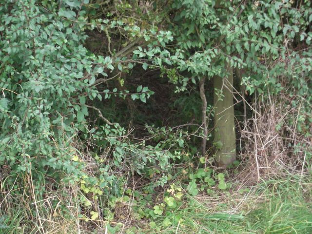
The remains of a lime-kiln, where John Clare worked for a while as a lime-burner. - 18.11.2011

The lime-kiln is also on private land, and almost invisible in the summer.
We turned left along the road, and walked past the first footpath sign near Manor Farm, and past the limekiln, to find the path we needed, which goes off to the right at a bend in the road.  Time for another coffee-break, before tackling the remaining three or four miles.

The path is wide and clear, and we had no trouble finding the point where we turned right across a field towards a strip of woodland marked as Little Sutie on the map. Through this was where I had wandered last time i walked here. The map shows the path diverging slightly from the wood on the right hand side.  This time we followed the edge more closely and we found the path through the quarry with no difficulty. Once at the quarry the bridle way is clearly posted.


Clipsham Quarry 24 Nov 2011
The path from the quarry towards Clipsham provided a few earlyish blackberries today. No problems following the route from here as for most of the way it runs between hedges,  and the village is clearly visible. 

We walked along the Castle Bytham road for about a mile to get back to the Yew Tree Avenue. Fourteen miles on the clock today. 


Map and details

Thursday, August 30, 2012

Southey Wood and Castor Hanglands variation with Ufford and Upton

Led by me. With Gordon and Barry. Mostly grey, but dry apart from one heavy shower which we dodged in the Granary café. Some muddy patches. About 10 miles.


We parked at Southey Woods - walked north, then west, following the main path through the woods until we reached the metal gate, where we turned right, north along the bridleway known as "the drift". At Marholm Road we turned left ,  swinging right through Ufford.   This village is well worth a wander.


The information board was erected in 2000, and explains the history of various buildings.


The church stands at the highest point in the area, and was the site of a beacon, one of a chain nationwide, warning about the Spanish Armada.
Ufford Hall is a grandiose building dating from the 18th century. 
Picturesque houses.
There are several examples of dates and inscriptions on the walls - for example
Newport Farm MCCLXX
and this one:


Before the last of the village buildings we took a footpath to the right which follows the edge of fields.  Be sure to take the path to the left of the hedge when this is possible, and you'll avoid the hedge burrowing experience.
Exit strategy?
The path came out at the side of Jubilee Wood (planted for Victoria's jubilee) on to High Field Road.
We turned right here and followed the road to the T-junction. We turned left along the only slightly busy stretch of road. At the cross roads we carried straight on the to Granary tea shop.
Here we had a well-deserved coffee break, while the heavens opened.  Luckily this didn't last long.

We followed their private path into Castor Hanglands and through Ailsworth  Heath. We kept going south through the wood.  This was noticeably muddier than it had been last week. I was lucky enough to see a fox cross the path a short distance ahead of me.

 Outside the wood we walked south until we saw a sign and a cross track.  We turned right (west) and followed wide track along the field edge.  The wheat we saw last week has been harvested, but those strange structures - horse jumps? - are still there.   Instead of turning right and across fields to Manor Farm we continued west beside trees until the path turned sharp right, then left (labelled on the map as Blind Lane track).  At the left turn there are tree stumps obligingly carved with an initial each - these make excellent seats.  We followed Blind Lane as far as the road, where we turned right and walked past Model Farm and through Upton village.

We followed Church Walk round until we emerged nearly opposite Manor Farm and the church.


We were curious about this stone pillar, fenced off in a field near Manor Farm


Church of St John the Baptist

W.C. 1767

We returned to the track which took us over the cattle grid and headed north towards Southey Woods car park. On the way we passed this 'observation tower', but decided not to try climbing the rather uninviting steps.
Soon afterwards we could see the car park where we finished the walk.
Map and details

Thursday, August 23, 2012

Southey Wood and Castor Hanglands

Led by me, with Gordon. Sussed out a few possible variations. Pleasant, warm not hot, a lot of woodland walking, some heathland, some road walking. Coffee at Granary/ Farm Shop. 8.6 miles total. Some mud in Castor Hanglands, but not bad. Saw and heard green woodpecker.

We parked at the entrance to Southey Wood, and walked along Langley Bush road north-east to the corner where the plaque, erected in 2009, tells of the history of Langley Bush.  John Clare wrote a poem about  Langley Bush.


Langley Bush Road bends to the left and continues north to the junction with Stamford Road. We turned left and walked along until it becomes Marholm Road. Shortly before the village of Ufford we took a bridleway to the left, which led us into Southey Woods.  The path turns left and there is a barrier to stop vehicles entering.The main track thorugh the wood is easy to follow as it goes east, then turns right, left and right once more before continuing pretty well south, past a picnic area to the main entrance. 

We stopped at the car for a break 0 a little early as we hadn't yet covered four miles. 

Next we took the bridleway opposite the Southey Woods car park. This goes south, past a farm building and a stretch of woodland, underneath a line of electricity pylons, then past a small church on the left.  This is part of the tiny settlement of Upton.
The church of St John the Baptist, Upton.
Shortly after this we turned left and walked past a field with a stone artefact.
Is this a sundial? See link about Upton.
Next we walked along the edge of Manor Farm's yard. 
Perhaps not a way-marker? It'd be a good one.
 The path continues across a couple of fields, more or less south-east, then turns slightly left (east) along the edge of fields.
What?  Why? We saw a similar arrangement with a bench.
In less than half a mile we met a north-south path, which crossed our route. We turned left to head north into Castor Hanglands Nature Reserve.  Once again the path was easy to follow - there is plenty of insect life, and the woodland stays quite damp.  The reserve is interesting and contains heathland as well as woodland - in parts it is almost a mini-New Forest area.
Not quite New Forest ponies
At the northern end of the reserve it is possible to take a path directly to Southey Woods, to the left. We carried on, and just as we turned right along the northern edge, we noted a permissive path for customers of the farm shop.  On this occasion we took the longer route, coming out at the road (between Ailsworth and Helpston).  A couple of miles of road walking took us past the farm shop, then we turned left onto Langley Bush Road and retraced our steps to Southey Woods car park.


At one point we heard the loud call of a green woodpecker and saw it disappear into the woods.


Map and details

Wednesday, August 22, 2012

Rutland Round 4 - Barrowden to Normanton

With Marta. Fine day, with a slightly chill wind. Sun mostly, a few spots of rain. Underfoot good. Lunch at Ketton, Northcliffe Arms. Just over 11 miles in all.

Leaving Barrowden 

We set off from Barrowden, with an unaccustomedly chill wind today. Walked through the village to the road towards Wakerley until we found the footpath going off to the left.  We walked with the hedge on our left through three fields, then when the path meets a bend in the river we went through a stile and along above the river for another three fields before entering Welland Spinney.
The path is clearly marked. When you come out of the spinney it is usually easier to follow the edge of the field, rather than cut the corner as the official path does. Turn left and right following the field boundary, then carry on, ignoring paths to the right, including the one to Tixover Church, which stands in splendid isolation away from the village.
Is this really a cairn? 


The path goes past Manor Farm, Pear Tree Cottage and other houses before turning to the right and downhill. After Tixover Hall and Lodge the road peters out and becomes a footpath, separated from the A47 by some shrubs.   Before long you arrive at the point where the road to Duddington leaves the A47, and you can see the bridge over the Welland.


Bridge and old mill at Duddington, seen from the path

Just before the bridge the path turns to the left - it is both Rutland Round and Jurassic Way for some distance here.  We walked this on 25 July 2012.  


The blue paint - anti-vandal paint perhaps - is still on the gate, as before, and still sticky, but this time the gate was open, so we had no contact!   We followed the path over a large field with sheep, and up to a stile into a strip of woodland.  While we were walking we heard a green woodpecker, then saw it fly and land on a nearby telegraph pole.  There were a couple of herons across the river, and a red kite.  We chose to have a break at about the same spot as last time, but today, instead of seeking shade, we looked for somewhere out of the wind.  

Next we crossed the playing field - or so marked on the map. The path goes straight across the middle of the field, and emerges on to the road near Tixover Grange.  Just after the drive the path leaves the road on the left hand side, and cuts diagonally over a field, cutting the corner off the road. The route continues directly opposite and there is about a mile of perfectly straight walking along the edge of arable fields. Near Kilthorpe Grange it has been slightly re-routed, but is clear and easy to follow.   It continues along a narrow path with fencing from large gardens on the left, and trees on the right, until it meets the Collyweston to Ketton Road.  At this point the Rutland Round diverges from the Jurassic Way again, so instead of turning downhill we carried on into Geeston and Ketton. Signs for the Hereward Way are also good for the R.R.
There was a convenient bench near here.
We walked along the road past the house in the picture until we reached a house called 'Newnham'.  Here we turned left and followed the track and path to the railway line. We crossed the footbridge.

You can just see the signal
We followed this to reach the bridge over the River Chater, and the old priory and church


Then we wandered along the main street in search of food. We had lunch at the Northcliffe Arms, which has a pleasant outside non-smoking area.
The Railway Inn was closed

The word Ketton was removed pre-world war II, in case of invasion

After we had eaten we found the path close to the Post Office. It leads past Home Farm, and climbs gently up towards the huge quarry. The path is clearly marked and easy to follow across a very strongly built bridge.

We had a little trouble working out the way just after this section, but with a bit of map work and aligning the cement works with our position we sorted ourselves out before we'd gone off track.
We went past New Wood Lodge and made our way to the road. It was straight over the crossroads, and in about 200 yards we turned right.  This road took us directly past Normanton village - we didn't take the turning to the right, but carried straight on.  We went past Oak Tree Farm, and  Rutland Water was  visible ahead of us.  When we reached the main road we crossed over and turned left into the car park.


Map and details

Monday, August 20, 2012

Barrowden to Fineshade and back

Led by Mel. With Norma, Joe, Karen, Eddie, Gordon, Barry, Maureen and me. Fine, rather humid and cloudy until lunchtime. A few muddy bits in woodland. Just under 11 miles.

The route is the same as this one , but the starting point was different and we did the walk in the opposite direction.

As the route is pretty familiar I thought it was time for some people-pics.


Eddie, Barry, Maureen, Gordon
Alison, Norma

Karen and Joe
Norma, Mel and Gordon
Cake, by Maureen.
Descrip of walk later.


map and details