and occasionally rides a bike.
A word of warning. The walk descriptions are not detailed enough to guide you - please take a map. The batteries never run out, and you always have a signal. Oh, And don't take left or right as gospel!

Saturday, December 8, 2018

Market Harborough to Foxton Locks and back along the canal.

Thursday 06 December, with Maureen. Again, we changed our original plan because of muddy paths!  
We set off from the canal basin near the Waterside restaurant. Luckily we were intercepted by a nearby resident who told us that we should make a detour along the main road for about a quarter of a mile. House-building is in progress and one of the bridges is closed until February. 

We duly turned back and walked away from the town until we found the footpath sign which took us back to the canal, where we turned right along the towpath.  It's about five miles to Foxton Locks.

One of Sustrans millennium posts

 After five miles we were hungry, and put that right at Bridge 61 pub. A brief rain shower was almost over by the time we emerged.
Foxton Locks
Almost sunlight!
At one point we saw a kingfisher flying straight along the water, not looking as shiny as one sunny days.

We had another short break on the way back, but, for the first time in a while we walked (just) over ten miles.


Pitsford Water clockwise

Thursday 29 November

With Eddie and Maureen. It was rather cold and windy with occasional drizzle, so Pitsford seemed an easy option. We kept a pretty steady pace of just over three miles an hour - in spite of a very brief break. The weather just didn't encourage hanging about. With heads down, we didn't see any notable wildlife. Where have all the lapwings gone? 


Ready for whatever the weather is throwing at us!


Friday, December 7, 2018

Lyddington to Uppingham by road.

Wednesday 28th November 2018. With Marta. Wet weather, so we decided to avoid the muddy fields. Just under 5 miles. We walked to Uppingham and wandered around the back streets on the heritage trail. 


Let nothing filthy, spoken or seen, enter the threshhold within which there is a child. (Juvenal)


The fatstock market was in the square - lots of pigs, sheep and cattle. Coffee in The Crown.


And then we walked back - down the hill!

Just nder

Thursday, December 6, 2018

Circular, Lyddington to Stoke Dry .

Monday 26 November 2018.  With Eddie and Norma. Six and a half miles. We set off from Lyddington, taking the road south out of the village. Soon after the minor road to Thorpe by Water we took the public footpath ( not the permissive one) which heads across the fields to the A 6003. We crossed this road and turned right, walking uphill for a couple of hundred yards alongside the road, until we saw the footpath sign pointing left. The path took us uphill to a point where we got views of Eyebrook reservoir. 


 The path then went downhill and almost to the edge of the water, though there's a fence with a "Private" notice. We should have continued close to the fence, but were distracted by a gap in the hedge and veered off too far to the right, passing this magnificent oak tree,
 before finding the correct route again! 

It's so easy to wander off track!!

 When we arrived at the road we turned right and walked uphill into the village of Stoke Dry, with its intriguing church of St Andrews.


Wall paintings inside the church.

 We had a snack break at the church before continuing along the road and back to the A 6003. We crossed the road, and took the footpath through fields down hill joining the minor road (Stoke Road) just before the village. To complete the walk we did another loop of a mile or so on the footpath behind the houses on the opposite side of the road. 

Monday, December 3, 2018

Kirby Hall from Gretton circular

Monday 19 November with Norma and Eddie.  Just under 5 miles, followed by lunch at Lydia's .

Starting from the village hall, along the dusty track past Kirby Hall, across the road and follow the footpath before turning right to go past the data storage centre (?). Turn right along Gretton Road, go past the junction with Kirby Lane. At the recycling plant turn right again along the footpath and follow footpaths back into Gretton.


Sunday, December 2, 2018

Gretton, Thorpe by Water, Caldecott, Gretton

With Eddie, Thursday 15th November, 7.5 miles approx. 

We took the path down Church Gap, and out into the field with ridge and furrow. We cut across to the half-hidden gate. Through the gate and along the path to the railway line - cross with care. On the other side the path goes downhill over a field which is often muddy, then follows the hedge. Just before farm buildings the path goes through the hedge and we turned right along the farm track.  At this point the path has diverted slightly and now follows the line of the Welland. There is a new bridge since I last walked the route three years ago. Not quite Monet, but at least it has two handrails. 


 When we reached the B672, we crossed it and walked along the minor road into Lyddington. A favourite of mine, with its very mini switchback, and little traffic. As we joined Lyddington we turned left, away from the village, and took the permissive footpath on our right, just outside the village. 
This was not the path we intended to take, as we soon realised, but we followed it and with a bit of map reading and a slight retracing of steps we rejoined the original path, over the fields, including one with a few curious, but not aggressive cows. We reached the main road, the A6003, at the electricity substation. Here we turned left and followed the main road into Caldecott. This section, about half a mile, is not to be recommended, even though the verges are quite wide - it's very noisy and busy.

From Caldecott we took our usual route across the valley.  We turned left along the B672, and after less than half a mile the footpath turns off to the right. we followed it , coming closer to the river after a few fields. We reached Mill Road at the weir and made our way back up to Gretton.

Saturday, December 1, 2018

Gretton, Rockingham, Caldecott, Gretton

Wed 14 November.  With Marta.  The same route as on Thursday 1st November.  About 9.5 miles.

 Views over the Welland valley


 Approaching Rockingham - placid cows

 and goats.
 We stopped in the tea-shop on Rockingham, before continuing to Caldecott, and back close to the river
 before heading up the hill to Gretton.


Monday, November 12, 2018

Gretton, Harringworth Lodge, Bulwick fig of 8

Monday 12 November 2018. With Eddie, just under 10 miles. A glorious autumn morning, underfoot pretty good, but some muddy patches. 

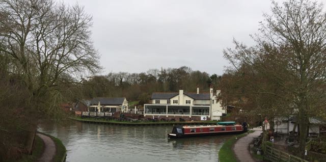
From Gretton village hall we turned along Kirby Riad towards Harringworth, and took the Jurassic Way past the cow barn, and over the fields as far as Harringworth Lodge. At the end of the lake, we turned right just after a hedge, where another path continues round the lake.   We crossed two fields then the minor road between Deene and Spanhoe.  The path continues in a straight line across four fields towards a small wood, called Bantrup Bushes. At that point we turned right and shortly after the end of the wood, left, following the hedge until we turn right and join a surfaced track. This leads to Red Lodge Road and we turned left to cross the A43 by a bridge.


 We went into Bulwick and had a coffee at the village shop - The Pickled Village. 
A quick look at the map and we decided to try a slightly different route to return. This went along the Red Lodge Road until the road turns o the left and a bridleway goes off to the right. There are not many waymarks, but the route is clear with a map - over a loughed field, then alongside a hedge, and across another field, aiming for the corner. A short section after this took us to the Spanhoe-Deene Road again. We turned right and rejoined our earlier route a little further along, where the path turns left across fields and back to Harringworth Lodge Lake.

We walked past the house and buildings, turning left from the main drive to take the footpath behind the tennis court. Then over the stile, and turn right. When we meet a crossing of the ways we turn left to start heading back towards Gretton. We stuck pretty well to the route, although we detoured round the first ploughed field.

After three more fields where the stiles are marked, we rejoined the Jurassic Way and returned to Gretton.

Friday, November 9, 2018

Foxton Locks to East Langton.

With Maureen and Eddie. About 8.5 miles. Flat, some mud. We were doing a check on part of the Leicestershire Round route.

We set off from the Foxton Locks Top car park, walked along the road as far  as the canal. we turned left and kept the canal on our right, passing the viewpoint over the inclined plane, and then the small museum, before crossing over to the other side as we approached the bottom end of the flight of locks.
View towards the top cottage

The inclined plane

Looking over towards the bottom of the locks

The top cottage cafe
 We kept to the canal towpath, not taking the Leicstershire Round route, partly because it is poorly marked from this direction. we left the canal just before the JG Pears factory, and crossed the B6047 to pick up the footpath which goes to the left just before the weighbridge. For once this path was easy to walk and has obviously been cleared. I have felt the need for a machete before now!

Our route heads north across a couple of fields and becomes the Leicestershire Round, which leads us under the mainline railway and over the Langton Brook via a footbridge, then across fields, past the memorial stone to a horse called Lottery (the first winner of the Grand National - see link and this one. ) There's a picture by John Frederick Herring Senior in the Woolavington Collection of Sporting Paintings at Cottesbrooke Hall as well.
Eddie has just paid brief homage to Lottery.
The path here is clear, well marked, with a few stiles and gates. Before long we arrived at the bench at the bottom of the hill into East Langton, and stopped for a break.

We returned along the Leicestershire Round path, following the route in reverse - past Lottery's stone, over the footbridge, and underneath the railway. After another two fields and a strip of woodland, there are two more fields. The factory can be seen ahead. We crossed the A6 and went up the steps on the other side. After another field we turned right following the sign, towards the B6047.  This time our way was clear, apart from some dropped litter. I have seen it overgrown and virtually impassable in the past. We came out at the road, and turned right for a short distance to use the central island to cross the road.

The footpath sign leads us down a concrete slope and to the corner of a field. The path should take us about 50 yards to the left of the small brick building. I didn't spot the path today, so we ended up doing the two sides of a traingle instead of the hypotenuse, but we picked the path up at a footbridge . We followed the waymarkers, although there is one point where we were unsure, but eventually we came out at a gate and stile to a path between houses and outbuildings. This leads to Swingbridge Street, in Foxton.  Turn L and soon R to take footpath between houses to Middle Street. Turn L, then R on path between hedges to Main St, opposite Shoulder of Mutton pub. Turn L and walk up to Canal, turn and follow Canal to Foxton Locks. Signage a little hit and miss through the village.

Maureen and I stopped for a tuna sandwich at Bridge 61.


A quieter scene than in summer.