and occasionally rides a bike.
A word of warning. The walk descriptions are not detailed enough to guide you - please take a map. The batteries never run out, and you always have a signal. Oh, And don't take left or right as gospel!

Showing posts with label Burton Overy. Show all posts

Monday, July 29, 2024

2024/07/08 Illston, Carlton Curlieu, Burton Overy

 Monday 08 July

With Norma, Kate and Maureen. The w eather this morning was excellent for walking - but it got a bit hot later.  


We started from Illston on the Hill - and walked to Carlton Curlieu


where we found a welcome bench.


From there we continued to Burton Overy


and back to Illston.

The total route was 5.5 miles.


Norma saw a green woodpecker (I heard its yaffle but didn’t see it)


Wednesday, April 5, 2017

Illston, Burton Overy, Little Stretton, Kings Norton


Monday 03 April, 9.50 am. With Norma. Fine sunny weather, and very little mud underfoot.
8.3 miles in all.

This is the same route as this walk  and this one, but it's spring now, and feels different. 

Leave Illston by the gate at the end the no through road past the pub, and go up to the next gate on the left. Turn right, and at the end of the next field take the left-hand path. If you can't see it, take the right hand one, and you can join the correct route a couple of fields down via another stile.

Keep Illston Grange on your right, and follow waymarkers to a stile leading on to the metalled section of Gartree Road. Cross the road and follow way markers (easy to see at this time of year) through a few fields, coming out near a farm on a road with a cattle grid. Cross the road and follow the path over two fields to the road leading into Burton Overy.

Houses in Burton Overy.
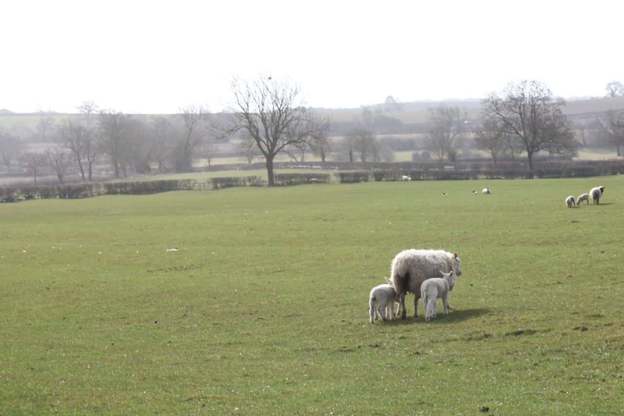
 Turn slightly left then right, past The Bell, and over a small bridge, near which is an oak tree planted by the local WI in 1988. Soon afterwards there is a path leading off on the right hand side into a field full of sheep and lambs.


The path goes slightly uphill to the corner of the woodland and on to meet the road between Kings Norton and Great Glen.  It becomes a bridleway, and is easy to follow, behind a couple of houses, labelled on the map as The Cottage. Some way further on, at a field boundary there is a permissive path allowing you to take a short cut towards Little Stretton. 

At the road turn left, and look for a driveway and footpath. Public Footpath for 420 yards it says, but it leads past a pond, and a large house, then into a narrow path behind some barn conversions, and into a field behind the church, and round into Little Stretton churchyard.

The church is more visible in spring, through the trees.
 A bench near the church provides a good stopping place.


Little Stretton church
Almost too pleasant to move, but needs must. We walk out to the road through the village, and just outside the footpath goes off to our right, clearly marked, and made good through the growing rape crop. It leads us to Kings Norton, coming out very close to a farmhouse, on the road above the church. We walk down, past the church, turning back to snap this most photographed of churches - by me anyway.

Kings Norton Church showing off its best side in the sun
We take the road to Illston, and when the road bends to the left we carry on ahead on a byway. Today the cows are the other side of the fence, and one or two sidle up to say hi.
GPS is the latest fashion, darlings.
 From here it's straightforward. Follow the byway to the road, turn right and at the next junction look for a footpath sign in the hedge on the left. This takes you back past Illston Grange, which is on the right. There are lots of sheep and lambs here too.
In the opposite corner, a little way past the Grange is the path, through a series of gates near the horse area. Follow the waymarkers and the path goes along field edges down into a dip and then uphill and back to Illston.

Monday, July 22, 2013

Illston circular - Kings Norton, Little Stretton, Burton Overy, Carlton Curlieu


Mon, 2013 Jul 22 9:36 AM British Summer Time
Led by me, with Gordon, Barry and Maureen, Cloudy at start, then v hot. Dry underfoot. Eight and three quarter miles.


Mostly the same as two recent walks done on Thursday 18 July, and Thursday 11 July, but this time anticlockwise, and with a short extra loop.

We take the right hand path after the small field in Illston, hugging the hedge, then through the wheat and behind Illston Grange, over the pasture, with a small stand of trees on our right and the house on our left.  When we leave the field at the crossroads,  we turn right and walk a short distance along the road before taking the byway to Kings Norton. 

The views of the church from this path are magnificent, and Gaulby Church is visible as well.  The byway goes in a straight line to the road, and then uphill to the church and the village.

 At the road junction we ignore the road to the right and carry straight on. The footpath goes to the left past a farm, and through the farmyard.  We follow the way marks over a couple of fields and across a bridge through the hedge to a road, where we turn left, and just after the junction to Little Stretton, we pick up the path at a farm gate, near some large agricultural buildings. 

There are a fair number of butterflies on the wing, and around the thistles.
Hmm - just closed its wings!


Over a few more fields, and the odd stile, and we arrive at Little Stretton.  As last Thursday, the church porch is a pleasantly cool place to sit for a while.

We follow the path, past the old Manor House and the pond, along the avenue of trees to the road. We turn right and find our path just after the junction towards Stoughton. We turn left and walk along the edge of a field of wheat. At the far end a quick read of the map sets us on the right route and we follow the path past The Cottage, across the road and over pastures towards Burton Overy.  The pub appears to be closed today.  

I offer two alternative routes - one of about 2 miles, one of 3. Barry says decisively, "Oh, I think the longer one!"  Suits the rest of us, so we walk uphill from the village on the Carlton Curlieu road. When the road turns to the left we continue through a farmyard and fields directly to Carlton Curlieu - we can see the church on the hill ahead.

This village has a tempting bench so we take another rest - Maureen and I almost have a nap. But we must onwards.  From the Illston Road theres a bridleway to the left, which swings right between two hedges as far as Carlton Curlieu Manor.
Gordon strides ahead
Here's Maureen, with Barry as lanterne rouge.

Ha! caught this one just before it closed its wings!


Across the road the path takes us below the Manor, beside the hedge, then uphill and through a large wheat field. We reach Illston before too long - quite pleased to get away from the heat.

Map and details


Friday, July 19, 2013

Illston circular via Burton Overy, Little Stretton, Kings Norton


Thu, 2013 Jul 18 9:50 AM British Summer Time
Led by me, with Maureen and Eddie. Very hot, good underfoot. Same as walk a week ago. About 8 miles.

The same route as last Thursday's walk, but  without the unintentional strayings. I won't describe the route in detail here.

If you look at the photo above really really carefully, you may just see the waymarked yellow post among the leaves. This is at grid ref SP691984.  To be fair the path is now clear on the ground, as the hay has been harvested.  Last Thursday I was distracted by a wide opening in the hedge about 50 yards to the right! 

After crossing the minor road close to a cattle grid, we cross a field with cows, and another piece of grassland, then join the minor road again as it goes downhill to Burton Overy. We've cut a corner off by footpath.

These cows had no intention of leaving the shade of the trees - wise beasts.
Burton Overy church lies to the west of the path
We walk through Burton Overy, noting that the Bell is open later.  We find the path and take this as far as the footpath to Little Stretton.  It's not very clear through the last cornfield.

Little Stretton Church was and is dependent on Kings Norton.  

There is a bench in the sun, but in today's heat we decide to shelter in the porch for our break.

Then its through cornfields and pasture to Kings Norton, where we have a peep inside the church.

This is a photograph of an eighteenth century painting of the Fortrey family. William Fortrey was responsible for the rebuilding of Kings Norton Church between 1757 and 1775. For more about the village British History Online has a page with loads of information.
This monument was erected by William Fortrey  in memory of his parents, William (d. 1722) and Anne (d. 1733).
More tagged cows, with Kings Norton Church on the horizon.
We make our way back past Illston Grange and its horses - who are all thirsty today.
We drive by a slightly roundabout route to Burton Overy - a pint of iced lemonade!


Thursday, July 11, 2013

Illston circular via Burton Overy, Little Stretton, Kings Norton.


Thu, 2013 Jul 11 9:32 AM British Summer Time - finished at about 1pm. 
Just over 8 miles. With Gordon. Fine sunny day, rollingly hilly. Good underfoot, some paths not clear on the ground.

Exploring more of the many paths around Illston.  This time we take the left hand path after the small rough field at the southern end of Illston. This goes through the middle of the field, and is fine and wide through the growing wheat.
We follow it downhill and up in front of Illston Grange, which lies on our right as we walk.

The path leads to the road - a metalled section of the Gartree Roman Road - and crosses it. We carry on in a southwesterly direction until we reach another minor road. We stray slightly from the route, then find the cattle grid and the path signs. Over more fields to the road down into Burton Overy.
I like these brickwork patterns
We walk straight on past the Bell - too early anyway. After a couple of hundred yards we find the footpath sign on our right. We pause to say hello to a solitary walker indulging in a peaceful coffee - he tells us he's on his way back home.
The black sheep family
We head north west to the opposite corner of the field and carry on in this direction until we meet the road between Kings Norton and Great Glen. The path becomes bridle way, and continues along the field edge past a couple of houses marked on the map as The Cottage. We go pretty well straight and up hill, then have a break before making our way by an unintentionally devious route to the road junction. I blame paths not made good and clear for our straying.
At the junction we take the road towards Little Stretton - this is the busiest stretch of the route, but it's not long.
Our next footpath sign is at the end of a drive on our left. Public Footpath for 420 yards it says.  It goes right into Little Stretton past a pond on our left and a big house and some smart barn conversions on the right.
In reflective mood
We cross a small field of shade-seeking cows. From the path we can nearly see the church.
The cows move considerately out of our way, and we take the path behind the church and into the small village.
Little Stretton Church -with sunny bench
We turn left along the road and follow the footpath through the hedge on our right.  At first the path follows the hedge, and the grass is quite long. We concentrate on finding our way through, and don't see the path which has been made good.  We discover it when we get to the other end of it!
For the rest of the way into Kings Norton the way is clear, though there is another short section of road.  It's warm and sunny - we have another break outside the church. 
Kings Norton church shows its less imposing non sunlit side
We walk down the road from the church, and at a left hand bend take the public byway, which runs in a straight line through fields and a couple of gates to Burton Overy Lane.
I stop to take this pic once I'm through the gate. Now all I can see is the anatomical detail of the calf's rear end.
There are more fields with cows, most of whom are wearing collars - at first I thought "Cowbells - how odd?" but they were not bells.  Could this be the explanation? Their own GPS tracker.
At Burton Overy Lane, we look back at the churches of Kings Norton and Gaulby, which dominate this area.


A short walk along Burton Overy Lane brings us to the crossroads with Gartree Road. The footpath through the hedge on our left takes us behind Illston Grange, then down hill and up along by the hedge and back to Illston.
One of the horses at Illston Grange.
Map and details - ignore anything after the 8 miles- return to start.


Monday, April 15, 2013

Illston on the Hill circular


Mon, 2013 Apr 15 9:35 AM Western European Time 
Led by me, with Barry. Weather much warmer today - even the wind wasn't cold. Underfoot mostly dry, except for a few gateways - one in particular near Burton Overy. Quite rolling terrain. Distance 10 miles. Total climbing 643 feet.

This walk was adapted from one in Heather MacDermid's book "Foxton Locks to Rutland Water"

We drive out to Illston on the Hill on a fine morning with a smidgen of sun in the air, and warm - a tropical 55F, or around 12C. Not quite shirt-sleeve weather, but comfortable.
We set off from the Village Hall, walking past Oak Farm, and The Acorns to a T-junction. Across the road is the path, clearly marked as it crosses fields of sheep and lambs.
This ewe has three lambs - I missed the opportunity when they were all in a line!
There's a footbridge and then the path makes its way uphill and north east to Barn Farm. It carries on in the same direction past a big house called The Farm, where it joins the road (B6047).
Here we turn right and after 100 yards or so we turn left into Rolleston Park, where there is a cattle grid and then a long drive lined with horse chestnuts - not yet in leaf this year. We walk along the drive, past the gates to the Hall, and take a step back in time as a trap and four (?) approach us.


A great way to take the dogs for a walk
We pass the stables and the dairy - now rather fine houses, before taking the signposted track to Billesdon on the left, and then the marked footpath to the left which leads past the Cranhill Farm development.

We walk up the drive to the main road (B6047) again and after about 50 yards we turn left along  the "gated road to Illston". Very pleasant walking, trees to our left, views to our right, and hardly any traffic.  There's a space between gateposts, but no gate. Just before this our path turns off to the right and follows the hedge a short distance before going behind the splendid Ashlands, a mansion built in 1867 in Tudor style.  It's surrounded by manicured lawns and trees and has views over towards Frisby and Billesdon.

We walk downhill and to a grassy track with a small wood on our right. We walk along two sides of the wood and then keep the hedge on our right through three fields, swinging left at the end to join the lane which goes to thr right and up the hill into Gaulby.

We walked along the road to the church, and took a break on a bench nearby - sheltered and sunny today.

counting the hours while minutes run free - a clock with one hand
Until about 500 years ago no clocks had minute hands and you had to judge approximately how far to the next hour you were from the position of the hour hand - a bit like a sundial, I suppose.
Gaulby church with its four pinnacles and weathervanes.


Daffs at last!
Then we took the road to Kings Norton, passing some fine houses - one called Dovecot House . . .
. . . and there's the dovecot.
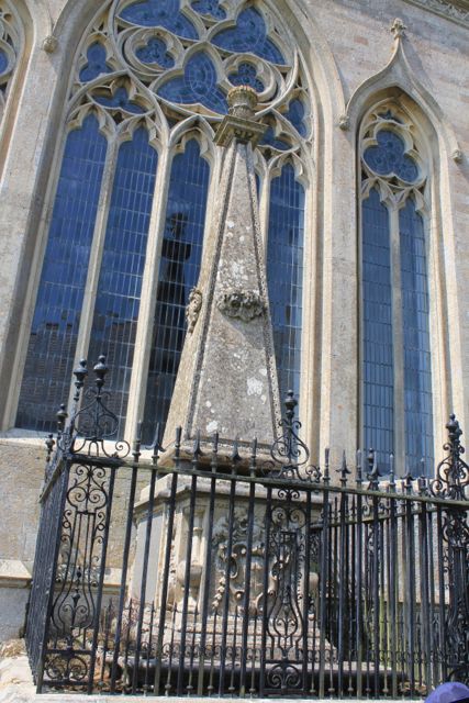
Kings Norton Church (St John the Baptist) is a very imposing building for such a small village.
Kings Norton Church
Shortly after the church, along the road towards Illston, there is a footpath off to the right.  We decided to take this route - across a field and past a small hollow - where sheep were taking advantage of some water. It didn't look very appetising.

We kept to the higher ground passing some small wooded areas on our left.  In the fourth field the path swung round to the left and downhill to meet a track which follows the Roman road, Gartree Road.


Decision time again - Burton Overy or not?  We have plenty of time, and the weather's good. Ten miles sounds like a decent walk, so we head along the path which follows the stream for a few fields. Just before Burton Overy we meet our muddiest obstacle - a gateway of course. I go ankle deep, but the boots are up to this, and my feet stay dry.

We walk along the main street past the large church and some interesting houses.
Timbered house in Burton Overy
At the pub (the Bell) we turn left along Carlton Lane, and follow this up the hill as far as Chestnut Farm, ignoring a footpath off to the left. At the farm we go through a gate and then beside a barn and into a field. Here we keep to the left hand side and walk downhill to a footbridge over the stream. From here we can see the small tower of Carlton Curlieu church, and make for this, following the path until it meets the road. We pause to persuade an errant lamb back into the field - another one that looks like a small quarried dip.

We walk past the old rectory and the church and turn left for 100 yards or so, then left along the bridle road to Illston.  This runs clearly between two hedges as far as the road (Gartree Road is a real road here) t Carlton Curlieu Manor House farm. It's still signed clearly as the bridle road to Illston, but isn't as superb as the last section.
In fact it's easy to follow, although the last field is a bit of a chore. We can see Illston church from the path.  We walk back to the village hall through the village with its church and pub.
Thoroughly enjoyable.