and occasionally rides a bike.
A word of warning. The walk descriptions are not detailed enough to guide you - please take a map. The batteries never run out, and you always have a signal. Oh, And don't take left or right as gospel!

Showing posts with label Ufford. Show all posts

Monday, August 19, 2019

Southey Wood, Ufford, Castor Hanglands, Upton

Monday 12 August 

8 and 3/4 miles, with Eddie and Norma. Flat, although with a high point! Fine weather.

We parked near Southey Wood, where the car park is now closed.


 We followed the main footpath north and then west, eventually turning right, north along the bridleway known as "the drift". At Marholm Road we turned left ,  swinging right through Ufford.  
St Andrew's church was the "highest point", on Church Hill, at 44.16 meters (almost 145 feet!) above sea level.

It was the site for a beacon to warn of the invasion of the Spanish Armada. 
We walked past the large houses in Ufford, and took a footpath to the right which follows the edge of fields.  Be sure to take the path to the left of the hedge when this is possible, as the hedge becomes impassable further on.

The path came out at the side of Jubilee Wood (planted for Victoria's jubilee) on to High Field Road.

We turned right here and followed the road to the T-junction. We turned left along the only slightly busy stretch of road - we collected a small bag full of cans along the verge here.
At the cross roads we carried straight on the to Granary tea shop, attached to Willow Brook Farm shop,  where we had a well-deserved coffee break .

Scones for some ... cherry pie for Eddie...
We followed their permissive path into Castor Hanglands Nature Reserve. No horses today, but there were some cows and sheep.


We kept going south through the wood, and came out to open farmland. We continued straight ahead until a path crossed ours, then we turned right.  Instead of turning right and across fields to Manor Farm we continued west beside trees until the path turned sharp right.  At a left turn, which we didn't take there is a tree stump obligingly carved into an excellent seat. 
From here we walked past Manor Farm, and the field with the pillar - we still haven't found out where it comes from. 

We looked at St John the Baptist Church, Upton - set a little way away from the small village itself.we decided it was a bit too far to walk for the key. The church was built as a Chapel-of-Ease in the Parish of Castor in AD 1120. Major restoration work was carried out in 2005 and 2006. Repairs were made to the bell-turret, the roof and the windows, with support from English Heritage.

We peered through the windows - there is a large tomb with carved figures.


From here we returned to the track which took us over the cattle grid and headed north towards Southey Woods car park. 
On the way we passed this 'observation tower', and very soon arrived at the road and the car.

Monday, July 20, 2015

Bainton, Ufford, Helpston, Ashton

Another outing in John Clare territory. 


Mon, 20 Jul 2015 9:28 BST
With Gordon. A dry morning with cloud, then sun, then cloud. Coffee at John Clare Cottage. Very flat, very pleasant.  Between 6 and 7 miles.

I followed a walk from this leaflet, and extended it to include Helpston. The possibility of a coffee at the John Clare Cottage may have been a factor. 

We set off from the Buttercross near the church in Bainton, turning left along the main road and then right on the road to Ufford.  When the road forked we followed the right hand branch - the left hand one goes to Ashton.

We pass the Wash Dyke sheepwash, where sheep were cleaned before being shorn. A lot of wool was exported to Flanders for weaving.
Shortly after this we followed the footpath past the conservation area, where there is a sort of moat and wetland habitat, then some woodland. This took us southwest for a short half mile, and we turned left, heading more or less south towards Ufford.  The path west leads to Barnack. We could see Ufford church on its mighty hill.  After a few fields we reached the road at Moors Corner, and continued into Ufford. We passed a few houses, then turned left on to a public footpath track.  At first the track is to the right of the hedge, then crosses to the left. It heads east past The Jubilee, a wood planted to mark Queen Victoria's diamond jubilee in 1893 (97?). 
At the road we turned left then soon right at the next footpath. This is a farm track and takes us past Hilly Wood and on to King Street. 
We turned right and almost immediately left, joining the Torpel Way for a while. We passed one footpath to the left, but took the second one. This cuts through Rice Wood, before following a field edge. When we met Heath Road we turned left. The road becomes Woodgate Road, and before long we found that the John Clare Cottage was indeed open and serving coffee and tea. 
The flowers have gone now - photo from 11 July

We made a short diversion to tip our hats to John Clare's grave, and that of his parents. A friendly woman was tidying up, removing the wilted Midsummer cushions placed there in a ceremony each year by children from the local primary school.


 We passed the almshouses, and took a footpath to the left, behind the school and then across fields.
 We joined King Street and the Torpel Way again. We turned right alongside the road and walked to the junction.  Here our path was on the left, and crossed Torpel Manor Field, once the site of a fortified Norman manor house, held by the Torpel family in return for the feudal service of six knights. It eventually passed to the de Camoys, and then royalty, before falling into ruins by the seventeenth century. It was surrounded by a small deer park.
The site of Torpel Manor
 The area is now managed by the Langdyke Trust.  The path crosses the site, then continues between a wire fence and a hedge all the way to Ashton.  It looks as though this could get pretty overgrown, and is definitely a single file and pay attention route.
 In Ashton we made use of the seat below the village sign, and had the snack we'd not had earlier.
Yes, I flipped the pic so that we can read the sign!
 We left the Torpel Way at Ashton, and went a little way along the road north, before taking a different footpath to the left. This section contained several stiles, passing fields of horses, and a stables. 
 In the field after the stables there is a footbridge over a stream down to the right, then the path leads along the edge of fields and past a poultry farm back to the B1443 and into Bainton.  We crossed over and took Church Lane back to the car.


More thatched animals in Bainton.

Saturday, July 18, 2015

Southey Wood, Upton, Castor Hanglands, Ufford.


John Clare - Footpaths

Now tracking fields where passenger appears
As wading to his waist in crowding grain

Wherever as we pass the bending ears

Pat at our sides & gain their place again

Then crooked stile with little steps that aid
The climbing meets us & the pleasant grass
& hedgerows old with arbours ready made
For weariness to rest in pleasant shade
Surround us & with ecstasy we pass
Wild flower & insect tribes that ever mate
With joy & dance from every step we take
In numberless confusion all employ
Their little aims for peace & pleasures sake
& every summers footpath leads to joy

Pet MS A54 p415
Middle Period IV 318


Fri, 2015 Jul 17 9:59 AM BST
With Marta. Lunch at Granary Tea room, Willowbrook Farm Shop. Underfoot mostly dry, weather fine with some sun. I think between 9 and 10 miles.

Today the car was left in Southey Wood car park, and we crossed the road to walk south along the bridleway. A quick glance at the Observation Tower, surrounded by nettles and brambles in summer, didn't tempt us to explore further.

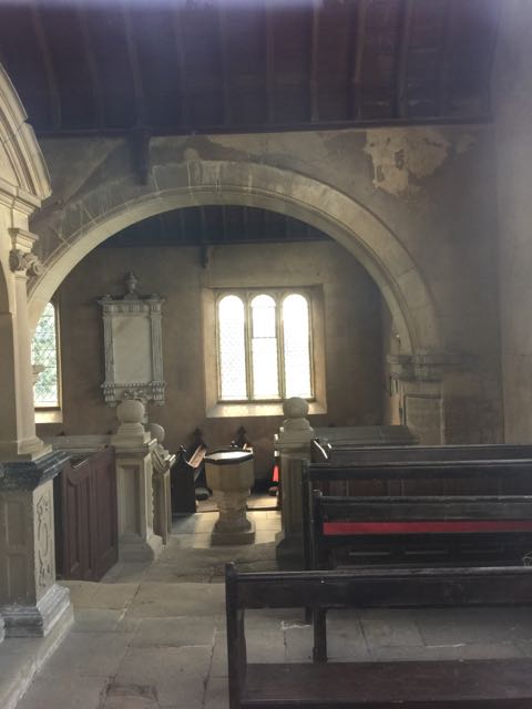
The way ahead is clear and easy heading towards Upton. The church is locked, though opening times can be found here.  A peep through the window showed a large stone tomb with effigies and carvings.
It is dedicated to St John the Baptist, and  is a 12th century Norman church with a north aisle rebuilt in 17th century, chancel restored in 19th century. 


 This pillar is in a nearby field. I think the cows may be fed in there too, as they became quite interested when we went to have a look.

From here we turned left through Manor Farm yard, and picked up the path from a footpath sign close by. After crossing a couple of fields we turned left along a cart track heading east. At the point where another path crosses, we turned left towards Castor Hanglands Nature Reserve. The place is alive with butterflies, and true to form, there were muddy patches near the entrance gate. 
There were several ponies, fenced off from the main path. This white one is a bit plagued by flies.
Just after the reserve . . .
. . . cows peer over the fence . . .
. . .and this one pretends not to be bothered. We head for the Granary Tea Shop. A little early for lunch, but it's the only convenient place, so we stop. 

Our route continues across the road, slightly to our left past some cottages. On the left is Swaddywell Pit Nature reserve, complete with a poem by John Clare. We don't have time to explore today, but I make a note for another time. The path goes alongside, then across a reclaimed tip, where the path is decent. It continues with woodland on our right, then crosses a field to meet the road (Heath Road). Here we make a very sharp left turn, about 45 degrees, without crossing the road.  We walk with the hedge on our left. 

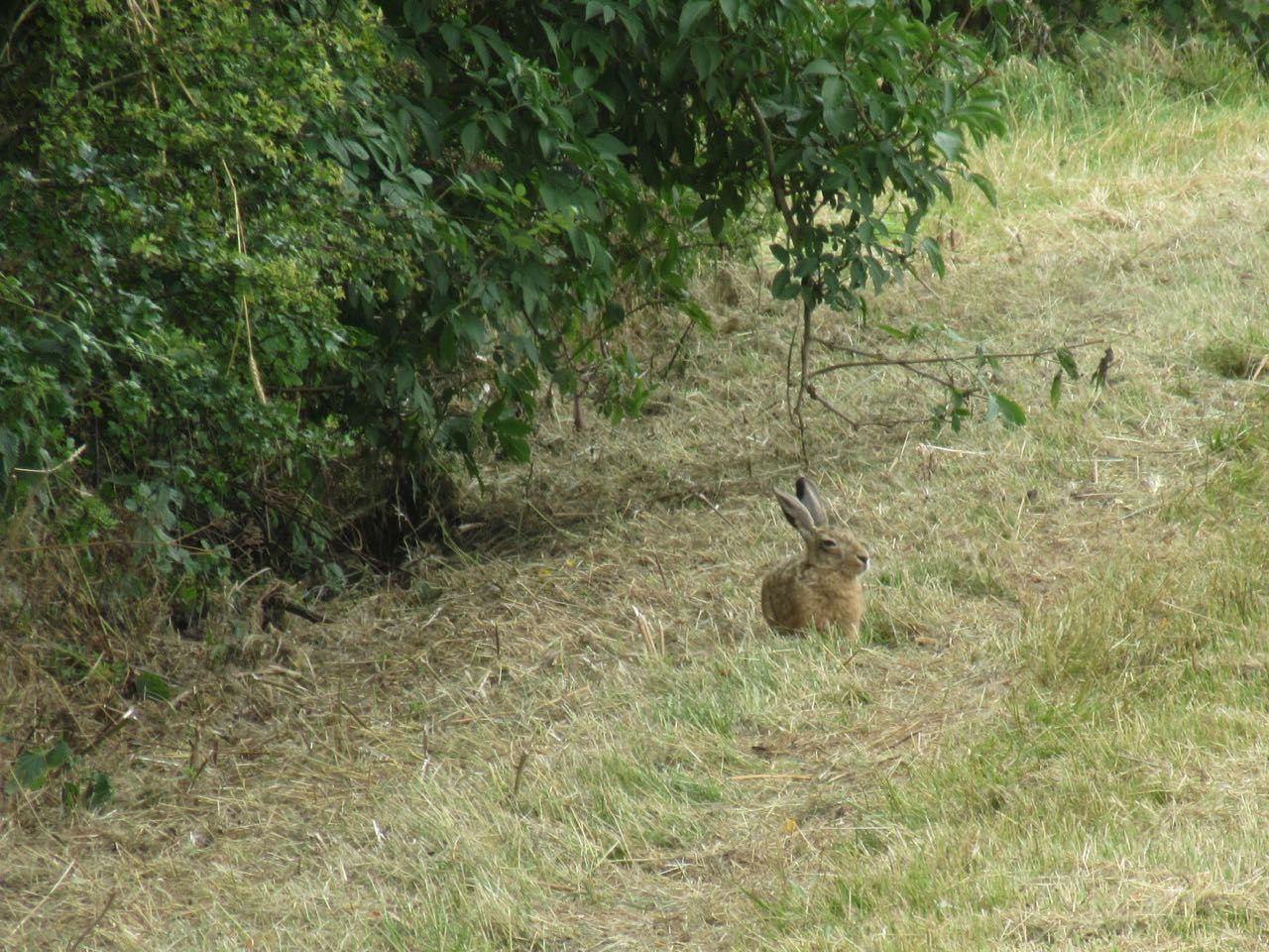
In the distance we spot a hare sitting on the path. Photo opp - again I only have the little camera, but get a few shots - at least you can tell it's a hare, and see its ears and eyes.


Eventually we move forward and the hare decides it's time to leave. We pass a pond with plenty of dragon and damselflies zipping around, then an area dedicated to shooting, with lookouts and a pile of used cartridges.
When we reach the road we turn right, with Hilly Wood on the opposite side of the road. We dodge the cars (not too many) for half a mile before turning left on a footpath at the end of the wood.  There are lots of these giant bellflowers, along the roadsie, and woodland margins here.
After another half mile or so, we turn left at the next road, and walk a couple of hundred yards before turning right on another footpath past woodland called The Jubilee. This footpath takes us with the hedge on our right, past golden cornfields, with a view of Ufford church over to the left.  
This was the site of a warning beacon for the Spanish Armada, as it's one of the highest points locally at 44 metres and a whisker above sea level. The path crosses to the other side of the hedge just before the first houses in Ufford. 
We walk through following the main road, and make use of a bench at the top of the hill opposite the church.
Just after leaving the village of Ufford, after the road bends to the right, we take a cart track to the right, which goes past Lambpits Spinney and after a while turns through a gate into Southey Wood at The Severals. The main woodland track turns south after a while and delivers us back to the car.

Lots of information about Ufford, Southey wood, Swaddywell Pit and Castor Hanglands can be found  on this website.  Look under places of interest.

Thursday, September 20, 2012

Southey Woods, Castor Hanglands

Led by me, with Maureen and Gordon. Grey, very occasional light drizzle, a cool wind, but ideal temperature for walking. Less muddy than usual in the woods. Just over 10 miles.

Similar to this walk August 23rd and this walk August 30th
Ufford church, at 44 metres above sea level, is one of the highest points in the area

Another slight variation on this walk. We started at the Willow Brook Farm Shop, and took the footpath just across the road heading more or less north-east.  The path leads across a reclaimed landfill site with warning 'no smoking notices'.
 Then it continues along the side of a wood. At the corner the path should go diagonally across a field to the minor road, but we walked along the edge and then for a short distance along the road. Freshly ploughed fields are hard work until the paths have been made good.

We turned left at the point where the path meets a bridleway at the junction with the road. We walked west along the bridleway, past a pond and a few trees until we reached Langley Bush Road.  Here we turned right and walked north along the road as far as the end of Hilly Wood.
We turned left again (north west approximately), following a bridleway to High Field Road.   We should have turned left here (see garmin trace)  and walked south east as far as the second block of woodland, called Jubilee Wood.  A right turn just south of west took us to the path into Ufford, where we turned left and soon uphill, past the hall and the church.
We walked passed Hillside Close on the edge of the village, and another 400 yards later, turned right on to the track known as 'the drift' .  We ignored the inviting seat here, and walked about half a mile south to the gate leading into Southey Wood.  We followed the main waymarked path until after another mile we had a break at the well-placed picnic tables.
The tiniest bit chilly today!
After that it was straight past the car park and over the road to the track towards Upton.  This leads down hill past the church and we chose to follow the road through the village, past a row of thatched cottages and some houses, then turned left past Model Farm, before heading left along a bridleway marked on the map as Blind Lane.  We met a man trotting on a horse along this section. 
At the end of Blind Lane there are three chopped tree trunks with the letter A,S,W scratch-carved into them - useful seats, but we resisted the temptation this time, and followed a path diagonally across the corner of a small field through some woodland and out onto a shady path heading east. This leads on to the open fields, now harvested, with the two improvised horse-jumps. See this post.

We carried on towards the east, until we met the north-south path, and turned left and north towards the Castor Hanglands nature reserve. 
The main path through the reserve is clear and easy to follow.  Today it was noticeably less muddy than it has been.  Not much visible wildlife, but we did meet these horses.


We carried on through the reserve and then took the permissive path to the farm shop and cafe, where we stopped for lunch. 

map and details

Thursday, August 30, 2012

Southey Wood and Castor Hanglands variation with Ufford and Upton

Led by me. With Gordon and Barry. Mostly grey, but dry apart from one heavy shower which we dodged in the Granary café. Some muddy patches. About 10 miles.


We parked at Southey Woods - walked north, then west, following the main path through the woods until we reached the metal gate, where we turned right, north along the bridleway known as "the drift". At Marholm Road we turned left ,  swinging right through Ufford.   This village is well worth a wander.


The information board was erected in 2000, and explains the history of various buildings.


The church stands at the highest point in the area, and was the site of a beacon, one of a chain nationwide, warning about the Spanish Armada.
Ufford Hall is a grandiose building dating from the 18th century. 
Picturesque houses.
There are several examples of dates and inscriptions on the walls - for example
Newport Farm MCCLXX
and this one:


Before the last of the village buildings we took a footpath to the right which follows the edge of fields.  Be sure to take the path to the left of the hedge when this is possible, and you'll avoid the hedge burrowing experience.
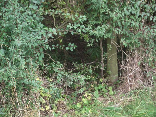
Exit strategy?
The path came out at the side of Jubilee Wood (planted for Victoria's jubilee) on to High Field Road.
We turned right here and followed the road to the T-junction. We turned left along the only slightly busy stretch of road. At the cross roads we carried straight on the to Granary tea shop.
Here we had a well-deserved coffee break, while the heavens opened.  Luckily this didn't last long.

We followed their private path into Castor Hanglands and through Ailsworth  Heath. We kept going south through the wood.  This was noticeably muddier than it had been last week. I was lucky enough to see a fox cross the path a short distance ahead of me.

 Outside the wood we walked south until we saw a sign and a cross track.  We turned right (west) and followed wide track along the field edge.  The wheat we saw last week has been harvested, but those strange structures - horse jumps? - are still there.   Instead of turning right and across fields to Manor Farm we continued west beside trees until the path turned sharp right, then left (labelled on the map as Blind Lane track).  At the left turn there are tree stumps obligingly carved with an initial each - these make excellent seats.  We followed Blind Lane as far as the road, where we turned right and walked past Model Farm and through Upton village.

We followed Church Walk round until we emerged nearly opposite Manor Farm and the church.


We were curious about this stone pillar, fenced off in a field near Manor Farm


Church of St John the Baptist

W.C. 1767

We returned to the track which took us over the cattle grid and headed north towards Southey Woods car park. On the way we passed this 'observation tower', but decided not to try climbing the rather uninviting steps.
Soon afterwards we could see the car park where we finished the walk.
Map and details