and occasionally rides a bike.
A word of warning. The walk descriptions are not detailed enough to guide you - please take a map. The batteries never run out, and you always have a signal. Oh, And don't take left or right as gospel!

Showing posts with label Huntingdonshire. Show all posts

Thursday, April 26, 2018

Grafham Water anti-clockwise.

Monday 23 April. With Marion, Maureen, Kate and Eddie.  Weather dry but with a chilly wind. Summer has taken a break! 9 miles in all.

We set off towards Grafham village, following the cycle route rather than the footpath closer to the water. As we reached the village it felt a little like herding cats, as Eddie went in one direction to see if he could see the community shop, while I waited for the other three to catch up. Luckily, they are more amenable than cats, and ther are not many places to get lost on the way round.


We continued past the church, then took the road past the caravan site and the cottages called Orchard row, and walked round as far as the spinney and up the small incline, before having a short break. This was at about three miles into the walk.


As we walked round the next section bluebells were in evidence - they've come out since our last visit two weeks ago, though without sunlight they don't look too spectacular on the photo.

The cafe was an excuse for a second stop and hot drinks all round at the six mile mark, then it was just a matter of the walk through part of Perry, and across the dam back to the visitor centre and the car park.

Tuesday, April 24, 2018

09 April - Grafham Water

With Norma and Marion. 9 miles in light drizzle.

We walked clockwise from the Marlow Park visitor centre, stopping for coffee at the Harbour cafe, then on.

View from the cafe
 Another brief pause at Grafham church porch for a browse of their second hand books,  then finished off with lunch back at the Visitor Centre cafe.

Lots of primroses, and blossom, and we saw a couple of bluebells emerging.


Thursday, January 14, 2016

Grafham Water clockwise

Thu, 2016 Jan 14 9:23 AM G M T 
With Maureen, Gordon and Tommy. A cold grey day, but we had no rain. Set off from the Visitor centre south of Grafham village. 8.6 miles.

Light rain was forecast, but it had stopped by the time we arrived, though the wind was cold. 

 The gang are all wrapped up for the weather today, and raring to go. 

The path is easy to follow, over the dam and round. At the village of East and West Perry we followed the road until we met the sign to the Water again, then continued round through Littless Wood with its nature trails - something to explore on a day when there are drier conditions underfoot. 
We had a break at Savage Spinney when we'd walked just over five miles. A welcome bench, and fairly sheltered, though we were not tempted to hang around for long.
 From here we continued past more seats, and footpaths leading away from the lake.
 We chose to follow the cycle route for the last section, ignoring the slightly shorter but rather wetter footpath closer to the water.
A dragon for luck?
The road took us into Grafham village , past the church, where we turned right and followed the small road and cycle route back round to the car park with its visitor centre, and, most importantly the open cafe.


Thursday, May 23, 2013

Offord Cluny and Godmanchester circular


Thu, 2013 May 23 9:46 AM Western European Time 
Led by Barry, with me and Gordon. Track walking, then riverside. Clear paths, very flat, dry underfoot apart from a small section in Portholme Park. Just over 9 miles. Weather mostly dry, some sun, a couple of showers. Cold wind. Coffee and a toasted teacake in Godmanchester.
Photos taken with Fujifilm FinePix L55 - my very cheap point and shoot.


Offord Cluny church
We leave the church behind us and turn right past the village hall, and then left along New Road, heading east. This soon becomes  narrow, and climbs up gently to reach Waterloo Farm.  Here it becomes a bridleway, and turns slightly to the right, then due south for a hundred or so yards, before swinging left and due east once more.  Before long it joins a north-south bridleway - with signposts.

We take the route to Godmanchester - north.  It descends gently for almost 2 miles into the town. This is part of the Pathfinder Long Distance Walk
The Pathfinder Walk (46 miles) was designed by the RAF as a heritage trail in memory of the RAF Pathfinder Force and links up the 4 airfields (Wyton, Graveley, Oakington and Warboys) used by the Pathfinders when they were set up in 1942. The route runs through farmland, fen and open heath but also has some road walking.

Godmanchester
There is a friendly café, so we stop for a break and elevenses.
The Queen Elizabeth Grammar School
In May 1561, at the request of the townspeople, Queen Elizabeth I issued letters-patent granting her name to the school. 

The two pictures below are of a building erected in 1844 by one mayor, Edwd Martin and enlarge in 1899 by another mayor, W. Gadsby.

I like the chimneys.

messing about on the river
The view should improve when the construction work is finished

The Chinese Bridge
We cross the bridge into the lovely riverside parkland,  but have to pause to shelter from a sudden hailstorm.

We walk as far as Portholme Meadow, reputed to be the largest meadow in England. It was formed from silt when the Great Ouse flooded, and according to the info board it still floods in the winter. It's covered with buttercups and a small pink flower at present.

We're now walking along the Ouse Valley Way, and follow the path.
Comfrey flowers by the path
 We see Hinchingbrooke Castle on our right, before the path  turns south close to the river.  
Hinchingbrooke Castle has sprouted a phone mast
The trees and hedge shelter us effectively from the wind, and we're tempted by a picnic table and bananas at a Brampton pond in a conservation area.
Pond and conservation area
We make our way past Buckden Marina with its very upmarket chalets and boats, and arrive back at Offord Lock. It's a short walk to the car.

Wildlife - the usual swans, geese, ducks, a couple of terns, some swifts.
Map and details


Thursday, May 9, 2013

Offord Cluny, Paxton Pits and the Ouse Valley Way


Thu, 2013 May 9 9:27 AM Western European Time 
Led by Barry. Maureen, Eddie and me. Fine with a few drops of rain. Quite windy in parts. Lovely flat waterside walk - Paxton Pits and Ouse Valley Way. 10.5 miles. 71 ft of "climbing".

We set off from Offord Cluny, taking a footpath past the church, which is open, so we go in.
The church is fairly plain, but I like this window.
The window is dedicated to the memory of all those airmen and airwomen
who served with 35 squadron RAF Graveley 1939-45
The path continues across another field towards the mainline railway - a quick pause to say hi to this foal.
hoping for food no doubt - and disappointed.
We note that the light for the rail crossing is green, so we follow instructions and cross quickly. It's a pretty busy line.
Then a bridge over a couple of weirs, and over the locks to the narrow road by the Old Flour Mill and the road bridge, with views over some riverside bungalows.
We turn left and follow the footpath marked on the OS map as following Diddington Brook. It goes southwest for a while then turns left and heads south to the tiny village of Diddington.
We walk past a row of semis and a thatched cottage, before going diagonally left over a field then following the field boundaries,  right, left, right and walk south past the bumps and hollows of the site of the medieval village of Boughton.
medieval village – site of
Shortly after this we pass a farm with a dovecote and a collection of outbuildings.
Soon there are signs of a disused gravel pit - still plenty of gravel there.
We follow the path south through woodland with glimpses of watery ex-gravel pits, look around for woodpecker holes, and then go to the Visitor Centre for a welcome cup of coffee.
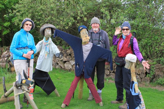
It's Little Paxton Scarecrow Festival on Saturday, and these characters are in evidence.

Ok, which ones are the scarecrows??
There are various exhibits in the centre, including this magnificent mammoth jawbone which was found in the quarry workings at Paxton Pits in August 2000.
We leave the visitor centre and make our way through some streets on the edge of Little Paxton - scarecrows are still hanging around.


We don't have time to look for Bo-bo the clown today, so we follow the footpath until it meets the Ouse Valley Way.
We turn left and follow the river Great Ouse downstream for three miles or so. All very peaceful, with a few water birds - geese (not sure if they were greylag or pinkfooted - I couldn't see their feet anyway!), and swans on the river.
Eddie strolling before he puts the hammer down.

Offord D'Arcy church
Unless we're prepared to swim, we have to go the long way round.

We were told that this heron spends a lot of time here.
We follow the Ouse Valley Way until it meets the road and we retrace our steps to Offord Cluny.
The road bridge
Brown Bonnet Cottage
Wildlife - lots of birdsong, including some very striking singing, just inside one of the woodland areas - quite a small bird, but it was against the light and high up, so I haven't much to go on. Should have recorded its song - that's what phones are for! Lots of birds on the lakes - tufted duck, geese, swans, a couple of great crested grebe - oh and the heron, who posed for ages, but was just too far away.
Map and details
Thursday, January 12, 2012

Kimbolton-Tilbrook, Pertenhall, Stonely, Kimbolton


Led by Barry, with me Eddie and Maureen - weather grey, some drizzle, improved to sunshine. Just over 10 miles (including mini-detours). 


Llamas and a mini-cow?


Pertenhall church in the diocese of St Albans - we took shelter in the porch for  our snack break


One more mile, guys!  We can do it!

Map and details