and occasionally rides a bike.
A word of warning. The walk descriptions are not detailed enough to guide you - please take a map. The batteries never run out, and you always have a signal. Oh, And don't take left or right as gospel!

Showing posts with label Dorset. Show all posts

Thursday, June 18, 2015

Corfe Castle to Nine Barrow Down


Wednesday 17 June 2015 , along the Purbeck Way.
Around a seven mile walk on a sunny afternoon. Our original intention was to climb East Hill, but the weather and the path were altogether too good to refuse. 

From Corfe Castle's NT car park turn left and take second road on left - Sandy Hill Lane.
On the left just after turn to railway station is a permissive path to East Hill.
it's very steep, and most of the gradient is steps. 
There is also a gentler track which meets this one just before the first radio mast, but misses out East Hill with its fine views of the Castle.

At the top of the steps, head for the top of the ridge, following signs to Rollington Hill.
Fabulous views over to the north, over Poole harbour and Wareham Channel.

The path continues along the ridge, going slightly south of east.
It's a bridleway too.

The prevailing winds are westerlies.


We followed it for about three and a half miles to the point where it begins the descent to the road to Ullwell and Swanage. The track veers right, there's a radio mast ahead, and a toppled trig point
close by.

We retraced our footsteps with a ten yard or so detour to see a bee orchid. A couple had told us where this was.

most of the walk was on wonderful springy grassland - so much so that I took my shoes off for a short distance.
On the way back the clouds were creating spooky effects around the castle.

Tuesday, August 5, 2014

A week near Sandleheath - more cycling than walking

'Hampshire July 2014
Arrived Friday 25/7 Ate at Damerham pub with its hippy enterprise feel but good food, altho' they seem to think vegetarians eat less.


Saturday 26/7 we met Jenny and Esther at Bursledon station car park and walked along the river Hamble to Manor farm Country Park and back. Then went to Esther's for evening meal.


Sunday 27/7 Esther did a 70 mile sportive from Waterlooville. We did a 20 mile ride to Cranbourne - stopped for large lemonade at Damerham. Map etc . Later over to Esther's.  Quick visit to the allotment.


Monday 28/7 - we met Esther etc at Moors valley Country park.


We drove there the back way, via Verwood. Ate at the Ship in Fordingbridge.


Tuesday 29/7- lazy morning, then ride into Fordingbridge to get b'day card for Aneurin. Onwards and up to Whitsbury and almost Coombe Bissett via byway, then returned via Rockbourne. Map etc.Tea and scone in Rose and Thistle. Not cheap but good.  About 20 miles in all again.


Wednesday 30/7 - went to Alderholt G C for coffee, then to Mockbeggar via Harbridge and ibsley. up the hill past Red Shoot and almost to Fritham, returning via the top road and down through Godshill and Fordingbridge. around 28 miles. Map etc.
Then to Esther's for dinner.


Thursday 31/7 - a lazy day, more reading than anything. Then to Esther's for a meal.

Friday 01/8 - returned home via Salisbury, and called at Crofton Beam Engine on the Kennet and Avon Canal.

While we were away we saw various birds, including reed bunting, a kingfisher, and some wheatears, we believe, flying from post to post ahead of us as we cycled on a byway.

Tuesday, July 1, 2014

Short saunter at Maiden Castle - 21 June 2014

A fine hot day again, and we have to leave Dorset, alas, though we look forward to a couple of days with the family before heading home.


No rush today, since Joseph is partying until 1 pm. Plenty of time for a short stop at Maiden Castle near Dorchester, once we've found the way there - no, the back roads on the map are not for cars.

After yesterday's effort I almost refuse to leave the car, but it's well worth walking up the track to the earthworks, and reading about the history of the hill-fort settlement.
I capture the castle - another silly headgear photo!
We can see the Hardy monument that we visited yesterday, higher up a couple of miles or so west of us.
six-spot burnet?

some moth

common blue?


marbled white

more burnet moths


When we've finished speculating about the people who once lived here, we wander around and discover sheltered spots full of flowers - among others birds-foot trefoil covered in Burnet moths, and masses of orchids. We see marbled white butterflies, blues, small tortoiseshells, and lots more that we can't immediately identify. Harry took some pictures. And one of a corn bunting singing on the stalk of an umbellifer.


Then we're ready to roll. We make a quick garage stop to buy some lunch provisions, and then a mini diversion to the tiny manicured village of Winterbourne Zelston to picnic, and it's all systems go to Southampton.


Saturday, June 28, 2014

alirides - the sequel: to the Hardy Monument and back

Set off about 10 am on Friday 20th June 2014. The route was almost entirely on National Cycle Route 2, apart from the odd diversion.  Total mileage just short of 40 miles. Hot and sunny again, and over 2 000 feet of uphill. 

By the looks of this first photograph, I could have settled down to an idle day! 
From Stoke Mill, near Broadoak via Dottery, Bradpole and Loders.
The pub in Loders served us coffee just before they officially opened - most welcome and very friendly service.   
The bridge just outside Loders commemorating 1914.  We diverted slightly into Uploders before following the road towards Shipton Gorge - not a gorge at all, though it has hills.
We had views of the sea from the higher ground.
We eventually met the river Bride and the (reputedly) flat section of the route.
After following the river valley for some time we reached Litton Cheney and its pub the White Horse.  An excellent sandwich with trimmings and plenty of liquid taken on board here. Once more, very friendly service.
From there we rode to Long Bredy and Little Bredy.
I confess to a couple of pauses on this long hill, but I did ride up it.
Not much further now to the Hardy monument - not to the writer but the seaman of "Kiss me, Hardy" fame. Wonderful views all around from here.
A friendly walker offered to take our photo.
He had walked along the South Dorset ridgeway from Weymouth.
We could see Chesil Beach.
Harry in the landscape
Strip lynchets - remains of a mediaeval farming system.

The ride back was easier, as there was more downhill, and the wind was behind us.  All the same any climbs felt like very hard work.  Especially the last short one! 

Map and details

Thursday, June 26, 2014

West Bay, Bridport to Golden Cap and back

Wed, 2014 Jun 18 11:27 AM BST.  Around 10 miles. 1,600 feet of ascent. Glorious weather - sunny and hot.

We set off from West Bay.
West Bay harbour stalls

The mighty hunter brings apple cake

This is where we're heading

The cliff to the east

We follow the South West Coast Path uphill from the seafront, and head west.
The many seats are tempting, but it's early in the walk. 
Birds' eye view


The path climbs up, then descends into Eype, then climbs again towards Thorncombe Beacon.

Sheep with a personal shelter - of sorts
Not time for lunch yet, so on and down again, to Seatown, with its holiday camp, pub and shop - coffee time.
Our objective!

Onward and upward once more. The path has been diverted slightly inland, but is well signed.
Looking back
This section has some steep parts, and I'm getting hungry, but we carry on to the trig point. 627 feet high doesn't sound a lot, but we've climbed up from sea level three times to get here! It is the highest point on the south coast.

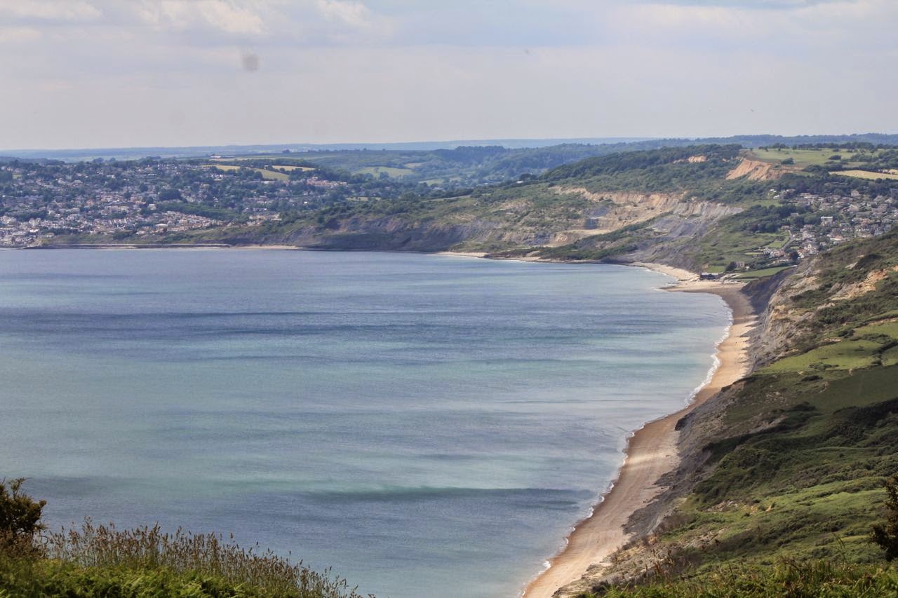
the view west to Charmouth and Lyme Regis

The view down
We admire the views - as far as Portland to the east, and into Devon to the west. Then it's time for lunch and a rest.

Back to Seatown and we reckon we've earned an ice cream by now. Then up to Thorncombe Beacon once more, and eastwards to West Bay.


A sense of achievement
A strenuous walk but well worth all the effort. And we carried the apple cake home, a little squashed, but still edible! 

Map and details