and occasionally rides a bike.
A word of warning. The walk descriptions are not detailed enough to guide you - please take a map. The batteries never run out, and you always have a signal. Oh, And don't take left or right as gospel!

Showing posts with label Battle of Naseby. Show all posts

Friday, December 6, 2019

Marston Trussell- Sibbertoft circular, on minor roads.

Thursday 05 December, with Maureen. Just over 8 miles. It's almost the walk we did in March 2014, after a spell of wet weather, but today we didn't do the extra mile to include Clipston.


The walking was easy, and the frost had melted, though there were some muddy patches on these quiet roads. The whole area is where the very bloody battle of Naseby took place on 14 June 1645.
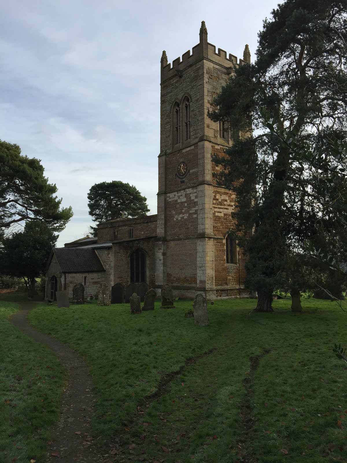
Marston Trussell church, the start and end of our walk.
We walked into the village and turned left at the junction, past the fishing lake.
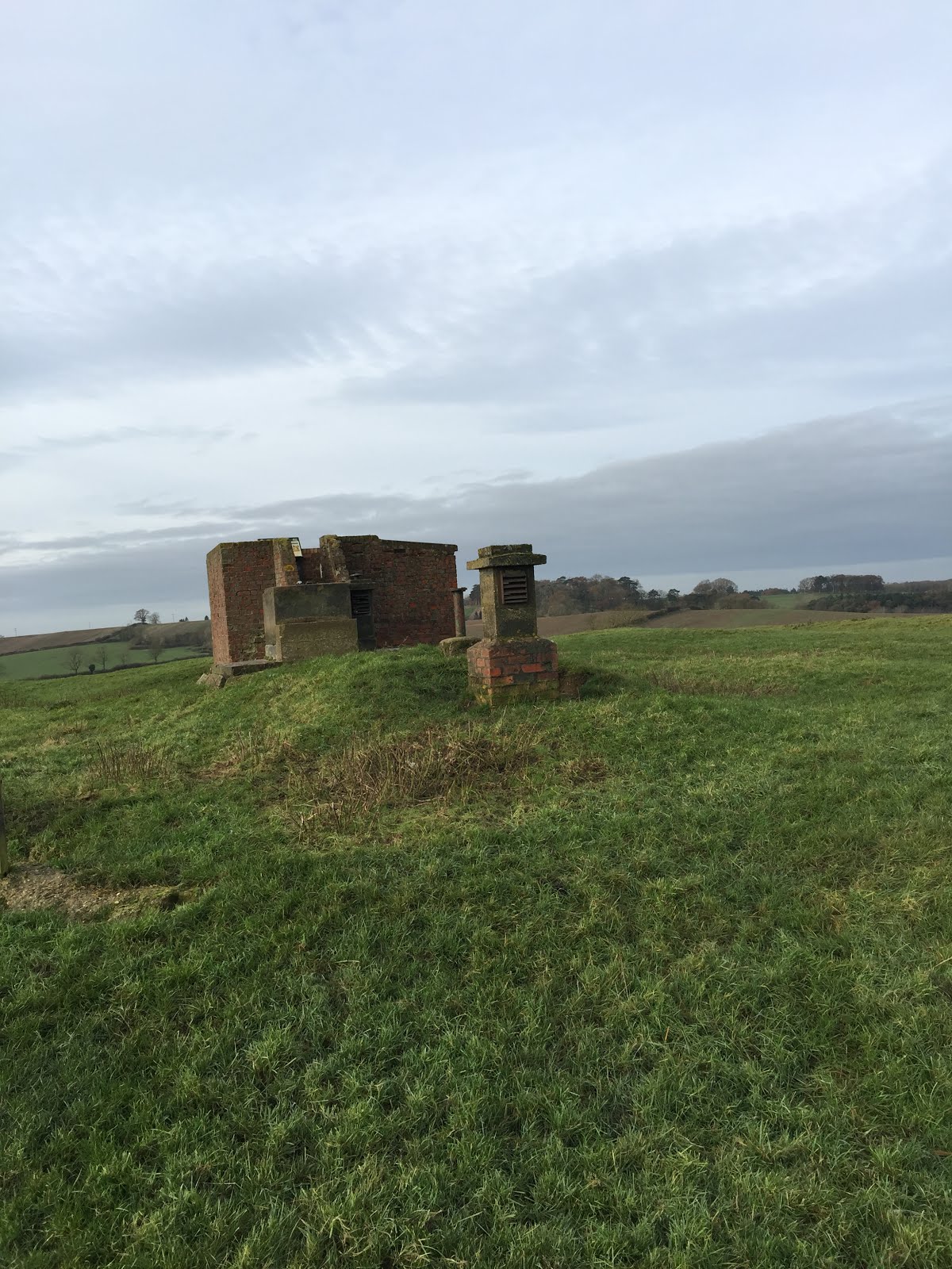
 We followed the road round to the right past Marston Lodge, and continued, ignoring the small road to Sibbertoft. The road climbs steadily, but not steeply up to the ROC Viewpoint, just off the road to our right.

An information board gives details of the battle off Naseby. I'm convinced soldiers must have to be drunk in order to fight, and that this is one reason why they behaved so badly to the local people, especially the women.
\


At the T-junction we turned right, away from Clipston and towards Sibbertoft. We arrived at the church as eleven o'clock was striking. This has been a pleasant place for a break on several walks in the past - in spring the snowdrops are lovely, but of course, not in early December.

An unusual flower trough by the village sign.
We carried on past the church, ignoring a road to our right with the signpost to Marston Trussell.  Instead we headed downhill, with Hothorpe Hall in view. There is a small road off to our right, and we took this to reach Marston again.
it leads past the magnificent trees in the grounds of Marston Trussell Hall,

and back into the village.


Lunch at Farndon Fields farm shop cafe.

Saturday, October 25, 2014

Marston Trussell and Sibbertoft circular + Lubenham village


Fri, 2014 Oct 24 9:36 AM BST
With Marta. Dry, damp underfoot in places, but some ploughed fields sticky. About 7 miles.
From the church, where the porch roof is being repaired, we walk towards the Sun Inn (also being repaired or renovated, and then past Marston Trussell Hall on the road towards Theddingworth.


Roses outside Marston Trussell Hall
We turn left opposite Hothorpe Hall, and walk along the road as far the bend. We take the bridleway to the right, and follow it as it climbs steeply between Barn Hill Spinney and Coombe Spinney. Great views back are a good excuse for a breather.
View towards Theddingworth from Hothorpe Hills
At the top the bridleway goes through a gate and takes a path alongside fields to the Roserie just north of Sibbertoft. 
Outside a house in Sibbertoft


We join the road, but not for long. There's a Jurassic Way signpost, and a path between hedges and houses.
There is always a hopeful horse
We take it  then cross a couple of fields to reach St Helen's Church.  People are around, so we look inside briefly - I'm intrigued by the bird carvings on one of the pillars. But it's time for a break - we've come around 4 miles.
Sibbertoft church

Bird carvings inside the church
At the church lychgate we turn left and walk along the road for a couple of hundred yards, then find our path on the right hand side in a gap in the hedge. It's still the Jurassic Way.
fungi in the church yard


The waymarking is good, and takes us to the opposite corner of the first field, then along the field boundary of the next. We cut corners of the next two fields and then come to a waymarker pointing directly across a recently planted field. We can see the route, but decide to walk around two edges before rejoining the Jurassic Way on a recently surfaced track (an improvement on the previous mud-bath), which goes steeply downhill, through woodland (Mount Pleasant and the Lawns).
Autumn colours 
At the bottom of the roadway, we can see the way marks and path. It climbs uphill then flattens out and comes out on the road at Dick's Hill.
We cross over and take the footpath at the bottom of the field, keeping the hedge on our left. After some time we reach Rectory Farm, and carry on past this until we reach a minor road From East Farndon to Marston Trussell. 
Other colours near Rectory Farm
 We turn left, and soon afterwards right. Our path should lead across the field to the opposite corner, but once again we take the way of least resistance, and follow the field edges. Marston Trussell church is clearly in view now.
We come to a footbridge, then cross the field where fleeing royalist cavalry were slaughtered after the Battle of Naseby. This brings us to the church. We walk through the churchyard, and back to the car.
From 1986 Bbc's Domesday reloaded
                                     
   St.Nicholas Church,Marston Trussell was originally built in 13th century in
 sandstone.The site is believed to date back to Roman times.The tower, 71 feet
 high,was built about 1525 and has 5  bells now rung by 1 man and 4 women.  
 The porch is made from oak possibly  part of a Danish Ship. Part of the    
 nearby castle was also used,only the  moat and mound can still be seen.There
 have been 35 priests since the church was built.There has been only one     
 christening in the last 5 years.  
At the Battle of Naseby King Charles' Cavaliers made their last    
 stand against Cromwell's men and were defeated.The ones that broke away     
 from the battle retreated towards Leicester but many were cornered  at  
 'Pudding Poke Marston',slaughtered and buried near the church yard.      

We have a good lunch at the Coach and Horses in Lubenham, see an old graffiti-carved table top from a former pub down the road on display in the bar and some black and white photographs, including one of the Tower House. The barman is very happy to tell us the story behind them, and as a result we have a mini walk round the village after lunch before going home.
There's more to these villages than meets the eye on a drive along the main road.
Tower House, Lubenham
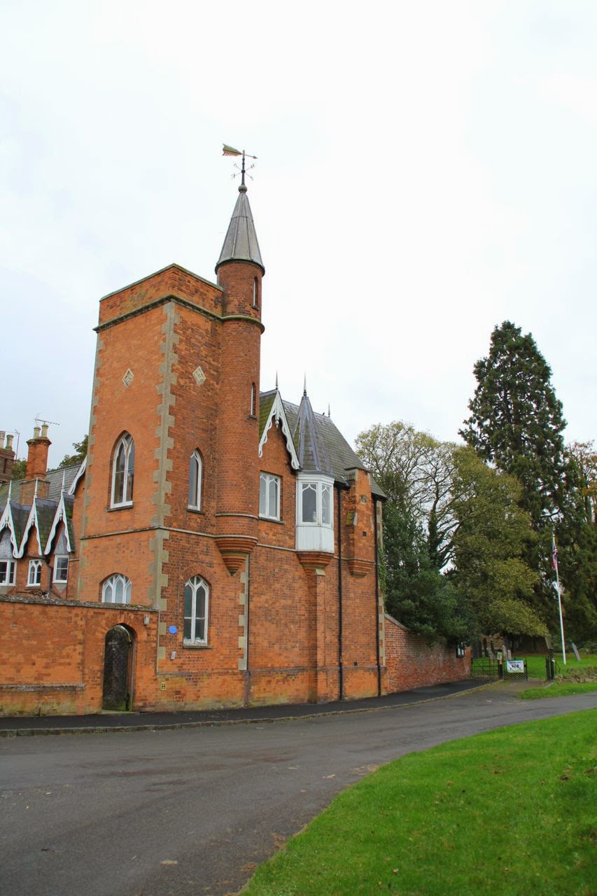
The Tower house was originally a farmhouse,  called the Cottage. It was enlarged in 1865 as a hunting box for Benedict John "Cherry" Angell, a horse racing enthusiast who celebrated his major wins by adding to the house. The tall tower was built to commemorate his horse Alcibade winning the 1865 Grand National. From there he could watch the races.

An old cottage, Lubenham

A quilt inside Lubenham Church


How tall is the tree?
All Saints Church. Lubenham - it is believed there was once a spire, which blew down in the Great Storm of 1703.

Map and details

Monday, March 17, 2014

Marston Trussell and Clipston - footpaths and some roads.

Mon, 2014 Mar 17 9:33 AM GMT
Led by me, with Barry, Gordon and Maureen. Not cold, dry, some sun. Most paths drying up, though we also did some road walking. Just over 8 miles, including about a mile walking around Clipston.

They (the hours) pass by and are put to our account.
We go through the churchyard and follow the path over a field full of lumps and bumps - there was once a moat and it may be the place mentioned in the paragraph on the photo below, where bodies were buried after the Battle of Naseby.
We head for the footbridge, then instead of crossing the next field we walk round the edge, as the path is unclear.  We find our way out over a footbridge, with the footpath sign. Looking back we see the church.
We cross the road and decide to try the footpath opposite. It is not always entirely clear where we should go, but we make our way with the help of the signs, the map and Barry's magic grid reference machine.  We cross the Jurassic Way path and head uphill towards Twantry Farm. 

There's a tricky bit where the path goes through a hole in the hedge, but is unmarked, so we take the alternative route through a gate a hundred yards or so to the left. A bit muddy but we battle through. Then it's a matter of following the farm drive until a footpath leaves to the left and cuts across the field, cutting off a bend in the road.  A few yards of road walking take us to the Royal Observer Corps lookout. We make the short detour to explore this and are repaid with wide 360 degree views.


 Onwards - we take the footpath which leaves the road on our left, just opposite the ROC viewpoint. This leads us across a field which a fine example of ridge and furrow.  One more field and we are on the road just outside Clipston.
We walk along Chapel Lane, and make use of the steps for our break. I take a snap of Thomas Jarman's gravestone. Time to direct you to my own silly verses. 
 Time for a wander round the village, which has some magnificent old buildings
Free Grammar school and hospital, now the primary school

Another one-handed clock


Prince Rupert's Cottage 

Clipston church
My first intention is to use the footpath near Peg's Lane, but one route is across a very muddy field with a bull, and I can't see the other route, so we revert to the road out of the village, turning left along the Sibbertoft road. When we reach the turning to Marston Trussell (2 1/2 miles), we decide to take the shorter route along Dick Hill, past the woods, turning right just after Marston Lodge.

We go straight ahead when the road goes to the right to East Farndon, past the Lake.
We turn right at the T-junction and back to the church.  

Thursday, March 6, 2014

Marston Trussell, Sibbertoft, Clipston and back - minor roads.

Thu, 2014 Mar 6 9:31 AM GMT
Led by me with Gordon and Maureen. Almost 9 miles on minor roads - a little hard on the feet and legs! 483 ft of climbing. it was raining when we set off by car, but not a drop fell on us once we were walking.
Just to prove that the sun almost shone
From the church in Marston Trussell, we take the road through the village. When it bends to the right, we carry straight on past Marston Trussell Hall. We follow this road for a good mile to a T-junction.
We turn left almost opposite Hothorpe Hall, towards Sibbertoft. We follow this road for about a mile and a half, up a steep hill to a T-junction.  Here we turn right into the village of Sibbertoft, walking past the church and the war memorial and straight on until we reach a sign to Clipston (single track road).


Sibbertoft church

We walk along the road to Clipston. Part way along, there is a Battle of Naseby information board at the Moot Hill viewpoint .
The battle, on 14th June 1645, was a decisive moment in the English Civil War, when Charles I's army was defeated by Cromwell's New Model Army.  

After about a mile and a half a road to the left shows a signpost to Marston Trussell( 2 1/2 miles). We went on a little further into Clipston to find a place to sit for a break.
There's a rather fine chapel.

Near the chapel is a gravestone to Thomas Jarman, composer of hymns. There's some interesting information about him, in particular his quarrel with the local Church of England vicar here. After coffee and a scone, we retraced our steps to the signpost to Marston Trussell.

The road climbs up,and we can see the Royal Observer Corps look out with its flagpole. From here you have a great view of the site of the Battle of Naseby, though we're saving it for next time.

Later, we pass the entrance to the oddly named Twantry Farm. Our road goes downhill past some woodland, and at the bottom is crossed by the Jurassic Way. On the map this part of the road is labelled Dick's Hill. It must refer to the bit we've passed already, since it's flat from now on. The whole length of the road is about two miles. We reach a junction, and the drive to Marston Lodge Farm, with a pond.

Dick's Hill

At the junction we turn right towards Marston Trussell.  Walk about half a mile.This is the only part of the walk where we meet more than a couple of cars.
At the next junction, we take the left-hand fork. There is a fine view of Marston Trussell Hall from the Lake to our left.

At the T-junction, we turn right and back to the church.
Map and details