and occasionally rides a bike.
A word of warning. The walk descriptions are not detailed enough to guide you - please take a map. The batteries never run out, and you always have a signal. Oh, And don't take left or right as gospel!

Showing posts with label over 10 miles. Show all posts

Monday, August 11, 2025

A visit to Árainn Mhor

 Part of the ‘Round the Island’ walk. 10 miles (16 km) with 1100 feet (335 m) of ascent.

the full walk


Our route, with elevation profile - always exaggerated, but looks impressive!

We caught the ferry over to Arranmore Island, from Burtonport. The weather was hot.


Some highlights - the views as we climbed out of the main village;


the walk down to the lighthouse and back,


with skylarks, cuckoo and choughs; the man in a car taking his dog for a walk;  the “bog road”;

the Beaver island connection;


the few other people - a couple of blokes drinking ? tea? in front of a house; the runner near the lighthouse; the couple taking a walk near the chough cliffs; a group of German walkers;  the lack of cars;


the cafe ‘An Bolgam Beag’ (the Little Cup of Tea - named by a boy from the island); the very friendly young lady serving , who was born on the island and spent a lot of time there; 


the man on the boat from Larne, who took a photo of us, and then talked about birds and Tory Island.


The day finished with fish and chips at McCafferty’s in Dungloe

and a magnificent sunset from the house!


Sunday, September 1, 2024

Ashurst and Lyndhurst, Hampshire

 Ashurst and Lyndhurst


Friday 30th August 2024. With Harry.


We set off around 10 am to do a walk similar to one we did last year, but in reverse. It’s around 12 miles in all.


Through the houses to the main road to Lyndhurst - very busy as usual, but we soon left it and the noise of traffic behind. We took a not very obvious footpath opposite the New Forest Inn, and turned right  into the Woodlands area, with its grassy paths.


We followed the path west  past Ironshill Inclosure, leaving the Lodge hidden in the trees to our left. Then we crossed a gravelled track, and continued ahead for a short distance. There we turned left and walked through some more open land where there was a donkey grazing.


We sought a dry log to sit on and have a coffee break.

We know not to approach the animals, but this fellow took the initiative, in spite of us not feeding him.


There were also a few ponies. Very New Forest.


The path skirts the golf course and head towards the main road once more.

There is an underpass for pedestrians and animals - clearly well-used by the ponies.


Now we climbed the gentle slope of White Moor, making for the ridge close to Beaulieu Road. it was quite hot on this section of the walk, but nothing like last year.


After a mile and a half or so we reached Matley Wood campsite and a shaded section of the walk. This made a surprisingly quiet spot for lunch.


The path continued down hill, and we reached open heathland again.

We turned left along the path towards Ashurst Lodge, crossing the Beaulieu River via a footbridge.


At this point a herd of ponies appeared heading west..


We continued and took the path towards Ashurst Farm, crossing the mainline railway on the way. At Ashurst Farm (marked on the house as Churchplace Cottage, we followed the main track which comes out near the Happy Cheese pub. Once we arrived at the Southampton to Lyndhurst Road, we retraced our steps back to base.


Thursday, July 25, 2024

2024/06/11 - Thrapston to Stanwick Lakes


Tuesday 11th June


I drove to Geddington, then Marta drove us both to Thrapston and we asked permission to park in the pub car park.

“Yes, of course, no problem!”

“We were thinking of buying a coffee, “ says Marta, ‘What time does the pub open?”

“Not until 12,” replies the woman, “So it’ll be a long walk”


In fact we didn’t get back until 3pm, since we walked the 5 miles to Stanwick Lakes Visitor Centre and had lunch before walking back. 


11 miles in all - legs are complaining, even though it’s one of the flattest walks around!

A cuckoo accompanied us as we approached the Visitor Centre, and we heard it again, very close on the return leg. Also a black cap. 

Very few drops of rain.

Wednesday, July 17, 2024

1st April 2024 - Kent - Cooling, High Halstow, Egypt Bay, Cliffe,

1st April 2024

Do you think we should take our wellies?

Yes, some of the tracks are a bit wet.

Just as well….by the way this is Dickens country.

We followed the Saxon Shore Way to the Northward hill Nature Reserve, and the wellies proved their worth as we went through Bromhey Farm.


We discovered that even this area has steep hills in the Nature Reserve  - birds, butterflies and blossom, and some mud underfoot in the woodland areas.

Coffee just outside High Halstow,  then we took a footpath past Decoy Farm. From here there were fine view over the Thames towards Canvey island, Leigh on Sea and Southend.


We followed a narrow road which was hardly more than a farm track to Swigshole and out to the coast path at Egypt Bay, where we saw two avocets on the mud flats.


At this point it had started to rain.

We walked along for a while, coming to an embankment which seemed to be the path - hard work walking along and quite windy wet and cold.

As the rain eased a bit we found a place to eat our egg and bread, and drink more coffee.


 Then began the marsh experience as we found the tracks we hoped to take were marked as private. There was a footpath which was marked at the bridges, and which we successfully followed with the OS app on the phones.  The rain persisted and it was definitely welly conditions underfoot. 


After a couple of miles or so we emerged at the village of Cliffe and made our way back to Cooling, past the Castle,

the church and the pub, and reached home at 4.30 pm, by quiet roads, which were slightly flooded in a couple of places. 


Around 11 miles in all, over 5 and a half hours, including the breaks.

Surprisingly strenuous, considering it was mostly flat. 

Monday, July 15, 2024

Dec 26th, 2023 Whitsbury, Breamore, Woodgreen, Fordingbridge

 This walk contains part of last year’s walk in reverse.


 From Whitsbury House Coach House at 10.40. Down the road opposite the gateway,  towards Lower Farm,  taking the footpath to the right leading slightly uphill through the soggy woods - plenty of mud and squelchiness.


We climbed up, then followed the bridleway along the edge of the woods, past a track leading to a church, which we didn’t visit. Fields of horses   one labelled “Good morning, Olive”. This is part of the large stud farm.  

At a junction just before the Manor House (according to the OS map) we turned right and went downhill as far as Lower Farm, where we turned left following bridleway signs. After a gate we turned right to another bridleway leading  south eastish, marked as Long Steeple Lane on the map. When we reached a minor road (Roundhill Cross) we took a footpath to our left, diagonally and uphill over a field, emerging at Rookery Lane (Upper Street). 
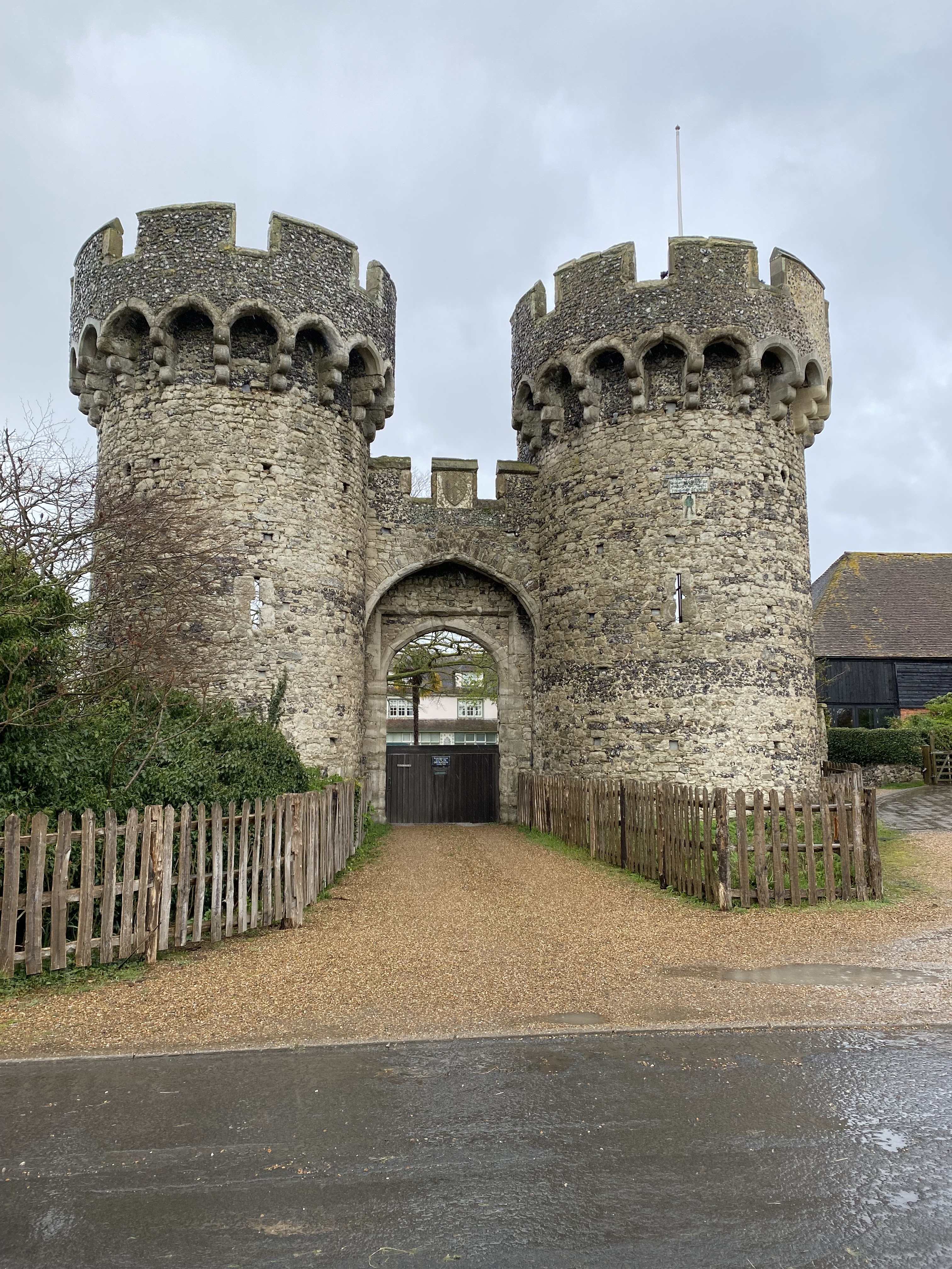


At the next road junction we turned left towards Breamore House, then following signs to the museum and farm shop (closed of course), then turning right and finding the track to Breamore church.


We visited this building last year - today we made use of the seats in the porch for a coffee and Guinness cake break at our 3.5 mile point.

It’s a lovely building, and the graveyard is huge.

We returned to the road, and headed towards the main A338 road - we decided to give the footpaths a miss - the are looked pretty soggy.


At the A338 we turned right and had a short walk alongside this busy road, past the Bat and Ball pub to the left turn to Woodgreen. There’s bridge over the dismantled railway line, then another over the mill stream, and one more over the main course of the Avon - looking very full this year.


As we come into Woodgreen, at the junction near the pub, we turn right and climb up to the right turn to Castle Hill. This road has parking spots and a great view over the river as it snakes its way along the valley.


We walk down through the woods and through Folds Farm, following the Avon Way, with several small bridges over small branches of the river - small, but once again, full.  There’s plenty of mud and the puddles make me pleased I chose to wear wellies today.   The last and widest bridge over the main river is a suspension footbridge, and you can feel its movement as you walk over it to reach Burgate Manor Farm.


At the main road (A338 again) we turn right for a short distance, then left to join a footpath through Lower Burgate, past some playing fields on the right, ignoring the right turn and on until we reach the minor road junction at Tinkers Cross.

There are new houses being built - by this time we needed more fuel, so found a couple of breeze blocks to use as seats, and had more coffee and the remains of the large chunk of cake. ( 8miles done by now).

We finished the walk with a gentle but consistent climb up the road to Whitsbury. The roadside offers mosses, fungi, and tongue and other ferns.


Back at base at 3 20 - we’ve done a good ten miles today, and there were 418 feet of ups and downs.