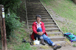
and occasionally rides a bike.
A word of warning. The walk descriptions are not detailed enough to guide you - please take a map. The batteries never run out, and you always have a signal. Oh, And don't take left or right as gospel!

Thursday, June 30, 2011

Walk from Deerleap car park, New Forest

Sunday 26 June 2011, almost five and a half miles.


A hot day, and fierce sun. I needed to stretch the legs, but had to seek shade.  This walk starts from the car park and follows the track downhill towards the railway line.  I crossed the bridge, but then retraced my footsteps to go into the wooded area where I followed a woodland track which pretty well skirted the area.


On the way back two pony carriages were coming over the bridge, and I saw and heard several trains.  It was one of those walks where taking photos became as much fun as walking.  Foxgloves en masse, mainly pink but a few white ones and the light through the ferns. 


 Then I caught sight of a white admiral on the bramble flowers, and some orange butterflies I hadn't noticed anywhere before, but later identified as silver-washed fritillaries. 

The butterflies are very obvious in flight, but my skill is not developed enough to capture that.

Deerleap, for details and map click link:   26 June 2011

Monday, June 20, 2011

Whitwell - Sykes Lane - Empingham - Horn Mill - Fort Henry - Exton - Whitwell

Mel, Norma, Ian P, Barry O, Gordon, Maureen, Jill, and me.   8.6 miles (ish) Sunny, warm, dry underfoot. 


From Whitwell - Sykes Lane - footpath across side of dam to Empingham - through village, past pub, turn left - take second footpath (with seat!)
over fields to Horn Mill trout hatchery - alongside spinney etc to Fort Henry Lake - turn left follow road alongside Tunneley Wood, turn left along Viking Way, take footpath before cemetery, into Exton via Dairy Lane, turn left along Stamford Rd. Cross road at T-junction and follow signed footpath through several fields, emerge at Noel Arms, Whitwell.    There we found this magnificent commemorative plaque:


We braved the main road crossing and walked along Church Lane etc to car park.
Lunch at Harbour Cafe Whitwell.

Link to map etc

Friday, June 17, 2011

Badby to Nether Heyford along Nene Way

The journey begins

Friday 17 June 2011.  With Marta.  Approx 8 - 9 miles.  Slightly humid and showery, but pleasant underfoot.

We took the (metaphorical) bull by the horns of our dilemma, and decided to attack the Nene Way from the South-West, starting at Badby.  Not quite the source, it seems, so that is for another day - we intend to track that down when we've completed the whole route.  That could take some time, since the next available date is at least a fortnight away.


We didn't set off until about 12.30, and for future expeditions we must do better. 
The start is clearly marked from the Green in Badby, past some cottages, then through fields by a small stream.
The infant Nene?


The path leads to the road into Newnham, climbing the hill
Alfred Angas Scott was a famous motorcycle manufacturer and he stayed at the New Inn in 1908.  The Newnham hill climb was a regular motorcycle event before World War 2. It was held on Good Fridays. On Thursday 20 July 2000, a similar race was held.


The path goes through the churchyard and downhill past a large monument, overgrown with vegetation - the path leads through to a cottage with a well outside, then down hill, along the streets.  Some of the signs are not exactly obvious, but all went well until we came to a gate into a field where an obvious concrete track led down to another gate on our right, towards trees by a river... eventually we realised there was no way out, and returned. A local farmer set us right, saying that we really should have noted the way the arrow before the gate was pointing - up to the left past a telegraph pole and through various gates with a white disc waymarker. 


This section was hillier than we expected, and the more scenic as a result.  We came out at Little Everdon Hall, set in parkland, with a Countryside Stewardship sign on the gate.  Very attractive hamlet.  After the last house there is a sign to the left - as we walked we passed one or two places where there are turns to the left from the path, and a few confusing signs.  
Every WHICH way?


Marta has a well-earned coffee. There was no bull today.
Through fields of barley, and rapeseed with poppies, we passed a gate where swallows were perching. They let us get pretty close to them before flying off.
Swallows


We arrived at the road to Weedon Bec.   We called in to the first pub for a drink, and were amused by a small child with a remarkably placid puppy in a room which looked more like a living room than a bar.  In the local mini-supermarket we bought a sandwich 'meal deal' and took this along to eat where the Nene Way follows the Grand Union Canal towpath briefly, past Weedon Wharf to Bridge 25.  We lost track of the actual path in Weedon, but found it near the cemetery under the Canal Aqueduct. We managed to orientate ourselves by the position of the Canal and the very busy West Coast Mainline railway beyond.


At Bridge 25 we left the canal towpath, and made our way towards the A5. Not the most scenic part of the walk, but not quite as tricky to cross as we thought.  We went slightly to the right of the footpath to get a better view of the traffic!
At this point be careful to go straight ahead, avoiding the clear path diagonally to the right.  The Nene Way and the Macmillan Way follow the same route here for a short distance. You go over a footbridge and across a wide field towards Flore church.
All Saints Church, Flore
You walk through the churchyard, and go to the right past the school, along Nether Lane and Kings Lane.  At this point we just missed seeing a fox and cubs playing in a field, according to a couple who had been watching them.


The Nene Way leaves Flore between two thatched walls
The path continues across fields east, then south-east, then south into Nether Heyford, crossing the slightly wider river.


The Nene near Nether Heyford

Monday, June 13, 2011

Skeffington - Billesdon - Tilton - Skeffington

Monday 13 June 2011.  With Barry and Eddie. 8 miles.  3 hours and a bit. Fine weather after unpromising start. Mud on boots weather after yesterday's rain.   Humid. Undulating.
Wildlife - several hares. A yellowhammer.


This hare came towards us on the path, then scarpered. I took this with normal lens, and then enlarged, so  I am amazed you can make out the hare.

One for pedants' corner.  What's with the wedding obsession? Second notice I've seen in  in four days.

What bushes are these? We didn't walk near enough to find out.

Another over-enlarged picture - you can just about make out the yellowhammer.


(to be completed) 
For map and details click this link

Thursday, June 9, 2011

Gumley - Smeeton Westerby - Kibworth Beauchamp - Foxton - Gumley

Thursday 9 June 2011. Barry and Eddie. Just over 8 miles.  About 3 and a half hours. One of the more hilly walks in the area, and some good views.  Not much arable field walking.


The Tower House Gumley - it used to be the stable block for the Hall.

St Helen's Church, Gumley.


Up above Gumley. Saddington reservoir is somewhere in the valley.
Fine views and splendid colours - the poppies have been magnificent this month.

The intrepid explorers (explorers are always intrepid)
As we walked downhill we noticed a raised ridge, clearly artificial, carrying water. At first it could almost have been a moat, although it didn't surround the hill, but continued flowing very slowly. So we had to investigate, and follow its course uphill and to the right of our official path. Eventually we found the spot where it joined the Grand Union Canal. 


A little nearer to our route was the outlet for excess water, into a stream flowing through this culvert.
and where any excess water drains off.

Wednesday, June 8, 2011

Wistow - Kilby - Foston - Wistow

Wednesday 8 June 2011, with Marta - between 7 and 8 miles. Weather showery, but mainly fine. 
Walk taken from the October 1997 issue of Country Walking magazine.


Wistow Hall from the road
We were so keen to look through the bridge that we missed the footpath by the church and had to turn back to it.  Then we failed to take the left turn we should have taken just across a footbridge, and continued to the Grand Union Canal at bridge 78 (I think).


Lock keepers Cottage

Tenth Century church at Foston

Foston has been a deserted village for about 400 years, but St Bartholomew's church, dating from the tenth century is still in use.  People had arrived to prepare for the Flower Festival when we got there.


Keep on the strai(gh)t and narrow!

A pleasant walk - a good lunch at the Dog and Gun in Kilby, but a little too much arable field walking, at low level with no real views, in the middle part of the walk - between Kilby and Foston,  and a tad too much road walking - narrow verges and more traffic than I expected.  The beginning third and the final third were better.
tbc


For details and map click this link

Monday, June 6, 2011

It's been raining

and I'm taking a few people on the walk described on Friday 3 June, 2011... 

and today it was cloudy, but dry and warm
 and the whole walk is  a bit over 7 miles without the detours. 

All the same I ended up with muddy trousers, wet almost to the knee, from walking through a wheat field after last night's rain.
Possibly one or two more inclines than I recalled.


Map and details


With Sue, Kate, Barry and Eddie.

Friday, June 3, 2011

Pytchley - Broughton - Badsaddle Wood - Pytchley

Friday 3 June 2011.  With Marta.  Around 7 miles - almost 3 hours. Sussing the scene for a Monday walk.
Conditions, hot, sunny, bit of wind, very dry underfoot. 
Wildlife - another hare.

 The walk is adapted from the series Walking Close to - the River Ise near Kettering booklet, by Clive Brown, with the starting point at Pytchley.


Espaliered pear tree on a house in Pytchley.

1. Park opposite the Overstone Arms, walk up to the crossroads, turn left along  the High Street. take the right fork to Top End, walk to the end of the End, and turn left through a farmyard.

Turn right after a black barn, and take a bridleway past farm buildings and then between fields.  Follow the bridleway between hedges as it swings left.  As this ends you come to a field where you bear right to cut across the corner, through a gap in the hedge, then follow the right hand edge of the field, keeping trees to your right.
A well-earned rest - after - ooh - half a mile!  And only space for one of us.

2. The track goes down to Underwood's Hill  Spinney, then across a footbridge and up a slope to the right to join a bridleway. Turn left and follow the bridleway to a gate.  There is a gap in the hedge leading to a narrow overgrown path - follow this to the stile at the other end and turn right. (There are plenty of notices here telling you to keep to the footpath!)
Over another stile and along a narrow fenced-in path. Another stile, and the path continues between walls, through what looks like a private yard, and out through someone's garden, more or less.Broughton church is on our right.

The clock face is red. Lots of local ones are blue. 


3.  Walk down the path to Church St, and go left to join High Street and a little later the Northampton Road.


This sign shows the Broughton Tin Can Band in action, chasing away evil spirits - or it's rumoured it was once gypsies?


Is this one of the evil spirits?

 Walk a fair distance to the end of the houses and there is a garage. It can't be seen until you are pretty close.
The latest superpowered police car?

Opposite is a footpath sign through a gate.  Turn left and cross the field - you can see the paths cleared through the crops. Walk with the hedge to your left, and keep your eyes open for a stile part way along the field edge - you cross this to your left,  and continue in the same direction, but with the hedge on your right.  You cross two footbridges - both over dry stream-beds this time.

4. Go through a gap in the hedge, and turn right, crossing the field diagonally to the left to a gate in the opposite corner. Cross the minor road and walk along the farm track, continuing past the farm (Pytchley Lodge) which you pass on the left.

5.  Continue for 400 yards, ignoring a wide track to the right,  until you reach a waymarker pointing right. Follow the path across the fields. (if the field is sticky, after crops have been lifted and the field has been ploughed you can continue to the next field boundary and make  your way along with the hedge on your right until you join the original path). The path goes over a footbridge and round to the left of abandoned Badsaddle Farm. Follow the grass bridleway to the left, which takes you down the right-hand side of Badsaddle Wood.  Keep on through the welcome shade and you reach the A43 at a lay-by.

6. Go through the lay-by, turn left along the first wide track leading down the right hand-side of a large field. We couldn't see a sign post for this footpath.  At the end of the field there is a cross-paths.  You go ahead, turning slightly to the left, then joining a farm track - grassy rather than metalled.   You cross a farm road, close to a pylon, and in the next field keep to the left, with trees on your left.

7. At the bottom of a slope, turn right for about 30 yards and cross a serious footbridge.  Continue in the original direction, keeping the trees on your left.  You walk along a bridleway between hedges ( a bit overgrown) until you reach a minor road (Orlingbury-Broughton). Cross the road.

8. Head slightly diagonally left to the hedge corner. The gap is right in the corner - there is a large gap slightly to the right of it, but ignore it.  Carry on with the hedge on your left. In the next field, move away from the right hand edge, following the path through a dip and past a lone tree.  Carry on through field to a gap in the hedge, and across another field.
In a few days time, this may look like a lake from a distance .

You reach a stile just past some farm buildings.

9.  Turn left through the small farmyard, and down a path between the house and a wall.  You emerge at the corner of Butcher's Lane. Follow this to High Street, passing the primary school with its raised veg beds and mini-pond.  Follow the High Street back to the Overstone Arms.


Once more, with thanks to Clive Brown's booklet  Walking Close to the River Ise near Kettering. 


Thursday, June 2, 2011

Orlingbury - Little Harrowden - Orlingbury


2 June 2011.  With Barry and Maureen. Around 7 miles - just under two and a half hours. Fine, warm, dry.

Mostly arable land - wheat, rapeseed and some pasture. No bull in the field with the label, though we saw cows and calves - none of which showed any interest in us.
There was a hare on the path ahead of us at one point, and then a fox in the middle of a field, quite unaware of us for a while.  Both too distant to photograph.

A strange snippet about Orlingbury, and Badsaddle Wood