With Maureen. Thursday 16 March . 7.8 miles. Around 200 feet of ascent.
We set off from Top Dysons, near the Old Forge in Cranford St Andrew, and walked along St Andrew's Lane, as far as the footpath to the right, which took us through the grounds where the church and hall are situated. There were plenty of sheep and lambs.
The path heads across the parkland and emerges at The Green, which becomes Church Lane and passes St John's church.
Shortly afterwards we take the footpath which leads through a field, up to a gap in a fence, and down a dip with a footbridge. We should have stayed further to the right, as we ended up close to the off-road tracks in the old quarry. In the end it was not a big problem and we made our way to Twywell. We walked along High Street, the Green and Lower Street before following the footpath sign to Twywell Hills and Dales, on the site of old ironstone workings.
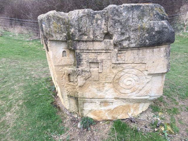
The first part of the path is through pleasant woodland, then there is a section where the noise of the A14 is intrusive. We followed a path between fences which brought us to this carved stone.
Notice the Dartmoor ponies which are there to graze and protect the habitat.
By following the map and path signs we made our way back to Cranford - almost seven miles in all, but I need to walk it again to get the route clear.
and occasionally rides a bike.
A word of warning. The walk descriptions are not detailed enough to guide you - please take a map. The batteries never run out, and you always have a signal. Oh, And don't take left or right as gospel!
Showing posts with label Twywell. Show all posts
Tuesday, April 4, 2017
Thursday, October 1, 2015
Lowick, Drayton Park, Slipton, Twywell circular
Thu, 2015 Oct 1 9:22 AM BST
With Maureen and Gordon. Beautiful day - early mist then sunshine - dry underfoot. About 6.5 miles.
We set off from Drayton Road in Lowick once more, this time walking along the road as it passed several houses, then going through the gate where the private road and public footpath begin.
A gentle climb brought us to Drayton House, which looked splendid as the last morning mist began to lift.
![]() |
| The avenue is a continuation of the present day road |
We followed the private road as it made its way down towards Slipton. Autumn fruits hung in the bushes.
Some fine chickens were ranging freely
Fields were freshly ploughed. Luckily we were not walking over these!
The tractor was still ploughing.
When we reached Slipton, we turned left and walked as far as the pub (The Samuel Pepys).
![]() |
| More apples |
![]() |
| A eucalyptus tree |
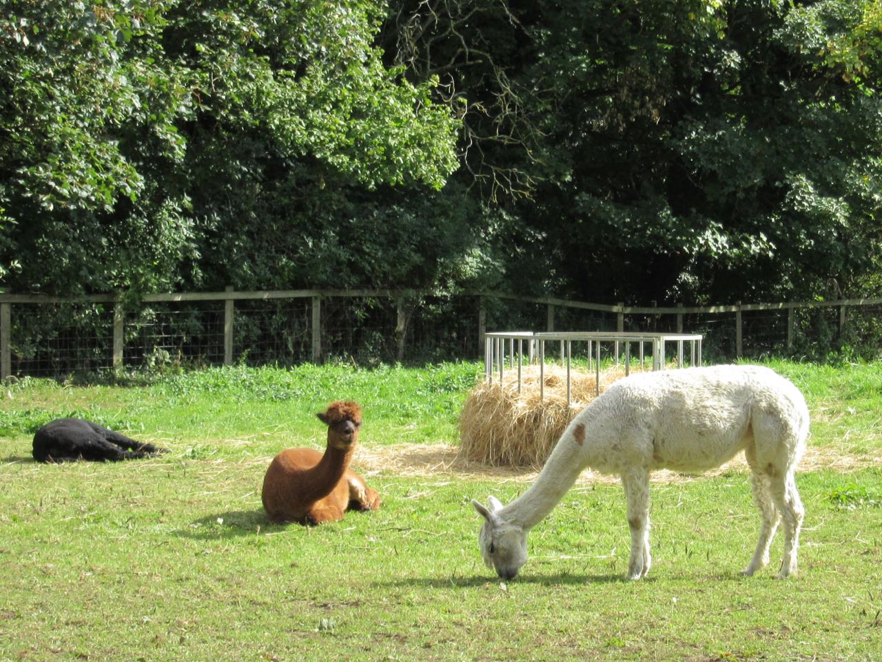
Just over the road from the pub is a footpath which we took through a field with horses. This led to the bend in a road, where there is also a footpath to the left along the hedge. The footpath comes out near Manor Farm, where the llama/alpacas are, then out on the road in Twywell.
We turned right along the road for a short distance before taking the footpath to Hills and Dales. The path skirts the back of the gardens in the village, and by keeping to our left we emerged near Monday's field of strange sheep and out at the other end of the village, near cottages called Cyprus Row. Here is a fine bench on a patch of grass - an ideal point for contemplation and coffee and a scone.From Twywell we had to walk along the road for about a mile - it's a road with little traffic, but rather spoiled by the noise from the nearby A14, hidden behind trees. At the junction with the road towards Slipton we turned left and quickly right on to the footpath we used on Monday. We followed this as it widened into a bridleway as far as the large locked agricultural building.
![]() |
| One of the commas we saw |
![]() |
| Red admiral |
![]() |
| Starlings on the wires |
![]() |
| A wide track between autumn hedges |
![]() |
| A shaggy inkcap |
The path should go straight on and then left from here, but we went left then right to end up in the same place - there's a waymarker just before you cross a farm road. Then the path cuts across a field to the right hand edge of a wooded area, and follows the field edge round to the right to a footbridge over the brook.
![]() |
| A different view of Lowick church |
![]() |
| Colourful trees |
![]() |
| The footbridge |
A better walk than Monday's - we missed out a couple of muddy sections and some ploughed fields!
Monday, September 28, 2015
Lowick, Twywell, Drayton Park
Mon, 2015 Sep 28 10:09 AM BST
With Maureen and Gordon. Late start after eclipse! Moonstruck leader wandered a little before finding the way. Around 7 miles in beautiful weather.
We parked on Drayton Road, near Mill Lane, then took Main Street out of the village.
![]() |
| Lowick "cathedral" |
![]() |
| A door to the "Old George" |
After crossing a farm road, the byway became trickier to follow, but we made our way, turning south, to the junction of the roads to Twywell and Slipton. A large block of concrete , close to some splendid blackberries made a good place to stop for a break.
![]() |
| The juiciest fruit is always just out of reach - luckily for the birds. |
![]() |
| Toll Cottage with its rounded wall |
![]() |
| I thought this gal and her mate were pigs from a distance! |
More llama/alpacas . . .
Our path took us north east and down into a deep cutting.
We decided to follow this path and miss out Slipton on our way to Drayton Park. There were a couple of recently ploughed fields - at least the mud was dry, but they were quite tough going.
![]() |
| One field down, one to go! |
According to the Historic Houses Association, visits can be arranged at a price, and minimum group size 12. They describe it as still very much a family home, as it has been for 1000 years! More info here.
Another enjoyable walk in spectacularly good weather.
Wednesday, May 22, 2013
Twywell circular
Tue, 2013 May 21 10:34 AM Western European Time
With Marta. Good weather, fairly flat. Some navigational tests because of poor waymarking, and paths not made clear on the ground. One accidental timer stop. One crossing of A14. About 10 miles ish. Grey weather but no rain.
How did we miss the tumuli, labelled Three Hills? The usual lack of mapwork, I suppose! Unfortunately we can't see the path on the ground, but work out where we should be able to meet it by walking along field edges and finally see the waymarkers. Back on track we head for Rectory Farm, and turn left into Great Addington, in search of lunch. We find this at the Hare and 'ounds. It's dropped its aitch, poor sign. A good enough sandwich, a friendly landlady, and rather dear J2O, but it does the trick.
Off we go again, taking the path from Cranford, beside the Manor House. We have a slight feeling of dread on seeing the sign "Footpath to Burton Latimer", but hope we'll be able to find the paths on the ground as clear as on the map. It's not to be, of course, and each time we stop and look for a trace of a cross-field "made good" path, we are disappointed. To cut a long story short, we try our best, find some way markers which don't help a lot, and emerge on the A510 about half a mile to the south of the Round House. For the sake of simplicity we walk along the road - there is a decent sized grass verge.
At the Round House we take the bridle way north, over the drive to Wold Farm, and a couple of fields, before we turn left along a hedge and then follow a diverted path round the edge of a quarry.
Then over a field and we have to brave the A14 itself. Life would be pleasanter with more bridges and subways! The central reservations makes the crossing simply a matter of patience, and we are on the edge of Cranford. We have to do a bit of thinking to be sure that we're on the right track towards Twywell At first we wandered too far to the right.
Once on course, it's pretty straightforward, and we arrive at the Hills and Dales country park - we walk north east into Twywell.
We saw and heard a pair of lapwings and lots of red kites.
A footnote - Irthlingborough's Waterloo film centenary!
Map and details
Thursday, March 17, 2011
Lowick - Twywell - Slipton - Drayton Park - Lowick
6 miles - Thursday 17 March - with Barry, Eddie, Gordon and Maureen
Just under two and a half hours. Easy walking on tracks and minor roads - one section where hedge had been grubbed out and ditch dug was muddy.
Park by the old school in Lowick, take Lobbs Lane, then tracks up and across to meet a minor road leading to Twywell, to the right. Walk along this for about a mile to Twywell, then take another footpath to the left across fields in Slipton, and down to the church which is separate from the rest of the village, walk through the churchyard, and after a short while through a gate and a private drive to a minor road leading up to Drayton House.
Drayton House
Click on the title of this post for an aerial view of Slipton, and an interactive aerial view of the whole area.
Just under two and a half hours. Easy walking on tracks and minor roads - one section where hedge had been grubbed out and ditch dug was muddy.
Park by the old school in Lowick, take Lobbs Lane, then tracks up and across to meet a minor road leading to Twywell, to the right. Walk along this for about a mile to Twywell, then take another footpath to the left across fields in Slipton, and down to the church which is separate from the rest of the village, walk through the churchyard, and after a short while through a gate and a private drive to a minor road leading up to Drayton House.
Drayton House
Great house which Sir Simon Drayton was given a licence to crenellate in 1328. Additions were carried out during C15 and late C16. The house was remodelled during the early C18. Much of the west part of the house was rebuilt and the hall refronted in 1702 to designs by Talman.
Sheep, parkland, statues.Click on the title of this post for an aerial view of Slipton, and an interactive aerial view of the whole area.
Subscribe to:
Posts (Atom)