and occasionally rides a bike.
A word of warning. The walk descriptions are not detailed enough to guide you - please take a map. The batteries never run out, and you always have a signal. Oh, And don't take left or right as gospel!

Showing posts with label Barrowden. Show all posts

Monday, February 28, 2022

Bike ride Gretton to Barrowden and back

Sunday 27th February 2022. About ten miles. With Harry. Across the Welland at Middle Bridge, towards Lyddington and along Thorpe Lane’s double mini-hill. Then road towards Harringworth, turning off at Morcott turn and up the big hill, and across to Barrowden. 

selfie near Wakerley

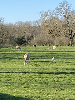
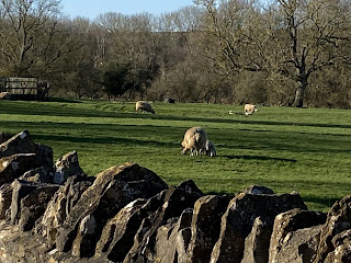
Lambs


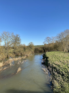
River Welland is quite full

From Barrowden to Wakerley, then Harringworth and just the final hill to go. Much better from the point of view of low sun this way round. 

Tuesday, November 23, 2021


Sunday 7th November, with Harry.

Afternoon , cold and bright. We cycled to Harringworth, Wakerley and Barrowden and back via valley road and Mill Road - approx 10 miles, I guess. Quite hard work, and a bit windy. 

Photo by Harry.


Sunday, October 17, 2021

Harringworth Round

 With Eddie and Maureen, about 7.5 miles. Not warm and very little sun.

Harringworth stables.

We decided to tackle this anti-clockwise, taking the path close to the entrance to the stables which crosses the field towards the Welland. The path follows the river as far as Turtle Bridge.

Nettles are still thriving


We turned right soon after crossing the bridge, and made our way towards Barrowden with the hedge on our right. Look out for the way marker guiding you across a field and away from the church spire.

We crossed a couple of fields with stiles, and turned left up the road, the right and left at the junction. We didn’t visit the coffee shop today - the weather was not inviting enough for us to go the extra mile. Instead we continued towards Morcott - quite a. long slightly uphill stretch of road.
View of the windmill ar not easy to get from here, but I tried.
We had to cross the A47 - not too bad this way as visibility is good . Across the road we went through a short downhill section of woodland, then crossed a field to a stile and steep steps down to the A6121. We crossed this and walked through Morcott as far as Mount Pleasant Road, where we turned left then picked up the footpath leading back to the A47 close to the junction with a small road. The next section involved crossing a couple of fairly big ploughed fields - downhill and fairly dry.
We followed the path which goes under a small railway bridge before climbing steeply to Morcott Road (from Seaton to Morcott. Lovely views of the Welland valley viaduct from here.
We took a late scone and coffee break at Seaton church - the usual sun trap bench was at least sheltered from the wind.


From now it was downhill all the way past the farm with its pond to the Welland valley, dry and unflooded and easy walking back to Harringworth. 
We took the path under the viaduct through the churchyard and past the stables to return to the cars


Tuesday, October 12, 2021

BY bike from Gretton to Rutland Water

 Tuesday 12 October 2021. With Harry 20 miles. The weather promised to be sunny, or so we thought as we drank coffee in the garden.

Out ward route via Harringworth, Wakerley,  Barrowden and the Luffenhams. Return via Lyndon, Wing, Seaton and Harringworth.

A pair of swans on the Welland near Wakerley.

A murky Rutland Water from Normanton car park as the drizzle persisted.

Approaching Wing

Coffee break over…


Penultimate hill climbed - only the hill between Harringworth and Gretton remains


3 hours, 20 miles, 1160 feet of ascent. 

Sunday, June 21, 2020

Another ride around the Welland Valley

Gretton - Lyddington - Seaton - Barrowden - Wakerley- Harringworth - Gretton.
the elderflowers have gone. Plenty of meadow cranesbioll and some mallow. Wild roses, another umbellifer (ie not cow parsley), knapweed, honeysuckle. The river looked peaceful at Wakerley Bridge.  Looked as though the pub was open in Barrowden - people picknicking on the green, near the duckpond.
Three hills - up from  Lyddington, up to Barrowden turn on Morcott Road, and finally Harringworth Hill.
oh yes,  the road between Wakerley and Harringworth is bad, but not as bad as the one past Kirby Hall!

No photos today. About 14 miles I think.
Thursday, March 28, 2019

Harringworth - Barrowden - Morcott - Seaton round

Thursday 28th March, with Maureen and Eddie. The same walk as last Thursday, but in reverse. About 8.5 miles. Fine and warm once more.

From Harringworth village centre we walked a short distance along the road to Wakerley, then turned left to the path through the field near the stables. We followed it to the Welland, and walked with the river on our left as far as Turtle Bridge.
Here we crossed the river and continued our walk along the field edges before heading diagonally to the left, and slightly uphill into Barrowden, through a field of sheep and lambs.
We followed Back Lane and eventually reached King Street and the Commnity Shop and cafe. Almost 3 miles, so it was an early break for coffee.
Out of Barrowden via the village green and duckpond.
Vantage point for a photograph

There was an uphill stretch along the road towards the windmill, just before the A47, which is easier to cross from this side of the road!


Through a short woodland section with plenty of violets underfoot, then across a recently ploughed but smooth and dry field.
Down a flight of steps, and across the A6121 and through part of Morcott village, until we met the waymarker indicating our footpath, along Mount Pleasant Road. This soon leads into a field. It goes slightly uphill and before too long back to the A47, close to the petrol station complex. We crossed and took the path directly in front us. Another ploughed field, but again dry and smooth, and going downhill, with good views around. 
At the bottom of this slope we turned right and followed the yellow posts as far as the railway bridge. Under this and we turned left then right for a short steep climb up to the road to Seaton.
In Seaton we paused for a rapid drink, sitting in the sun outside the George and Dragon.
Seaton Church
Our route took us down church Lane and past a few houses, then downhill with views of the viaduct, across a disused railway line and across the minor road. Through a small gate and along the drive of the very impressive farmhouse. The path goes round the house, and over a wooden footbridge, before heading across fields towards the Welland, and over the river, then left under the viaduct and back into Harringworth, via the churchyard.

Harringworth church.

Lots of daffodilas and spring flowers in the villages. Celandines, violets, primroses and blackthorn in abundance.
Tortoiseshell and brimstone butterflies.
Lunch at Lydia's cafe, Gretton.


Thursday, March 21, 2019

Harringworth - Seaton - Morcott - Barrowden - Harringworth

 Thursday 21 March 2019, with Eddie. Around 9 miles. Fine and quite warm, with a small amount of mud.  Fine views of the viaduct, twice with a train crossing. Coffee and teacakes at Barrowden Community Shop.
We set out from Harringworth, close to the cross. We took the Wakerley Road for a few yards, walking down past the stables, and through the churchyard, resplendent with blossom this morning.
At the road we turned left for a few yards then took the footpath alongside the houses, to the right. We followed the path turning right rather than left to the village Hall. It goes along to the viaduct, but is a bit tricky to find in places. At the viaduct we turned left and went through a gate, then across the field making for a footbridge over the Welland. Across a couple of fields, the second one quite sticky. We were wiming for a footbridge to the right of the large farmhouse.
The footpath takes you round this house and on to the drive and the road. We crossed the road and took the steps up and over the dismantled railway, then onward to Seaton.
Looking back to the viaduct
A flock of sheep and lambs appeared to think we were good shepherds,  and followed us enthusiastically across one of the fields - alas they were disappointed.
Sorry, folks, no food for you!
We passed houses and the church in Seaton, turning right at the next road. We walked past the pub and took the road signposted to Morcott and Barrowden.
The viaduct again
Just before a bridge we took the footpath down into the valley, leaving the gate to the railway on the left. We came to the bridge under another dismantled railway.


Eddie working out where the railway lines went...
We kept the railway track on our right, and made our way along field edges (avoiding more ploughed land) up to the A47, not far from the motel, petrol station and cafe. We crossed - it's busy - then took the footpath northeast from the road junction near the motel etc. and into Morcott. We turned right along the road to the junction with the A6121 from Stamford, and crossed it to the footpath heading eastish. We skirted the field to avoid more mud, went through a short stretch of woodland and came out at the A47 close to the junction with the Barrowden Road. 
Barrowden windmill
After this it was simply a matter of walking downhill to the village and finding the Community shop and cafe for a welcome coffee and teacake. We probably stopped for half an hour or so, before making our way back out of the village, past the pub, the village green and the duckpond, along Seaton Road for a few yards, then turning left and finding the stile to join the Jurassic Way, which we followed across a couple of fields, then close to a dismantled railway. We turned left and downhill to Turtle Bridge and the Welland.
Borderlands - the sign over the bridge says "Rutland"


We turned right to follow the river as far as the field with horses, which we crossed to reach the road where we had parked.
And once again ...


I can't resist posting the charts for pace - mostly just over three miles per hour - and the elvation profile, which makes it look as though we have scaled mighty peaks!,


Tuesday, April 4, 2017

Wakerley, Laxton Hall, Barrowden

Monday 27 March. led by Tommy, with Norma, Maureen, Ken and me. 
6.5 miles, in decent weather.

Unfortunately I switched the GPS on part way round!


We set off from the car park in Wakerley Woods, and walked through following the Jurassic Way signs until we reached the next barrier after the edge of the woods, when we  turned right to take the path behind Laxton Hall.


After that we followed the newly made path which replaces the right of way through the land which is being quarried, then used for landfill. The new path is clear and generally good, but I suspect the walk will be dusty and noisy once work starts in earnest.

The seagulls follow the tractor . . .


We took the road between Harringworth and Wakerley, walking for about a quarter of a mile, then turning left along the footpath, keeping to the edge of the recently ploughed field and walking alongside the dip left by old workings, with the lime kilns in the background.
We took the Jurassic Way again from Wakerley to Barrowden, crossing the Welland.


We took the footpath on the west o Barrowden which emerges near where the road crosses the Welland, a the old station building.  t the junction we picked up the Jurassic Way footpath near the house which used to be the pub. It goes behind the church and comes out on the road. At present they are building an access road to the quarry near the corner.
We followed the road and picked up the Jurassic Way footpath back to the car park.
We're almost back
 Lunch at Barrowden Community shop.