and occasionally rides a bike.
A word of warning. The walk descriptions are not detailed enough to guide you - please take a map. The batteries never run out, and you always have a signal. Oh, And don't take left or right as gospel!

Showing posts with label OS Explorer 222. Show all posts

Friday, September 13, 2013

Walcote - Swinford - Walcote


Thu, 2013 Sep 12 9:33 AM British Summer Time
Led by Barry, with me, Maureen and Gordon. Flattish, sheep and cattle and some arable. Dry weather with a little sun later. 7.8 miles.

There's a smell of resin from the cut wood

I meet the gang at East Carlton, and we make out way by car to Walcote once more. We park behind the same vehicle - 6IGEON of clay-shooting fame - as Monday.

The rowan berries are bright
We take the A4304 for a short distance before our path leaves to the left - somewhat hidden by the lushness of the hedge.  We cross the field and then walk along the edges going south.  We pass a few tiny ponds in field corners and clamber over ten or a dozen stiles. We notice them today - nearly all are slippery.   In one field behind Thornhill Stud,  there are several horses.  A white one is quite interested in us - not just for a fuss though.  
"Is that all I get?"
We walk past some old practice jumps , then cross the Lutterworth Road.  Near Swinford Corner we take another path southwest - a bridleway this time, so no stiles for a while.  This leads towards the M1 - we kept on the bridleway all the time, ignoring a path to our right.   When we reach a bridge carrying the farm track over the motorway, we wander out to watch the traffic rushing along, then go back , and leave the bridleway, taking a footpath   going south east with the motorway roaring away on our right as we walk.  After a couple of hundred yards we turn east, and the noise grows fainter, as we approach the village of Swinford - nothing to do with swine, it seems, according to some online information:


The village of Swinford is a compact village at the head of a small tributary of the River Avon. The Anglo-Saxon name would have been “Suin Heaford” meaning “the head or source of the Swin Stream”. In time it was shortened to “Swin-ford”, but has nothing to do with swine!

1718 - the photo isn't quite in focus!
The village is quite big, and provides a seat where we sit a while. 
Our footpath heads slightly north of east, past a playing field, over fields (more stiles) and past a wooded area, before meeting a byway heading more or less north.  The main features here are power lines and wind turbines, both of which provide background music as we go.

After almost a mile, the byway meets the road between Walcote and Swinford.  We promised outselves we'd have a second break today, so we sit on a handy length of wood, even though it's no more than 3/4 mile to Walcote.  A bus passes by, but little else.  

I had to include this photo for the colour that's in it!

On the roadside there's a stall with plums and veg. Too tempting - I pays me money - but the paper bag's wet and they fall out instantly.  They're not difficult to collect and re-bag, and tonight I feast again! 
I love vegetable gardens - and sunflowers

The Old Post Office

Walks - you must be crazy!


A pleasant walk, with more than twenty stiles - and no rain until later in the evening.  There are still a few swallows around.

Tuesday, September 10, 2013

Walcote circular, via Gilmorton and Kimcote


Mon, 9 Sep 2013 10:19 British Summer Time
Led by Barry, with me and Gordon. Pretty flat, good underfoot - mix of arable and cattle country. 7.5 miles. No rain while we were out. At least 26 stiles. 

We had a last minute change of plan when we discovered the A43 was closed and that side of Corby was as near gridlocked as I have ever seen it.  So we headed back across Corby and past Market Harborough.  Thanks to Barry for a last minute alternative to my walk.

I've driven past Walcote countless times on my way to the M1 when heading north, but had never stopped.  As so often there is more to these villages than meets the eye of the passing motorist-in-a-rush. 

We find a place to park, and set off north along Brook Street, taking a footpath west, to the left just before the road divides. The path soon turns north once more,  along the field edge and over a few fields before turning north west and passing the corner of Winterfield Spinney. 
 The path zigzags a bit through fields north then west, but when two paths meet between Oback and Thornborough Farms we turn right in a northeasterly direction.  In the third field we take the left hand option when the path divides. This takes us to the left hand corner of the field, across another one, then along the edge of a third, very smelly today, as it's recently been manured.  Good job we don't intend to eat in any posh pub.

We turn left and walk uphill for a few hundred yards along the Lutterworth Road, which is busier than we expected.  
The footpath goes off to the right,  and heads north north east to Gilmorton. We pass the old motte in a field near the church - no public right of way, so we sneak a peek through the gate.

Our path goes through the churchyard, where we take a break. 
Gilmorton Church

An unusual memorial bench.


The church porch was built to celebrate Victoria's diamond jubilee - the stained glass is clearly Victorian, and we think the carved head above looks like the lady herself.

We leave the church behind us and walk through the village.
Grey skies today!

We turn right along the road to Kimcote, and when the road bends to the right we take a path straight ahead. It looks as though there was once a village or similar here - lots of lumps and bumps in the ground, but nothing on the map.
This runs parallel with the road just south of Bruntingthorpe airfield/ proving ground.

We follow the path to the north of The Lodge, and then turn south towards Kimcote, over more fields.

Kimcote church
  We walk past the church and cross the road to Poultney Lane, through the village and farms.  The road turns into a footpath past sewage works, and then gradually leads southwest towards Walcote. 
Globe artichokes - yum!

The not-so-swfit River Swift.
We meet the road, cross the mighty Swift, and at Woodside Farm, we turn left on a footpath which takes us back to the village.

Wildlife note:  There are still a few swallows feeding up on the plethora of insects - mainly daddy-long-legs - before they leave for the sunny south.

Map and details


Monday, May 6, 2013

Welton - Braunston - Ashby St Ledgers - Welton


Mon, 2013 May 6 9:43 AM Western European Time 
Led by me, with Barry. Fine, sunny, warm to hot. Quite up and downy. Good views. 8.5 miles - the last two miles were in the car, when I'd forgotten to switch the machine off.

Welton is one of those villages set back from the main road - you need to be make a deliberate effort to go there. The main part of it is on the hill near St Martin's church and the White Horse pub.
St Martin's church from the rear

Pub and church - above the pub door are the words "Abandon hope all ye who enter . . ."
We take the path by the pub, going downhill through grassland and a field to the road. Over the road we cross meadow land with cows and calves, sheep and lambs.

A short uphill stretch and we reach the canal, where we cross the bridge and turn right towards Braunston.
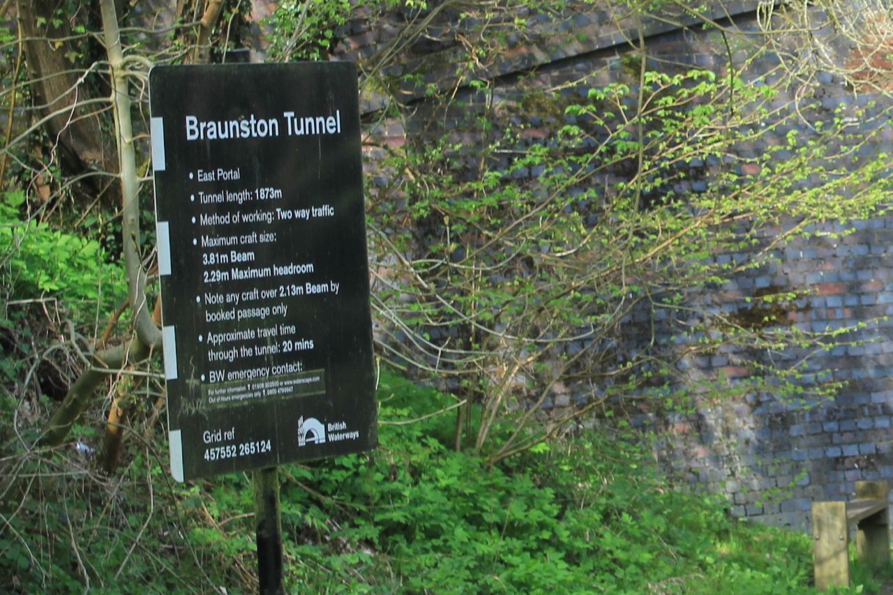
A narrowboat emerging from the Braunston Tunnel

We have to leave the canal and walk over the hill.  The tunnel's a good mile long.
Braunston lies ahead

An air shaft for the tunnel
Bicentenary plaque


We stop for an ice-cream at the canal shop before leaving the water and taking the Jurassic Way to Ashby St Ledgers.

We walk up to Braunston village, and take the road just by the Wheatsheaf -  Ashby Road which goes to the right. We follow it until it bends to the right.  At this point the old road is now a track leading straight ahead - towards Ashby St Ledgers.
The track narrows to a path, and climbs up to a minor road, with great views behind.   At the highest point, we turn right along the road, and very soon left, at a Jurassic way marker in the same direction as previously.  The path goes downhill to the A361. We cross, pass the Old Coach Inn, and walk through the village, until a road junction just before the church.  
the old stables

Church and the gatehouse to the Manor.
We take the road to the right, past a Co-op farm and a building labelled the Old Dairy. When we reach a junction our path goes slightly to the left, cutting off a long corner of the field.  Then it's through a series of fields where rapeseed is just starting to show yellow.  
The path is clear and easy to follow up hill towards Welton.  It comes out between houses on Ashby Road. All we have to do is work out where the church is and we can find our way back to the car.

There's some kind of treasure hunt going on - people with sheets of paper wandering around in groups - and cars driving slowly around. 
Hunting for the answer - what happened to John?

We're lucky enough to arrive at the church just as one of the churchwardens opens it - it's normally kept closed.
The sad story of what happened to John is answered by this gravestone - poor little lad.

I wonder if this is "starved" as in "frozen" - a northern use of the word. My grandmother used to warn us we'd "be starved to death" if we didn't put our coats on in winter.  
Whoever erected the stone seems to be making a big point about the neglectful parents . . .
Map and details
Other walks touching this one: 
Ashby SL, Braunston, Barby
Jurassic Way:  Charwelton to Braunston
Jurassic Way: Braunston to Winwick

Monday, July 30, 2012

Ashby St Ledgers - Braunston - Barby - Ashby St Ledgers

Led by me with Barry and Gordon. Mostly fine, though we had a heavy shower. Underfoot generally good. Stiles awkward on occasions. 9 miles plus.
This walk came from here.
We took the road going west out of Ashby St Ledgers, crossed the A 361 and joined the bridle track which forms part of the Jurassic Way.  It climbs gently up south west until it reaches a minor road (Welton to Barby). Here we turned right and picked up the Jurassic Way again a few yards along the road, where it runs off to the left.  This track leads downhill, and we could see Braunston church spire and a sail-less windmill nearby. These disappear from view as the track descends and then rises again between hedges towards Braunston.  We entered the village at a bend in Ashby Road.  This road leads down to the central green near the Wheatsheaf pub. Here we crossed the road and took a footpath slightly to our left, leading downhill through Jetty Fields Park and then down to the Canal near Braunston Bottom Lock.
View from the Bridge

Old pump house - to pump water back up to the Top Lock

Chimney dated 1897
We walked along the canal, turning right, past the marina and lots of moorings.  


There is also a boat-café, called the Gongoozlers' Rest. Highly recommended by one of the boat-dwellers.

Just after the towpath took us under the A45, we left it, and crossed the road, then followed a footpath just beyond the bridge, and turned right up a grassy slope to the church.  Here you can either follow the road round behind the church, or walk through the churchyard.  We didn't look at the gravestones, but there are apparently a lot of boatmen and women buried here.
Braunston church, and the dark cloud which dumped its contents on us about ten minutes later.


Windmill without sails in Braunston

We walked along the main street for a while, and on our way back noticed this:
cruck frame (?)
Then we returned to our route, and followed the residential street Greenway along, then took the fourth turning into Countryside (really).   The footpath heads more or less north. I think we missed the route after the first field, as we ended up on the wrong side of a hedge after a tricky stream crossing. Another time, I'll try aiming slightly to the left of the corner!

We walked along the edge of a large field of wheat, and manage to cross the hedge at the top, and find the real route.  This leads over a few stiles and passes a house at a distance on the left, then soon turns slightly to the left of Braunston Fields Farm. We crossed a field with some teenage bullocks, who were far more scared of us then we of them.  The path crossed diagonally and then led into a small wooded valley, taking us to the corner of Tiltup's Wood.

Here we crossed one field - a short uphill section, and then aimed for the one prominent tree at the top of the next field.  The path then crosses another field, and Camp's Copse (not marked on the map, though there is a sign inside! 
OK, we're on the route!
Soon we arrived at the minor road leading into Barby. We turned left.  On our right we could see another sail-less windmill, this time in dire need of some attention.
Barby Windmill
We didn't go into the village, but carried straight on over the crossroads, and walked for half a mile or so before meeting the footpath from Barby to Ashby St Ledgers.  This turned right towards Ashby.  We crossed a field and then walked alongside Home Wood, as far as Briccle Wood, where the path turned right.  It runs parallel to a reservoir, but there are just a few glimpses through the trees.

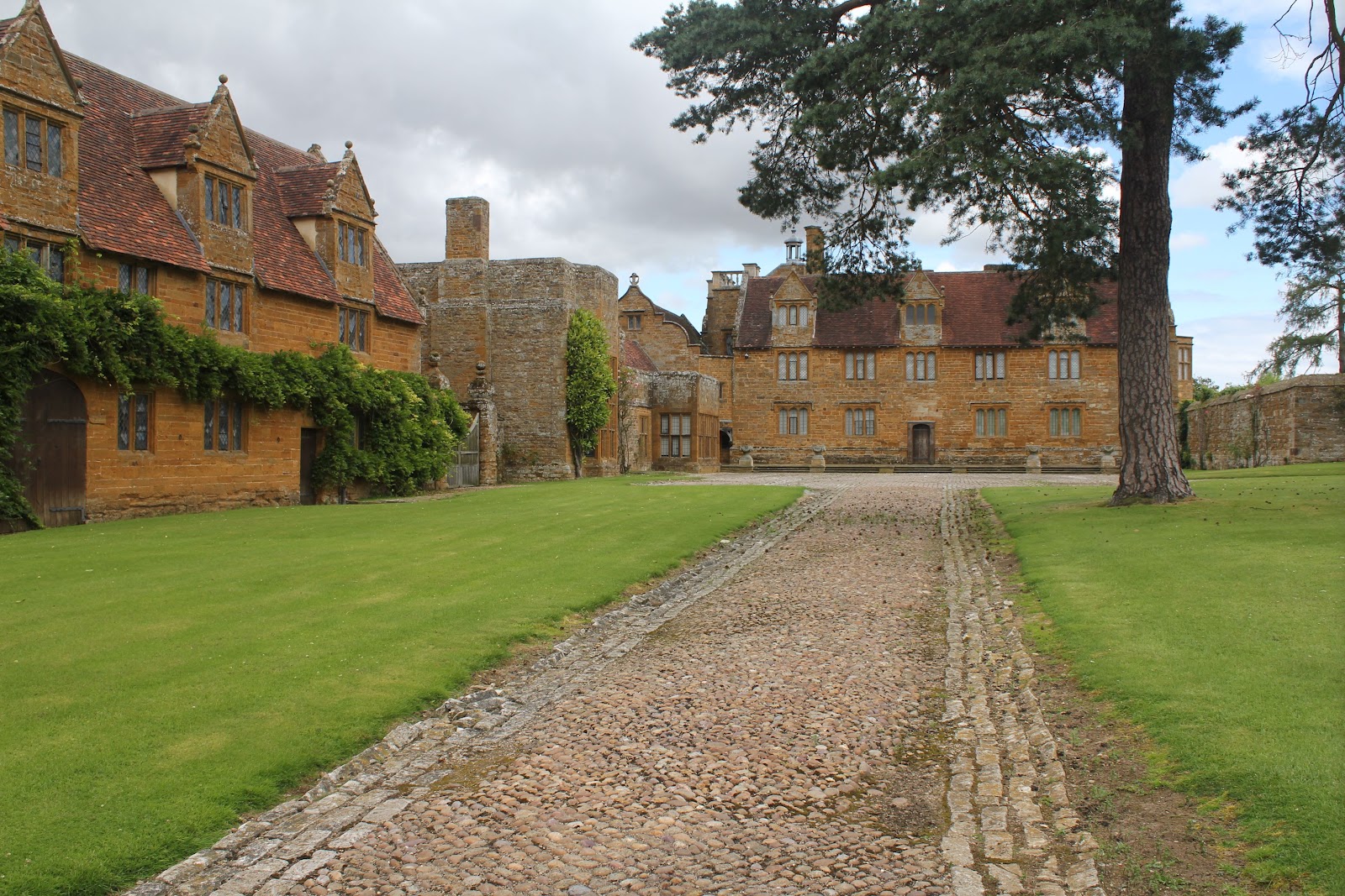
We emerged from the trees and crossed a meadow and a track, but at this point the map told us to cross a section of woodland - there seems to be no way through, and there are path signs to the left of the wood, so that was the way we went.  The path headed south-east into a small dip and up again until it met the A361.  We picked the path up on the other side, and followed it as best we could coming out at a bend in the road just before the Manor House in Ashby St Ledgers. A magnificent building with quite a history, involving the Catesby family, the Gunpowder Plot, and later worked on in the early 20th century by Lutyens.

Ashby St Ledgers Manor House

The gatehouse and the church are also interesting.  There is a little more info and a few more photos  on the post here, as we walked through Ashby when we did the Jurassic Way.

Two fascinating villages on today's walk.

Thanks to Gary's blog - To the hills


map and details