and occasionally rides a bike.
A word of warning. The walk descriptions are not detailed enough to guide you - please take a map. The batteries never run out, and you always have a signal. Oh, And don't take left or right as gospel!

Showing posts with label Welham. Show all posts

Tuesday, June 13, 2023

We conquer the Caudle

Monday 12th June 2023


 We conquer the Caudle ! Seven rather hot miles on Monday morning with Norma Jarvis, Kate Booth, Maureen Owens. From Stonton Wyville, over the Caudle to Welham, where we paused for a welcome coffee break in the Red Lion. Then along the quiet roads to Cranoe, up the hill and on to Glooston. Another much needed break, and one of Maureen’s scones in the shaded porch of Glooston church, before crossing the fields on the Leicestershire Round route back to Stonton Wyville.  Home in plenty of time before the downpour in the late afternoon.


About 350 feet of climbing, but the profile looks impressive!


Friday, May 31, 2019

Stonton Wyville, Glooston, Cranoe, Welham and the Caudle

Thursday 23 May 2019.  With Maureen. Just under 7 miles.

We set off from Stonton Wyville church and followed the Leicestershire Round route over the fields to Glooston. We glimpsed a fox, orange in the sunshine, with its tradmeark white tip of the tail. From Glooston we walked the quiet road to Cranoe, going downhill past the church.  

At the crossroads we went straight on towards Welham. After half a mile or so we took the footpath on the left at Churchfield House.  We followed the waymarkers along the hedge until we arrived at Welham Road between Slawston and Welham.  We stopped for a break in an idyllic corner with plenty of cow parsley.
We turned right along the road towards Welham, and soon picked up another footpath on our left.  This soon brought us to Welham. 
From Welham we walked for a short distance along the road to Thorpe Langton, with a detour into the churchyard.
Welham Church

We walked past Bowden Lane, and followed the road as it turned to the right. A little further along it bends to the left. At this point there is a bridleway sign and a pretty clear path leads quite steeply uphill. 
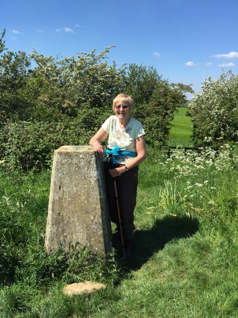
It eases off and after a mile turns to the right and leads to the trig point at 147 metres (about 480 feet) height on the Caudle. Not a great height, but it gives good views all round.


Once we'd saluted the trig point we headed downhill and them along the farm track and across the road, back to Stonton Wyville.  

We had lunch in the Bewicke Arms Tea Room in Hallaton. The sandwiches were excellent value and substantial! 

Monday, September 7, 2015

Weston, Sutton Bassett, Welham circular

Mon, 2015 Sep 7 9:35 AM BST
Led by Mel. With Jackie, Tim, Norma, Chris, Sue, Terry, Tommy, Jill and me. Fine and dry. Just over 7 miles.

A very pleasant morning's walk through fields and lanes, beginning and ending at the Wheel and Compass, in Weston by Welland.  We walk toward the village, turning left and then right near the church on to Sutton Road. Before long a footpath goes off on the left and climbs uphill. When we reach the signpost which points in six directions we take the turn to Sutton Bassett, which goes down into the valley passing Lodge Farm, and its noisy but non aggressive dogs. At the road we turn left not taking the immediate left turn, but keeping on the B664 for a short distance before the footpath continues off to the right.  We walk west for a while, and have a snack break, in the company of a friendly chicken - escapee or free range? 


 We head west for around a mile, then meet the lane between Bowden and Welham.  There is a mile and a half of road walking - but very quiet - we met one car and one bicycle.  The lane comes out near Welham church. We continue past the Red Lion and take the footpath just over the road, heading north east alongside the Welland.
 We cross the dismantled railway and reach Green Lane, where we turn right.

Another mile or so of very quiet road brings us back to the starting point, and our destination for lunch.


Thursday, June 11, 2015

Thorpe Langton, Caudle and more

Thu, 2015 Jun 11 9:27 AM BST. With Maureen and Gordon. One of the warmest and pleasantest days this year. Dry underfoot. Just over 8 miles.
This walk is almost the same as one from last year - but we stayed on the Midshires Way road to Welham this time instead of taking the footpath near Churchfield House farm. I reckon this is shorter by about half a mile.

We turn right from the main road, just past the pub, downhill past the car park, Caudles Cottage and a farmyard, and the road becomes a track 'unsuitable for motors'. 
Just before the ford we take the path on the right hand side, which takes us to a stile, and Leics round signpost. Over the stile and into a long narrow field of brown cows. The path starts to climb gently towards some trees. All is easy to follow, with Leicestershire's fine yellow posts and Leics Round way markers. We keep the hedge on our left as we climb to the trig point - a short,steepish (for us) start to today's walk.
View from the Caudle

Almost there - a steepish start to the walk

The trig point - 147 m
From the trig point we head to the next hedge and turn left, with hedge on our right and follow bridleway signs (blue arrows). We cross through the hedge and then keep it on our left until we come to a gate. From here the path cuts across a field of crops, and leads easily downhill to the unsurfaced road towards Stonton Wyville . At the crossroads we go straight ahead to the small village, then turn right almost opposite the church. We ignore a footpath off to our left.
After a short distance the road bends left, and we soon turn off this to our right, following a well-marked footpath alongside a field or two, through a hedge and across another field for a mile or so to reach Glooston.
Open bell tower at Glooston
We take an early break at Glooston, less than halfway round, but I need my coffee. Very tempting to sit and linger in the warmth of the sun today.
Window decorations at Glooston

Ancient yew tree
 Onwards and downhill slightly to find the minor road to Cranoe - past the Old Barn Inn, turn right at the junction and go straight ahead at the crossroads.The road climbs up before descending into Cranoe, past its perched church. We left the Leicestershire Round at Cranoe.
Cranoe church
 I put a bit too much road-walking in today. We follow the road - a minor one and part of the Midshires Way - all the way to Welham, a good two miles.
View from Midshires Way between Cranoe and Welham
 At Welham we turn right past the Old Red Lion, ignore a road junction to our left, pass the church and walk along Bowden Lane. This is another quiet road, and goes past a farm, and the Welham stud. Soon after crossing a bridge over a brook, and then reaching the fishing lake, we take a bridleway through trees to the right.
New Forest ponies at Welham stud, Bowden Lane

Bridleway towards Thorpe Langton
The trees continue for some time, then the bridleway goes along the edge of a cultivated field and two meadows with cattle before it reaches the road between Great Bowden and Thorpe Langton. We turn right and follow the road into the village to collect the car.

Not a lot in the way of wildlife today - a pheasant, some swallows, a red kite, the odd crow. A couple of butterflies - a brimstone and one I'm not sure of, and didn't photograph. 
Map and details

Tuesday, July 15, 2014

Thorpe Langton circular, via the Caudle

Mon, 2014 Jul 14 9:06 AM BST
With Gordon and Eddie. Around 9 miles in all.

A fine Monday morning sees us parking in Thorpe Langton, before setting off downhill past the pub car park, along a farm track. When we reach the ford, we need to walk down the right hand side along a grassy, slightly overgrown path  before using the yellow waymarkers to navigate into the long field with cows and a few calves. This is part of the Leicestershire Round, and I've walked it several times in the other direction!


We head through the field, as the path goes uphill towards some woodland.  We follow the way markers, keeping the hedge close on our left as we make the final climb to the trig point - it's not very high, but the views of the surrounding countryside are good.

From the trig point we go down to the hedge and turn left following the bridleway along. After going through a gate the path goes downhill towards Stonton Wyville. We walk a little way along the unsurfaced road, the  over the crossroads and into the small village. 

We turn right opposite the church, then turn left and very quickly right to follow the path across a few fields and into Glooston. All well marked along here. 


From Glooston we follow the road - a very quiet one - as far as Cranoe.
We give the church a miss this time and decide we'll have a break when we turn left on to the footpath, just after Churchfield Farm.  We follow this path until it meets a side road into Welham, the take another footpath, through an overgrown gap with two stiles, and through a field of rather large though reasonably placid bullocks, then into the village. 


We walk past the pub on our right, then  the church on our left, we carried straight ahead into Bowden Lane, the minor 'no through road' leading southwest parallel to the Welland. After about a mile we turned right along the bridleway and followed this northwest to Great Bowden Road, where we turned right and walked back to Thorpe Langton.

Map and details