and occasionally rides a bike.
A word of warning. The walk descriptions are not detailed enough to guide you - please take a map. The batteries never run out, and you always have a signal. Oh, And don't take left or right as gospel!

Tuesday, February 28, 2017

Brixworth and Brampton Valley Way

Just over 6 miles. With Norma and Ken. Although the weather was grey and showers threatened we stayed dry, apart from a few fat raindrops just as we stopped for a break.


We set off from the Country Park car park, walking towards the causeway clockwise for a few hanundred yards before taking the footpath to our left and up towards the A508. We crossed the road, and then took the right hand fork of the footpath through the houses, (the Ashway and Iron Pikes) and along Holcot Road, Harborough Road, High Street and Church Street, eventually to Brixworth church. We walked through the churchyard and turned left through a gate down Station Road. When we reached Church Street we turned right along Saneco Lane and found our foortpath through the fields and down hill towards the Spratton Crossing on the Brampton Valley Way. 

We followed the old railway path south for about a mile and half, as far as Merry Tom Crossing, then took the bridleway past Merry Tom Farm and back up to the outskirts of Brixworth.  We turned right at Northampton Road , and followed the cycle route signs to the main A508 roundabout back to the car park.

Thursday, February 16, 2017

Chelveston, Yelden, Melchbourne

Tuesday 14 February 2017.  With Marta. Paths mostly good, though we could have avoided one muddy field. A bit of road walking involved, but none busy. Just under 10 miles.

Before we started the walk we called into Chelveston churchyard to admire the snowdrops and aconites - they should be in peak bloom for the Snowdrop weekend (18th and 19th).


We walked along the road from the church away from Chelveston, through Caldecott and past the Crescent. Shortly after this the road turns 90 degrees to the right, and a track/bridleway continues ahead - this is what we took. Wind turbines were on our left.  There is a short muddy section, then the track is surfaced again and leads into the pretty village of Yelden, which is in Bedfordshire.

 Yelden has the remains of a Norman motte and bailey, considered to be the finest archaeological monument in Bedfordshire, according to the information board.  The remains are yet to be explored and excavated.  The castle had fallen into disuse by 1360.
The church sporting a wind turbine hat

One view of the castle site
The notice board showed the route of a local walk to Melchbourne. Seemed like a good idea, so we decided to try part of it. We took the footpath to the right of the castle mound heading south east across the meadow.
Fieldfares
The signs are very clear at this point.  When we had negotiated a stile we followed the path to our left along the field edge - conditions were ok. We couldn't see the mapped footpath across a ploughed field, so continued to the fairly quiet road and turned right. A couple of hundred yards later we turned right along a bridleway close to a strip of woodland called Yelden Spinney. In future I will carry on to the next track if the weather has been wet!

The path running left to Crowfield Farm, though clearly marked was muddy. Heavy, sticky stuff.

 Crowfield farm appears to be mainly used as barns. Our path from here to Melchbourne was easy to follow and there was no more serious mud. We passed a few animals.

and a pre-school in a farm.
We crossed a road and continued on the footpath , turning left at the end to Melchbourne church, where we had a break, in sunshine.
Trees through the porch window

The church of St Mary Magdalen, mostly rebuilt in 1779.Pity about the funny upper section.
A row of cottages carefully photographed to avoid the unattractive car element.
We took a slightly different route back to Yelden.

We took the road (from Knotting) to the junction with the Swineshead-Yelden road, where we turned left, at the St John Arms pub. We walked for maybe a mile along the road, then rejoined our previous route by turning left - the turn after the spinney.
Yelden again
from Yelden we took the Three Shires Way for a short distance, past Bottom Farm, turning left at the sign to Middle Lodge.  The path must pass near the area with caravans, but we mistakenly continued along the track to Manor Farm house and had to turn left again to rejoin the path.
This goes directly though the middle of the large wind farm and solar array, a section of well over half a mile, before leading alongside farmland and back into Chelveston.


Monday, February 13, 2017

Wadenhoe, Aldwincle, Pilton, Achurch

Monday 13 February 2017, 9.45. Maureen, Steph, Norma, Tommy and me. Fine sunny morning after the wet weekend. Same route as last Thursday, though we took the road from Lilford bridge to Achurch instead of the Nene Way through the woods.  Not too muddy underfoot.

Swan on the Nene near Wadenhoe

Is this alder??

Aldwincle church

The track from Cross Street

The bridleway was probably the worst section for walking

Another buzzard, too distant to get a decent photo

Pilton church

A break in the sun!

Snowdrops

Back down to Wadenhoe

The mill with blue sky.

Ignore anything after the 7 mile point! 

Saturday, February 11, 2017

Wadenhoe, Aldwincle, Pilton, Achurch

Thursday 09 February 2017.  With Maureen.  The reverse of Tuesday's walk, with a little extra.  7 miles in all. Muddy in patches.

We parked near Wadenhoe village hall, and walked along the Nene Way path, below the church towards Aldwincle.


 On the way we passed this fire-pit, perhaps for scout camps?
 We followed the path into Aldwincle, emerging near the church, where we turned right and shortly afterwards left along Cross Street. This becomes a farm track - with puddles, but easy enough to walk along. We turn right when we meet the bridleway (once the Thrapston to Oundle Road . . .). When we meet the metalled road we turn right again on a footpath  beside the hedge. this leads to the road between Aldwincle and Wadenhoe.
A short section of road walking and we arrive at Wadenhoe War Memorial. We make good use of the bench!
We followed the road past the houses on the way out of the village, and at the bend took the footpath signed to the right. There are two paths, and we took the one through a gate and fence, then across the field to the opposite corner, where the path goes into a short section of woodland before rejoining the road towards Pilton. 

Carvings on the Bede House

We went through Pilton, past the Bede House, and to the church, before turning south across fields.  One gate and a stile and we reached the road heading to Lilford and Titchmarsh. We turned left over the two bridges across the Nene, then picked up the Nene Way footpath through the Linches. There are a few muddy patches here.

Up through the Linches

Almost an owl
Just as we reached the road to the church at Achurch, there were snowdrops everywhere.
The Nene Way goes through the churchyard, then downhill over a grass field, crosses a branch of the river and another field before arriving back in Wadenhoe near the Mill car park.

On the way we saw a red kite. As always it was too quick for me to get a decent snap!


And finally a few exotic chickens.


Friday, February 10, 2017

Wadenhoe, Achurch, Pilton, Aldwincle

Tuesday 07 February 2017.  With Marta. Dull weather, but dry.

We parked near the village hall and began by walking trough the village to the mill, then across the river, following the Nene Way over another bridge and up towards St John the Baptist church at Achurch.  Just over six miles.

The Nene is quite high


Looking up from the car park to Wadenhoe church

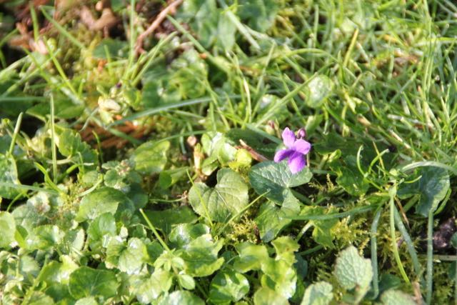
This looks like Mr Toad - or a friend

We parked near the village hall and began by walking through the village to the mill, then across the river, following the Nene Way over another bridge and up towards St John the Baptist church at Achurch.  Just over six miles.

Towards Achurch St John the Baptist

Ferns in the churchyard
From the churchyard we made our way through the Linches woodland, emerging just before the road junction, where we turned left and downhill towards the road bridges over the Nene.

Snowdrops in the woods

By the road to Lilford bridge
Soon after the traffic lights we turned right over a stile in the hedge to take the path to Pilton. From there we could see Lilford Hall.
Lilford Hall on the other side of the river
We followed the path and made a short diversion to the church, which has connections to the Tresham family, and possibly the Gunpowder Plot.  We were able to look inside, as one of the key holders was near by.  We had a pause for coffee and cake too, and the sun came out.

Then we walked back through the village, and along the road towards Wadenhoe, taking the footpath to our left through some trees and then across a field with a few Jacob's sheep. We aimed for the gate between two sheds and came out on the road near Wadenhoe War Memorial, where there's another bench. 

Noisy rooks

Curious sheep
At this point we decided to break for lunch at the Old Barn, before deciding on further plans. 
We agreed to go up to the church and "see how we felt". We were energetic enough to walk along the road to Aldwincle, which isn't bad as it has a pretty wide grass verge and not a lot of traffic. We made our way back along the Nene Way path to the car park.

Sunlight and blue sky