and occasionally rides a bike.
A word of warning. The walk descriptions are not detailed enough to guide you - please take a map. The batteries never run out, and you always have a signal. Oh, And don't take left or right as gospel!

Tuesday, July 30, 2013

Harringworth circular, via Seaton, Morcott and Barrowden.


Mon, 2013 Jul 29 9:35 AM British Summer Time
Led by Mel, with Norma, Brenda, Kate, Shirley, Maureen, Marion, Chris, Barry, Gordon, Terry, Jill and me. Weather fine and warm. Looked as though it would rain as we reached the cars. 8.5 miles approx. 488 ft of climbing.

Bright-eyed and bushy-tailed, we set off from the middle of Harringworth - the steps of the cross make a comfortable seat for girding ones feet.  Our first choice of route is rapidly aborted  since nettles and shorts make a poor combination.  
We take the second path on the Gretton Road out of Harringworth, turning right across the Welland valley, heading northwest over fields, with the viaduct to our right.  We cross the river  - higher than it has been after recent rain. We make for the big farmhouse,  take the path round this and to the road. Over the road we go up the steps to the dismantled railway and head uphill to Seaton.

Here we turn right and walk to the crossroads, heading east.  We take the road ahead, which follows the ridge, and gives great views over the valley and viaduct. 

Just after the road starts to go downhill, and at a right hand bend we take the path to the left,  - marked Rutland Round.  It takes us downhill and under the dismantled railway.
The merry throng - about to turn on to the path

under the old railway
Coming up towards the A47
After a few more fields we climb up to the A47 and cross over before taking a footpath which crosses a field diagonally (northeast). When we reach Morcott High Street we turn right. We cross the Stamford Road near the White Horse, and head southeast towards Barrowden.  

Beware though. in the wooded section there be wasps, and two were stung. I think they had the bad luck to be at the back after the rest of us had disturbed the insects.
We have to cross the A47 again here, and it's an awkward spot.  Once over we walk along the road due east into Barrowden.
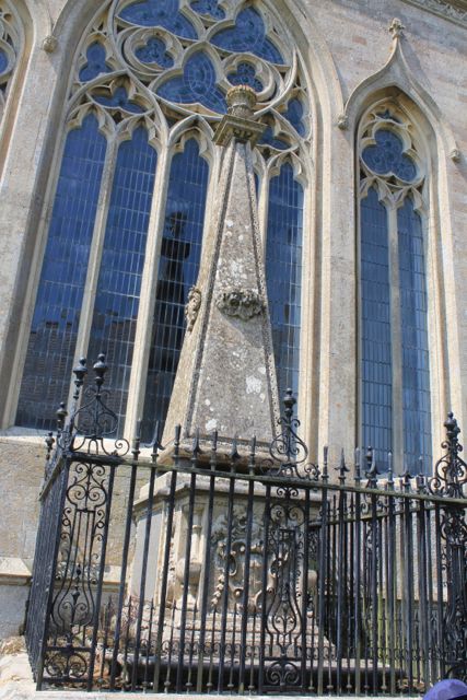
This plaque catches our eyes.  Mr Google helps answer our questions with info from Maurice Kellner's Genuki page about Barrowden:
In 1829, a Thomas Cook met Marianne Mason, a farmer's daughter living at West Farm, Barrowden. He was an itinerant Baptist missionary, but due to a lack of funds, he became a wood turner and cabinet-maker. They married in 1833 and moved to Market Harborough. On 5th July 1841, they hired a special train to take some Leicester Temperance supporters to a rally at Loughborough. This was the foundation of the Thomas Cook travel agency.


The community shop makes an excellent coffee stop, with outdoor tables. 
First aid for wasp stings
Time to relax
From here it's a gentle downhill walk, once we've retraced our path back out of Barrowden. At the junction we take the (left-hand) Seaton road not the one to Morcott, and at the next farm road turn left and then right along the Jurassic Way - over a stile and across fields - all pretty dry with clear paths. We go diagonally over the fields, then follow the hedge south west. We reach a track and cross over so that the hedge is now on our right.  After another four fields or so we meet another track and turn left, downhill to the Welland and Turtle Bridge.

What the stylish walker is wearing this year

and more stylish walkers
leaving Rutland for Northamptonshire

We turn right alongside the river and follow its course for a while

The other side of the viaduct
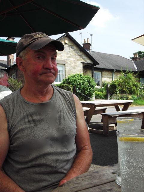
We cross the fields belonging to the riding school, and reach the road into Harringworth. A change of footwear, and into the recently re-opened White Swan for a very good sandwich lunch. A few drops of rain threaten, but we've had a fine dry walk.


Saturday, July 27, 2013

Bike ride to Fineshade and Kings Cliffe


Sat, 2013 Jul 27 11:47 AM British Summer Time
With Harry. Hot day. A few hills. loads of butterflies. Just under 18 miles.

Fab field of wild flowers just outside Gretton.  Then downhill to Harringworth, up to Wakerley, down to the A43, across and down then up to Fineshade Woods. Quick stop for a drink, then we rode through the woods with a pause-papillons. No photos, mind, they hardly stopped fluttering.

Down to the edge of Kings Cliffe, past Blatherwick Lake, turn off to Laxton, cross A43 again. Through Laxton, downhill to Harringworth, then the long slow hill back into Gretton.

Had to go back later and take some more pics.


Thursday, July 25, 2013

Uffington circular, via Greatford, Barholm and Casewick Park


Thu, 2013 Jul 25 9:25 AM British Summer Time
Led by me, with Maureen and Barry. Flat walk, some arable fields were awkward, but mostly very easy and clear. Distance just over 10 miles.


We needed a change from north-east Leicestershire, so I thought Stamford, and looked for somewhere with paths that would link. I chose Uffington,  and this walk that takes in Greatford, with its hall and smart houses, Barholm with church and another Hall, then Casewick Park and Hall with ha-ha.

We park near Uffington Church,
 close to the primary school,  
This house and school
the property of
George Augustus
Frederick Albemarle
Earl of Lindsey
were built
A.D. 1848.
then walk back to the main road towards Stamford.  
We pass a drinking fountain monument to celebrate Queen Victoria's Diamond Jubilee in 1897, and then the gates to the church are on the right

 and those of Uffington Manor on the left.

We continue past several buildings, and past West Hall Farm, until we find our footpath before the next series of houses. It's a narrow path and comes out into arable fields.
 It leads to Mill Mound, which we think is in the trees marked off as private, and for nature conservation.  The path goes along a wide track heading north, turns right for a short distance then north again.  We know we have to turn left after about a mile, and  after a quick grid ref check by Barry, we see the waymarker!   So, it's left, then left then right until we come out at a right-angle bend in the road from Newstead to Belmesthorpe. We should have turned right just before this, so back we go to pick up the Macmillan Way, along a wooded path going north east for about a mile.
I haven't identified these yet.

At the next road we turn left, then take the first junction on the right. Still walking more or less northeast, we follow the road for half a mile or so before meeting the railway line and level crossing.

Another half a mile takes us to our turn off - the footpath goes left opposite a private farm road to the right.  The path follows a wide track, which kinks slightly to the right - don't be tempted by the stile straight ahead, which gives access to the small building at the weir, and nothing else.
  
After crossing a bridge over the West Glen River - great name - the map says we are in Shillingthorpe Park.  We walk past cows, who couldn't give a damn, and have a break just before going into some woods.
The path is clearly marked as the Macmillan Way, and into the woods, but we could as easily have skirted the trees and turned right here, instead of a hundred yards further on. But then we'd have missed the group of boys on bikes, who were clearly enjoying the start of the summer holidays.

The next part is probably the least pleasant part of today's walk - the waymarks are there, but point straight across a field of rapeseed - and it's wet and has flopped over the path. 
The worst is over by now!
Intrepid walkers that we are,  we carry on regardless, and end up with wet legs.  Remarkably we are still on track when we reach the wooded path, fenced off from the land alongside.  We emerge into Greatford - a settlement of fine dwellings and gardens. 
The Stamford Giverny?
We turn right, and walk almost south, past the Hare and Hounds, and along a surfaced path to a stile. Then it's over fields, to a bridge over a dyke, across another field and into Barholm.  The church porch is just too tempting, so we pause a while.
Norman doorway in South Porch.
There's a cross in the churchyard, which commemorates Thomas Carew Trollope who was killed in 1915 during the First World War. Info from website linked above.
The church tower has the date 1648, when it was rebuilt to a large extent, during the English Civil War,  and the odd inscription:


Was ever such a thing, 
Since the Creation,  
A new steeple built,
In the time of  Vexation

The clock dates from 1919, and commemorates another World War I casualty, Charles Cyril Stapley.

We turn right out of the church and follow the road, as it goes round past the pub and the old hall. The wood pigeon below had twigs in its beak, and was so unworried by us that we thought it wasn't real, until it blinked.

The road becomes a track. At the far end, hidden away, is the footpath sign, directing us over four or five fields, southwest towards the main railway line - no level crossing gates here, but the view each way is clear.
One of the few butterflies I've managed to snap while on a walk!
Once across the railway we go over a bridge into a field full of potatoes. We follow tractor tracks to where the path should leave the field, and there's our waymark.  Through another field with a clear path and we arrive at Casewick Park. It's rather like an Alice in Wonderland fantasy, with lollipop trees and avenues and an army of gardeners sprucing it up.
Lollipop trees
Mysterious monument at end of avenue


dovecot

Welcome to the estate
Here's the ha-ha - difficult to see in pic below.

Lovely pad

1906
It's a beautiful house, and the setting is magnificent too.  There's a ha-ha to keep the sheep off the lawn without spoiling the view from the house.  We fantasise awhile.  According to wikipedia it is the site of a deserted medieval village as well, but only two houses remained by 1816.

It's only a mile back to the car, down Casewick Lane, past Meg's Well, which seems to be the stream in the wood to our left, according to a helpful driver passing by. The road leads directly into Uffington and we arrive back at the car after a walk of just over ten miles.

Map and details

Monday, July 22, 2013

Illston circular - Kings Norton, Little Stretton, Burton Overy, Carlton Curlieu


Mon, 2013 Jul 22 9:36 AM British Summer Time
Led by me, with Gordon, Barry and Maureen, Cloudy at start, then v hot. Dry underfoot. Eight and three quarter miles.


Mostly the same as two recent walks done on Thursday 18 July, and Thursday 11 July, but this time anticlockwise, and with a short extra loop.

We take the right hand path after the small field in Illston, hugging the hedge, then through the wheat and behind Illston Grange, over the pasture, with a small stand of trees on our right and the house on our left.  When we leave the field at the crossroads,  we turn right and walk a short distance along the road before taking the byway to Kings Norton. 

The views of the church from this path are magnificent, and Gaulby Church is visible as well.  The byway goes in a straight line to the road, and then uphill to the church and the village.

 At the road junction we ignore the road to the right and carry straight on. The footpath goes to the left past a farm, and through the farmyard.  We follow the way marks over a couple of fields and across a bridge through the hedge to a road, where we turn left, and just after the junction to Little Stretton, we pick up the path at a farm gate, near some large agricultural buildings. 

There are a fair number of butterflies on the wing, and around the thistles.
Hmm - just closed its wings!


Over a few more fields, and the odd stile, and we arrive at Little Stretton.  As last Thursday, the church porch is a pleasantly cool place to sit for a while.

We follow the path, past the old Manor House and the pond, along the avenue of trees to the road. We turn right and find our path just after the junction towards Stoughton. We turn left and walk along the edge of a field of wheat. At the far end a quick read of the map sets us on the right route and we follow the path past The Cottage, across the road and over pastures towards Burton Overy.  The pub appears to be closed today.  

I offer two alternative routes - one of about 2 miles, one of 3. Barry says decisively, "Oh, I think the longer one!"  Suits the rest of us, so we walk uphill from the village on the Carlton Curlieu road. When the road turns to the left we continue through a farmyard and fields directly to Carlton Curlieu - we can see the church on the hill ahead.

This village has a tempting bench so we take another rest - Maureen and I almost have a nap. But we must onwards.  From the Illston Road theres a bridleway to the left, which swings right between two hedges as far as Carlton Curlieu Manor.
Gordon strides ahead
Here's Maureen, with Barry as lanterne rouge.

Ha! caught this one just before it closed its wings!


Across the road the path takes us below the Manor, beside the hedge, then uphill and through a large wheat field. We reach Illston before too long - quite pleased to get away from the heat.

Map and details


Friday, July 19, 2013

Rutland Water anticlockwise on the bike


Tue, 2013 Jul 16 1:12 PM British Summer Time
With Harry - very hot weather, lots of drink stops. 14.5 miles for me. I see that I ride more quickly on the road. 


Very hot, slathered in sun cream, two good drink stops - greatly enjoyed the ride, and the breeze. An odd artificial drink at Whitwell cafe, and a delicious pint of lemonade with ice at the Horse and Jockey in Manton.

A well- earned rest. Harry looking pensive.
Map and details

Illston circular via Burton Overy, Little Stretton, Kings Norton


Thu, 2013 Jul 18 9:50 AM British Summer Time
Led by me, with Maureen and Eddie. Very hot, good underfoot. Same as walk a week ago. About 8 miles.

The same route as last Thursday's walk, but  without the unintentional strayings. I won't describe the route in detail here.

If you look at the photo above really really carefully, you may just see the waymarked yellow post among the leaves. This is at grid ref SP691984.  To be fair the path is now clear on the ground, as the hay has been harvested.  Last Thursday I was distracted by a wide opening in the hedge about 50 yards to the right! 

After crossing the minor road close to a cattle grid, we cross a field with cows, and another piece of grassland, then join the minor road again as it goes downhill to Burton Overy. We've cut a corner off by footpath.

These cows had no intention of leaving the shade of the trees - wise beasts.
Burton Overy church lies to the west of the path
We walk through Burton Overy, noting that the Bell is open later.  We find the path and take this as far as the footpath to Little Stretton.  It's not very clear through the last cornfield.

Little Stretton Church was and is dependent on Kings Norton.  

There is a bench in the sun, but in today's heat we decide to shelter in the porch for our break.

Then its through cornfields and pasture to Kings Norton, where we have a peep inside the church.

This is a photograph of an eighteenth century painting of the Fortrey family. William Fortrey was responsible for the rebuilding of Kings Norton Church between 1757 and 1775. For more about the village British History Online has a page with loads of information.
This monument was erected by William Fortrey  in memory of his parents, William (d. 1722) and Anne (d. 1733).
More tagged cows, with Kings Norton Church on the horizon.
We make our way back past Illston Grange and its horses - who are all thirsty today.
We drive by a slightly roundabout route to Burton Overy - a pint of iced lemonade!