and occasionally rides a bike.
A word of warning. The walk descriptions are not detailed enough to guide you - please take a map. The batteries never run out, and you always have a signal. Oh, And don't take left or right as gospel!

Showing posts with label Loddington. Show all posts

Tuesday, August 13, 2024

Great Cransley, Cransley reservoir, Thorpe Malsor, Loddington, Great Cransley

 Friday 9th August

Cloudy, but pleasant weather.


Met Marta at her place at 10. We did the same route walk as I did on July 15th. We drove to Great Cransley, parking along Church Lane, and  followed the same route as last time.  This involves the path almost opposite the Three Cranes,  crossing the field to meet Northfield Road. We turned right and walked for half a mile or so. When we reached a double footpath sign on our left, we took the left hand path with a hedge on our right. This leads down to the sailing and fishing lodge on Cransley Reservoir.  


The path takes us across the dam, and when we come to a fancy we turn right and walk uphill. After some distance the path follows the field boundary round to the right, and takes us into Thorpe Malsor. 

We chatted to a local man, whose dog had a sore foot. He covered rural crime, farmers’ tractors or satellite guides being stolen, his son’s motorbike, the fact he was in his decorating clothes …and more.


We sat and had a coffee and oatcake on the bench outside the church, before continuing along the road to Loddington. 


This section is about a mile beside the road, which is just a bit busy for comfort. The foot way is too narrow and we decided it was safer to cross over and face the oncoming traffic.


We turned left along a public footpath shortly before the end of the village and walked over the fields, annd down hill slightly to cross the stream. The bridge was slightly to the right of where we expected it. We continued past Mill Farm, and through more fields back to Cransley, keeping on route slightly better this time than last week!


Near Cransley as we left the field where there are horses and sheep, the slightly overgrown alleyway provided us with some delicious blackberries.

Just over 5 miles.

As The Three Cranes wasn’t open for lunch we went to the Red Lion in Broughton, where the landlord offered to make sandwiches for us - we think he may have been sent out to buy the bread!  Tuna sandwiches with salad and mayo. We drank alcohol-free beer with it. Very helpful and cost only £7.15 each in all.

Monday, July 29, 2024

2024/07/15 Great Cransley, Thorpe Malsor, Loddington,

 Monday 15th July

With Norma and Maureen. 

We parked at Great Cransley, walked to the reservoir,


and then to Thorpe Malsor Church for a break. 


Along the road to Loddington,


then after the road turning to Cransley , at the end of a row of houses and a hedge, we turned left and followed a footpath, which
crossed a field, and dipped down to cross a stream.

We c
ontinued in the same direction (southeast) over a bridge crossing another stream, past Mill Farm, eventually reaching a field of wheat, where the path hadn’t been made good, so we strayed slightly, following tractor tracks, then had to follow the edge of the field to find the path in the southeastern corner.

Another field where we followed the line of the fence to our left, through a flock of sheep and a hopeful horse. Then we went through a gate and along a narrow path, back into Great Cransley.


Just over 5 miles in all

Sunday, May 26, 2019

Back to base - Tugby - Loddington - (Skeffington)

With Marta, on Wednesday 22 May 2019. Seven and a half miles, starting from Café Ventoux on the strict understanding that we'd have lunch there, not just use them as free parking! 

"We take our name from the famous cycling Mountain, Mont Ventoux in France, which has been featured in the Tour de France since 1951."

The walk covers much of the same ground as this one.

We set off turning right away from the A47, and after a couple of hundred metres we turned right along a track signed as a bridleway, heading east towards East Norton. We followed this at Little Gunsel. At a junction of paths we continued ahead through more woodland (Hardy's Gunsel this time), with a hedge on our right.  At the next junction we took the right hand  path, heading southeast, crossing a small stream.

There's another meeting of paths and at this point we caught sight of East Norton Hall through the trees.
We turned very sharp left, slightly west of north, taking a freshly marked (weedkilled) path over a field and down to a footbridge, marked on the OS map as a ford. We kept the hedge on our left and walked uphill to the remains of Loddington Mill (just a base as far as I could tell), then along a cart trackwhich bent round to the east toward Loddington village. In the hedge on our left is a stile and a path to Loddington church - conveninet bench here for a break.


Carved heads old and newer.


We went back to investigate the disused railway line - there's a permissive path heading south, but no clear access to head north. We met a woman radio tracking nesting pheasants for the Game and Wildlife Conservation Trust which has a project nearby.

We decided to follow the path by the church to the village and the road which turns left, then left again at Oxey Farm along Wood Lane. About a mile further on, at the bottom of a hill,  we turned left on to a footpath by the Eye Brook. We crossed the stream - again the map marks a ford, but there is a bridge. 
We climbed gently along a wide track towards Skeffington Lodge Farm, and couldn't resist another pause for a drink.

Time for a selfie!

Typical scenery and sky
Past the farm and a couple of houses we turned left along the Midshires Way - the path is now clearly marked and easy to follow. We arrived close the the A47, and turned left at a right angle, and followed the path to Wood Lane, where we turned right and returned to the cafe - for lunch as we had promised. 

Saturday, May 4, 2019

East Norton, Loddington, Skeffington, Tugby and Café Ventoux.


Thursday 02 May, with Maureen. Somewhere around 8 miles. The app went mad between mile 6 and 7!  Rain was forecast for later and started to fall just as we reached the car.
We started from East Norton, taking the road towards Loddington until we found a bridleway sign. We turned left along the bridleway and walked for roughly the same distance west until we met a junction of paths. We walked round the edge of a field
rather than follow the strict path line, as it was rather muddy. We crossed the second field, which wasn't too bad.
Then we had to cross a footbridge and walk slightly uphill with trees on our left.  we soon joined a cart track, which curve round to the right. After a while we crossed a dismantled railway line. There is a permissive path here, but we ignored that and went through a gate to our left, just after it. The path leads up to Loddington Church, which is some way outside the village.

The path goes through the churchyard, turns right and joins the minor road after crossing another footbridge. At the road we turned left and left again at the junction. The road was pretty quiet - we saw maybe three cars and four bicycles.  
The weather looked a bit dramatic, but we stayed dry!
After a mile or so we turned left at a crossroads, and then walked for almost another mile on Wood Lane, an undulating road, turning along a footpath by the Eye Brook, at the bottom of a hill. By now we needed a break, and improvised seating.


We walked on parallel to the brook, a little higher up, then crossed it via a footbridge, 


before turning to our left and climbing gently towards Skeffington Lodge Farm with its buildings and impressive mini solar array. We continued past a few houses until we met the Midshires Way. We turned right and followed it south, across another slightly sticky field.  We should have aimed directly for the point of the triangular woodland, but misjudged it slightly - even Leicestershire's yellow marker posts are not always instantly visible! 


Looking back to Skeffington Lodge's solar panels and possibly Robin-a-tiptoe.
Back on track we walked up to the A47 before turning sharply left and following a clearly (with weedkiller?) marked path over a field and then along field edges to meet Wood Lane again.
At this point we turned right and walked for a few hundred yards along the road as far as the Café Ventoux. The countryside round here is a little gentler than the place it's been named after, but it is a welcoming place and does a decent coffee.

After this it was a matter of retracing our steps along the road, and picking up a footpath east, to our right, at the wooded area called Little Gunsel. At a junction of paths we continued ahead through more woodland (Hardy's Gunsel this time), with a hedge on our right. At the next junction we took the right hand path, heading southeast, crossing a small stream. Right again at the next junction heading south with East Norton Hall on our left. 
When we came to the village road, we turned left and made our way back to the car.

A short drive back to the Café Ventoux for lunch completed the walk.


Sunday, January 20, 2019

Great Cransley, Loddington, Thorpe Malsor, Cransley Reservoir.

With Maureen, Thursday 17 January, six and a half miles. Bright sunny weather too.


We parked on Church Lane.  We followed the no through road round to the right and turned right at the footpath through Cransley Wood. The path was a bit muddy, but very pleasant.
At the end of the wood, we follow a grassy track to the left, and the field boundary as it turned round to the right a little while later. The path turns left and along a disused railway track, over a footbridge.

This path emerges near Mawsley Lodge, a disused farm which is fenced off. Go past the farm, and turn right through a gate, along the edge of a couple of fields. The path meets another one, and here you turn to the right and continue in a northeasterly direction, going under a line of electricity pylons.


 The track bends to the left and is surfaced as it passes a large house and continues into Loddington, entering close to the Cricket ground.  You can take the left hand road at a junction, and vary the walk a little by passing the church. We stopped for a break in the sun, just before the church.

We walked through the churchyard and across the field to the main road out of Loddington. 


Next we had to walk along a pavement next to the road - luckily not a very busy road. At a crossroads we turned right into Thorpe Malsor.   Downhill a short distance and we turned right along a track just before the church.

  A wide track goes along the edge of woodland, then at the end of the first field it turns left.Before long Cransley Reservoir comes into view at the bottom of the slope. We walked across the dam and past the sailing club, then took the footpath through a gate, then slightly uphill with a hedge on your left, to meet the road back to Cransley. 

At the road we turned right past White Hill Lodge, and followed the road. A short distance before the village a footpath cuts the corner, through a field. To reach the village aim for the farm, but go to the right of it, and there is a stile.
This is close to the Three Cranes pub, which is now closed, and Church Lane.

We were greeted by the first mass of snowdrops I've seen this year. 

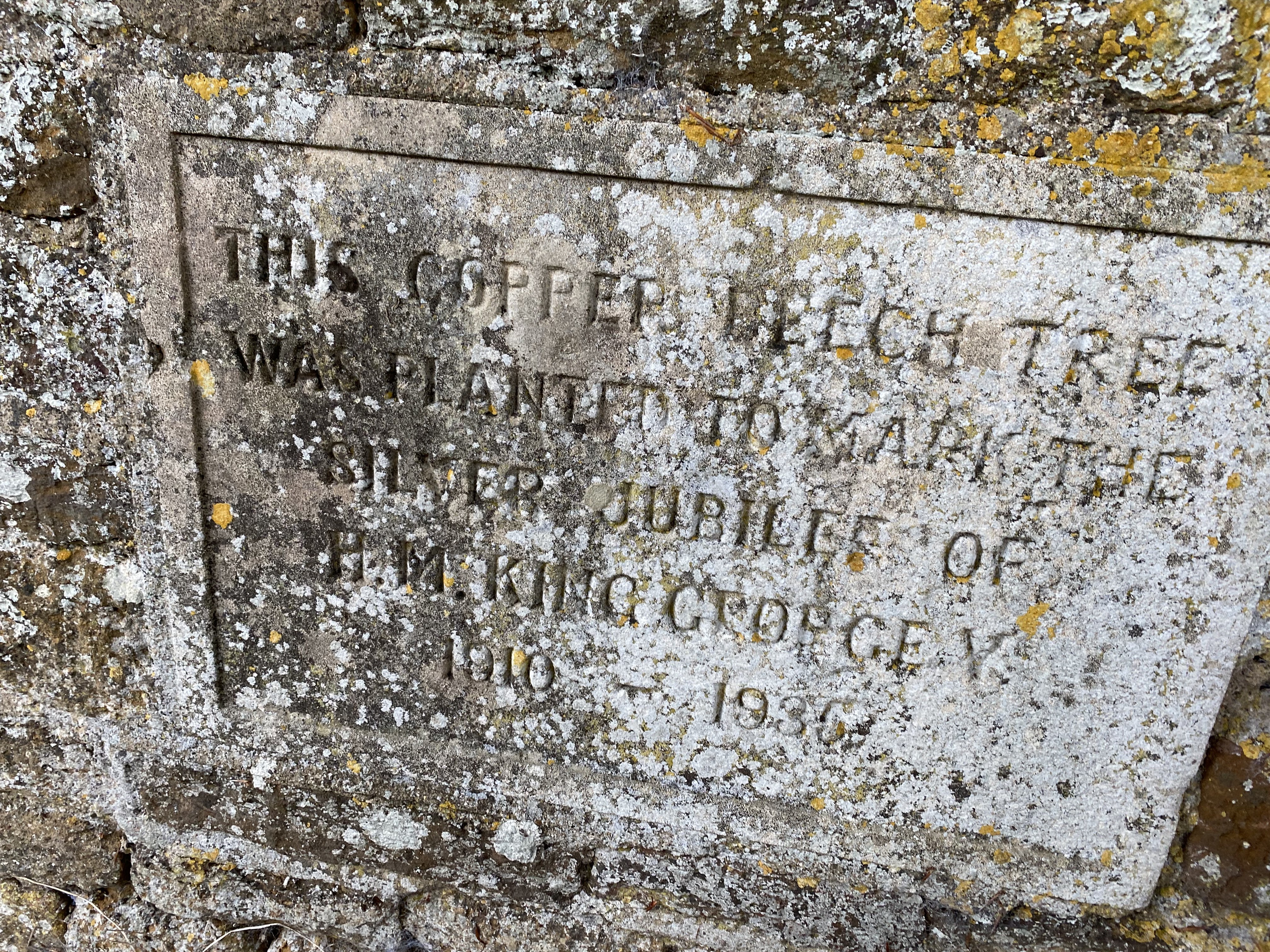
 There's a beech tree planted to celebrate George V's silver jubilee.
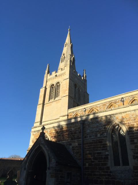
We took a short walk down to the church and caught a glimpse of the small lake behind Cransley Hall.


Monday, September 18, 2017

Great Cransley, Loddington, Thorpe Malsor

Walked on two occasions -Thursday 14th September and Monday 18th September 2017(with Norma and Maureen).
Just under 7 miles. Good conditions underfoot, and on both occasions we avoided the rain.


We parked on Church Lane. At the end just before the sign saying no through road for motor vehicles, we took a path through a wide gate, passing some waste ground on our right and then a cemetery. After the cemetery the path goes downhill through a field of sheep, then up again close to Old Lodge Farm. When it meets a track, you turn right and  follow the track downhill and up again.
Red admiral making full use of the ivy flowers

 At a T-junction you turn right and continue for a short distance until you see a signpost. Turn left here through Cransley Wood. The path may be a bit muddy, but on both occasions I walked it was very  pleasant.
 At the end of the wood, follow a grassy track to the left, and follow the field boundary round to the right a little while later.
 It is easy to follow the path, as it turns left along a disused railway line and over a footbridge.
 This path emerges near Mawsley Lodge, a disused farm which is fenced off. Go past the farm, and turn right through a gate, along the edge of a couple of fields. The path meets another one, and here you turn to the right and continue in a northeasterly direction, going under a line of electricity pylons.
There are a couple of cattle grids like the one in the picture, but there are gates at the side!


  The track bends to the left and is surfaced as it passes a large house and continues into Loddington, entering close to the Cricket ground.  You can take the left hand road at a junction, and vary the walk a little by passing the church - no benches here, though there are some along the road.

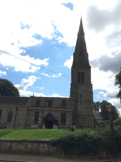
 I had a little trouble waiting for a photo-opp here - avoiding including the bins, and waiting for the sun!
The second photo was on Monday - different sky!

We walked through the churchyard and across the field to the main road out of Loddington. 


This section is about a mile of walking along a pavement next to the road - luckily not a very busy road. It passes Three Chimneys. At a crossroads you turn right into Thorpe Malsor. 
Not quite yarn-bombing, but very pretty!
You walk downhill and just before the church turn right.
 A wide track goes along the edge of woodland, then at the end of the first field it turns left.

 Before long Cransley Reservoir comes into view at the bottom of the slope.
 There's a perfectly sited picnic table just before the dam. On Thursday there were dragonflies, and plenty of birdlife - grebes, swans, the odd coot.


 An excellent spot for a break, before crossing the dam.


 and the sailing club.

The footpath goes through a gate, then slightly uphill with a hedge on your left, to meet the road back to Cransley. 
At the road turn right, go past White Hill Lodge, and follow the road. A short distance before the village a footpath cuts the corner, through a field of sheep, where three or four tups had been fairly busy. To reach the village aim for the farm, but go to the right of it, and there is a stile.
This is close to the Three Cranes pub, and Church Lane.


We finished our outing with a sandwich and coffee in the Dunelm store in Kettering.