The footpath hugs the edge of the playing field, before going along between hedges and emerging at the junction of a road and a track to the right, marked on the map as "Occupation Road". We followed this over a bridge across the Welland.


There is a left hand bend and before long a footbridge where we turned right to head towards Bringhurst high on its hill.
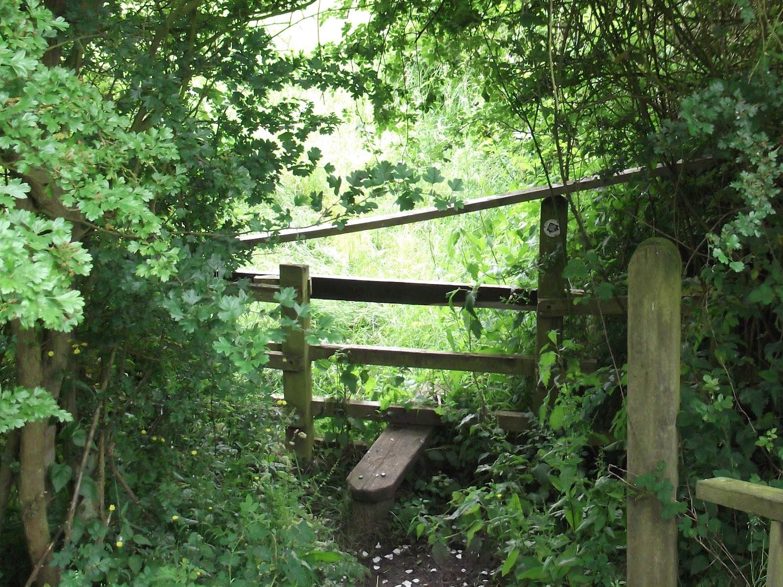 |
| This stile is not very welcoming with the extra crosspiece! |
 |
| and this way marker isn't very clear |
 |
| Three fields of overgrown wet oilseed rape up to Bringhurst |
The section from the dismantled railway and through the fields to Bringhurst was very hard work, and we ended up soaked, even though no rain was falling.
 |
| Looking back from the edge of Bringhurst |

From Bringhurst, we turned turned right at the road junction. A couple of hundred yards down the hill is a footpath sign to the left, and the path goes round the hill, below the site of a Roman villa, and then behind Bringhurst primary school and across a couple of fields before reaching the road at Great Easton.
 |
| Possibly the oldest cottage in Great Easton |
Turn right and over the stream, following the road to the centre of the village. Turn right at the Sun Inn, and continue along the road towards Caldecott, past a house with horseshoes on the wall.

A little farther on there is a small cemetery with the graves of the Cave family. After this we took a track to the right, with recycling banks at the start. The track leads across the dismantled railway and behind some buildings, across a footbridge over a stream, and then a bridge over the Welland.
Just after crossing the river, you turn left and go through a hedge to follow the path between two hedges. This leads to the road between Rockingham and Cottingham.
Slightly to the left across the road is another footpath sign.
The path takes you thorough a couple of fields and gates to Rockingham's cafe and shop, where we stopped for an early lunch. We sat outside, although there were a few sudden gusts of wind. The path emerges on to the main road by the Sondes Arms.
We went up the hill, and turned left at the sign for the footpath to Gretton. This goes to the right of Rockingham Landrovers yard. We went through two gates, then diagonally down the field. From here it was mostly a question of following the path, keeping a look out for gates, and avoiding the path which crossed our route. |
| From West Hill, Gretton, looking over the Welland Valley |
 |
| More changeable June skies |
3 comments:
Walking through the field of wet Oilseed Rape looks like fun Alison.{:)
'Changeable', isn't that a word that the Weather Presenters use to hide their inability to forecast the likely conditions.{:)
Indeed, Roy, but it usually seems to mean 'rain' with a bit of blue sky now and again ;)
Another good photographic record of the walk. I like your eye for architectural/cultural details.
Post a Comment