We started from Saddington, and walked along the Smeeton Road to Bridge 72. I intended to take a footpath for part of the way, but we didn't notice it as we passed it. Then along the canal and over Saddington Tunnel,
 |
| North western end of Saddington Tunnel |
descending to the tow path on the left of the canal. We left the tow path at Fleckney Bridge, where we used the two hand gates and crossed the bridge, taking the path through Mill Field Wood at right angles to the canal here.
 |
| By the Mill Field Wood millenium stone |
Past the MM stone and across the fields to the Kibworth-Saddington Road, and over into the mud and gravel track which becomes Mill Lane just before entering Smeeton Westerby.
We turned right into the village centre, then left at Debdale Lane. We followed this past Bridge Farm and Bridge 67 cookery school.
 |
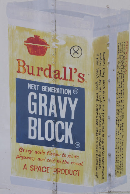
| This ad was on an old container-cum-shed near the cookery school. I googled and it seems it has now gone out of production to the chagrin of many cooks. |
Through a farm gate and we followed the track uphill until we reached the canal. Just before the gate and stile we found an inviting patch of shade for a snack and water break.
At the canal we turned left toward Foxton, passing the large narrowboat yard at Debdale Wharf, under a couple of bridges.
 |
| Fine display in a boat garden. |
We crossed the first footbridge over the canal. We took the path along the right-hand edge of the field, and across another, past some farm buildings and uphill thorugh a field where they may or may not have been a bull - there was certainly a herd of creamy and white cows, along with a lone horse.
The path led uphill with Gumley Wood on our left, across rolling countryside - the hilliest and most scenic part of the walk was saved until the later stages. We crossed the small road from Gumley to Debdale, a little way short of the junction. A brief walk through thistle and butterfly country cut off a corner, and we crossed the road from Gumley to Smeeton.
 |
| Thistle and butterfly country |
The path is a track between two hedges, then turns right to follow the edges of fields, clearly marked and climbing gradually, until, just before Smeeton Gorse, the Leicestershire Round path from Gumley joins our path. A short steep climb over grass leads to the highest point, with good views and a strategically placed bench. (To the right of this is HIll Farm, Smeeton Hill, according to the map.) We followed the Leicestershire Round path along the 'ridge' then downhill , crossing two footbridges and going through a number of stiles before climbing to Saddington where we emerged along an enclosed path into the village, directly opposite the well-hidden footpath sign I missed at the start of the walk.
Map and details
No comments:
Post a Comment