Fri, 2014 Oct 24 9:36 AM BST
With Marta. Dry, damp underfoot in places, but some ploughed fields sticky. About 7 miles.
From the church, where the porch roof is being repaired, we walk towards the Sun Inn (also being repaired or renovated, and then past Marston Trussell Hall on the road towards Theddingworth.
 |
| Roses outside Marston Trussell Hall |
 |
| View towards Theddingworth from Hothorpe Hills |
At the top the bridleway goes through a gate and takes a path alongside fields to the Roserie just north of Sibbertoft.
 |
| Outside a house in Sibbertoft |

We join the road, but not for long. There's a Jurassic Way signpost, and a path between hedges and houses.
 |
| There is always a hopeful horse |
 |
| Sibbertoft church |
 |
| Bird carvings inside the church |
 |
| fungi in the church yard |

The waymarking is good, and takes us to the opposite corner of the first field, then along the field boundary of the next. We cut corners of the next two fields and then come to a waymarker pointing directly across a recently planted field. We can see the route, but decide to walk around two edges before rejoining the Jurassic Way on a recently surfaced track (an improvement on the previous mud-bath), which goes steeply downhill, through woodland (Mount Pleasant and the Lawns).
 |
| Autumn colours |
We cross over and take the footpath at the bottom of the field, keeping the hedge on our left. After some time we reach Rectory Farm, and carry on past this until we reach a minor road From East Farndon to Marston Trussell.
 |
| Other colours near Rectory Farm |
We turn left, and soon afterwards right. Our path should lead across the field to the opposite corner, but once again we take the way of least resistance, and follow the field edges. Marston Trussell church is clearly in view now.
We come to a footbridge, then cross the field where fleeing royalist cavalry were slaughtered after the Battle of Naseby. This brings us to the church. We walk through the churchyard, and back to the car.

From 1986 Bbc's Domesday reloaded
St.Nicholas Church,Marston Trussell was originally built in 13th century in
sandstone.The site is believed to date back to Roman times.The tower, 71 feet
high,was built about 1525 and has 5 bells now rung by 1 man and 4 women.
The porch is made from oak possibly part of a Danish Ship. Part of the
nearby castle was also used,only the moat and mound can still be seen.There
have been 35 priests since the church was built.There has been only one
christening in the last 5 years.
At the Battle of Naseby King Charles' Cavaliers made their last
stand against Cromwell's men and were defeated.The ones that broke away
from the battle retreated towards Leicester but many were cornered at
'Pudding Poke Marston',slaughtered and buried near the church yard.
We have a good lunch at the Coach and Horses in Lubenham, see an old graffiti-carved table top from a former pub down the road on display in the bar and some black and white photographs, including one of the Tower House. The barman is very happy to tell us the story behind them, and as a result we have a mini walk round the village after lunch before going home.
There's more to these villages than meets the eye on a drive along the main road.
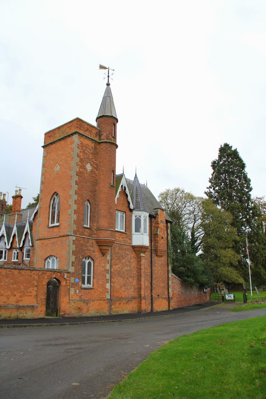 |
| Tower House, Lubenham |

 |
| An old cottage, Lubenham |
 |
| A quilt inside Lubenham Church |
 |
| How tall is the tree? |
 |
| All Saints Church. Lubenham - it is believed there was once a spire, which blew down in the Great Storm of 1703. |
Map and details
No comments:
Post a Comment