and occasionally rides a bike.
A word of warning. The walk descriptions are not detailed enough to guide you - please take a map. The batteries never run out, and you always have a signal. Oh, And don't take left or right as gospel!

Showing posts with label Fleckney. Show all posts

Thursday, June 20, 2013

Fleckney circular via Arnesby and Shearsby


Thu, 2013 Jun 20 9:19 AM British Summer Time 
Led by Barry, with me, Gordon and Eddie. Gently rolling farmland. Dry underfoot, fine weather, rather sultry. A whisker over 11 miles.

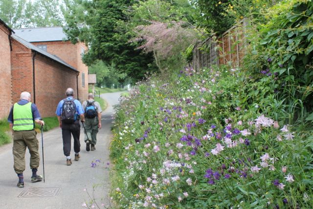
We take a footpath on the south side of Kilby Road - it's not long before Barry decides he's overdressed.  Eddie's playing the high vis card today, to the tips of his toes.

The path rejoins Kilby Road, via Furnival Close, and crosses to the north side, along Coleman Road, and soon after the road bends right our path goes off to the left - in a westerly direction.  It turns north then northwest, and passes a fox covert on our right. It continues over fields to Kilby, at Tottering Hall Farm.
Cue reminiscences about Craven 'A' and Willy Woodbines, too.
Nice garden bench
We walk along Main Street, passing the pub, and have to cross the A 5199.  The stile on the other side is less than welcoming.
Good job you had your sticks!
We can see the next yellow waymarker but the trail is not clear until the following field.

We soon join Foston Lane, a much busier road than you'd think from the map.  It runs down to the A5199.  We turn right and walk for a few hundred yards past Foston Hall to the left turn where Foston church is signposted.  Foston has been a deserted village for about 400 years, but the 10th century church is still in use.
St Bartholomew's Church

invites you to bring a candelabra

From Foston we head south along Barley Lane, past a very few houses, until our path turns left, after two hundred yards or so. We walk roughly southeast, though the path turns right then left in order to make for Arnesby.  The windmill can be seen clearly on the skyline ahead. As we get nearer it disappears in the trees, and it's impossible to get a decent photo nearby.  It's privately owned and looks like a delightful place.
just about visible from the public footpaths.
According to a local postie the mill hasn't been used as a mill since at least the 1970s. 

We walk through the village and find St Peters Church, which is open.  In the churchyard is a memorial to a man who died in WW2 in a camp in Thailand. I should have photographed it.
These Norman arches date from the early eleventh century.
The porch makes a good place for a snack.
We go back a short distance to the marked footpath to Shearsby.   It's a bit less than a mile.

Foxgloves
Unusual breed of sheep

Dutch variety of honeysuckle

The footpath brings us out at the northern end of the village, with this view of the church.
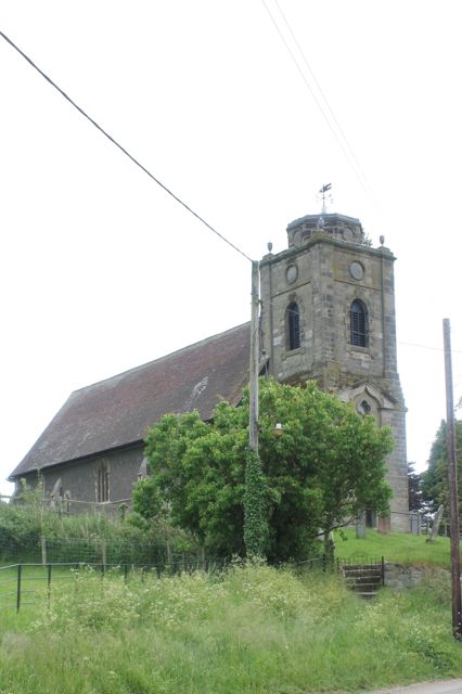
Shearsby Church

From the churchyard

Chocolate box cottages

An overflow of flowers
We turn left at the bottom of the hill and walk towards the main road, the A 5199 again.  We turn left at the junction and cross the road to take the Leics Round footpath close to New Inn Farm.  The path is clear from now on, through fields with horses, then some with cows.
Camera shy?
We reach a minor road and turn right for a short stretch. At the junction our path leads east, then turns slightly to the north.  
The wildflowers are splendid this year!

When we reach the edge of Fleckney's houses we turn to the left and walk along the path close to the houses.  One way or another we make our way back to where the car is parked on the Kilby Road.


Friday, October 5, 2012

Leics Round 1 - Foxton to Bruntingthorpe

With Marta. Grey, but no rain. Chilly wind. Muddy in places. Lunch at Fleckney. Almost 10.5 miles.
Lock Keeper's Cottage Café Foxton
A great start to the day was coffee and a slice of fruit cake at Foxton Top Lock before we walked down to the canal towpath at the bottom of the flight of locks,  and our official starting point for the Leicestershire Round.


We walked over Bridge 61 and turned along the tow-path north, away from the Locks area.  After a few hundred yards we crossed the footbridge, with its Leicestershire Round waymark and headed across the fields towards Gumley with  the church spire and the tower of Tower House visible in the woods.
The path climbs up to the village and leads on to the Main Street, where we turned right and walked up past Tower House and St Helen's Church.


We took the path by the church and near the wood, across a couple of fields to Debdale Lane. 

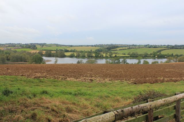
We crossed this small road, going downhill quite steeply, then up again by a small wood called Smeeton Gorse.  We arrived at the top of Smeeton Hill, where there is a bench.  Today the views of Saddington reservoir were much clearer than in summer.  The reservoir and channels were built to feed the canal.


A little grey, but lovely rolling countryside around Saddington.   And yes, we had to go up to the village.

After going through Saddington we mad our usual mistake and ended up a little too far  north, coming out near where the road forks to Fleckney on the left and Kibworth on the right. We walked a little way back to pick up the Leicestershire Round across afield to a gate part way along the hedge.  From here you can see a clump of trees, hiding a pond.  We made for the left hand side and then for the corner of the houses on the edge of Fleckney.

We decided it was lunch time, and walked an extra mile and a half or so to the Crown in Fleckney.  

We returned and picked up the track we needed which turns southwest at the corner of the housing, and heads upwards.  Once we joined the hedge we walked with this on our right for a while, and then on our left as far as the next road.

We crossed the road and walked straight ahead on a minor road for a short distance before turning on to the footpath to the left.  For most of the way ahead the path is fairly clearly marked, and took us through various fields with cows and horses, before climbing up past New Inn Farm, and on to the A5199.  We crossed this and walked along for a short distance to the road into Shearsby.
Shearsby church seen from the A 5199

perched on a hill
At Shearsby we took time for a mini-break, and a chat to a couple who have walked the Round before. There are convenient benches on the wide roadside verge.
We walked through the village, along Back Lane and Mill Lane and past some cottages which look like the model for a jigsaw puzzle.
Just outside the village the Leicestershire Round path turns right into a field.  We kept close to the hedge - it is the route, and kept us from disturbing the cows too. The path here was fairly muddy.   In the next field we kept the hedge on our right, and turned slightly left when we came to a small wooded area.  After this spinney, we crossed the hedge, which was now on our left. We went gradually downhill, and passed more trees on the left, before crossing a very big field - the line is marked by the signs.  In the next field, the path follows the hedge and joins a clear farm track alongside another two fields, before curving to the left and leading into Bruntingthorpe via Little End.  
1716 Tithe Barn in Bruntingthorpe


Next leg's starting point.


Map and details

Thursday, August 16, 2012

Saddington - Arnesby - Bruntingthorpe - Shearsby - Saddington

Just outside Saddington - not on our intended route

Saddington church


Arnesby village
Arnesby church (St Peter)

rolling the straw?
between Bruntingthorpe and Shearsby


Shearsby
So . . . write up to follow.

Map and details