and occasionally rides a bike.
A word of warning. The walk descriptions are not detailed enough to guide you - please take a map. The batteries never run out, and you always have a signal. Oh, And don't take left or right as gospel!

Showing posts with label Marston Trussell. Show all posts

Tuesday, December 10, 2019

Marston Trussell and Sibbertoft again

Monday 09 December, with Maureen and Eddie. 8 1/2 miles.

Exactly the same route as last Thursday, but no detour to the ROC observation post this time.
"The Lake" in Marston Trussell
.
Instead when we decided to shelter in Sibbertoft  church porch for our break, out of the biting wind, we were able to look inside, and talk to one of the local church "admin".
That's why the walk comes out longer in theory this time. Churches and old buildings with thick walls seem to affect GPS signals.


Between Clipston and Sibbertoft


Village sign


Bird carvings in the church

The thicker lines are when we were in the church.

A couple more observations about Sibbertoft - the river Welland has its source here, apparently under a patch of grass; and a Wellington bomber crashed nearby on 24th December 1941, killing all members of the Polish crew.


Friday, December 6, 2019

Marston Trussell- Sibbertoft circular, on minor roads.

Thursday 05 December, with Maureen. Just over 8 miles. It's almost the walk we did in March 2014, after a spell of wet weather, but today we didn't do the extra mile to include Clipston.


The walking was easy, and the frost had melted, though there were some muddy patches on these quiet roads. The whole area is where the very bloody battle of Naseby took place on 14 June 1645.
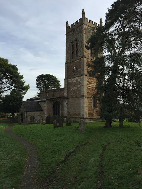
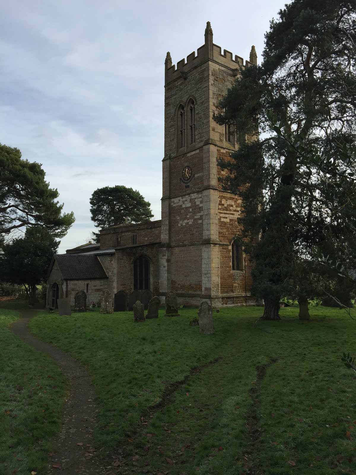
Marston Trussell church, the start and end of our walk.
We walked into the village and turned left at the junction, past the fishing lake.
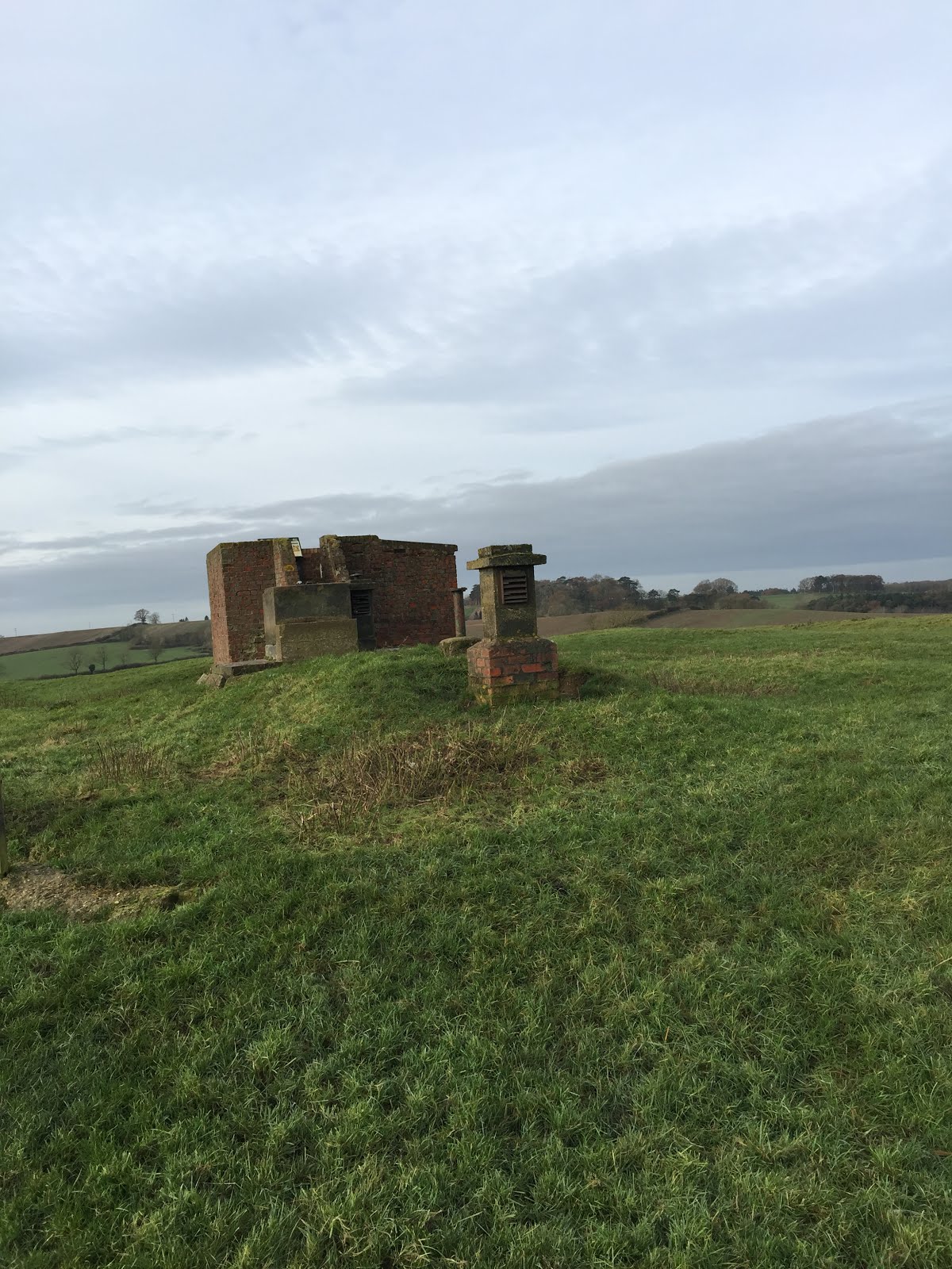
 We followed the road round to the right past Marston Lodge, and continued, ignoring the small road to Sibbertoft. The road climbs steadily, but not steeply up to the ROC Viewpoint, just off the road to our right.

An information board gives details of the battle off Naseby. I'm convinced soldiers must have to be drunk in order to fight, and that this is one reason why they behaved so badly to the local people, especially the women.
\


At the T-junction we turned right, away from Clipston and towards Sibbertoft. We arrived at the church as eleven o'clock was striking. This has been a pleasant place for a break on several walks in the past - in spring the snowdrops are lovely, but of course, not in early December.

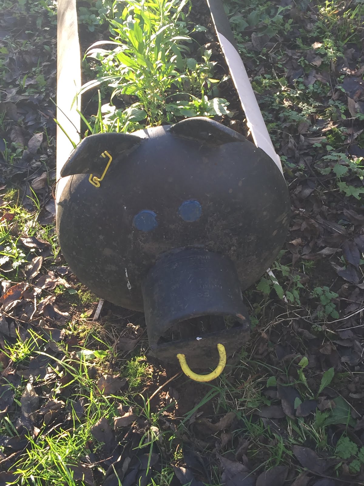
An unusual flower trough by the village sign.
We carried on past the church, ignoring a road to our right with the signpost to Marston Trussell.  Instead we headed downhill, with Hothorpe Hall in view. There is a small road off to our right, and we took this to reach Marston again.
it leads past the magnificent trees in the grounds of Marston Trussell Hall,

and back into the village.


Lunch at Farndon Fields farm shop cafe.

Tuesday, June 12, 2018

Foxton to Marston Trussell and return

Monday 21 May, 9.30 am, with Maureen, Kate and Eddie.
Just under 8 miles.
As previous walk on 26th April. 
we started from Foxton top car park, headed to Lubenham, then past Lubenham Thorpe Hall to Marston Trussel, returning to Lubenham and taking the alternative path over Mill Hill and back to Foxton.

Masses of red campion

One of the 33 stiles!

Lubenham church

Maureen, Eddie and Kate

Maureen, Alsion (me) and Kate

Pink hawthorn

The Welland

Sorting the sheep from the goats

The view from the fields near Foxton School


Friday, April 27, 2018

Foxton Locks to Lubenham and Marston Trussell.


With Marta. About 8 miles.  Weather sunny at times, with a few showers.The same walk as on April 19th, but starting from the Foxton Locks long-stay car park, then taking the path from the bridge, heading south east over the fields toward Holme's Farm and the fishing lake, with its horses nearby. (More detailed instructions in the previous post.) we crossed the road between Foxton and Lubenham and walked into the village via the path at the bottom of Mill Hill, through the recreation ground.

Rather a fine-looking beast
After we crossed the main road, our way through village took us along Rushes Lane, past the Tower House and the church, across the Wealland and under the double arched railway bridge.


 The Tower House was the home of BJ (Cherry) Angell, the owner of the horse which won the first National Hunt Challenge Cup, run in Lubenham and the precursor of the Grand National.


We had a quick look at the moat of Thorpe Lubenham Hall.
 Then we took the footpath across the field below the hall,  crossed the drive at the bridge and followed the Welland along to the road into Marston Trussell.
Although the sky was grey when I took the photo, we had some sun, and very little rain.

We retraced our steps through to Lubenham, crossed the road and took the path through the recreation ground, but this time continued straight up Mill Hill, leaving the beacon to our left.


As before we folllowed a clearly marked path, to the left of Gartree prison, eventually coming out close to the school in Foxton. We got slightly wet at this point walking through 
a field of wet oilseed rape plants.

We took the road into Foxton for a few yards, then the footpath on the right hand side, which took us behind Foxton church and into the village.


We turned left then right at the junction, in order to join the canal towpath at North Street.
It's about half a mile to the locks. We had lunch at Bridge 61, and were lucky to escape the heaviest shower of the day while we ate.  The walk up past the flight of locks and back to the car park completed our day.

Wednesday, April 25, 2018

Marston Trussell to Foxton Locks and return

Thursday 19th April 2018
With Maureen on what felt like the first day of summer - all in the past now!  
About 8 miles, and mostly on field footpaths which were not sticky with mud. Lunch at Foxton before returning via a slightly different route.

We walked from Marston Trussell church along the road towards the main road to Lubenham and Market Harborough. 

Marston Trussell church
 Shortly after a small bridge crosses the river Welland, a footpath leads off to the right, more or less following the river and county boundary.
View from the bridge
This section of the walk was idyllic, slightly wet in one or two places, but no sticky mud!
The beautiful Welland

The river goes under the drive to Thorpe Lubenham Hall. We cross this and pick the path up on the other side, where it heads across a field with cows and horses. The river is over on our left hand side.

We emerge on to the road into Lubenham, near the hall moat.


The railway bridge has two arches. Under the second one the road is lower, in order to allow high loads to pass through.

We walked past the church and the Tower House, and straight ahead to the main road. We crossed the road and took the small road to the left, and a footpath to Foxton via Mill Hill and the recreation ground. there's a short steep climb to the top of Mill Hill, and then you follow the well-marked footpath, or on one occasion the nearby field edges. Some of the route is enclosed between fences, which helps to keep us on track.

The fields are not far from housing close to Gartree prison, but the prison is not obvious from this route.

It was getting warm, so we decided to have a break, and took this selfie to send to my daughter who was bemoaning the fact that she was stuck at work, instead of out on her bike.

At a fork in the path we took the left hand option which comes out near Foxton School. There was a magnificent gate, but it looks a bit redundant.

Lovely situation for a school, with some open views. We turned left along the road to Foxton, and very soon took the footpath to our right, which runs along the edge of the field.
There's a view of Foxton church I haven't had before.
We turned left along Swingbridge Street, then right along Main Street until we joined the canal. A left turn took us onto the towpath and we headed northwest then southwest for a good half mile to reach bridge 61 pub at the bottom end of the flight of locks. Sandwich and coffee to fortify us - sitting outside in the sun, with parasols! 
Summer???
 We continued our walk south along the towpath beside the flight of locks, and along the upper section of the canal until it meets the road.
 After crossing the bridge, we took the signed footpath which heads southeast, diagonally across the field, leaving the car park over to the left. It's pretty easy to follow over a few stiles past what is marked as a disused camp on the map, and a fishing lake. We walk with the lake on our left.
 Just after this was the only place we had to look around for the path. There's a farm type track which bends to the right and forms a sort of cross roads with the field edges.  The stile was slightly to the left of the crossing point, and then the path keeps to the left along the field boundary. Once we'd found it all was clear again. Footpath markers and stiles led us over the fields to meet the Lubenham to Foxton Road.
Spring springing

We didn't count the stiles, but there were a few! 
Our footpath continued on the other side of the road, but it turns left near some farm buildings, and then heads towards another stile. All of the time we were going south east, until we reached Lubenham again.

A break near the church - it was hot! and then the final stretch, retracing our steps past Thorpe Lubenham Hall and along the Welland to Marston Trussell.