and occasionally rides a bike.
A word of warning. The walk descriptions are not detailed enough to guide you - please take a map. The batteries never run out, and you always have a signal. Oh, And don't take left or right as gospel!

Showing posts with label Ashby St Ledgers. Show all posts

Monday, May 6, 2013

Welton - Braunston - Ashby St Ledgers - Welton


Mon, 2013 May 6 9:43 AM Western European Time 
Led by me, with Barry. Fine, sunny, warm to hot. Quite up and downy. Good views. 8.5 miles - the last two miles were in the car, when I'd forgotten to switch the machine off.

Welton is one of those villages set back from the main road - you need to be make a deliberate effort to go there. The main part of it is on the hill near St Martin's church and the White Horse pub.
St Martin's church from the rear

Pub and church - above the pub door are the words "Abandon hope all ye who enter . . ."
We take the path by the pub, going downhill through grassland and a field to the road. Over the road we cross meadow land with cows and calves, sheep and lambs.

A short uphill stretch and we reach the canal, where we cross the bridge and turn right towards Braunston.
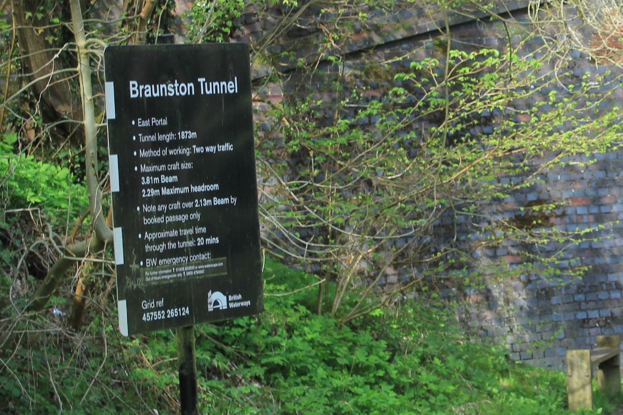
A narrowboat emerging from the Braunston Tunnel

We have to leave the canal and walk over the hill.  The tunnel's a good mile long.
Braunston lies ahead

An air shaft for the tunnel
Bicentenary plaque


We stop for an ice-cream at the canal shop before leaving the water and taking the Jurassic Way to Ashby St Ledgers.

We walk up to Braunston village, and take the road just by the Wheatsheaf -  Ashby Road which goes to the right. We follow it until it bends to the right.  At this point the old road is now a track leading straight ahead - towards Ashby St Ledgers.
The track narrows to a path, and climbs up to a minor road, with great views behind.   At the highest point, we turn right along the road, and very soon left, at a Jurassic way marker in the same direction as previously.  The path goes downhill to the A361. We cross, pass the Old Coach Inn, and walk through the village, until a road junction just before the church.  
the old stables

Church and the gatehouse to the Manor.
We take the road to the right, past a Co-op farm and a building labelled the Old Dairy. When we reach a junction our path goes slightly to the left, cutting off a long corner of the field.  Then it's through a series of fields where rapeseed is just starting to show yellow.  
The path is clear and easy to follow up hill towards Welton.  It comes out between houses on Ashby Road. All we have to do is work out where the church is and we can find our way back to the car.

There's some kind of treasure hunt going on - people with sheets of paper wandering around in groups - and cars driving slowly around. 
Hunting for the answer - what happened to John?

We're lucky enough to arrive at the church just as one of the churchwardens opens it - it's normally kept closed.
The sad story of what happened to John is answered by this gravestone - poor little lad.

I wonder if this is "starved" as in "frozen" - a northern use of the word. My grandmother used to warn us we'd "be starved to death" if we didn't put our coats on in winter.  
Whoever erected the stone seems to be making a big point about the neglectful parents . . .
Map and details
Other walks touching this one: 
Ashby SL, Braunston, Barby
Jurassic Way:  Charwelton to Braunston
Jurassic Way: Braunston to Winwick

Monday, July 30, 2012

Ashby St Ledgers - Braunston - Barby - Ashby St Ledgers

Led by me with Barry and Gordon. Mostly fine, though we had a heavy shower. Underfoot generally good. Stiles awkward on occasions. 9 miles plus.
This walk came from here.
We took the road going west out of Ashby St Ledgers, crossed the A 361 and joined the bridle track which forms part of the Jurassic Way.  It climbs gently up south west until it reaches a minor road (Welton to Barby). Here we turned right and picked up the Jurassic Way again a few yards along the road, where it runs off to the left.  This track leads downhill, and we could see Braunston church spire and a sail-less windmill nearby. These disappear from view as the track descends and then rises again between hedges towards Braunston.  We entered the village at a bend in Ashby Road.  This road leads down to the central green near the Wheatsheaf pub. Here we crossed the road and took a footpath slightly to our left, leading downhill through Jetty Fields Park and then down to the Canal near Braunston Bottom Lock.
View from the Bridge

Old pump house - to pump water back up to the Top Lock

Chimney dated 1897
We walked along the canal, turning right, past the marina and lots of moorings.  


There is also a boat-café, called the Gongoozlers' Rest. Highly recommended by one of the boat-dwellers.

Just after the towpath took us under the A45, we left it, and crossed the road, then followed a footpath just beyond the bridge, and turned right up a grassy slope to the church.  Here you can either follow the road round behind the church, or walk through the churchyard.  We didn't look at the gravestones, but there are apparently a lot of boatmen and women buried here.
Braunston church, and the dark cloud which dumped its contents on us about ten minutes later.


Windmill without sails in Braunston

We walked along the main street for a while, and on our way back noticed this:
cruck frame (?)
Then we returned to our route, and followed the residential street Greenway along, then took the fourth turning into Countryside (really).   The footpath heads more or less north. I think we missed the route after the first field, as we ended up on the wrong side of a hedge after a tricky stream crossing. Another time, I'll try aiming slightly to the left of the corner!

We walked along the edge of a large field of wheat, and manage to cross the hedge at the top, and find the real route.  This leads over a few stiles and passes a house at a distance on the left, then soon turns slightly to the left of Braunston Fields Farm. We crossed a field with some teenage bullocks, who were far more scared of us then we of them.  The path crossed diagonally and then led into a small wooded valley, taking us to the corner of Tiltup's Wood.

Here we crossed one field - a short uphill section, and then aimed for the one prominent tree at the top of the next field.  The path then crosses another field, and Camp's Copse (not marked on the map, though there is a sign inside! 
OK, we're on the route!
Soon we arrived at the minor road leading into Barby. We turned left.  On our right we could see another sail-less windmill, this time in dire need of some attention.
Barby Windmill
We didn't go into the village, but carried straight on over the crossroads, and walked for half a mile or so before meeting the footpath from Barby to Ashby St Ledgers.  This turned right towards Ashby.  We crossed a field and then walked alongside Home Wood, as far as Briccle Wood, where the path turned right.  It runs parallel to a reservoir, but there are just a few glimpses through the trees.

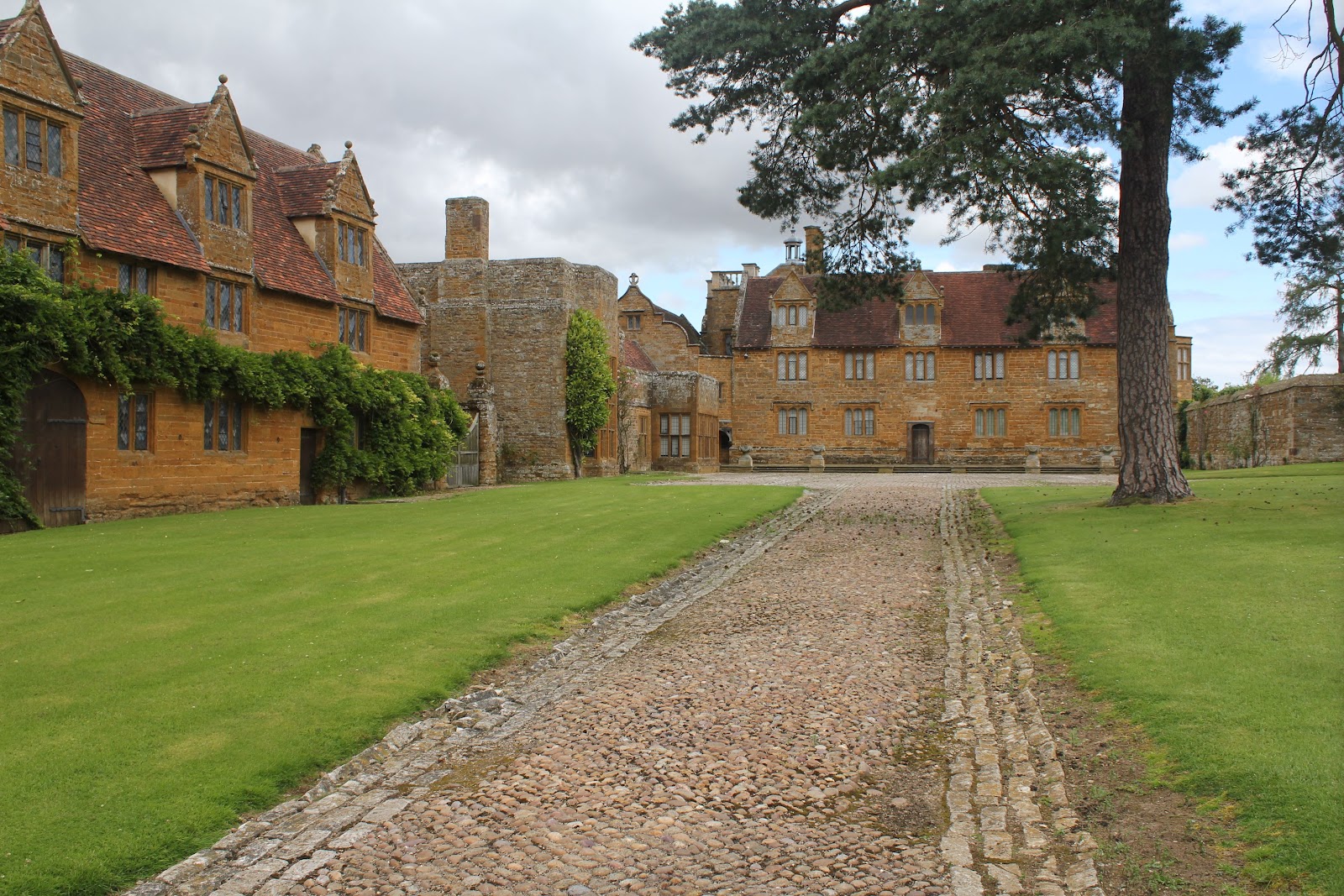
We emerged from the trees and crossed a meadow and a track, but at this point the map told us to cross a section of woodland - there seems to be no way through, and there are path signs to the left of the wood, so that was the way we went.  The path headed south-east into a small dip and up again until it met the A361.  We picked the path up on the other side, and followed it as best we could coming out at a bend in the road just before the Manor House in Ashby St Ledgers. A magnificent building with quite a history, involving the Catesby family, the Gunpowder Plot, and later worked on in the early 20th century by Lutyens.

Ashby St Ledgers Manor House

The gatehouse and the church are also interesting.  There is a little more info and a few more photos  on the post here, as we walked through Ashby when we did the Jurassic Way.

Two fascinating villages on today's walk.

Thanks to Gary's blog - To the hills


map and details

Wednesday, May 23, 2012

Jurassic Way 4 - Braunston to Winwick


With Marta. 11 miles. Very hot. It felt like hard work. Dry underfoot apart from under the M1.


We started from the Admiral Nelson, crossing the canal to the towpath, and following it as far as Braunston Bottom Lock.
Here we crossed the bridge and made our way uphill - there are a couple of footpaths, and more by luck than judgment we ended up, as we should, going through Jetty Field Pocket Park, past the allotments and into the village, at a road junction.  Just by the Wheatsheaf Inn, take Ashby Road to the right,  follow it until it bends to the right. At this point the old road is now a track leading straight ahead - towards Ashby St Ledgers.


Looking back towards Braunston
The track narrows to a path, and climbs up to a minor road. Here we turned right and walked a short distance before turning left, in the same direction as previously.  The path goes downhill to the A361, which we crossed, then followed the main street of Ashby St Ledgers through the village, until it bent left just before the church of the Blessed Virgin Mary and St Leodegarius.
As well as some very attractive thatched cottages, the village has a Manor House, which was worked on by Lutyens, in the first third of the twentieth century.


 Its gatehouse was a meeting place for the Gunpowder Plot conspirators, including Robert Catesby.
Timber-framed gatehouse - Catesby rode 80 miles from London to bring news that the Gunpowder Plot had been discovered 5th November 1605. He was caught up with, refused to surrender and was shot dead three days later.
The Jurassic Way continues straight ahead from the bend in the road, by the church.
We were in need of a break and a snack, but first we crossed several open fields before finding a suitable shady tree.  After this we headed across more fields slightly downhill towards the M1 and the mainline railway of Watford Gap.
There's a bridge under the railway, but you have to cross the A5 - fortunately it is not too busy.

The path took us over the canal and up the towpath past the flight of locks and marina. A lovely oasis, spoiled by the noise of M1 traffic.


We crossed a field making for the tunnel under the M1. It smelled and felt rather as though cows had sheltered there - the wettest place for miles.


We followed the footpath into Watford, where we turned left along the main road, uphill as far as Church Street. Another left turn took us to a junction where we turned left, then right just past a barn, where wagtails alighted on the roof and swallows were flying around.
The path goes across some parkland, and makes towards Henley's railway bridge, which the then owner of Watford Court built so that the railway would be at a distance from his house. Watford Court was built in Elizabethan times, and demolished in the 1970s.
Henley's railway bridge
The path is generally well marked, but we did need to consult the map a couple of times - for reassurance at least.  Most of the time it's a case of following the paths. There are a few places where a way mark would come in handy, for example when the path (clearly restored through a field of crops goes diagonally across a field, then zig-zags round field boundaries. This is marked on the map as near Flavell's Lodge, though we couldn't identify any building.
You come to a cross paths (crossroads for paths) where you take the right hand path past Silsworth Lodge - this can be identified.  The path goes round the buildings, turning north briefly before going east towards West Haddon, and entering the village near the primary school. The path goes along a short street named The Green.
Turn right, go to the mini-roundabout, and turn left up High Street. Take the next left, Crown Lane, or walk through the churchyard.  At the top of Crown Lane the path for Winwick leaves.
We bought lunch in the local shop, though there are a couple of pubs as well. Faced with the choice of sitting on a bench in the sun, or grass in the shade, the shade won, easily.


The final section was pretty straightforward, following the signed path north through fields and under the West Haddon bypass (A428).
The path arrives at a surfaced track near Glebe Farm. Follow this and turn right on the gated road which leads all the way to Winwick.  We turned right at the crossroads in the tiny village and walked uphill past the Hall to the seat by the pond where we'd left the car.


Thanks to Northants CC leaflet - available only online as a PDF, alas.


Map and details