Another of my favourite parts of Leicestershire, showing a more forbidding face than usual.
Lowesby is a small village just off the road between Tilton and Melton.
 |
| Lowesby green with church |
We walk down the hill, leaving the phone box, post box and village pump behind us. The church stands on our right.
 |
| Barry investigates the village pump |
The road drops sharply for about a hundred feet, then rises again. Just before a sign for Hanmer Lodge Farm our footpath turns to the right. The snow has settled in the furrows of the fields, making an embroidered pattern.
 |
| Field tapestry |
We walk across the fields. Drifted snow and mud make this quite a workout. The path is well signed with yellow posts. Thank you Leicestershire! Down to the left hand corner of the first field, then we keep the hedge on our left. Our path turns slightly to our left (slightly north of west) and we cross a minor road - Park Road on the map, near some farm buildings. The path takes us through a short wooded area.
 |
| near Inkerman Lodge |
We wonder if this carriage was once used on the nearby dismantled railway.
 |
| Emergency shelters or des res in the woods |
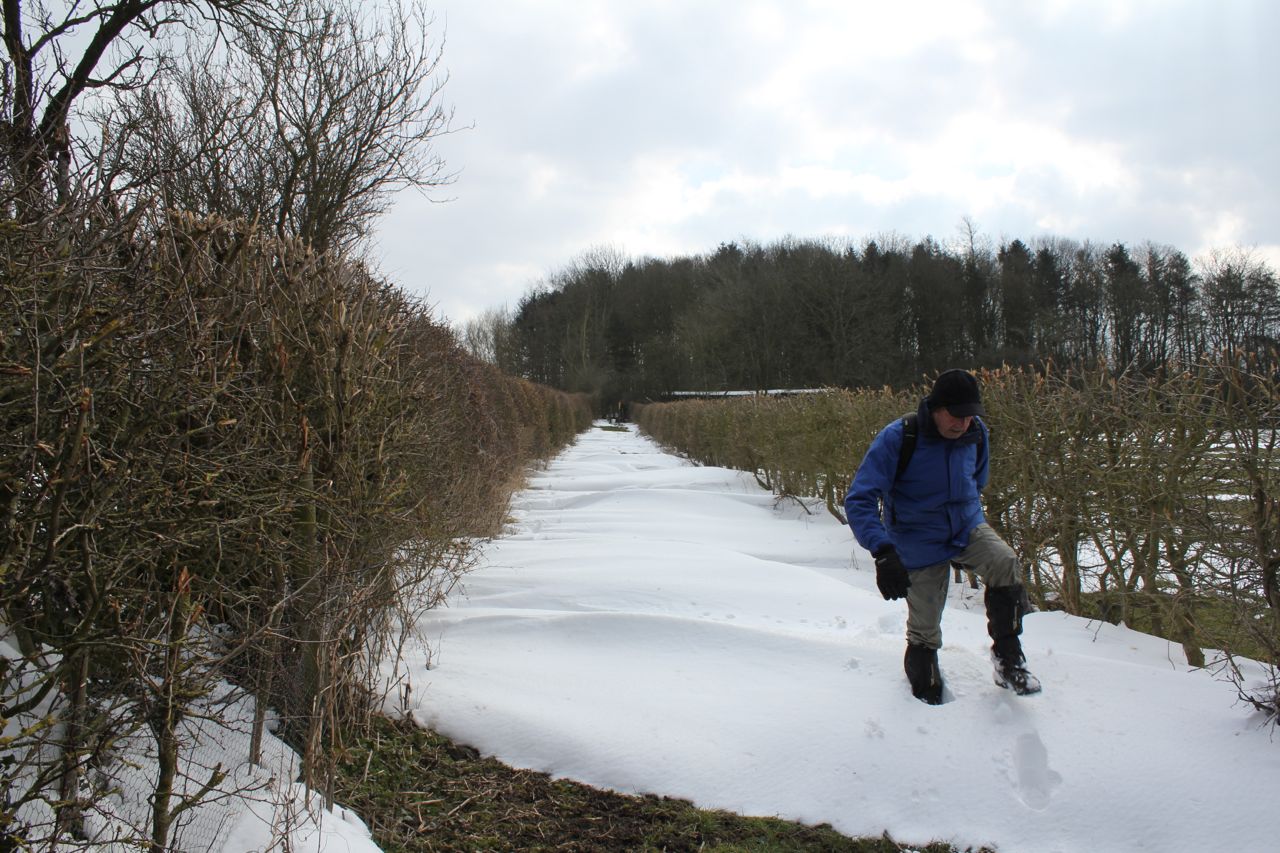
Our way ahead is quite clear - between two hedges. The snow has not melted in here, but someone has left footprints ahead of us.
 |
| Gordon picks his way through the snow |
 |
| can't go right |
 |
| can't go left |
 |
| must be this way |
We cross a couple of open fields, then a small road, and we walk with the hedge and stream on our right making for Hungarton. The ground is churned up near the village. Snow-cleaned boots or not, we plough through.
 |
| hell's bells . . . |
 |
| . . . and Hungarton church clock strikes eleven |
Calves and sheep are under shelter.
 |
| A farmer with a sense of humour - I didn't notice the reg until I saw the photo. |
 |
| The Shire Horse? |
 |
| One forlorn daffodil |
We decide to look at the church - it's locked, but we can't resist the stone benches in the porch, and we've not walked quite three miles yet.
 |
| Old church porch - fine shelter for an early break |
The church dates from around 1290 and is the oldest building in the village. Lots of houses sport an eighteenth century date.
 |
| The Old Rectory Hungarton |
 |
| Another millennium village sign - with Quenby Hall, Longhorn cattle and Hungarton church and village hall. |
 |
| ornament on post (1) |
We walk through the village, past the village hall, and start along the road towards Quenby Hall, before cutting across country on a footpath with the hedge on our left. Fine views back to Hungarton all the way up the hill. We're pleased to see that the path skirts the ploughed field.
 |
| Hungarton, seen from the drive to Quenby Hall |
Quenby Hall must have one the most splendid settings in the county, perched high on the hill with wide views all round. It's recently been on sale for £11 million and there's some other info. Out of my range, alas. Rather sad, really, as it did have an organic longhorn herd and a cheese-making business. It claims to be the place where Stilton cheese originated.
 |
| High Jacobean architecture - Quenby Hall |
We pass the house turning to our right and following the line of the ha ha wall round to the other side.
 |
| from the other side |
I can't find any details about this mini-obelisk, and the Latin inscription is worn. I made out EDITHAE OPTIMAE UXORE . . .
We continue along the drive past a couple of fields to a gateway where we turn right, cutting off the corner of a small field, through a gate and head south west downhill, to the opposite corner of the field near some woodland. There's a way marker, and a local map.

and an empty.
 |
| ornament on post (2) |
We cross the bridge over the dismantled railway and take the path towards Cold Newton Lodge.
 |
| dismantled railway |
There's a way marker by a pile of building rubble, perhaps from railway days.
 |
| ornament on post (3) |
The path is going south-east now, with the hedge on our left. We go into the next field and veer a bit to far to the right, but it doesn't take long to get back on track - the gate is just round a bend in the hedge. At Cold Newton Lodge we turn left, and follow the footpath north-east all the way past Sludge Hall, along a track to the minor road leading to Cold Newton - Enderbys Lane. We turn left.
 |
| Sludge Hall - good name today? |
Just before Cold Newton we take a footpath uphill to the right.
 |
| Nah, I don't think they're going to feed us! |
This emerges on the road, not far from Hanmers Lodge Farm, and we're almost back. We just have to walk downhill and then up into Lowesby.
 |
| Back to Lowesby |
We saw a hare, quite a few birds, including a robin, at least one lapwing and red kites on the way back.
Map and details