and occasionally rides a bike.
A word of warning. The walk descriptions are not detailed enough to guide you - please take a map. The batteries never run out, and you always have a signal. Oh, And don't take left or right as gospel!

Showing posts with label clock w one hand. Show all posts

Monday, March 17, 2014

Marston Trussell and Clipston - footpaths and some roads.

Mon, 2014 Mar 17 9:33 AM GMT
Led by me, with Barry, Gordon and Maureen. Not cold, dry, some sun. Most paths drying up, though we also did some road walking. Just over 8 miles, including about a mile walking around Clipston.

They (the hours) pass by and are put to our account.
We go through the churchyard and follow the path over a field full of lumps and bumps - there was once a moat and it may be the place mentioned in the paragraph on the photo below, where bodies were buried after the Battle of Naseby.
We head for the footbridge, then instead of crossing the next field we walk round the edge, as the path is unclear.  We find our way out over a footbridge, with the footpath sign. Looking back we see the church.
We cross the road and decide to try the footpath opposite. It is not always entirely clear where we should go, but we make our way with the help of the signs, the map and Barry's magic grid reference machine.  We cross the Jurassic Way path and head uphill towards Twantry Farm. 

There's a tricky bit where the path goes through a hole in the hedge, but is unmarked, so we take the alternative route through a gate a hundred yards or so to the left. A bit muddy but we battle through. Then it's a matter of following the farm drive until a footpath leaves to the left and cuts across the field, cutting off a bend in the road.  A few yards of road walking take us to the Royal Observer Corps lookout. We make the short detour to explore this and are repaid with wide 360 degree views.


 Onwards - we take the footpath which leaves the road on our left, just opposite the ROC viewpoint. This leads us across a field which a fine example of ridge and furrow.  One more field and we are on the road just outside Clipston.
We walk along Chapel Lane, and make use of the steps for our break. I take a snap of Thomas Jarman's gravestone. Time to direct you to my own silly verses
 Time for a wander round the village, which has some magnificent old buildings
Free Grammar school and hospital, now the primary school

Another one-handed clock


Prince Rupert's Cottage 

Clipston church
My first intention is to use the footpath near Peg's Lane, but one route is across a very muddy field with a bull, and I can't see the other route, so we revert to the road out of the village, turning left along the Sibbertoft road. When we reach the turning to Marston Trussell (2 1/2 miles), we decide to take the shorter route along Dick Hill, past the woods, turning right just after Marston Lodge.

We go straight ahead when the road goes to the right to East Farndon, past the Lake.
We turn right at the T-junction and back to the church.  

Monday, April 15, 2013

Illston on the Hill circular


Mon, 2013 Apr 15 9:35 AM Western European Time 
Led by me, with Barry. Weather much warmer today - even the wind wasn't cold. Underfoot mostly dry, except for a few gateways - one in particular near Burton Overy. Quite rolling terrain. Distance 10 miles. Total climbing 643 feet.

This walk was adapted from one in Heather MacDermid's book "Foxton Locks to Rutland Water"

We drive out to Illston on the Hill on a fine morning with a smidgen of sun in the air, and warm - a tropical 55F, or around 12C. Not quite shirt-sleeve weather, but comfortable.
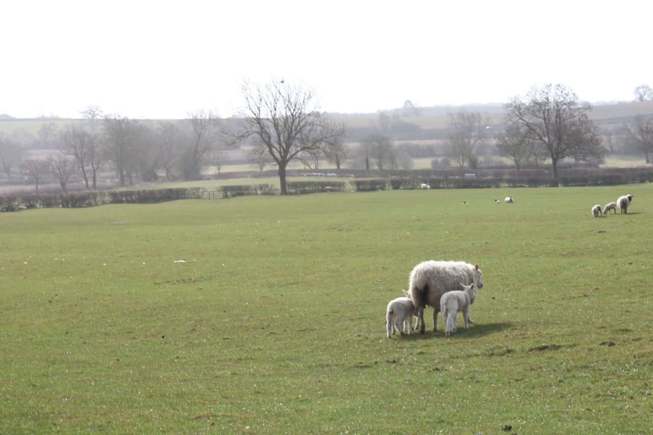
We set off from the Village Hall, walking past Oak Farm, and The Acorns to a T-junction. Across the road is the path, clearly marked as it crosses fields of sheep and lambs.
This ewe has three lambs - I missed the opportunity when they were all in a line!
There's a footbridge and then the path makes its way uphill and north east to Barn Farm. It carries on in the same direction past a big house called The Farm, where it joins the road (B6047).
Here we turn right and after 100 yards or so we turn left into Rolleston Park, where there is a cattle grid and then a long drive lined with horse chestnuts - not yet in leaf this year. We walk along the drive, past the gates to the Hall, and take a step back in time as a trap and four (?) approach us.


A great way to take the dogs for a walk
We pass the stables and the dairy - now rather fine houses, before taking the signposted track to Billesdon on the left, and then the marked footpath to the left which leads past the Cranhill Farm development.

We walk up the drive to the main road (B6047) again and after about 50 yards we turn left along  the "gated road to Illston". Very pleasant walking, trees to our left, views to our right, and hardly any traffic.  There's a space between gateposts, but no gate. Just before this our path turns off to the right and follows the hedge a short distance before going behind the splendid Ashlands, a mansion built in 1867 in Tudor style.  It's surrounded by manicured lawns and trees and has views over towards Frisby and Billesdon.

We walk downhill and to a grassy track with a small wood on our right. We walk along two sides of the wood and then keep the hedge on our right through three fields, swinging left at the end to join the lane which goes to thr right and up the hill into Gaulby.

We walked along the road to the church, and took a break on a bench nearby - sheltered and sunny today.

counting the hours while minutes run free - a clock with one hand
Until about 500 years ago no clocks had minute hands and you had to judge approximately how far to the next hour you were from the position of the hour hand - a bit like a sundial, I suppose.
Gaulby church with its four pinnacles and weathervanes.


Daffs at last!
Then we took the road to Kings Norton, passing some fine houses - one called Dovecot House . . .
. . . and there's the dovecot.
Kings Norton Church (St John the Baptist) is a very imposing building for such a small village.
Kings Norton Church
Shortly after the church, along the road towards Illston, there is a footpath off to the right.  We decided to take this route - across a field and past a small hollow - where sheep were taking advantage of some water. It didn't look very appetising.

We kept to the higher ground passing some small wooded areas on our left.  In the fourth field the path swung round to the left and downhill to meet a track which follows the Roman road, Gartree Road.


Decision time again - Burton Overy or not?  We have plenty of time, and the weather's good. Ten miles sounds like a decent walk, so we head along the path which follows the stream for a few fields. Just before Burton Overy we meet our muddiest obstacle - a gateway of course. I go ankle deep, but the boots are up to this, and my feet stay dry.

We walk along the main street past the large church and some interesting houses.
Timbered house in Burton Overy
At the pub (the Bell) we turn left along Carlton Lane, and follow this up the hill as far as Chestnut Farm, ignoring a footpath off to the left. At the farm we go through a gate and then beside a barn and into a field. Here we keep to the left hand side and walk downhill to a footbridge over the stream. From here we can see the small tower of Carlton Curlieu church, and make for this, following the path until it meets the road. We pause to persuade an errant lamb back into the field - another one that looks like a small quarried dip.

We walk past the old rectory and the church and turn left for 100 yards or so, then left along the bridle road to Illston.  This runs clearly between two hedges as far as the road (Gartree Road is a real road here) t Carlton Curlieu Manor House farm. It's still signed clearly as the bridle road to Illston, but isn't as superb as the last section.
In fact it's easy to follow, although the last field is a bit of a chore. We can see Illston church from the path.  We walk back to the village hall through the village with its church and pub.
Thoroughly enjoyable.


Monday, September 12, 2011

Brigstock to Great Oakley via Geddington

Part of Mel Jarvis's Around Corby Walk, but clockwise.


With Barry and Gordon. between 9 and 10 miles in reality. Weather - a shower before we started, then very windy, but sunny. Hard work in the teeth of hurricane Katia's tail.


Beware - ignore miles 5 to 7 on the garmin link- no way did our guided tour of Geddington church cover 2 miles!  Nor was I running back and forward across the village! Technical hiccup. Then I left the machine running in the car for part of the journey back.  Human error.


We started walking from behind Brigstock Village Hall, crossing the stream via a footbridge, and taking the right-hand of two paths uphill over several cultivated fields. The path runs parallel to and slightly higher than the A43 road.


Making our way towards Stanion with a headwind
Crossing the brook
Once in Stanion we turned left into Willow Lane, then left again just before Keebles Close along a short footpath leading to the Pocket Park, which is managed for wildlife.  After the park we turned left again and walked along the road for about 100 yards before turning right on to the footpath which took us uphill through more fields towards Geddington Chase.
Walking uphill from Stanion

The path cuts off the corner of the first field, then follows the hedges as it climbs up a hundred feet or so.  It is well marked.  Eventually we arrived at Geddington Chase, and followed the wide grassy avenue to Chase Lodge, a fine well cared for house and garden, ruined (for me, though I'm sure the owners have good reason) by their guard dogs, which bark enthusiastically as soon as they hear or see you.
We followed the clear footpath arrows around the house and took the path south-west - not the one directly opposite us. This leads downhill through the woods, past an abandoned building, and on to a track which becomes Wood Street leading into Geddington village.  This is a village with a history far bigger than its size would imply.  Its most famous attraction is the Eleanor Cross, built by Edward I to mark one of the resting places of the funeral procession of his wife, Eleanor of Castile, as  her body returned to London in 1290. 
We stopped to look at the information board outside the church, and local enthusiast and editor of the Geddington website, Kam Caddell, came to tell us about the village and gave us a guided tour of the church, which dates from around the eighth century, and stands on a previous pagan site, linked to the well beneath the cross, which is reputed never to dry up.  The village was a favourite haunt of English royalty for most of the twelfth and thirteenth centuries. For more information about this , go to the village website .  
The bridge over the River Ise was built in 1250

We crossed the bridge and walked along Bridge Street almost as far as the Post Office/ Tea Room before turning left along the path leading through a park.  It took us out at the main road (opposite Dallington Crescent.  The path continues across the road, just next to the drive to a house.  We followed the path,  eventually turning right near Mill Farm and emerging on to the road between Geddington and Newton.  A few hundred yards of road walking, then we took a path to the right.  There are two paths - we followed the right hand fork.
We walked uphill through a couple of large cultivated fields towards an electricity pylon - the highest point of this section.  The next stretch was downhill, under the railway bridge, and through a field near the old Great Oakley Station. Across the road and into a field next to the track the path has paving stones - the story goes that the landowner laid York stone slabs for the locals to walk to the station, which was far enough away from his land that it caused no disturbance. But once the station was no longer in use, the York stone was replaced by something cheaper - concrete.


We emerged into Great Oakley at the Row, and shortly afterwards took a footpath to the right, through the hall grounds, past a large pond, and past the church with its one-handed clock


We followed the road from the church, turned left, then right to pick up the footpath which follows Harper's Brook to the Spread Eagle.


Then it was about a mile to collect Gordon's car and get a lift home ( and a bag of apples!)