Mon, 2013 Jun 24 9:46 AM British Summer Time.
Led by Barry, with me, Eddie and Gordon. A dull morning, mostly dry underfoot. Not hilly, through arable land and villages. 9 miles.
The walk covers the same ground as this one, but starting in Sywell rather than Hardwick.
From the church we turn east along the road towards Mears Ashby, ignoring the first footpath sign to our left, which leads between houses.
Our path is off to the left, just as the road bends round to the right.
The path crosses the corner of the first fields, and in the second one heads for the far right hand corner. It snips the corner of the third field, and in the fourth goes down to cross a stream. Then we head almost due east again uphill to join Glebe Road going into Mears Ashby.
We follow the road on the north edge of the village and turn left at Highfield Road. In a short while the path goes left, heading north now. After four fields we meet the Sywell to Wellingborough Road, and cross it. We cross two fields, then come to a dividing of the ways - we take the right hand path - or head for the high ground. Don't get skylined, advises Barry in ex-army mode. We pick up the path and make for Hardwick, via farm buildings and houses. We turn right along the road to the church, then left, and find our path off to the left as we come out of the village.
We're still going north, over a couple of fields and then a bridge over a stream. At this point we decide to follow the field boundary since the path hasn't been made good.

 |
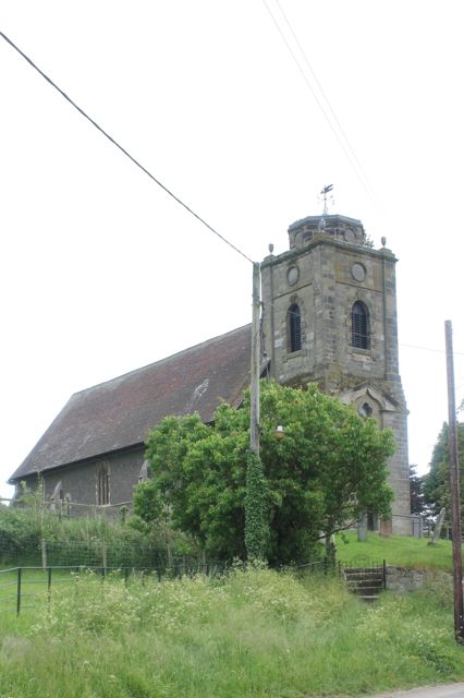
| Sywell church |
Our path is off to the left, just as the road bends round to the right.
The path crosses the corner of the first fields, and in the second one heads for the far right hand corner. It snips the corner of the third field, and in the fourth goes down to cross a stream. Then we head almost due east again uphill to join Glebe Road going into Mears Ashby.
 |
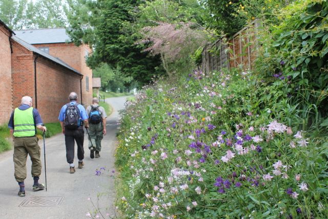
| Too early for today's break |
We're still going north, over a couple of fields and then a bridge over a stream. At this point we decide to follow the field boundary since the path hasn't been made good.

When we reach the low ridge we turn left, going west. It's fairly windy at this point and we pick a spot sheltered by the hedge for our break. The path hugs the boundary until we reach a large open field - here we continue west straight across the field.
At the hedge we turn left - there's a small ruined building on the other side of the hedge.
South now. In the second field there's a pool surrounded by trees - the path circles this - we choose the right hand route.
We arrive at a very small road, and the dogs of Hardwick Lodge. The people are friendly, and c hat a while, before suggesting we take the diverted route which is marked, and wishing us good walking.
We follow the path on its slightly devious route, eventually walking alongside Hardwick Short Wood and Sywell Wood. We come out at Wood Lodge Farm, and meet the road into Sywell past the airport and the Aviator Hotel.
Just before Sywell Hall we take a path to our left, which brings us out at the footpath we ignored on the way out.
Map and details
At the hedge we turn left - there's a small ruined building on the other side of the hedge.
South now. In the second field there's a pool surrounded by trees - the path circles this - we choose the right hand route.
We arrive at a very small road, and the dogs of Hardwick Lodge. The people are friendly, and c hat a while, before suggesting we take the diverted route which is marked, and wishing us good walking.
We follow the path on its slightly devious route, eventually walking alongside Hardwick Short Wood and Sywell Wood. We come out at Wood Lodge Farm, and meet the road into Sywell past the airport and the Aviator Hotel.
 |
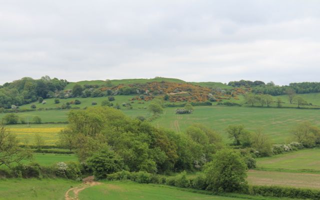
| A quick look at the map |
 |
| flying the flags |
 |
| Sywell geese |