and occasionally rides a bike.
A word of warning. The walk descriptions are not detailed enough to guide you - please take a map. The batteries never run out, and you always have a signal. Oh, And don't take left or right as gospel!

Showing posts with label Barnwell. Show all posts

Thursday, April 10, 2025

Polebrook, Armston, Barnwell

 Monday 7th April

A circular walk from Polebrook to Barnwell with Norma.  Fine sunny morning.  


The walk came from a local magazine 
https://stamfordandrutlandliving.co.uk/articles/walks/polebrook-barnwell/

Things were straightforward as far as Barnwell, with one deviation where we saw reindeer,


but we soon got back on track.


More thatched figures in Barnwell.  


We stopped at the Montague Arms for a leisurely coffee, then walked to the end of the village, by the brook.


We made our way back over rather a lot of flat fields, into the easterly wind a bit.

Came slightly unstuck at the wood near Polebrook - we must have missed the proper path, so did a woodland cross country course, cracking dead wood as we went.


The path was there at the other side.  Needs a short recce before we take anyone else!


On the way we saw a peacock or two and an orange tip.

We lunched at the Barn Garden Centre just outside Oundle - pleasant, good service etc. Had a vegan sandwich (I don’t often eat vegans, but…) - hummus and salad. 

6.3 miles in all.


First part of walk wasn’t recorded!

Wednesday, April 16, 2014

Barnwell circular, via Armston

Mon, 2014 Apr 14 9:20 AM BST
Led by Barry with me and Maureen. Mostly good paths on clear fields. Not much mud. Fine if windy. Almost 8 miles.

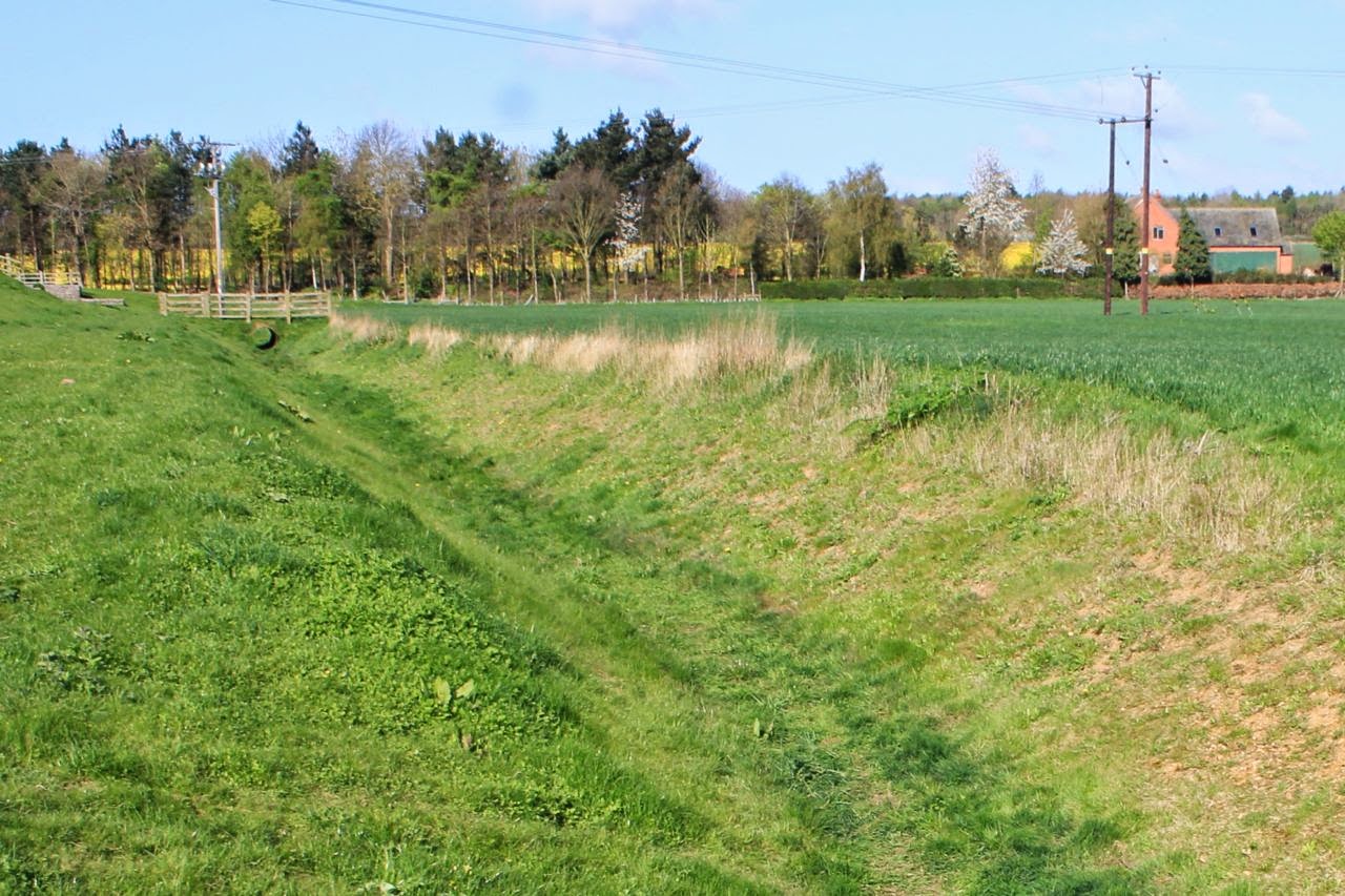
We head south out of Barnwell, past All Saints Church - and take the non-Nene Way bridleway which leads across a dyke-cum-drainage ditch beyond Lower Farm.
The path turns slightly and leads south east over Barnwell Brook with its small sluice, and uphill slightly. There are cowslips and other flowers along the way. We join another bridleway, swinging slightly further towards the east and making for Bull Nose Coppice.
Here our path turns 90 degrees to head more or less northeast, then north, passing South Lodge Farm on our left, and heading to the minor road.  We can see the village of Thurning a mile or so away on our right.
We cross the Thurning to Barnwell Road, and skirt North Lodge Farm before resuming our course to the north. We're getting ready for a break, and find a sheltered spot with a fine view of the water tower.
We follow the field boundary for a couple of fields, then cross the Barnwell to Hemington road. We catch sight of Polebrook church some way ahead of us. The path goes straight ahead, turns left then right following field boundaries, then diagonally over another field, through a short stretch of woodland, and across a narrow field. It turns left and follows the hedge, then right and along until it meets a "privately maintained road, where we turn left, almost retracing our steps for a couple of hundred yards. We follow this road as it bends right and takes us into the hamlet of Armston.

The road swings left and as it bends to the right once more, our path goes off to the left, south east. It crosses a field and skirts Armston Grove woodland.
It continues in the same direction behind Barnwell Manor, eventually turning left and into the village.


Monday, July 2, 2012

Polebrook - Barnwell - Polebrook

Led by Barry. Wet clingy drizzle and wet grass. It looked unlikely to clear so we shortened the walk and stuck to hard surfaces where possible. Polebrook Church has interesting WWII memorial. 5 1/2 miles approx.


Grey sky, waterproofs on - we set off near Polebrook church

Even the donkeys seek shelter

and the cows are lying down


By the time we get to Barnwell, it's still raining. Glimpses of the castle 

One of the donkeys has emerged when we pass their field for the second time
Memorial to two airmen in Polebrook church. For the full story scroll down on this website.

We might just need to hitch a lift in the ark this summer


Map and details

Friday, September 16, 2011

Nene Way 8 - Barnwell to Wansford

With Marta.  Weather fine, not sunny but warm.  14.44 miles, including short detour to Fotheringhay Church and shop in Nassington.


We started from Barnwell Country Park, crossed the old road opposite Oundle Mill and followed the Nene Way, which is pretty well marked, along past the marina, and locks, through some wide meadows, and over a footbridge into Ashton. The first part of the walk overlaps with this walk from Thursday, Aug 18, 2011


Through the village and after a while we turned left at the 'Entrance Lodge' to follow the road which turned into a track, past a Rifle Range, past Tansor Lodge on an old Roman road and into Warmington.  Coffee break (from a flask), part way along here. 
When we reached Warmington village we turned right, then left coming out at the church, which is a big one. 


and on to Eaglethorpe with its 17th century limestone dovecote


After this we made our way under the A605, through a decorated underpass

and over the fields to Fotheringhay. We climbed up the castle mound
Two boats below Fotheringhay Castle mound
The pub does a good lunch, then we wandered around the church - there's an impressive historical exhibition in there, and it's much lighter than many churches.


The prospect of another six miles was a little concerning, but we've done over 12 recently.  We left Fotheringhay on the Apethorpe road.  The turning to the right is just before the speed limit sign, but easily missed. A track leads to Walcot Lodge, where we turned right again.  About two thirds of a mile later, we were almost tempted to keep following the wider track which veers to the left, instead of going straight ahead. There is a Nene Way sign, but it's not immediately obvious.  There's a short turn to the left, then right a little later, but once all this has been negotiated, the route leads down towards Nassington. We needed something to drink, so detoured to the local shop.
Back to the route proper, and onward to Yarwell Mill, with its boats and caravan site. These millstones are on the road leading out of the Mill.

We should have taken a path across a field at this point. Instead we continued to the road, and turned right towards Yarwell. Not much difference in the distance. From here it's about a mile across fields - lots of horses grazing,
 and Wansford Bridge soon comes into view.


Phew, Wansford Bridge - that's the Northants Nene Way done and dusted.


Map and details

Friday, September 2, 2011

Nene Way 7 from Thrapston to Barnwell Country Park

 ( Garmin timer got switched off for a while, hence 'mile 6 to 7'  is at least two and a half miles long, and doesn't track the route at all between Achurch and just above Wigsthorpe.  After checking the route on the OS map the missing section is almost three miles. Total has to be about 12 miles.)


12 miles approx. Sunny, and very warm. As far as Lilford Bridge the walk is superb – after that there is too much road and flat open track, though Barnwell village itself is well worth a walk.

We set off from near the Woolpack Inn, walking through the village of Islip, which is very attractive, especially in the bright sunshine.  We went past Islip House and after a gentle walk uphill turned right to the road through the village with the church on our left.

A little past the church on the right-hand side of the High Street, at the Rose and Crown the path goes through the pub yard and through two fields which are beautifully maintained with a pond and trees.  


Then we arrived close to Islip Mill, where we crossed the lane into a meadow where cows were grazing.  Close to the path in some trees was a cow with a very young calf.


Further on the path goes through a spinney and by the edge of a small lake, and continues into Titchmarsh Local Nature Reserve.


We stopped for a few minutes in the bird hide, to watch a few grebe and swans. And later, to look at some black and brown sheep with wonderful horns.


The Nene Way, clearly marked, leads between two lakes. 
To the left of the path there is a trout fishery - very popular when we walked past.


The Nene Way leaves the Nature reserve after another notice board to make its way across a couple of fields and to the main street of Aldwincle.
Village sign erected in 2000


I’d heard of the Tea Shop at Pear Tree Farm, and we spent a pleasant half hour sitting outside at the back. Decking that felt right, since it was over a yard, colourful flowers in pots.

We sat at a table with a parasol, in glorious sunshine, watching a horse-rider leaving the stables, and lots of swallows flying in and out of the barn, and sitting on the tiled roofs . . . almost Mediterranean.
 Oh, the coffee was good too.


Still, this was a walk!  So we set off again, past the village school, and the church until we found the Nene Way footpath sign off to the right.
The path leads downhill slightly and turns left following the edge of two or three fields, behind the recreation ground. We went downhill slightly at the edge of a small wood and continued, not far from the river, but mostly hidden from it by trees – we could hear and catch the odd glimpse of people, boating and paddling in the river.

We made a small (deliberate) diversion to the church which sits on a hill above the village of Wadenhoe .
13th Century font


We looked inside, and found plenty of information about Wadenhoe past and present, including the true story about Thomas Welch Hunt, at the time the owner of Wadenhoe Manor,  and Charlotte Isham.  They had been married for ten months and were touring Italy when they were shot by brigands at Paestum. They are buried in the English cemetery in Naples, but there is a large remembrance plaque just inside the church door.  The church also displays copies of paintings of the couple, and the story behind the paintings, which are in Peterborough Art Gallery


We walked through the village, down the hill past the millennium sundial, past the village hall, the Kings Head pub, and followed the signs over a bridge near the mill. The weather was hot and the water very clear and almost tempting. 

After the footbridge we walked beside the river for a short distance, and in the next field had to walk diagonally across to another footbridge. Wow, people sunbathing!  Once we were over the Nene we turned left and slightly uphill making directly for Achurch church.  The path goes through the churchyard and a shady spot next to a wall with lots of crab apple trees looked ideal for a banana stop.

Marta recreates a pose found in some old photographs of her mother and aunts – from the 1940s?
We turned right past the church and briefly along a small road, until we saw the Nene Way sign pointing to the left into some woodland called the Linches.  The path is clear and comes out on the road near Lilford Bridge.  We followed the road past a junction opposite Lilford Hall gatehouses, which are small but quite ornate.


 There is a mile or so of road walking here, over the roundabout with the busy A605, past wide arable fields.


We had the field on our left and could see Titchmarsh church in the distance on our right.


Just before a dismantled railway we turned left along a small road to Wigsthorpe Hall Farm.  Recently planted trees provided welcome shade.


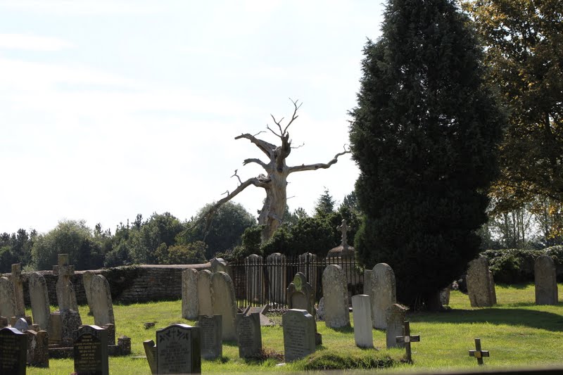
The path was clearly signed here and leads over the fields to Barnwell.  It emerges at the remaining part of All Saints Church with its graveyard, and a spectacular spooky tree.


The village is very attractive with the brook running through.

This bridge was built for the former Duke of Gloucester to walk from the Manor to St Andrews church.


We walked through the village and turned right along the Nene Way at a road junction, then left through a scrubby spinney to the Oundle bypass, which we crossed, then continued to the old road.  We followed this – about a mile again - past Oundle Mill and lock and back to the country park. 
I couldn't believe the colours in this tree - we are barely in September.
Oundle (or Barnwell) Mill


Pictures from a walk covering some of the same ground: