and occasionally rides a bike.
A word of warning. The walk descriptions are not detailed enough to guide you - please take a map. The batteries never run out, and you always have a signal. Oh, And don't take left or right as gospel!

Showing posts with label Ashton 2. Show all posts

Sunday, April 20, 2014

Ashton to Salcey Forest circular


Thu, 2014 Apr 17 9:36 AM BST
With Maureen. Probably just over 10 miles. Lunch at SF cafe. A bit too much road coming out of SF, and too much close to the M1 - noisy. Otherwise very pleasant, pretty flat. Weather beautiful am, turned dull and cooler pm.
We park in Ashton (near Roade), and walk up past the church and the bright blue primary school. The path goes off to our right, under the mainline railway bridge, then turns at a right angle to bring us out on the Hartwell road.
We turn left and walk a short distance before turning right along a footpath. This takes us south east to a minor road. We cross this and take the footpath angling left across a field, well maintained and signposted.
It is easy to follow over two fields, then cuts a corner of a field near Hartwell Park Farm, follows a line of trees and joins the drive just after the farm gate. We walk along the drive towards the village, and turn right along a footpath just before another gate which leads to the road into the village.
This path follows the edge of the cultivated field, then goes into another grassy one and turns right. We follow it south west past Ravenshead farm, until we rejoin the Northamptonshire round footpath, and here we turn left, almost due east.
The path is clear through crops across two fields, then we get slightly confused. We know the direction to go, we know where we are  - heading towards the lane to Chapel Farm, but we choose the wrong side of the hedge. The real path goes through two wide farm gates, downhill. There is a sign, but it's not easy to see, almost concealed by the hedge. And yes, there are more footpath markers at the bottom of the slope. We don't take the NR this time, but head straight up to the lane, turn right for a short distance then take the path onthe left hand side. According to the map this goes through the medieval village of Hartwell, but we see no evidence of it. The path turns left and meets a different Hartwell Road. A left turn and just over a hundred yards of walking takes us to Stone Pit farm, where our path goes off to the right. We walk behind the farm, and across one field, through a hedge and into a more sheltered field with a grassy edge - perfect for a short break.
We follow the path along the hedge for a couple of fields, through some awkward gates, past a pond and Hartwell End House and Farm.  
Turn left and then right over a stile, then through a gate and the muddiest section of the walk. Turn left here and go into the next field, keeping straight on  (north west here) as far as Elms Farm, and turn right along the hedge.
Follow the field edge to the right again, then turn left into some very attractive woodland, spoiled only by the din of the M1. Celandine, primroses, a few bluebells, stitchwort are some of the flowers growing here.

Our path takes us through a tunnel under the motorway, then we turn left and walk through the grassland and trees of Sandpit Copse. Very noisy, of course. It's a relief to meet Forest road and walk away from the M1. At the crossroads we turn left into Wootton Road, and eventually into the car park and cafe area in Salcey Forest. Lunch. And a forty minute break. Then another mile or so of Wootton Road, which is quite busy today, so we have to keep hopping on to the verge, which is not designed for walking.  It also runs near enough to the M1 to be unpleasantly noisy with the wind from the west.  We pass the dismantled railway, which now seems to be the access road to the wind farm. A little further on at Quinton Green, we join the midshires way and walk west towards the M1. This time we cross it via a footbridge and head a bit further west. Now the wind is carrying the noise away from us. Judicious use of map, garmin and footpath signs (and diversion signs) keeps us on track. We follow the midshires way as far as the road, then turn left and walk as far as Ashton Lodge Farm. A footpath to the right goes through the yards behind, and we follow it , crossing the railway by a bridge, then crossing a road and picking up the footpath opposite which brings us into Ashton. We leave the footpath and take the road downhill past the school and church and back to the car.
At various points in this walk you can choose different footpaths for variation. The big disadvantage is the proximity of the M1!

Map and details

Wednesday, April 16, 2014

Northamptonshire Round 5 - Ashton circular catch-up

Tue, 15 Apr 2014 10:15 BST
With Marta, around 8-9 miles. Beautiful weather, took it easy. Ate in Ashton.

We set off from near the pub inAshton (the Old Crown - who do a decent ciabatta+ salad +juice drink for £8). Follow the road towards Stoke Bruerne and take a path between two houses, to the left, near Vale Farm. 
Cross several fields past a stables, cross a track and some woodland, and follow the path southwest, then south until you reach the Grand Union Canal, at Lower Lock Farm.
water boatman in a trough

Turn right, north west, along the canal past three locks, then after a bigger gap a fourth one, and you are at Stoke Bruerne with its pubs, cafés and canal museum.


We stopped for a coffee, and unusually some chocolate cake, before leaving the canal. Cross the bridge and head towards Stoke Bruerne church.

The NR footpath goes right, just before the church. Or you can walk through the churchyard and join the path on the other side. It passes some houses and leads west towards Shutlanger. It crosses a minor road, goes through fields, one with what looks like an allotment in the middle of it, the next one full of sheep today, then past the monastery.

When you reach the junction of a road and a bridleway, opposite a private road, turn right towards the main road through the village.

Twitch Hill or High Street in Shutlanger lead on to Showsley Road, which you follow for half a mile past a dismantled railway, turning right along a bridleway where the road bends left. The path goes alongside a belt of woodland, and then past Nun Wood.

Female orange tip?
The signpost at the south end of Nun Wood is misleading - we turn right, then realise our mistake. Mr Garmin confirms this!
At the north end of the wood  the NR goes off ot the left, but our route today is to the right and we soon join the Midshires Way, then cross another footpath. Soon after this, at the end of the field, we turn left, and head pretty well east toward the road from Blisworth. We hear and then see a light plane taking off.

At one point we catch sight of the air shaft from the tunnel.
We turn right at the road  walk along for a hundred yards or so, then take the woodland path back to the canal. It joins the towpath just past the south end of Blisworth Tunnel.  
A short walk leads us to Stoke Bruerne again, but on a fine day close to Easter the waiting time for food is 40 minutes, so we plod on to Ashton, by road this time. It's a bout a mile and a half. Luckily for us the pub here is serving food, so we can have something more substantial than our emergency ration cereal bars!
We may try some more circular walks as we complete the NR walks.

Wednesday, March 5, 2014

Northamptonshire Round 4 (Salcey-Ashton) + Ashton-Blisworth (shortened)

Wed, 2014 Mar 5 11:28 AM GMT


With Marta. Around 9 miles in all. We shortened the route from Ashton because time was a little short. Next leg will start from Ashton and do it properly!

Not an auspicious start, when we both got caught up in traffic jams this morning. So what should have been a 10.15 ish start, ended up, after a coffee and teacakes for me, as an 11.30 start for the walk. 

From Salcey Forest Café we walked on to the road, turned left, then right at the junction towards the M1. We'd just decided that the path in the forest looked far too muddy, and were looking at the map when a helpful man appeared.  Funny how person looking at map = lost.  Still he did tell us about another path, which turned out to be the one we wanted.
It's very close to the M1, and quite noisy, but is open countryside and otherwise pleasant, then a section of woodland which takes us to a road under the M1. We turn right under the motorway, then left into more woodland which gradually leaves the noise and traffic behind us.
The path is marked pretty well and we walk along the path coming out at Hartwell End Farm and House. We walk past a large pond, and through a gate - at this point I switched my garmin off by taking my coat off, so the mileage recorded isn't accurate.How many times have I done this?
We follow the path, diverting slightly round a field edge and come out, as we intended at Stonepit Farm.  Here we turn left along Hartwell Road, and after a couple of hundred yards we take the footpath to our right, soon turning right again with the hedge.  We follow it to Chapel Farm, where we see our first outdoor lambs of the season.
We turn right along the farm road and at the next bend take the footpath to our left.  We ignore the first footpath coming in on our right, and carry on until we cross another path. Here we turn left, and follow this path just north of west, across a minor road, then as far as the Hartwell Road coming out of Ashton.  We turn left and walk a short distance along the road, then take a bridleway heading northwest at a left-hand bend in the road. This makes a right-angled turn left and brings us under a railway bridge and into Ashton near the school and church.


We turn right at the Old Crown and walk through the rest of the village.
Spring is springing!
At this point we have a rethink of the original plans for the walk and decide to take the shorter route to Stoke Bruerne by minor road.
 A good move - it's already well past two when we stop for lunch at The Navigation, right by the canal. It's warm enough to sit outside in a sheltered and sunny spot, the sandwiches arrive very quickly and taste good - ideal!

We take a short route to Blisworth, leaving out Shutlanger (until next time, anyway) and taking the Grand Union Canal walk, along the canal and the road.


When we reach Blisworth Tunnel entrance we have to climb up to the road, which is a little busier than I like, but nothing too bad.


We pass several farms and just before we go downhill towards Blisworth we pass this air shaft for the tunnel.
At Blisworth Tunnel car park we go back down to the canal. At this end of the 2821 meter long tunnel the tunnel hut has been restored and decorated inside.


We walk along the towpath until we reach Blisworth Mill (once a spice mill), and the road to the car.
Approaching Blisworth
The church stands on a rise and there's an overspill cemetery with fine gates just across the road.
We reach the car, and have plenty of time to pick up the other one from Salcey Forest well before they shut their gates at 5pm.

So, not entirely Northamptonshire Round, but a fine walk in beautiful weather. 

Saturday, August 10, 2013

Salcey Forest to Stoke Bruerne.


Thu, 2013 Aug 8 10:03 AM 
With Barry, Gordon and Eddie. Very hot. One or two unclear footpath experiences, including one that disappeared completely. About 11.5 miles. Lunch at Boat Inn SB. Too much road as well, though they were mostly quiet ones.

From the main visitor car park, we walk along the road and over the M1 towards Hartwell.  Here we turn off to our right on the path towards Rowley Wood.  We have to skirt the wood and we end up back in Hartwell, since the other route is likely to be longer. We decide on a footpath leading southwest past a farm. 
This is where we have the disappearing footpath experience though we think it may be due to very poor signposting. We waste a good half hour, then retrace our steps and head off towards Ashton, turning right along the Roade road - yes, I had to write that.  We take a footpath opposite a house marked as Colmarel Kennels on the OS map, and follow it without too much trouble. It leads towards the main Milton Keynes to Rugby railway line, and emerges on to the road into Ashton just before the bridge. 
under the mainline railway bridge
 We walk through Ashton, turning right, going past the Old Crown pub and then taking a footpath to our left  between two houses. The path turns right/west very soon, gradually making its way over several fields downhill gently to the canal.  We wander a little because of crops, but no real problems in this part.
A disreputable crew?


We meet the canal at Lower Lock Farm, and turn right along the towpath. It's a short mile to Stoke Bruerne past locks, and canal boats. 
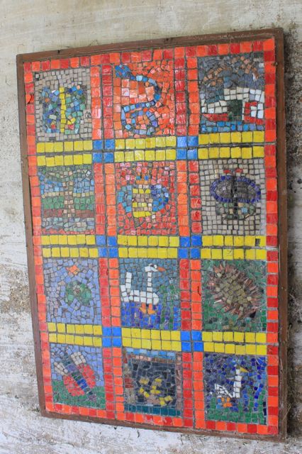
Under-bridge mosaics, 
moorhen and chick

on boat veg garden

growing cygnets
Dry dock
We lunch at The Boat Inn - decent grub, long wait.
The view across the canal
Back via the road to Ashton - it's a pretty quiet one, so not unpleasant. 
Wellingtonia and house
tall tree
Then across country again to Hartwell, where we have a rest in the little cemetery and chat to a woman who is clearing the leaves. 

From here we walk back along the road to Salcey Forest. 
Altogether we've walked just over 11 miles - it's been pretty flat, and quite hot.