and occasionally rides a bike.
A word of warning. The walk descriptions are not detailed enough to guide you - please take a map. The batteries never run out, and you always have a signal. Oh, And don't take left or right as gospel!

Showing posts with label Bedfordshire. Show all posts

Sunday, March 5, 2017

Chelveston, Yelden and Melchbourne

Thursday 02 March 2017. With Maureen.  9.6 miles.  Weather quite windy, with occasional sun.
A very similar route to the one I followed with Marta on February 14th. 

Once again we called in to the churchyard, where the snowdrops were starting to fade, but daffodils were popping up here and there.

We walked away from Chelveston, through Caldecott and past the Crescent, and took the bridleway straight ahead when the road bends to the right.  The path took us into Yelden, with its Norman motte and bailey. 


We took the footpath to the right of the castle mound heading south east across the meadow.When we had negotiated a stile we followed the path to our left along the field edge then continued to the fairly quiet road and turned right. We stayed on the road until we reached the St John Arms pub. Here we turned right and walked into Melchbourne village. We had a short break outside the church. 

We took the street close to the church, turning left. Very soon a footpath goes off to the right. this leads to the road, opposite the Day Nursery and farm. 
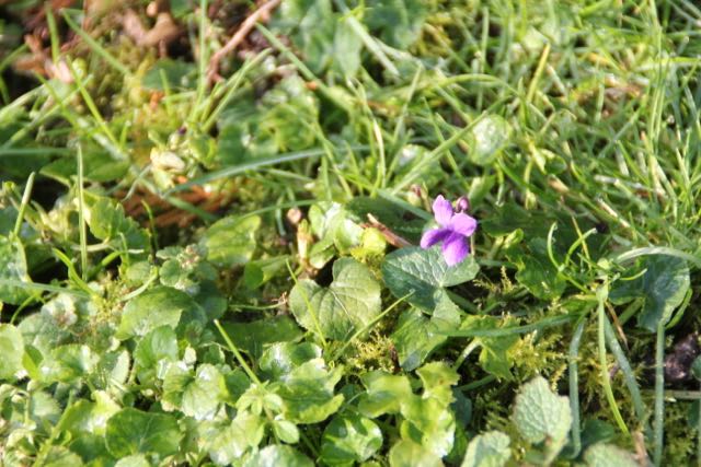
An odd photograph . . .
Across the road we picked up the path again. a little muddy at first, but soon easy to walk on. It took us alongside fields to Crowfield Farm buildings, and we followed the surfaced track out to the road.  We turned left and walked past one footpath sign on our left before turning left ourselves at the next one, and rejoining the route we had taken from Yelden earlier, and retracing our steps to the motte and bailey.

We walked along the road with the castle on our right, then turned left along the Three Shires Way, past Bottom Farm, turning left at the sign to Middle Lodge. We followed the path through the caravan storage place, up to the wind and solar farm at the top.  The path took us straight through and down into Chelveston. 


The walk felt longer than the nine and a half miles, probably because of the wind! 


Thursday, February 16, 2017

Chelveston, Yelden, Melchbourne

Tuesday 14 February 2017.  With Marta. Paths mostly good, though we could have avoided one muddy field. A bit of road walking involved, but none busy. Just under 10 miles.

Before we started the walk we called into Chelveston churchyard to admire the snowdrops and aconites - they should be in peak bloom for the Snowdrop weekend (18th and 19th).


We walked along the road from the church away from Chelveston, through Caldecott and past the Crescent. Shortly after this the road turns 90 degrees to the right, and a track/bridleway continues ahead - this is what we took. Wind turbines were on our left.  There is a short muddy section, then the track is surfaced again and leads into the pretty village of Yelden, which is in Bedfordshire.

 Yelden has the remains of a Norman motte and bailey, considered to be the finest archaeological monument in Bedfordshire, according to the information board.  The remains are yet to be explored and excavated.  The castle had fallen into disuse by 1360.
The church sporting a wind turbine hat

One view of the castle site
The notice board showed the route of a local walk to Melchbourne. Seemed like a good idea, so we decided to try part of it. We took the footpath to the right of the castle mound heading south east across the meadow.
Fieldfares
The signs are very clear at this point.  When we had negotiated a stile we followed the path to our left along the field edge - conditions were ok. We couldn't see the mapped footpath across a ploughed field, so continued to the fairly quiet road and turned right. A couple of hundred yards later we turned right along a bridleway close to a strip of woodland called Yelden Spinney. In future I will carry on to the next track if the weather has been wet!

The path running left to Crowfield Farm, though clearly marked was muddy. Heavy, sticky stuff.

 Crowfield farm appears to be mainly used as barns. Our path from here to Melchbourne was easy to follow and there was no more serious mud. We passed a few animals.

and a pre-school in a farm.
We crossed a road and continued on the footpath , turning left at the end to Melchbourne church, where we had a break, in sunshine.
Trees through the porch window

The church of St Mary Magdalen, mostly rebuilt in 1779.Pity about the funny upper section.
A row of cottages carefully photographed to avoid the unattractive car element.
We took a slightly different route back to Yelden.

We took the road (from Knotting) to the junction with the Swineshead-Yelden road, where we turned left, at the St John Arms pub. We walked for maybe a mile along the road, then rejoined our previous route by turning left - the turn after the spinney.
Yelden again
from Yelden we took the Three Shires Way for a short distance, past Bottom Farm, turning left at the sign to Middle Lodge.  The path must pass near the area with caravans, but we mistakenly continued along the track to Manor Farm house and had to turn left again to rejoin the path.
This goes directly though the middle of the large wind farm and solar array, a section of well over half a mile, before leading alongside farmland and back into Chelveston.


Thursday, July 12, 2012

Chelveston - Yelden - Shelton - Chelveston


Led by Barry. With Gordon and me. About 8.25 miles. Garmin playing silly games at our snack stop! Warm, sunny, but some mud underfoot.

We set off from Chelveston at about 10 am.  There is a memorial to the USAF 305th Bombardment Group (heavy) who operated out of the airfield during World War II, with the loss of many personnel.
The memorial was erected in 2006

The upright is the pole from which the wind-sock flew on one of the hangars
Our route took us past the Star and Garter pub, then on to a footpath which divided into a footpath and bridleway soon after a gate. We took the left hand path - the bridleway, which was a bit clearer though still covered in tall grass at this time of year.
We followed this path uphill,  through another gate, eventually arriving at the old runway - on our left was a mobile phone mast, on our right an agricultural building of some sort, with various trucks. The public footpaths through the airfield were reopened only in 2006, after local action.
A useful, if not beautiful, landmark


We turned right along the old runway/road, and when we were almost on a level with the mast we turned off to the left, and then right through a strip of woodland. We emerged at the other end of this and turned left along a quiet minor road, which took us into Yelden, via Church Lane.
Yelden church

Well, you would . . .
I realised that we'd been here before, on Feb 27 2012,  only when the motte and bailey came into view
"the finest archaeological monument in Bedfordshire"
We turned left past this site, then left again to join the Three Shires Way bridleway, which we followed as it wended its sometimes muddy way, as far as  Shelton. 
We stopped here to have a look around the small church, which dates from the twelfth century.  Snack break too.
St Mary's Church in the well-kept village of Shelton
We took the footpath opposite the church, which took us more or less north west right back to the old airfield runway again.  We turned left and walked for a good half-mile, past the agroindustrial unit to pick up the path we used at the start of the walk. We retraced our steps to Chelveston village.

Thursday, April 12, 2012

Thurleigh Circular walk

Led by Barry, with me, Gordon and Eddie.  Mostly fine, variable temperature - some muddy fields! Grr! 
Just over 9 miles. 


Off we go - wagons roll - 'aroo ah???'


Thurleigh church


artefacts to be discovered by future alien cilivisations

More traces of lost cultures
Ready for a shower
No obstacle too great!


Some llamas at Thurleigh Farm park - on our way back!

Map and details

Monday, February 27, 2012

Yelden - Melchbourne - Newton Bromswold - Yelden

Led by Barry. With Eddie and Maureen and me. Dry, grey - good underfoot.  9 miles.


We walked from Yelden with its motte and bailey - considered to be the finest archaeological monument in Bedfordshire, according to the information board.  They are yet to be explored and excavated, it says, and were used by the de Trailly family who were tenants, after the Norman invasion,  first of the Bishop of Coutance, then of the Earls of Gloucester.  The castle had fallen into disuse by 1360.
We walked from near the church, and turned right along the road. The castle remains were on our left, and we took the path just after them, zigzagging over fields following a way-marked path, eventually crossing the Knotting Road and into Melchbourne.


We had a look inside the church, which is fairly plain inside. It was rebuilt to a large extent in the 18th century.  The foundations and tower are all that remains of the original 13th century building.


For some time after leaving Melchbourne we were within sight of the large Melchbourne House, in Melchbourne Park.  The house was originally built for Lord St John of Bletsoe Castle in 1671.  It was rebuilt in 1741, and is now divided into separate dwellings.


From here we walked past some M o D land with a sign declaring Danger - Poison Gas. Not inviting.  This link gives a lot of info on the topic, including a clean-up operation in the 1980s.  It sounds as though there may still be some contamination, more than 60 years later.


We followed the path round the edge of the wood, eventually picking up the Three Shires Way, and walking towards Newton Bromswold with its elegant church spire clearly visible for some distance.


more follows.

Map and details

Thursday, January 19, 2012

Swineshead - Riseley - Keysoe - S'head

Led by Barry. With Gordon, Eddie, Maureen and me. Not so cold as Monday, but the wind was cold. Muddy fields made it feel like rather more than the ten miles recorded on my magic machine.


We parked in Swineshead, a pretty village with some very old buildings – cruck-framed? Timbered houses and barns.  
We walked up the street and took a footpath to the left into a field of sheep, which looked as though they expected something of us – they were to be disappointed.


to be completed


Map and details