and occasionally rides a bike.
A word of warning. The walk descriptions are not detailed enough to guide you - please take a map. The batteries never run out, and you always have a signal. Oh, And don't take left or right as gospel!

Showing posts with label Gumley. Show all posts

Wednesday, June 29, 2022

Gumley to Foxton Locks

Monday 27th June


With Norma and Maureen. 
We arrived in Gumley via the road from Debdale Wharf, coming into the village past the church, and parked on the Main Street facing downhill. 

We took a bridleway to our right (just after the Leicestershire Round leaves the road on the left) , through a wooded passageway.

After this we left the bridleway, taking a footpath to the left leading downhill through several fields with horses.

After a footbridge

we turned left along a bridleway but missed the point where it crossed the stream, and ended up on the drive to Gumley Lodge.


We picked up the footpath again, following it up the shoulder of a hill, through plenty of wet grass, to the left of a small copse.
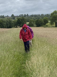
Eventually after two more fields we arrived at a road, close to the junction. We followed the road towards Foxton, turning off after half a mile before Bunkers Hill Farm, along a most unpleasant section of track, rutted by farm vehicles, and very overgrown and rough underfoot. Definitely not recommended!
This emerged opposite what was labelled as a ‘Gated Road to Foxton’ though we saw no gates. In just under a mile we were at the top entrance to Foxton Locks,


so followed the canal down to the pub/cafe, where we stopped for coffee and lunch. 


Then it was simply a short walk, over the bridge, then continuing north along the canal as far as a footbridge. Over the bridge and we headed directly east and mainly uphill for less then a mile to reach Gumley.


A short walk  of just under 5 miles, which felt longer… 

Wednesday, August 11, 2021

Gumley, Saddington, Smeeton Westerby, Foxton Locks

 Thursday 05 August, with Eddie. 7.5 miles, 450 feet of up and downery.


Met Eddie at 9.30 at Gumley. We walked uphill through the village, past their free library phone booth with its window box,

then past St. Helens church,

keeping Gumley Wood on our right, to cross a minor road. Through this unusual stile

and on through the fields following the Leicestershire Round to the high point with a memorial seat with a fine view.


It was downhill briefly, past Saddington Reservoir,

and up the steepish slope to Saddington village. We continued on the LR past Loafabout Cottage, with its inviting seat. 
Then our route took us through a flowery ginnel, jitty or snicket.


We left the LR at this point, turning right by a farm with lots of old vehicles, claiming to do property repairs… The footpath took us through a field where the two sheep seemed like hand-reared pets.

Their reaction to humans was “Let’s see if they have something for us.”  
For a few hundred yards we walked on the Smeeton Road, crossing the canal bridge, then taking a footpath to our left, climbing gradually to a track marked as Mill Lane and into Smeeton Westerby (once two separate villages). 
We turned right down Debdale Lane, a surfaced track, which leads past Bridge 67 Farm and also promises a cafe (Carma’s Cafe - a pop-up mobile one, not open until Saturday) This track goes to the Grand Union Canal, slightly north of Debdale Wharf. 


We turned right and followed the towpath to Foxton Locks - coffee or beer and a cake.  

Then we just had to walk to our right over the bridge above the bottom lock and follow the footpath to Foxton Road, where we turned right and did a final climb back to Gumley. 

Friday, February 12, 2016

Gumley, Foxton Locks - Laughton


Thu, 11 Feb 2016 10:00 GMT
Led by Tommy. With Gordon, Maureen and me. 6.5 miles. Fields quite soggy.

Lovely day, but hard walking through soggy fields. Tommy diverted the route since some fields were waterlogged even on high ground.
We walked up Main St and took the path to the left of the church, then across the field to Debdale Lane.
The path by Gumley church
On the other side we continued over three fields before turning sharply to the right, and following field edges east, then south, then east to cross Gumley Rd ( which is the continuation of Debdale Lane). 
An unusual style of stile
The path headed south east, then south, and crossed the canal via a footbridge.
Over the canal
We followed the canal as far as Foxton Locks.
By Foxton Locks
At the bottom lock we turned right, leaving the canal, over fields, then across Foxton Rad and Bunkers Hill.
Enjoying the sunshine
We walked along the road heading toward Laughton, and took a break a short distance before the village.
A sheltered spot for a break
Then we crossed the road for a few more fields - mostly downhill, about a mile into Gumley
More animals enjoying the sun

And back to the Bell for lunch

Map and details

Monday, September 29, 2014

Gumley and Laughton

Mon, 2014 Sep 29 9:48 AM BST
Led by Tommy, with Gordon, Eddie,Maureen and me. Just over 5 miles. Not very hilly, dry underfoot. Lunch at The Bell.

Just over 5 miles, through good scenery, decent paths and dry underfoot.
We start from the Bell in Gumley, ordering lunch before we left.  We walk a short way up the main street and turn off between houses to our right. The path takes us downhill, turning east (to our right) , through a couple of fields. We reach the Grand Union Canal and cross over the footbridge.

We turn right and walk the short distance to bridge 61 at Foxton Locks, cross over and pass the pub of the same name and Bottom Lock. Our path leaves the canal to the right just after the bridge at Bottom Lock and we head west, following the path over two minor roads and continuing for  almost a mile to where the path crosses the drive to Gumley Lodge. We're advised to keep to the footpath here rather than using the private drive. 
We turn left to cross the drive and take the path more or less southwest, which climbs gradually and meets Laughton Road close to a T junction. Our path goes off to the right just before the junction, going north west, climbing slightly until we reach Laughton itself.
Hens and horse riders mark the entrance to the village from this field. We have a break on the convenient seat opposite the green.  Then we carry on and take the road on the right. We go past 
What I am told is Laughton village hall - extended! Our path goes to the right at a bend in the road, and makes its way gradually down northeastwards towards Gumley Lodge again. We pass our route on the way out, but keep to our left and carry on in a more northerly direction. All is pleasant and not at all strenuous until we meet the final short steep pull up into Gumley.


Only five of us!  What happened to the others? Thanks for a lovely short walk today, Tommy!

Thursday, October 18, 2012

Gumley circular

Led by Barry - with Gordon, Maureen and me. Fine and sunny, very wet underfoot in places. Very rolling - great views. 7.6 miles.  

Covering some of the ground of this walk on 21 Nov 2011, but this time we could see the views.
Some overlap with this walk on 8 October 2012   as well.


We set off from Gumley, and took the footpath opposite the telephone box.  This path heads south-west.  Just before Gumley Lodge we turned  west crossing several fields before arriving at a small road close to Laughton.  We crossed the road and followed the footpath into the village.  A token sit on the bench - to check the map - and then through the village and past the church.
Laughton church and 'cob'  wall
Crook House (cruck house?)
We followed the path to the west after the church, downhill towards Mowsley, over a brook, and up hill, across a lane and into the village by the church and the old school.
Mowsley church
At a bend in the road we took a path between buildings, and when it reached a field we took the right hand footpath. This led downhill, crossed another field and a stream.  and headed north along field boundaries, clearly marked.  We found a sheltered spot, with trees,  where the ground was not too boggy and had our first break of the day. 
The track led more or less north until we reached a junction near Saddington Lodge Farm.  Here we turned right and headed north east towards Saddington village.
They took the longer route - I went direct. Luckily the boots proved fairly watertight.
In Saddington we went past the church, the riding school and the pub.
View of Saddington Reservoir from the pub
A little further along we turned right along the Leicestershire Round path - 1 and 3/4 miles to Gumley. Through the long thin field where there is usually one horse, then over the three bridges and up the hill where cows were grazing today.

At the top the views of the reservoir were excellent with no crops to block them.
Saddington Reservoir
Not the memorial seat . . .
The flat high level path is one of my favourites in the area.  We continued to the memorial seat to Mary Hodgkin -the  ideal spot for a second break.
Views to the north east - maybe Church Langton? And Charnwood hills in the distance.
From the seat at the high point of the path we carried on along the Leicestershire Round path, across Debdale Lane and into Gumley past the church. 
A shortish walk, but quite hard going - hills and mud underfoot.


Map and details