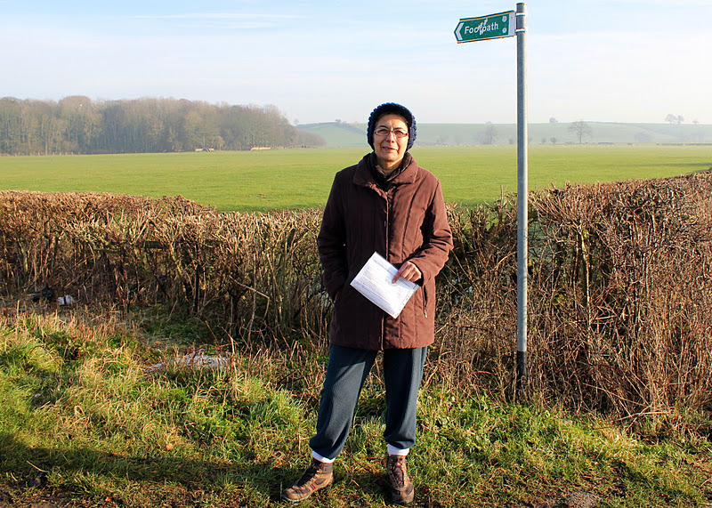
and occasionally rides a bike.
A word of warning. The walk descriptions are not detailed enough to guide you - please take a map. The batteries never run out, and you always have a signal. Oh, And don't take left or right as gospel!

Showing posts with label OS Explorer 206. Show all posts

Monday, April 29, 2013

Badby - Hellidon - Charwelton - Fawsley


Mon, 2013 Apr 29 9:39 AM Western European Time 
Led by me. with Barry and Maureen. Quite hilly, good underfoot - one ploughed field but dry. Weather dry and sunny with some wind. 834 feet ascent. Excellent views. 11 miles. Included the highest point in Northamptonshire at 738 feet/225 m. Peak bagged!


One of two ancient chestnut trees in Badby. They are trying to preserve them, but warn you not to park or hang around underneath them.


Leaving Badby by Bunkers Hill.
We crossed the A361 and followed the Gated Road to Catesby. It climbed gradually, and we took the second footpath on the left - a bridleway. 
After less than half a mile we could see the motocross track on Arbury Hill to our right, and walked to it across the field.  The summit is wide and flat and we're not sure we we found the very highest point.


Ha! I worked out the self timer. Another peak bagged - a molehill with quite a view.
Then it's back to the bridleway, and past the tunnel airshafts.  Yet another dismantled railway. We walk past a large house and arrive at the minor road to Hellidon.  We turn right then left into a very large ploughed field with little evidence of a path, apart from the signpost. Another smaller and easier ploughed field leads into a grass meadow and we see a small lake close to Hellidon village
There are swans nesting, and the trees show signs of approaching summer at last.
We find our way into the village which is glorious in its spring outfit. 
Spring and autumn together?
We stop to chat to a man who's repairing the stonework of his cottage, which dates from the eighteenth century. 
A fire insurance plate - if you didn't display this the firefighters would leave your house to burn.


We leave the village at the road junction opposite the Red Lion and make our way up Windmill Hill.
Hellidon from Windmill Hill
We find a place for a break - sheltered from the wind and with lovely views. The sun's shining and all's well with the world.
We follow the Jurassic Way as far as Charwelton. heading south east until we meet the minor road just before it crosses the old railway. We go slightly astray because the field is ploughed, but we're near enough.  We pick up the Jurassic Way signs and emerge on the A 361 in Charwelton, just opposite the pack horse bridge.


The footpath crosses a couple of fields from here and takes us to a small road leading to the church. It's open so we have a look round, then take another break on a sunny bench.

We leave the Jurassic Way now and take a path through a gate and to a gap in the hedge on the left side of the field, then across the corner of the next field. We cross the road and follow a footpath up a small hill, and over some open fields full of sheep,  and pass Fawsley Farm - (or Fawsley Grange) on our right. We come out on a farm road which joins a minor road at Little Fawsley. This road takes us into Fawsley, with its Hall - seat of the Knightleys, and the church which contains many of their tombs and monuments.
Fawsley Hall - hotel and spa.
 
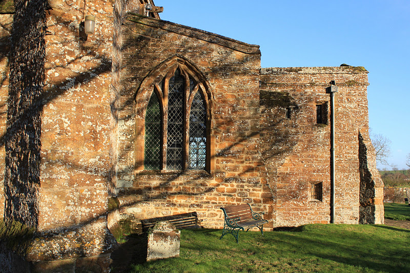
Fawsley church

All this - and a box collecting for a food bank too.

We follow the Knightley Way - very well signposted through parkland, pasture and Badby Woods, where wood anemones are in flower and bluebells are beginning to bloom.

All that remains is the walk downhill into Badby - well, there's steep short pull at the end - and then finding the car.  Another delightful walk, and fine weather. Not quite fine enough to take layers off yet, though.
Wildlife - a couple of birds I think were wheatears - very noticeable pale/ white rumps as they flew up, quite strong markings on an open meadow.
Map and details

Friday, May 11, 2012

Jurassic Way 3 - Charwelton - Braunston

With Marta. About 9 miles in all. Fine, sunny, coolish wind, muddy underfoot in places. Good food and friendly welcome at the Admiral Nelson in Braunston.

We set off from Charwelton, crossing the road from the packhorse bridge. The path starts on a driveway, but soon turns right across a field, and heads north towards a minor road.


At the minor road, do not take the footpath directly opposite, but turn left and walk for a few yards to another footpath across a cultivated field. You don't go over the disused railway embankment!


The path is clearly marked for most of the way, over cultivated fields and grassland.  Just as we arrived at a hedge a large deer leapt out in front of us and dashed away downhill out of sight.  A little further on we met a track and needed to run right - this may have been because we followed the field edge instead of cutting through diagonally.  A bit of map reading needed there.  Keep the radio masts well to the left.  We had to walk to the right of the dome showing through the trees - part of Windmill Farm.


The path brought us to the village of Hellidon, source of the River Leam,  an attractive out-of-the-way place.  We turned left at the Red Lion, then along Stockwell Lane (signposted 'Village Only'.


The church is to the left of the road, and accessed by some steep steps.
We followed the lane through the village, until it became a gated road to Lower Catesby.
After the houses signposting disappeared again. We had to turn right across a field and then follow the boundary over several fields with stiles, but no way marks. Today these fields were some of the muddiest and smelliest I've walked through for some time! We could see Catesby Viaduct, which confirmed that we were pretty well on track.

Our route across the disused railway line led through a gap where once stood a bridge, and at last the ground underfoot was firm enough for us to stop for a quick banana and coffee break.


From here the path was clearly marked through rapeseed and wheat fields, over a few streams via wooden bridges,
uphill to Bates farm building and down into the village of Staverton., over the A425.  We took the street to the right of the pub, then past The Green , where there is a Jurassic Way marker, showing the distance to Banbury - 22M, and to Stamford - 66M.  At the moment we're averaging perhaps 9 miles per walk! Staverton is one quarter of the way along.
From The Green we went along Oakham Lane, turned right then left into Braunston Lane, which we followed as it became a bridleway.  We walked along the bridleway until it turned sharply to the right. At this corner the path led slightly to the left through a field and was easy to follow - over the A45, through more fields, across another dismantled railway line by a bridge and down to the Grand Union Canal, and the Admiral Nelson Inn, where we stopped for lunch before making our way to car number 2.
Top Lock, Braunston through the pub window. Narrowboats were going through in pairs to minimise water use.


Map and details

Friday, January 13, 2012

Jurassic Way 2 - Chipping Warden - Charwelton

With Marta.  A bright sunny day - begun by scraping ice from windscreen. Ideal walking conditions, especially with base layer to keep me warm. Underfoot generally fine - some mud, wet grass. Between 8 and 9 miles.


Photo taken when we arrived here on Oct 2 2011 (yup - rain on lens :-( )
We set off from Chipping Warden, where we finished JW1 on 7th October 2011. We took the road towards Culworth, ignored the first footpath sign, but took the second path, about quarter of a mile along the road, left on a metalled track.  Not marked as Jurassic Way - do they mean to test our map-reading?


We followed this track round to the right, through a small wood, crossed a couple of fields and a minor road, and climbed up to around 500 feet, stopping to admire the view behind us.
Looking south going up hill towards Warden House Farm. There's still a trace of the fog I drove through near W. Haddon!
We'd built in a bit of exploration time, so turned to investigate the Cool Contours arts centre, part of the farm. Although nothing was happening today, we rather liked the wooden pigs.
After this we returned to our route, which took us through some trees and past a large pond in a dip below the farm.


Then, gradually downhill, making sure we took the left-hand path over a small hill, where the Macmillan Way goes right.


Then we walked across a small stream and on until we met another road, where we turned right, and ignored footpath signs until we saw a Jurassic Way sign at a right turn into the hamlet of West Farndon.  The path starts by a row of stone cottages, turning left across a couple of fields, before crossing another minor road.


 With a little imagination, I could have been in Provence? Replace poplar with cypress, let the sky deepen its blue. . .
Lookin down from the old railway bridge
We had no problems following the path as it took us over a disused railway line and towards a farm track, where we made use of a roller for a snack stop.
A short walk from here and we were at Woodford Halse, which has a variety of shops - we called in at the Fleur-de-Lys pub, but they don't do food. They recommended the Tea Station, a small friendly cafe, so we had lunch there, rather soon after our snack stop!


We left Woodford Halse by the path at the bottom of the hill, crossed the road and walked past the industrial estate, turning right just before a radio mast, along a track which eventually turns up to Charwelton Lodge, up on a hill. At that point we continued ahead, alongside a hedge, then over another dismantled railway.


The path took us past spoil from railway construction,  the deserted mediaeval village of Charwelton, and its fishponds to Holy Trinity Church and the nearby farm.


Across a field or two, we joined a lane then took a small footpath through a field of calves/small cows, then one with goats and horses, and emerged next to Charwelton's packhorse bridge over the infant Cherwell - probably 15th century. It's very small, and the road hides part of it.


A wise observer approves our achievement.


Map and details

Friday, October 7, 2011

Jurassic Way 1 - Banbury to Chipping Warden

Theoretically 11 miles, nearer 12.5 ( the garmin took a little while to pick up the satellites in this new area).   We should have set off earlier in the day to give ourselves more time to explore Middleton Cheney and Wardington.  Weather mostly fine, coolish, a couple of showers - the heaviest of them while we were having lunch.  With Marta.


From the car park in Banbury, via the shopping centre for a quick coffee, and a visit to the Tourist Information Centre to pick up another map, we made our way south along the canal, from Banbury Lock, in the direction of the water's fall, past various narrowboats and a few sculptures.
the canal
Long John Silver or Captain Hook?  I shoulda blurred out the background. 


The start of a new adventure - with Banbury Lock in the background, the Jurassic Way starts - though we couldn't find a sign for it.


 Someone's made a real effort with this waterside garden.
We're on the correct path. Just as well.


At this bridge the Jurassic Way leaves the canal and turns left, north-east heading towards the Cherwell, and the M40.  The bridge crossing the Cherwell has a plaque.

Just after crossing the bridge the path goes alongside the river and under the motorway.
 We could hear the noise clearly for quite some distance afterwards, as we walked across fields, over a railway bridge and past some agricultural buildings.


We're still on the right track
At a minor road we turned right, then left towards Warkworth.  In Warkworth, we turned left to a footpath opposite Manor Farm.  The path took us towards Overthorpe, passing a church at some distance on our right, then skirting Overthorpe along a tree lined path from which we could glimpse some splendid gardens.  We then turned right towards Middleton Cheney across fields and past allotments, down to  cross a stream and up into the large village.


We turned left and went across the by-pass ( A442) and into the High Street where we found the Take Thyme cafe and conveniently by-passed the worst shower of the day while we had our lunch.  There is a heritage trail, but we had no time to follow it today.
I hadn't realised Middleton Cheney was big enough to have a secondary school, or so many small shops. According to the village website, there are plenty of ghosts in the village as well.


From the cafe we went along Church Lane, and found the footpath between houses.  Soon after leaving the village, we crossed a field before walking alongside another one with llamas and sheep, and a tree surrounded by fallen apples which from a distance looked like unseasonal yellow flowers.
Onward and across the B4525,  over more fields, where the way is pretty clearly marked, then through a wooded area. The map was useful to check where to cross a narrow section of wood before turning right along the edge and past Chacombe House before arriving at the village itself.  The path climbs up into Chacombe through some woodland where signs are very clear.  You leave the village from the junction of Silver Street with Silver Street North.  You can see the church across the field, and there's a picnic area and a large stone.


From here the route as far as Wardington was straightforward, leading under the railway then uphill and across fields.
under the railway
some curious sheep


We had a small problem finding the way very close to Wardington,  and came out about fifty yards too far along Thorpe Road, but it was plain from then on, as the path led us round the village, but at one point (in the Close) there was a sign simply saying footpath.  We asked a local resident, who almost sent us back round the village, but finally showed us the nearest path, between some houses, and luckily the Jurassic Way was signposted at that point.  Then there was one occasion when a sign was actually pointing ahead instead of left as it should have done. This made us walk all of an extra couple of hundred yards, but finally the route to Edgecote was clear.  if we'd looked at the map instead of blithely following signs, we'd have been fine.
We met the road where there are a couple of cottages, then took the road to the right and followed it until it turned to the left into the village of Edgecote, just after the church.
From here we took a track, through a gate downhill to cross the Cherwell ( very small here), then up a gentle slope and into Chipping Warden.

Rain on lens again! 
Map and details

pdf fromNorthants C C - Banbury to Ashby St Ledgers
A video of this section - by voxley19  from August 2008 covering many of the same landmarks.