and occasionally rides a bike.
A word of warning. The walk descriptions are not detailed enough to guide you - please take a map. The batteries never run out, and you always have a signal. Oh, And don't take left or right as gospel!

Thursday, September 28, 2017

Hambleton peninsula, Rutland Water

Tuesday 26 September, 10.45 am - 12.45 approx.  With Marta, on a fairly grey misty morning, but dry.
Just over 5 miles, following the shoreline. 

We walked at quite a speed for most of the way, with a couple of pauses on the way.
Plenty of swans and other waterfowl, plus the occasional squirrel.

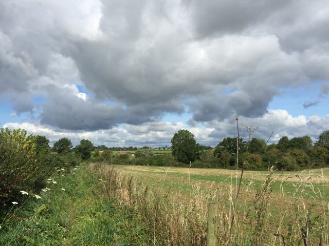
Autumn is kicking in now.


The route:

Thursday, September 21, 2017

Thorpe Langton to Glooston and back

Thursday 21 September 2017, setting off at 10 am. With Maureen.  6 miles. 

This was a combination of a walk for fun, and a check of "my" section of the Leicestershire Round. Most of the route is clear and well signed, but I tried to re-erect one post which was slipping into the bushes, and to clarify directions from the trig point towards Thorpe Langton. The footpath is very close to a bridleway up here and it's very easy to be misled, especially as there is no official sign to the path, but the bridleway to Welham is marked clearly.

Here is my effort - how long will it last?
Bridleway goes slightly to the left, Footpath straight down the hill, close to the hedge - on your right

"this side - by the hedge"

Ok, the walk! We set off from the Welham Road in Thorpe Langton, and followed the Leicestershire Round sign downhill along the field road, past Caudles Cottage and the pub car park.   At the point where there is a ford and two footbridges over the stream, the official LR path goes to the right and over a stile.

Conditions today were muddy, but less so than on a previous occasion, in February 2016!
We made our way up following the yellow posts. You need to be a bit careful not to get tempted by other posts on the right, but with a map and by following the waymarker directional arrows, you should be ok. At a stile the path keeps close to hedge and climbs up to the trig point. 

Just after the trig point our path turns left and joins the bridleway between Stonton Wyville and Welham.  Lots of way marks as you follow the path to a gate. The path downhill over an arable field is clear, and easy enough to walk. Follow it down and you reach the farm track between Thorpe Langton and Stonton Wyville, where you turn right towards a road.

Cross the road and go into the small village of Stonton Wyville.  Just before the church turn right. There's a bench here - I've made good use of it in the past, but today we carried on. Follow the road round and pick up the LR sign on a finger post "Glooston 1 mile".  This is a flat path,  and easy to follow across a few fields and to the small church at Glooston, which is half hidden on the right hand side just by the village hall and before the Old Barn pub.

 There is a choice of seating here - a bench if it's sunny, or the church porch out of the wind. We chose the porch today.
 For the return leg we retraced our steps as far as the point where the path to Welham and the Caudle leaves the no through road. We stayed on this lower level track which took us back to Thorpe Langton without tackling any more mud. 

We had lunch at Langton Garden Centre - it was very busy, and we had quite a wait. Not the ideal time to visit it, though the sandwiches and coffee were good.

Monday, September 18, 2017

Great Cransley, Loddington, Thorpe Malsor

Walked on two occasions -Thursday 14th September and Monday 18th September 2017(with Norma and Maureen).
Just under 7 miles. Good conditions underfoot, and on both occasions we avoided the rain.


We parked on Church Lane. At the end just before the sign saying no through road for motor vehicles, we took a path through a wide gate, passing some waste ground on our right and then a cemetery. After the cemetery the path goes downhill through a field of sheep, then up again close to Old Lodge Farm. When it meets a track, you turn right and  follow the track downhill and up again.
Red admiral making full use of the ivy flowers

 At a T-junction you turn right and continue for a short distance until you see a signpost. Turn left here through Cransley Wood. The path may be a bit muddy, but on both occasions I walked it was very  pleasant.
 At the end of the wood, follow a grassy track to the left, and follow the field boundary round to the right a little while later.
 It is easy to follow the path, as it turns left along a disused railway line and over a footbridge.
 This path emerges near Mawsley Lodge, a disused farm which is fenced off. Go past the farm, and turn right through a gate, along the edge of a couple of fields. The path meets another one, and here you turn to the right and continue in a northeasterly direction, going under a line of electricity pylons.
There are a couple of cattle grids like the one in the picture, but there are gates at the side!


  The track bends to the left and is surfaced as it passes a large house and continues into Loddington, entering close to the Cricket ground.  You can take the left hand road at a junction, and vary the walk a little by passing the church - no benches here, though there are some along the road.

 I had a little trouble waiting for a photo-opp here - avoiding including the bins, and waiting for the sun!
The second photo was on Monday - different sky!

We walked through the churchyard and across the field to the main road out of Loddington. 


This section is about a mile of walking along a pavement next to the road - luckily not a very busy road. It passes Three Chimneys. At a crossroads you turn right into Thorpe Malsor. 
Not quite yarn-bombing, but very pretty!
You walk downhill and just before the church turn right.
 A wide track goes along the edge of woodland, then at the end of the first field it turns left.

 Before long Cransley Reservoir comes into view at the bottom of the slope.
 There's a perfectly sited picnic table just before the dam. On Thursday there were dragonflies, and plenty of birdlife - grebes, swans, the odd coot.


 An excellent spot for a break, before crossing the dam.


 and the sailing club.

The footpath goes through a gate, then slightly uphill with a hedge on your left, to meet the road back to Cransley. 
At the road turn right, go past White Hill Lodge, and follow the road. A short distance before the village a footpath cuts the corner, through a field of sheep, where three or four tups had been fairly busy. To reach the village aim for the farm, but go to the right of it, and there is a stile.
This is close to the Three Cranes pub, and Church Lane.


We finished our outing with a sandwich and coffee in the Dunelm store in Kettering.

Saturday, September 16, 2017

Back in the UK - Gretton to Bulwick

uMonday 11 September 2017,  a day of sunshine and showers. Very close to 10 miles in total, including the walk from the village hall home for each of us!

I walked with Norma, starting at 9.45.  We set off from Gretton Village Hall, and followed the Jurassic Way as far as Harringworth Lodge and the lake. At the end of the lake, we turned right just after a hedge, instead of left towards the Lodge.   We crossed two fields then the minor road between Deene and Spanhoe.  The path continues in a straight line along the edge of four fields with the hedge on our left. Today they were clearing a crop and ploughing, so it's as well the path is along a grassy track. 
It heads towards a small wood, called Bantrup Bushes, where we turned right and followed the edge of the wood. Shortly after the end of the wood, the path turns left, and we keep a hedge on our right, eventually turning right to join a surfaced track. The track leads to Red Lodge Road where we turn left and cross the A43 by a bridge.


We walked into Bulwick and stopped at the Pickled Village for coffee served with a digestive biscuit.
The patio area is lovely at this time of year with baskets of begonias and walls covered with passion flower and fruits.
We had scones with us, and intended to sit outside the church to eat them in the sunshine, but this was the moment the heavens opened, so we sought sanctuary in the church porch.
Prunus sargentii - and Norma - in autumn garb

We returned by the route we walked for the outward leg, since the alternative risked being very boggy with the threatened rain!
The rain did more than threaten, and we got soaked twice, but blown dry quickly. 

We saw green woodpeckers on the edge of the woodland. (10 miles in all)

Friday, September 15, 2017

A short stroll to Hooper Bald

The day after the eclipse we drove along the Cherohala Skyway , which links Robbinsville, NC with Tellico Plains TN.  There are various viewpoint/parking spots along the way.


From here there is a very short walk ( about a mile there and back) to the bald. This is a grassy treeless patch, one of many in the southern Appalachians, generally along a high ridge or a mountain summit. No one is sure how they originated, but they are maintained by cutting.  
The view from this one is nothing special, as there are trees all around, but the walk was shady and agreeable even in the heat.


One of a party of four mycophiles - one of the men has written academic papers on the local fungi. You can just see him, engrossed in the search while I chatted to Pat.
The bald itself, clear, surrounded by trees. 
A beautiful little fungus - not edible - called, I think, Pholeota decorosa .


A final photograph to give some idea of the spectacular wooded mountains of Western North Carolina and Eastern Tennessee.

Lafayette-Moraga Trail by bike

I've walked some of the way along this trail before, and have always fancied cycling it. This year we were able to borrow bikes from the place we stayed, and so accompany Leonie, Brian, Eilidh and Aneurin.  

We rode from the entrance near 4th Street as far as Moraga Commons and back again - a total of around 12 miles of easy cycling.


The trail corridor has a rich and varied history. This trail was once used by mule trains to carry redwood from Oakland to Sacramento. Later, when the mule trails had passed into history, the lumber was carried by steam trains, including the Oakland-Antioch and Eastern Railroad, the San Francisco-Sacramento, and the Sacramento Northern, for which the easement was historically named. With the abandonment of the railroads the corridor became a utility easement, and, ultimately, with the cooperation of local communities, utility districts and the East Bay Regional Park District, a paved multi-use recreational trail was established serving hikers, bicyclists, and equestrians. 
from  Rails to Trails.


It was a very pleasant way to spend an afternoon.