Thu, 2013 May 16 9:46 AM Western European Time
Led by me. With Barry and Eddie. Lunch at the Ruddy Duck. Very flat, dry underfoot. Good weather with a fair amount of sun. Around 10.5 miles [ I had a few hundred yards when garmin was switched off - hence my maximum walking speed of - 146 miles per hour!]
Tuckers Nook - an irresistible street name, quiet, somewhere to park unobtrusively, before booting up and crossing the High Street to Quarry Lane. We turn right to follow the public footpath, then take the clear track around the west and south sides of the quarry area.

 |
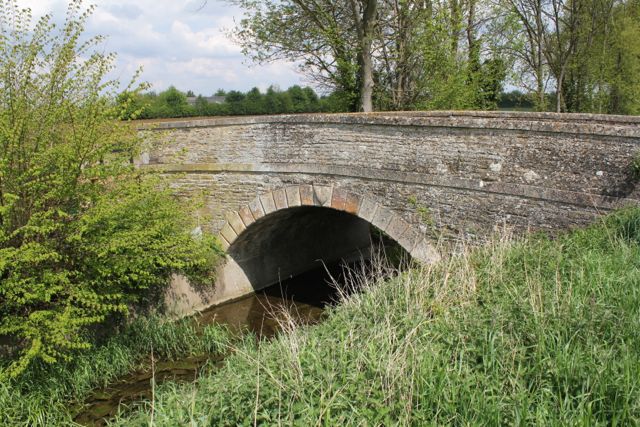
| It doesn't look too inviting |


 |
| Just big enough to walk through upright. |


It really isn't bothered by our presence. We turn right along the footpath, reach the Mile Drove Road, then turn along North Fen Road. We walk as far as the bridge with a display board about John Clare. For a gentle introduction to his work have a look at this blog.
A few hundred yards later, our footpath goes off to the left just before the first houses in Glinton.
We walk along until the path turns right than left, and now we have a possible alternative route. It's that sort of day - we'll try the other path via the course of the Car Dyke. We overshoot, then return. We come out in Peakirk just by the magnificent, nay splendid, Old Rectory. A left turn along a narrow footpath brings us to St Pega's church, with its open bell-tower and medieval wall paintings. This is very much a hidden gem, nestled among the trees, and with no tower or spire advertising its presence from a distance.


We've walked about 5 miles by now. Next stop the Ruddy Duck for a bite to eat. Then by street and pavement to Glinton, with a brief nod to Mary Joyce's grave. She was John Clare's first sweetheart. Their romance was thwarted because her family would not accept him socially. Alas, she died single at the age of 41, in a house fire. Here's a poem Clare wrote about her - before her death.

 |
| Glinton church |
 |
| Relaxed goat |
 |
On we stride along a street which leads directly to a footbridge over the A15. This must be the highest we've been above sea-level all day. We continue at the side of a field of yellow rape flowers, to the turn to Etton, a very small village, with a pub, a fair few horses, and the claim to have won the "Best Kept Village" competition at least three times.
 |
| Etton church |
With the help of our map, we wend our way back towards Maxey, meeting several dog-walkers - I think they are vital in keeping some of these paths open to the public!
We return to Maxey along Woodgate Road, and return to the car.
A day of wide skies, long views and plenty of water.
Wildlife:
Grebes doing a bit of a courtship dance, a heron staying obligingly still, terns, swallows and a very loud robin in Maxey.
A recent Countryfile programme includes a section on John Clare. It's about 12 minutes into the programme.
Map and details
2 comments:
A part of one of my cycling routes Alison.
Great for the waterbirds! I should try to get out there with the camera and just take my time - and the tripod - and the bigger lens, etc etc.
I'm impressed by the Peterborough Green Wheel initiative - hope it doesn't all fade away.
Post a Comment