Monday 4th July 2022
This walk is last year’s walk in reverse.
From Ty’n Rhyd to coastal path, via road towards Ysgo. We turned left at the road junction and then took the path eastwards.
At first it followed farm track next to a field of bullocks who were very excited by the arrival of the farmer in his land rover with a foxy looking dog, and a youngster on a quad bike. On to Penarfynydd Farm with its agile goats, a dog and an artificial pig.
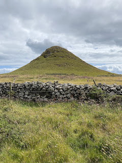
Followed the path to Mynydd Penarfynydd (177m).
On the way we met a Welsh-speaking gnome lady - who may have been an incomer enthusiastically learning the language. I think she asked us if we spoke Welsh, in Welsh, but hurried on by when we obviously knew no more than “Bore da”. She was the only person we saw along the coast path until we met a couple walking with a dog close to Plas yn Rhiw.
On the way we met a Welsh-speaking gnome lady - who may have been an incomer enthusiastically learning the language. I think she asked us if we spoke Welsh, in Welsh, but hurried on by when we obviously knew no more than “Bore da”. She was the only person we saw along the coast path until we met a couple walking with a dog close to Plas yn Rhiw.
We followed the coast path, pausing for coffee in a more sheltered spot. Onwards past a deserted building or two, some free-roaming horses, and sheep.
The path descends steeply and goes through a section of woodland, before climbing back up to the road near Plas yn Rhiw.
The path descends steeply and goes through a section of woodland, before climbing back up to the road near Plas yn Rhiw.
We followed the quiet side road past a small caravan and camping site, then straight on at the crossroads, toward Ty’n y Parc woods.
This was the section where we went off piste last year. This way round the path is obvious, although still steep and tricky in parts. It leads up to Ffynnon Saint/ the Holy Well. A well with a view.
From an info board:
“To your left you’ll see Ffynnon Saint (Saints’ Well). This well is on the centuries old pilgrims’ route to Bardsey. It’s an historical well that was used for baptisms “
Shortly after this the bridleway continues, but there is a short cut via a footpath, leading up more steeply to rejoin the main bridleway. We turned left, then took the right hand fork. Just before a wall we turned right, crossing heathland, heading northwest , through a gate, to reach a stile in the wall by a minor road. On the map this is Pen-y-Mynydd.
A pause for a drink and to admire the splendid view were in order, before we turned right along the road for a short distance, then turned left along a grassy track past what is marked as a Neolithic Axe Factory, past cairns, heading towards the relay station and the summit. (304 m, just under 1 000 feet - 997!)
The summit was a very windy place today, so after taking a few photos we sought a more sheltered spot for lunch.
We walked south west and took the footpath to our right just before the conical tump.
The footpath hugs the wall on its right, but is not very clear once you cross the wall. Luckily the terrain. is not too tricky, though not smooth. There is a wide gate and the remnants of a track, which was being used by a farmer on a quad bike, tending his flock.
It leads down to a T-junction on the road.
We took the road opposite towards Bodwyddog Fawr, then Groeslon crossroads, where we completed the circle of our walk, turned right and homewards, for cups of tea.Just over 9 miles.
According to google, “rhiw” means hill or slope! Very apt.


No comments:
Post a Comment