and occasionally rides a bike.
A word of warning. The walk descriptions are not detailed enough to guide you - please take a map. The batteries never run out, and you always have a signal. Oh, And don't take left or right as gospel!

Friday, September 28, 2012

Rutland Round 7 - Whissendine to Braunston

With Marta. Started grey and drizzly, but after Langham (11 am) it cleared up for the rest of the day. Still some mud underfoot, views good. 11.7 miles approx. A few hilly bits.

We set off from Whissendine around 9 30, and walked up past the church,  turning right on to Foxhills, and following the road round as far as Number 21.  The footpath runs alongside this house to a field, where we turned left.  There's a gateway on to the the road, but the path turns right and follows the hedge for a short distance before joining the road at a stile. We turned right along the road as far as a left hand bend.  At this point we continued straight ahead, on a bridleway leading to Langham.

By now we were both wearing waterproofs as the drizzle persisted. The hedge was on our left for a while, but at the summit of the track it changed to being on our right.  The views here are said to be excellent, but the mizzle made them a little hazy today.  We used John Williams' book and the OS map and found the path without problem. At one or two points along the way the waymarks have faded or become overgrown.

There is a junction of bridleways at the end of the field, and here we turned right, with the hedge on our left.  In the next field the path goes over a stile after a gap in the hedge on the lef. We followed the path alongside a deep ditch on our left.  We crossed a plank bridge and then turned right when a hedge blocked the way, turning left over a briidge in a short while cutting off the corner of a field before following the hedge and waymarkers to reach Manor Lane in Langham, via a stile.

We turned right then left into Orchard Road, then at the end of Orchard Road, right then left into Bridge Street.  Just after the bridge we turned right before the Noel Arms. 
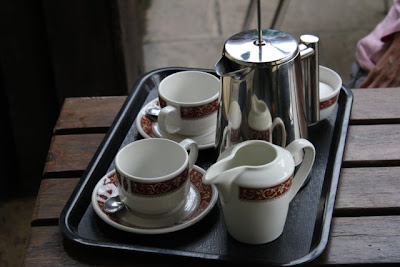
5 stars for the welcome coffee!


Well, to be truthful we were delighted to be able to buy an early coffee in the pub - the landlord took pity on our drowned rat appearance.


Ms Wet Anorak 2012?


The rain gods smiled on us and by the time we left twenty minutes later the rain had stopped.


At the end of Church Street we crossed the main road, turned right for a short distance before taking the bridleway towards Braunston, which leads off to the left.  The path climbs up hill following the left hand hedge and turning right to walk around the small wood near  Mill Hill.

At the end of the wood we turned slightly right and continued up to Manor Lane, a small road which leads into Barleythorpe.
Rutland Water in the distance
We walked down into Barleythorpe, and to the road, then turned right, along a pavement until a stile led into a playing field on our right. After this we walked along the edge of Catmose College, and through Rutland Care Village, before coming out close to the level crossing near Oakham Station.

We had our lunch stop at the Castle Café in Oakham - a very good broccoli and stilton soup.  It was still a little cool and damp for sitting out, so we went inside.
Outside the Castle Café, Oakham
We left Oakham on the road towards Uppingham and Kettering.
Floral peacock
Swooning Bridge, from where you would once have seen the gallows at the top of the hill.
Shortly after the bridge our path turned off to the left towards Egleton, crossing muddy fields which could have been a lot worse!  Of course, since the 2000 edition of the booklet, and the publication of my OS map, the bypass has been built.  It's on the newer maps, and doesn't complicate the route.

Through Egleton, we turned right along the road to the A 6003.  We crossed over the road and then the railway line to a path which leads up hill with a hedge on the left.

 At the second gateway we cut across the field slightly, joining a track past Brooke Covert East.  Soon after this the track bears right, but we took the route through a gate to the left.  The path goes downhill over a small bridge and past Bridge Farm into Brooke. 
Brooke Church
We walked through Brooke, turning right at the junction.  We passed some earthworks on our right, and a dovecote in the grounds of Brooke Priory - a house on the site of a 12th century priory.
Earthworks at Brooke
The dovecote
We took a footpath in the field opposite the priory, and walked alongside the stream, the Gwash.   After a few hundred yards the path crosses a footbridge to a bridleway.  We went across the bridleway through a gateway and over a field diagonally tot he left hand hedge. The path is clearly marked into Braunston. 
The last few steps of the Rutland Round

with a little more decorum

and a sense of achievement.
And here is Braunston Church again 

65 miles of very enjoyable walking, done on seven separate days. 


Map and details

A couple of pics from a walk in the same area in April 2009

Thursday, September 27, 2012

Broughton - Gt Cransley - Thorpe Malsor - Loddington - Gt Cransley - Broughton

This walk was led by me, with Barry, Gordon, Eddie. Garmin has trace from last Friday in Oakham, so distance probably about 9 miles - to 9.5. Started around 9.30 am. Almost same as walk on 9 August 2012.  Lovely weather, dry fine, sunny.
With thanks to the Broughton Bystander.

We took almost the same route as on this walk on August 9 2012.  We began from the Red Lion pub, walked down Church Street to Broughton church, with its red clock face, and flower meadow.  Then we took the footpath opposite alongside some houses, and passed a children's playground.  At Cox's Lane we turned left, making for the road to Great Cransley which we followed underneath the A43, downhill then up into Great Cransley.

We walked through the village, ignoring the church this time, and taking the second footpath which leaves on the right hand side, between houses.  It goes over a stile, then across a field full of sheep to Northfield Road, at the opposite corner.  There's a certain amount of road walking, past White Hill Lodge and round a right hand bend. At this point Cransley Reservoir came into view, below us on the left.
Cransley reservoir jewel blue beyond the ploughed field.
At the end of a field on our left we had a choice of paths, and chose the clear second one to the left, diagonally across a field downhill to a patch of woodland.  Once in the woodland we turned left once more to reach the sailing cub and the walk along the reservoir dam.


After the water we turned left then right making our way up the hill until we reached a right turn as the path met a farm track which went past a wood and into Thorpe Malsor.  We were lucky to see the person who keeps the church keys, and were able to see the restored organ and splendid interior.
All Saints, Thorpe Malsor

We turned left along the street out of the village, then left at the Loddington Road. We walked about a mile along the narrow footpath beside this road - not a very busy one, until we reached Loddington. The village sign was erected in 2001, and is made of ironstone and steel representing local industries.


The sun rising over the third millenium, with St Leonards Church

Three of us
We saw the church on our left, but didn't visit. Instead we headed for the cricket field and took advantage of its benches to have a break in the warm sunshine.

From here we took Mawsley Lane, and followed this as the tarmac turns to grass, and the path hugs the field edges on our left.  Eventually, just before the ground rises we reached a double farm gate directly in front of us, and a wooden gate to the left. Here we turned to the left towards Mawsley Lodge.

The path goes west then northwest around Mawsley Lodge, then joins the route of a dismantled railway, through some woodland, and over a bridge, until it turns right towards Cransley Wood.  The path goes through the wood and meets a road on the far side, which leads into Great Cransley.  We walked along to the end of Church Lane, and turned right at Broughton Hill, following the route back to Broughton. 

And somewhere along the way we met a couple of llamas.  Here's one of them:

Map and details
Another garmin glitch here - the first part of this route is the mile I walked round Oakham last week, and a straight line from there to Broughton.

Thursday, September 20, 2012

Southey Woods, Castor Hanglands

Led by me, with Maureen and Gordon. Grey, very occasional light drizzle, a cool wind, but ideal temperature for walking. Less muddy than usual in the woods. Just over 10 miles.

Similar to this walk August 23rd and this walk August 30th
Ufford church, at 44 metres above sea level, is one of the highest points in the area

Another slight variation on this walk. We started at the Willow Brook Farm Shop, and took the footpath just across the road heading more or less north-east.  The path leads across a reclaimed landfill site with warning 'no smoking notices'.
 Then it continues along the side of a wood. At the corner the path should go diagonally across a field to the minor road, but we walked along the edge and then for a short distance along the road. Freshly ploughed fields are hard work until the paths have been made good.

We turned left at the point where the path meets a bridleway at the junction with the road. We walked west along the bridleway, past a pond and a few trees until we reached Langley Bush Road.  Here we turned right and walked north along the road as far as the end of Hilly Wood.
We turned left again (north west approximately), following a bridleway to High Field Road.   We should have turned left here (see garmin trace)  and walked south east as far as the second block of woodland, called Jubilee Wood.  A right turn just south of west took us to the path into Ufford, where we turned left and soon uphill, past the hall and the church.
We walked passed Hillside Close on the edge of the village, and another 400 yards later, turned right on to the track known as 'the drift' .  We ignored the inviting seat here, and walked about half a mile south to the gate leading into Southey Wood.  We followed the main waymarked path until after another mile we had a break at the well-placed picnic tables.
The tiniest bit chilly today!
After that it was straight past the car park and over the road to the track towards Upton.  This leads down hill past the church and we chose to follow the road through the village, past a row of thatched cottages and some houses, then turned left past Model Farm, before heading left along a bridleway marked on the map as Blind Lane.  We met a man trotting on a horse along this section. 
At the end of Blind Lane there are three chopped tree trunks with the letter A,S,W scratch-carved into them - useful seats, but we resisted the temptation this time, and followed a path diagonally across the corner of a small field through some woodland and out onto a shady path heading east. This leads on to the open fields, now harvested, with the two improvised horse-jumps. See this post.

We carried on towards the east, until we met the north-south path, and turned left and north towards the Castor Hanglands nature reserve. 
The main path through the reserve is clear and easy to follow.  Today it was noticeably less muddy than it has been.  Not much visible wildlife, but we did meet these horses.


We carried on through the reserve and then took the permissive path to the farm shop and cafe, where we stopped for lunch. 

map and details

Tuesday, September 11, 2012

Bradgate Park - Beacon Hill - Ulverscroft Priory - Newtown Linford

Walked on Monday 10 September 2012, with Barry, Gordon and Maureen.  Mostly fine.


We parked at the Newtown Linford car park, and took the low level path along the main drive by the river Lin, towards the ruins of Bradgate House, childhood home of Jane Grey, the nine-day queen.  The park has been a deer park from way back when, and there are still plenty of deer in this area.

There's a lovely stretch of river.


and some impressive trees.


Remains of Bradgate House and a moody sky
Uphill to the obelisk


Just before reaching the ruins of the house, we took the path uphill to the left to reach the War Memorial, where there was a keen cold wind.  We didn't hang around, but followed the path through the spinney to Old John.
18th century folly and great viewpoint
Who said down hill was easier?
We headed to the Hunts Hill car park on the north west side of the park.  The way ahead was over the crossroads to Benscliffe Road, and after a couple of hundred yards we turned right into Rough Hill Wood - the path went up slightly then downhill to a golf course. Part way through the golf course we crossed Joe Moore's Lane.  The golf course was busier on a Monday than it had been on a Sunday, but no problems and the way is easy to follow.
After leaving the golf course the path crosses a couple of fields to emerge on a track, then goes past some stables and a large garage, then swings left and comes out on Maplewell Road.  Here we turned right and followed the road towards Woodhouse Eaves.  We didn't take the first footpath signed to the left, but turned left at Mill Road. This turns into a track and climbs fairly steeply towards Windmill Hill.
Up towards Windmill Hill

Looking over to Broombriggs

The windmill with viewing platform - the stairs are under repair at present
We chose not to go up to the windmill on this occasion - I'll put it in the good intentions file.  When the mill was operational there were no trees surrounding it.

We came out at the car park for Broombriggs Country Park, cheaper but more remote than Bradgate.  We crossed Beacon Road, turned left along the cycle track, then right on to a path for walkers.  After about 100 yards we turned left again on the main path.  Dappled shade makes this a lovely walk, in spite of some traffic noise from the road.  
A great opportunity for posers?
We turned off the main path along the grassy track which leads to the summit, via the toposcope, which claims views as far as Boston Stump over 50 miles away. Not today - though there was a group of trees in the way.  


Great views all round, even so.
Like the earrings


The obelisk and Old John from Beacon Hill.
From here we followed the route down past the car park, turning right past the toilet block and down the path parallel to the road. 

At the charcoal burner we took the small path to the left which came out at the crossroads. We crossed over to the Copt Oak road - there is a verge, but not quite wide enough for comfortable walking. Luckily this is a short section and we turned left along a footpath on the drive to Black Hill Farm. After the trees stop the footpath heads off to the right along a hedge.  You're not likely to make a mistake here, as there is a warning notice on the drive.

The path is clearly marked, and takes you along field edges to Ulverscroft Lodge Farm.  Here we turned left to go round the house and meet the drive which took us to the ruined 11th century Ulverscroft Priory.   The cottage nearby is inhabited, and there has been scaffolding up on some of the ruins for years. 
Pond near the priory

Ruins of Ulverscroft Priory
The drive comes out on Priory Lane, and we crossed over to Ulverscroft Lane.  I'm hoping the resurfacing they've just done doesn't encourage a lot of traffic - it's pleasant and quiet at the moment. 

Just under a mile along the lane we turned right to take a footpath which leads through fields.  When the path opens out in a field you fork left after crossing a stile.  After this the path is clear and goes through woodland. This was a bit muddy.   There is no problem until you pass a ruined building on the left (Ulverscroft Mill). Here  you meet another path, and turn left and shortly afterwards right to cross a footbridge.  The path leads into Newtown Linford coming out near some thatched cottages.


We turned right along the main street, full of interesting very well-kept houses.   It's probably just over half a mile back to Bradgate Park, and nearby there's a selection of tea-shops.

Map and details