and occasionally rides a bike.
A word of warning. The walk descriptions are not detailed enough to guide you - please take a map. The batteries never run out, and you always have a signal. Oh, And don't take left or right as gospel!

Sunday, August 11, 2013

Northamptonshire Round - NR 1 Holcot to Sywell Country Park


Fri, 2013 Aug 9 10:29 AM 
With Marta. The footpahts in the first part were not very clearly marked, but manageable with map. Downpour before we started, but fine rest of the day. Just over 7.5 miles.


Marta and I were a little stumped for our next long-distance walk. This is close enough to home, and only 51 miles in all. We'll visit areas that I don't know,  south of Northampton , and some more familiar territory on the way. 


Clear and detailed instructions for this section are on The Ten Foot Club website.  We seem to have walked an extra mile!   The Ten Foot Club are the guys who set the round up.


Miss out the next paragraphs ** to ** if you don't want to read my grouses!

**We didn't get off to a great start - I was grumpy after yesterday's disappearing footpath experience, Marta was a bit tired.  We were going to park at Pitsford reservoir by the dam, but just as we got there the heavens opened, so we diverted to the Visitor Centre for a coffee, foolishly assuming the parking tickets would be transferable. 

More grumpiness when we discovered that the café doesn't open until ten, and the tickets are not transferable.  Luckily we can always produce a black coffee from our portable coffee stop kit, and we decided to give Pitsford Water a miss - we've been there so many times already, anyway. So - we started our walk from the village of Holcot!**


Holcot church

The phone box has a new use
Just opposite the church and phone box book exchange is a footpath between the houses. There is even a NR sign, so we walk through the passageway, and then turn left and downhill along Poplars Lane to Walgrave Road. Here we turn right and on the corner there's a footpath sign leading us through a gateway guarded by two eagles.

The way is not very clear, but turns sharp left at the gates and follows the field boundary for a couple of hundred yards. There is a footbridge, but it's overgrown and people obviously take an easier route round the culvert. 
Then the path goes uphill diagonally. We went a bit too far to our right, and had to correct our route.  Some of the field boundaries may have changed since the OS map was last revised.  Another case of "clear on the map not on the ground".


Our route may be not quite right, but we either follow field edges or footpaths, and manage to get ourselves on track again.

For a short distance the way is clear and we meet the bridleway which leads us to the A43 - which we have to cross.  We turn left along the road for a hundred yards - a closer look at the map shows we should have turned right and found the footpath in the layby. No matter - we use a wide bridleway leading toward Hardwick Lodge, and then turning to the right towards Hardwick Short Wood and Sywell Wood.  Once more there are footpath waymarks and NR ones too.
A friendly fence repairer.
The path comes out near Wood Lodge Farm, and when we reach the road we turn left and walk the rather busy quarter mile or so to the turn off for Mears Ashby, on the Beckwith's Emporium Corner. A quick wander through there - but we decide it's too busy and too posh for today, so make our way to the village. This road is very quiet once you pass the Emporium!  
Our route takes us round the village - a pretty one - and we stop for a sandwich at the Griffin Inn.
The rest of the route is straightforward - the footpath goes off to our left after Mears Ashby Hall. After a short wooded section near the wall it heads southwest, slightly to our right, across a large field to the Mears Ashby-Earls Barton road.  The gap in the hedge is a bit overgrown and the road's a bit busy, but it's a short distance to the path on the other side.
From here it's plain walking and gently downhill towards Sywell Reservoir and Country Park.  Seven a half miles in all.

Wildlife spotted: one hare, quite close by, and a buzzard circling and mewing. Lots of butterflies.

Map and details


Saturday, August 10, 2013

Salcey Forest to Stoke Bruerne.


Thu, 2013 Aug 8 10:03 AM 
With Barry, Gordon and Eddie. Very hot. One or two unclear footpath experiences, including one that disappeared completely. About 11.5 miles. Lunch at Boat Inn SB. Too much road as well, though they were mostly quiet ones.

From the main visitor car park, we walk along the road and over the M1 towards Hartwell.  Here we turn off to our right on the path towards Rowley Wood.  We have to skirt the wood and we end up back in Hartwell, since the other route is likely to be longer. We decide on a footpath leading southwest past a farm. 
This is where we have the disappearing footpath experience though we think it may be due to very poor signposting. We waste a good half hour, then retrace our steps and head off towards Ashton, turning right along the Roade road - yes, I had to write that.  We take a footpath opposite a house marked as Colmarel Kennels on the OS map, and follow it without too much trouble. It leads towards the main Milton Keynes to Rugby railway line, and emerges on to the road into Ashton just before the bridge. 
under the mainline railway bridge
 We walk through Ashton, turning right, going past the Old Crown pub and then taking a footpath to our left  between two houses. The path turns right/west very soon, gradually making its way over several fields downhill gently to the canal.  We wander a little because of crops, but no real problems in this part.
A disreputable crew?


We meet the canal at Lower Lock Farm, and turn right along the towpath. It's a short mile to Stoke Bruerne past locks, and canal boats. 
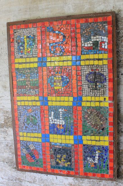
Under-bridge mosaics, 
moorhen and chick

on boat veg garden

growing cygnets
Dry dock
We lunch at The Boat Inn - decent grub, long wait.
The view across the canal
Back via the road to Ashton - it's a pretty quiet one, so not unpleasant. 
Wellingtonia and house
tall tree
Then across country again to Hartwell, where we have a rest in the little cemetery and chat to a woman who is clearing the leaves. 

From here we walk back along the road to Salcey Forest. 
Altogether we've walked just over 11 miles - it's been pretty flat, and quite hot.

Tuesday, August 6, 2013

Rutland Water clockwise by bike


Tue, 2013 Aug 6 3:07 PM
With Harry. Pleasantly warm and dry.  15 miles.

The second time I've cycled in two days!  I found the first section hard going - rough surface, then the steep hill from Manton.  This was another where the ride was the thing, with a break at Whitwell car park for a much-needed drink.  I'll stick a photograph or two from a couple of days ago, when I was wandering around with the camera.


Monday, August 5, 2013

On the bike to Fineshade


Mon, 2013 Aug 5 2:28 PM British Summer Time  Cycling Event Type: Recreation | Course: --
With Harry - fine weather, much better than forecast. Almost 19 miles.

I cancelled a walk this morning on the strength of the poor weather forecast, and the rain hammering on the conservatory roof before 8 am. I was wrong - it turned out to be not a bad day at all!

No photos today, too busy cycling, but I got up Harringworth hill without stopping. Not fast, but still.


Friday, August 2, 2013

Whittlesey and Flag Fen

What a difference a day makes . . . I think this place is always hot . . .it certainly was last time I walked here.

Thu, 2013 Aug 1 10:22 AM British Summer Time
Led by Barry with me and Gordon. 9.5 miles. Very flat, very hot. Lots of butterflies and dragonflies, plus several herons and a kite.

We set off from Whittlesey - the road in from Thorney seems pretty busy, with cars and not a few cyclists, possibly getting a few miles in before the forecast rise in temperature.
Contemplating Moreton's Leam (Drain)

Junction of the above and the Delph Dyke

This is where we leave the road for a peaceful half mile or so
Along the path which joins the Long Drove there are plenty of butterflies, dragonflies and damselflies.
We rejoin the road at Dog in a Doublet Bridge, and I see that the pub is open again.
I wish them every success
Our route follows the Nene Way next to the road along the north bank of the Nene.  Not a lot of shade here, but for most of the way we are walking above the road, out of the way of the not inconsiderable traffic.
We pass the huge Dog in a Doublet Lock, and walk west for around a couple of miles. 


When we arrive at the millennium bridge for cyclists and walkers the road leaves us, and the rest of the route is peaceful. First things first though, after that hot section, time for a break. 

A quick snack and a chat with three young cyclists from nearby Whittlesey, and we move on.  In about half a mile we turn right and head north to today's attraction - Flag Fen.  I haven't been here for at least 20 years, and it's much more welcoming and accessible now. At £2 for ancient people like us, good value too.


They also have a small cafe and visitor centre.  We meet Harry there, and have a walk around the roundhouses and exhibitions - another place you need to see two or three times, I think.
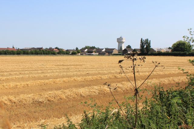
A landscape of straight lines

We walk back the same way as far as the bridge, but this time we cross it.
The sun is beating down by now - good job we've remembered our hats today.  
The view from Ball Bridge

RBS Sustrans Millennium signpost

distant swans

Approaching Whittlesey
from Stonald Road

 We follow the quiet road/ cycleway a fair way south of the Nene, past the brickworks and round until it joins the Roman Road which becomes Stonald Road, and continue for another mile to the car. You know what? I think my boots have dried out!

Lots of butterflies, including at least one comma, dragonflies, damselflies. 


Map and details

A footnote: In September 2013 we saw a performance by Eastern Angles Theatre of the play Dark Earth at Flag Fen.  Very appropriate place, and I'm pleased it was staged inside a tent - the weather was chill.


Leicestershire Round 12 - Hallaton to Foxton


Warning - this post contains frequent references to rain and nettles!

Wed, 2013 Jul 31 9:41 AM British Summer Time
With Marta. Hard work because of rain, wet crops in some fields and two or three places where nettles obstructed the path. One of those rainy days with dry intervals. 810 ft of ascent. Just over 12 miles. Excellent pub for lunch - The Bell at East Langton.

We start by walking past the large church along Churchgate, following it round to the little cemetery. Just after this we go through a kissing gate, taking the path close to the hedge on our left.  We cross the stream and make our way over fields, with the site of Hallaton motte and bailey to our right
The motte and bailey
We did wander from the path once or twice when we couldn't see the waymark posts. The rain made it more difficult to keep consulting the map or guide book!  Too many raindrops to wipe off.   So two graceful curves instead of a straight line on the garmin trace around Horseclose Spinney.   After that point we managed to follow the route as far as Cranoe church for an earlier-than-planned stop for coffee in the church porch, watched by a couple of carved heads. Some one has been at them with the felt-tip, but this is clearer on the photos than in real life!


The lion on the outside of the porch has been left alone.


From Cranoe to Glooston involves road walking, but the road is very quiet and the surface a welcome respite from the wet fields.  The rain is not stopping, and we take sanctuary in Glooston church porch for our second rain-pause in just over a mile.
 

We didn't set out with the intention of studying carved heads today, but here are another two.

We walked the route from Glooston to Hallaton quite recently, so find our way easily to Stonton Wyville. We become aware that water has seeped from wet crops down into our boots - squelch, squelch.  By the time we reach Stonton Wyville,  we're too wet to care, so after a quick adjustment of boots we head for Langton Caudle. Its fine views are visible but rain-hazed.  We could still do with one extra LR marker up here, but we reach the trig point without problem, since we know the way!
We came, we saw, we conquered!
We follow the path from the trig point keeping close to the hedge on our right, and go downhill, through a long pasture to the ford. Here we turn left along the bridle path to Thorpe Langton. We cross the main road and take the street leading to the church. We turn right along the footpath. This church offers us no sanctuary from the rain - even the porch is locked.

So it's over the fields to the farm road, turn left and at the end into a field and right through the gate in the hedge just after the shelter!  Onwards more or less east until we arrive at East Langton. We'll make the small detour to the pub.

They are remarkably pleasant to us even though we resemble drowned rats, and are quite happy for us to remove boots and socks in a side room before we order some lunch. The barman does offer us the choice of "waterlogged sandwiches", but we decide we prefer the ciabatta - served with salad and chips.  It's excellent.  £6.95 for the meal + £2 for a drink.  I recommend The Bell.

The last three miles or so are flat and shouldn't present much of a challenge - we think. And at first it's just like that - through meadow/pasture land - a herd of Lincoln Red cattle, or choc cows and calves, who look but aren't interested. Then there are sheep, and we go under the railway line. So far so good.

Two fields later we hit a small section of woodland.  The path goes through here, but it looks as though the vegetation has had a growing binge. Luckily I have my trekking pole on my back-pack.  I rarely use it, but it works as a substitute machete, and we force our way through along the marked path. 

We're going to head for the factory on the horizon. All goes well until we're within 100 yards, and we have the same problem with lush weeds. This time it defeats us before we start. I know there's another route. We go back, and just before we join the B6047, we face a similar problem. Tall wet nettles and umbellifers, and yes, LR waymarkers lead straight through this jungle. 

We get there. Then we have a slightly hairy 200 yards or so to walk on the pavement next to the busy road, dodging cars and vegetation.  It's a relief to reach the canal.  We've decided to make our own way to Foxton Locks. rather than tackle more soggy fields. 


A short distance along the towpath, and a large willow tree has split and a bough has fallen on top of a narrowboat and is blocking the waterway. No one has been hurt, and they're planning to get it cleared soon.  We can walk underneath it.  

Now things are looking smooth - the rain has stopped, we're beginning to dry out, and the prospect of a coffee at Foxton Locks is inviting.  A good path, water alongside, no nettles to fight. Life is sweet.  

Of course, just before we arrive at the Bridge 61 pub near the Locks, the rain begins in earnest, and we get soaked again.  We stay inside until there's another dry interlude, and walk up past the flight of locks to complete the circle of the Leicestershire Round. 


Map and details