and occasionally rides a bike.
A word of warning. The walk descriptions are not detailed enough to guide you - please take a map. The batteries never run out, and you always have a signal. Oh, And don't take left or right as gospel!

Thursday, April 18, 2013

Great Brington circular


Thu, 2013 Apr 18 10:05 AM Western European Time 

Led by Barry. Sun and showers - gentle rolling countryside - mostly dry underfoot. About 8 and a half miles. 466 feet of ascent.

Great Brington Church - on top of a hill, dominates the skyline as you approach by road
One of the churchwardens claims this could be the prototype for the US stars and stripes . . .
. . . after all George Washington's great-great-great-grandfather had this on his shield. 
We saw plenty of the curiosities in the church - including a seating plan from the seventeenth century  - not easy to escape attending church in those days, and this fine window by William Morris, a Libyan marble floor,  some 13th century stained glass.

The tombs of early Spencers from Althorp are in the church, in full decorative finery.

We walked through the village and on to Little Brington, over fields and quiet roads.
There's a shower on its way
The old Forge on Blacksmith's Lane.
There's a bench in memory of a woman who lived in the cottage all her life, until she died aged 79, in 2005.
Lo, we have blue skies

We managed to avoid this muddy water for once
Nobottle, and not a lot else either
Wood anenomes on the way to Harlestone - windflowers indeed, today.
Dovecot and Dovecot Laundry in Harlestone - it used to serve the local grand houses.
Althorp House from the road


Great Brington Old Rectory and church on the skyline
Woodland ride between Althorp and the church
Not cursed by interesting times
Spring brings aubrieta
Seven chimneys


Old Rectory

Looking across the countryside from the hill where G. Brington stands. 
Great Brington is well worth a google.


Map and details

Tuesday, April 16, 2013

Glooston - Thorpe Langton and back


Tue, 2013 Apr 16 9:49 AM Western European Time 
With Marta. Part of "my" stretch of the Leics Round. Lovely bright day, even some sun. Windy though. Garmin fail from Stonton W to Glooston, so I'll add a mile and make it 6.5 miles with 337 feet of climbing.

We set off from Glooston - the church hides away along the footpath above the Old Barn Inn.
Looking down from the beginning of the path

Glooston church . . .
. . . has lots of stone heads, all different as far as we could see
. . . and a rather bumpy graveyard.
The path to Stonton Wyville goes between the church and the village hall at the top of the slope, past the pub.  Nice clear markings and paths all the way to Stonton.
Church of St Denys, Stonton Wyville, all dressed up for spring
We follow the road through the village, and turn left towards the road between Hallaton and Kibworth.  We take the field road to Thorpe Langton. After about 100 yards we turn left at the bridle way to Welham.
This is the route of the Leicestershire Round!
The bridle way - a photo from 2008, when skies were blue

We follow the path uphill and along to the trig point on top of the mighty Langton Caudle - all of 147 metres (475 feet) above sea-level.  The views are excellent, and it feels higher.  It's windy enough for us to seek a sheltered spot for a coffee stop.

From here we go down by the LR route close to the hedge, ignoring the route off to the left which is the continuation of the bridleway to Welham.

So, downhill, with the hedge on our right, over the stile, past a pond harbouring a LR way marker. 
Which way would that be?
 Then it's onward and downward through a scrubby pasture to a spinney and then into a very long thin field with a few horses and cows. At the end of this we reach the footbridge over the ford, and we're back on the field road.

We walk into the village, past several farm buildings. In one of them there seem to be  several bulls, enjoying the sun! 

The pub in Thorpe Langton isn't open - it's a weekday lunchtime, so we walk back along the field road to Stonton Wyville - quicker, but nowhere near as pretty as the Caudle route.  We have another brief pause to admire the flowers. 

We make our way back to Glooston for a bowl of rather good sweet potato and broccoli soup.

All in all a very pleasant morning's stroll.


Monday, April 15, 2013

Illston on the Hill circular


Mon, 2013 Apr 15 9:35 AM Western European Time 
Led by me, with Barry. Weather much warmer today - even the wind wasn't cold. Underfoot mostly dry, except for a few gateways - one in particular near Burton Overy. Quite rolling terrain. Distance 10 miles. Total climbing 643 feet.

This walk was adapted from one in Heather MacDermid's book "Foxton Locks to Rutland Water"

We drive out to Illston on the Hill on a fine morning with a smidgen of sun in the air, and warm - a tropical 55F, or around 12C. Not quite shirt-sleeve weather, but comfortable.
We set off from the Village Hall, walking past Oak Farm, and The Acorns to a T-junction. Across the road is the path, clearly marked as it crosses fields of sheep and lambs.
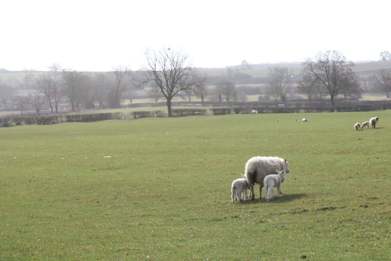
This ewe has three lambs - I missed the opportunity when they were all in a line!
There's a footbridge and then the path makes its way uphill and north east to Barn Farm. It carries on in the same direction past a big house called The Farm, where it joins the road (B6047).
Here we turn right and after 100 yards or so we turn left into Rolleston Park, where there is a cattle grid and then a long drive lined with horse chestnuts - not yet in leaf this year. We walk along the drive, past the gates to the Hall, and take a step back in time as a trap and four (?) approach us.


A great way to take the dogs for a walk
We pass the stables and the dairy - now rather fine houses, before taking the signposted track to Billesdon on the left, and then the marked footpath to the left which leads past the Cranhill Farm development.

We walk up the drive to the main road (B6047) again and after about 50 yards we turn left along  the "gated road to Illston". Very pleasant walking, trees to our left, views to our right, and hardly any traffic.  There's a space between gateposts, but no gate. Just before this our path turns off to the right and follows the hedge a short distance before going behind the splendid Ashlands, a mansion built in 1867 in Tudor style.  It's surrounded by manicured lawns and trees and has views over towards Frisby and Billesdon.

We walk downhill and to a grassy track with a small wood on our right. We walk along two sides of the wood and then keep the hedge on our right through three fields, swinging left at the end to join the lane which goes to thr right and up the hill into Gaulby.

We walked along the road to the church, and took a break on a bench nearby - sheltered and sunny today.

counting the hours while minutes run free - a clock with one hand
Until about 500 years ago no clocks had minute hands and you had to judge approximately how far to the next hour you were from the position of the hour hand - a bit like a sundial, I suppose.
Gaulby church with its four pinnacles and weathervanes.


Daffs at last!
Then we took the road to Kings Norton, passing some fine houses - one called Dovecot House . . .
. . . and there's the dovecot.
Kings Norton Church (St John the Baptist) is a very imposing building for such a small village.
Kings Norton Church
Shortly after the church, along the road towards Illston, there is a footpath off to the right.  We decided to take this route - across a field and past a small hollow - where sheep were taking advantage of some water. It didn't look very appetising.

We kept to the higher ground passing some small wooded areas on our left.  In the fourth field the path swung round to the left and downhill to meet a track which follows the Roman road, Gartree Road.


Decision time again - Burton Overy or not?  We have plenty of time, and the weather's good. Ten miles sounds like a decent walk, so we head along the path which follows the stream for a few fields. Just before Burton Overy we meet our muddiest obstacle - a gateway of course. I go ankle deep, but the boots are up to this, and my feet stay dry.

We walk along the main street past the large church and some interesting houses.
Timbered house in Burton Overy
At the pub (the Bell) we turn left along Carlton Lane, and follow this up the hill as far as Chestnut Farm, ignoring a footpath off to the left. At the farm we go through a gate and then beside a barn and into a field. Here we keep to the left hand side and walk downhill to a footbridge over the stream. From here we can see the small tower of Carlton Curlieu church, and make for this, following the path until it meets the road. We pause to persuade an errant lamb back into the field - another one that looks like a small quarried dip.

We walk past the old rectory and the church and turn left for 100 yards or so, then left along the bridle road to Illston.  This runs clearly between two hedges as far as the road (Gartree Road is a real road here) t Carlton Curlieu Manor House farm. It's still signed clearly as the bridle road to Illston, but isn't as superb as the last section.
In fact it's easy to follow, although the last field is a bit of a chore. We can see Illston church from the path.  We walk back to the village hall through the village with its church and pub.
Thoroughly enjoyable.


Monday, April 8, 2013

Twyford - Thorpe Satchville - Ashby Folville - Twyford


Mon, 2013 Apr 8 9:39 AM Western European Time 
Led by Barry, with Maureen, Gordon , Eddie and me. Fine, no sun, coldish, not very hilly, dry underfoot. Just over 6 miles.

We park near the church in Twyford and take advantage of the benches in the porch to get booted up for the walk. We take Hollands Lane out of the village, following a clearly marked footpath, through some trees, across a field or two and a disused railway line. We have a few minutes diversion rescuing a lamb which had wrapped its leg in fencing wire.  It hobbles off and joins its mother.  Fingers crossed, we hope it recovers.  
Then we continue along the path until we meet a bridleway - this isn't hugely clear, but there are signs on the marker post. We turn sharp left - the bridleway goes diagonally across a large field, but we walk down the hedge until we can see the waymarker. We walk across a couple of fields with the stream below us to our right. 
A 'lion' in wait
The bridleway takes us to a point where the road and disused railway meet. We take a path on the opposite side of the road and slightly to our right.  This climbs up towards the village of Thorpe Satchville, which sits on the ridge.
Thorpe Satchville
The photos from now on look as though we've travelled back in time - I forgot to change the setting when I switched from "auto". 
One of the few slopes in today's walk.
Eddie waits by the gate
Here they are.

We make a short detour to say hello to Thorpe Satchville church
then walk past a large house with a mini-haha.  At this point we're following the Leicestershire Round for a mile or so, towards Ashby Folville.   This goes under the disused railway, and clearly marked over several fields.

We leave the Leicestershire Round  shortly before the village to take a lower path to the road. 
The church is to our right.
Ashby Folville church
 We turn left along the road towards Twyford, and turn off to the right at a farm road and bridge over the Gaddesby Brook. This is part of the Midshires Way.   We take a break here, before leaving the Midshires Way, and instead we walk along the public footpath to Twyford.  Again it's clearly marked and easy walking, although at one point there were seven or eight stiles in quick succession - not quite a hurdles course. 
Then a pair of sheepdogs come out to greet us, and decide they're not obliged to herd us after all. They disappear after scent-marking a gatepost, and looking at us - challengingly?
We emerge next to the farm, and find a convenient bench, dedicated to Thomas Holland's 100 years in Twyford in 2005.  He died in 2009 - we later spotted his grave in the churchyard.
Not long before we're back at our starting point - a very pleasant six miles and a whisker.