and occasionally rides a bike.
A word of warning. The walk descriptions are not detailed enough to guide you - please take a map. The batteries never run out, and you always have a signal. Oh, And don't take left or right as gospel!

Monday, September 29, 2014

Gumley and Laughton

Mon, 2014 Sep 29 9:48 AM BST
Led by Tommy, with Gordon, Eddie,Maureen and me. Just over 5 miles. Not very hilly, dry underfoot. Lunch at The Bell.

Just over 5 miles, through good scenery, decent paths and dry underfoot.
We start from the Bell in Gumley, ordering lunch before we left.  We walk a short way up the main street and turn off between houses to our right. The path takes us downhill, turning east (to our right) , through a couple of fields. We reach the Grand Union Canal and cross over the footbridge.

We turn right and walk the short distance to bridge 61 at Foxton Locks, cross over and pass the pub of the same name and Bottom Lock. Our path leaves the canal to the right just after the bridge at Bottom Lock and we head west, following the path over two minor roads and continuing for  almost a mile to where the path crosses the drive to Gumley Lodge. We're advised to keep to the footpath here rather than using the private drive. 
We turn left to cross the drive and take the path more or less southwest, which climbs gradually and meets Laughton Road close to a T junction. Our path goes off to the right just before the junction, going north west, climbing slightly until we reach Laughton itself.
Hens and horse riders mark the entrance to the village from this field. We have a break on the convenient seat opposite the green.  Then we carry on and take the road on the right. We go past 
What I am told is Laughton village hall - extended! Our path goes to the right at a bend in the road, and makes its way gradually down northeastwards towards Gumley Lodge again. We pass our route on the way out, but keep to our left and carry on in a more northerly direction. All is pleasant and not at all strenuous until we meet the final short steep pull up into Gumley.


Only five of us!  What happened to the others? Thanks for a lovely short walk today, Tommy!

Saturday, September 20, 2014

Sibley Volcanic Regional Preserve

Friday 19 September 2014

A little under five miles of gentle walking, on clearly marked trails helped by the free leaflet at the trailhead.


We followed the volcanic trail, not completely in order, as it led us round the park, educating us about the formations in this part of the East Bay area. The tunnel and freeway are out of sight most of the time.

There were birds of various kinds, from Steller's and other jays, to some so far unidentified by us, small bold black-headed birds, and this one seen on a bush nearby,  possibly a female lazuli bunting or a female western bluebird . 
There were birds of prey hovering around, being mobbed as usual by smaller birds. One flying like a kestrel.

Butterflies, white and coloured, large and small, the scent of eucalyptus, pines and in the open areas anise.

Lizards lounging deckchair less along the side of the old Quarry Road - a favourite basking spot.

Grassland dried out and gone to seed. Two 'labyrinths'

Distant views of Mount Diablo and the Bay. the freeway not too far away, but hidden.

The last section of the walk back was blissfully shaded. 


Wednesday, September 17, 2014

In the Briones Regional Park

Map and details


Tuesday 16 September:
From the Alhambra Creek Staging Area on the north side.
We followed the Alhambra Creek Trail to its junction with the Spengler Trail.
We followed this to where the Spengler trail joins the Blue Oak Trail, then returned to the point where the Diablo View Trail leaves the Spengler Trail and descended to the parking area that way.
Most of the climb was reasonably shaded, but the way down less so.
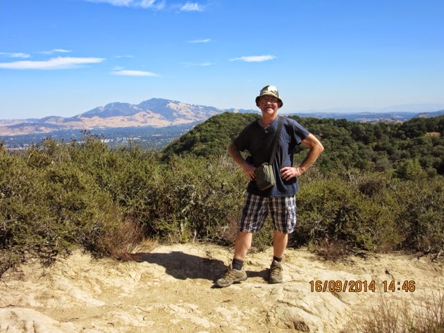
It was hot work and involved a fair amount of steep uphill and downhill walking.  Terrific views of Mount Diablo and other areas.

Monday, September 15, 2014

Walking in the Redwood Regional Park


A walk of just over 5 miles, with around 1 000 feet of ascent and descent, shaded through a cool redwood  forest, on clearly marked trails. Started from the Skyline Gate Staging Area. Good leaflets with map are available.

We followed the Stream Trail downhill through redwood forest with some eucalyptus. The stream itself was dry though the creek course is clearly visible.
We passed junctions with the Eucalyptus trail and Prince trail on our left. After about a mile and a bit we crossed a bridge and turned right, back on ourselves along the Mill Trail.  This turns sharply back itself to the left and climbs up to join the French Trail. 

We walked along this as it climbed up and then  descended several times before joining the west Ridge trail and taking us back to the parking area.

A fairly strenuous walk, but the two children (10 and 9) walked it very well.  Our reward was a delicious ice-cream from Smitten back in Lafayette.


Saturday, September 13, 2014

Lafayette Reservoir Shore Trail once more

Map and details


The weather out here is even hotter than usual for September - it makes any outdoor activity more than a little more effort. The shore trail at the reservoir last Tuesday was very hot, without the high level breeze. All the same there were runners and dog-walkers even just after midday - probably not the pleasantest time of day to be out.


Tuesday, September 9, 2014

Lafayette Reservoir, Rim Trail


Leonie warned us this walk was not flat, in fact"almost vertical in places". Taken with a pinch of salt, but certainly in one or two spots I could have done with the faithful trekking pole. It's travelled with me, but I left it in the cottage. It was a case of put your feet sideways and don't slip on the dry sandy sections.

A great walk, from the town centre out on the Mt Diablo Boulevard for a good half mile or so to the reservoir, then up to the Rim Trail, and follow it anti-clockwise on its undulating course well above the water.

There are fantastic views of distant mountains, towns, woodland and the reservoir below. Wall to wall blue sky, a crowd of chickadees, turkey buzzards and one or two homo sapiens.

6 to 7 miles in all, including the walk from Lafayette centre. 

Monday, September 8, 2014

Lafayette Reservoir

7 September 2014

with Leonie, Brian, Eilidh and Aneurin.

A gentle wander of a couple of miles around the reservoir in warm sunshine, with a Californian blue sky.
Really too busy chatting and walking to take everything in - there are boats on the water, people on the trail, and the odd small lizard.

The Nature info boards tell us about trees, reptiles, birds . . . and Brian thinks he's spotted poison oak with its prickles. To be avoided.

We all feel relaxed and fresh after the airing.


Monday, September 1, 2014

Fineshade to Blatherwycke and back

Mon, 2014 Sep 1 9:27 AM BST
Drizzly at start, then dry. Cloudy. Under 6 miles.Led by Mel - with Norma, Tommy, Gordon, Terry, Steph, Barrie E, Chris, Sue, Marion, and me.

The reverse of this route:


From Fineshade, down the hill and take the path off to the left across the big field with a dip in the middle. At the far side we take the path down through woodland, and across a grass field and a path between fences to a stile above Fineshade Abbey.
Here we turn left along the field to a gate with way marker which takes us on to a track through Lynn Wood. We meet a bridleway and follow it slightly to our right.
This takes us gradually downhill, past farm buildings and on to the road  between Bulwick and King's Cliffe. We turn left then walk east along the road for about 400 yards. A footpath through a hedge on the right hand side leads south west over a field, then through a maize crop.

Another field, then through a gap in the hedge and we turn right, following the field edges, with Blatherwycke Lake on our right.
 After almost a mile we emerge on to the road at a sharp right hand bend. We turn right and walk along to Blatherwycke Bridge, where we stop for a break.
Our former stopping place on an old tree trunk has now been enclosed and put out of reach.


From the bridge we walk on past a junction where a road goes left and on to the next one. Our path goes through a gate, or over a stile for the athletic and heads north through the middle of the field. A few more fields bring us to where the land dips down, almost Derbyshire style, past woodland to a concrete bridge. Here we join the Jurassic Way and follow it uphill to rejoin the path above Fineshade Abbey, retracing our steps to the car park and then the café.

Thanks, Mel for a pleasant walk, in almost dry conditions - just the tiniest drizzle!

Map and details