and occasionally rides a bike.
A word of warning. The walk descriptions are not detailed enough to guide you - please take a map. The batteries never run out, and you always have a signal. Oh, And don't take left or right as gospel!

Monday, April 29, 2013

Badby - Hellidon - Charwelton - Fawsley


Mon, 2013 Apr 29 9:39 AM Western European Time 
Led by me. with Barry and Maureen. Quite hilly, good underfoot - one ploughed field but dry. Weather dry and sunny with some wind. 834 feet ascent. Excellent views. 11 miles. Included the highest point in Northamptonshire at 738 feet/225 m. Peak bagged!


One of two ancient chestnut trees in Badby. They are trying to preserve them, but warn you not to park or hang around underneath them.


Leaving Badby by Bunkers Hill.
We crossed the A361 and followed the Gated Road to Catesby. It climbed gradually, and we took the second footpath on the left - a bridleway. 
After less than half a mile we could see the motocross track on Arbury Hill to our right, and walked to it across the field.  The summit is wide and flat and we're not sure we we found the very highest point.


Ha! I worked out the self timer. Another peak bagged - a molehill with quite a view.
Then it's back to the bridleway, and past the tunnel airshafts.  Yet another dismantled railway. We walk past a large house and arrive at the minor road to Hellidon.  We turn right then left into a very large ploughed field with little evidence of a path, apart from the signpost. Another smaller and easier ploughed field leads into a grass meadow and we see a small lake close to Hellidon village
There are swans nesting, and the trees show signs of approaching summer at last.
We find our way into the village which is glorious in its spring outfit. 
Spring and autumn together?
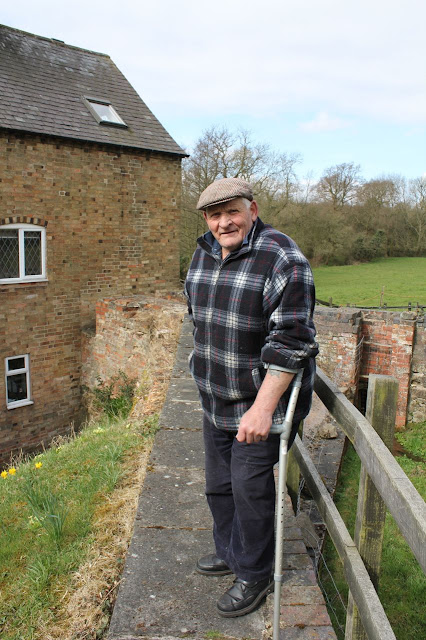
We stop to chat to a man who's repairing the stonework of his cottage, which dates from the eighteenth century. 
A fire insurance plate - if you didn't display this the firefighters would leave your house to burn.


We leave the village at the road junction opposite the Red Lion and make our way up Windmill Hill.
Hellidon from Windmill Hill
We find a place for a break - sheltered from the wind and with lovely views. The sun's shining and all's well with the world.
We follow the Jurassic Way as far as Charwelton. heading south east until we meet the minor road just before it crosses the old railway. We go slightly astray because the field is ploughed, but we're near enough.  We pick up the Jurassic Way signs and emerge on the A 361 in Charwelton, just opposite the pack horse bridge.


The footpath crosses a couple of fields from here and takes us to a small road leading to the church. It's open so we have a look round, then take another break on a sunny bench.

We leave the Jurassic Way now and take a path through a gate and to a gap in the hedge on the left side of the field, then across the corner of the next field. We cross the road and follow a footpath up a small hill, and over some open fields full of sheep,  and pass Fawsley Farm - (or Fawsley Grange) on our right. We come out on a farm road which joins a minor road at Little Fawsley. This road takes us into Fawsley, with its Hall - seat of the Knightleys, and the church which contains many of their tombs and monuments.
Fawsley Hall - hotel and spa.
 
Fawsley church

All this - and a box collecting for a food bank too.

We follow the Knightley Way - very well signposted through parkland, pasture and Badby Woods, where wood anemones are in flower and bluebells are beginning to bloom.

All that remains is the walk downhill into Badby - well, there's steep short pull at the end - and then finding the car.  Another delightful walk, and fine weather. Not quite fine enough to take layers off yet, though.
Wildlife - a couple of birds I think were wheatears - very noticeable pale/ white rumps as they flew up, quite strong markings on an open meadow.
Map and details

Sunday, April 28, 2013

Thorpe Langton to Foxton and back

Saturday 27 April, starting some time around 3pm and finishing around 7pm. Longish break at Foxton Locks. With Harry. Fine weather with a couple of short showers. No garmin, but distance estimated at around 8 or 9 miles, at a good pace. We followed the Leicestershire Round on the way there, but returned along canal as far as the Pears works.
Some not too interesting flat fields towards Foxton, and a couple of busy roads to cross.


Looking north to the Caudle
St Leonards,  Thorpe Langton
Lambs staying inside their field for once.
The view to the southwest with the lake near Grange Farm.

Onward


The wall of East Langton Grange
Lottery was the first winner of the Grand National - see link
and this one. There's a picture by John Frederick Herring Senior in the Woolavington Collection of Sporting Paintings at Cottesbrooke Hall as well.


chocolate cows

A brief shower
Foxton Locks in reflective mood


A bit of local colour


This was where we left the canal

Thursday, April 25, 2013

Ashby Folville - Barsby-Twyford figure of eight


Thu, 2013 Apr 25 9:32 AM Western European Time 
Led by Barry. Good weather, dry and firm underfoot, rolling countryside, fine views. Around 8.5 miles. less than 500 feet of ascent.


A poignant gravestone in Ashby Folville churchyard - a long life and a hard one?


Here lies
Sarah Smalley
who was a faithful
servant to
William Smtih
of Barsby
who departed this life
December 6th 1859
aged 83 years
the weary wheels of life
stood still at last


We walk along the path past the church, crossing bridges and a private drive . . .

before heading south west over fields along a footpath to the attractive village of Barsby.
A church or chapel converted into a house

another picturesque thatched cottage

timber frame

cruck frame
From Barsby we turned right and headed south east over several fields, crossing another footpath and continuing as far as Twyford.
cherry blossom
Spring is here, the blossom's out and the benches have emerged from the church porch.
The old "national school" with two dates in Roman numerals
A short way along Twyford's Main Street took us to our path - off to the right, and now heading south west again, over the B6047 and along Park Road, just to the north of Lowesby.
A right-angled turn to the right and we're going north west, following the field edges, and the waymarkers for a while, then turning slightly right and uphill just before Carr Bridge Spinney. We join the Mid-Shires Way for half a mile or so, walking along a ridge until we reach the road to South Croxton. This is still Mid-Shires Way. We turn left and walk along the road for a few hundred yards, then turn right down a track past farm buildings and houses. Spring has arrived - primulas in abundance along here.


Soon after this our path crosses the route we took earlier in the walk and it's downhill into Ashby Folville all the way.
Wooton Cottages. This plaster work called "pargetting" is more common in East Anglia. 


A walk of fields, extensive views, and a variety of interesting buildings.

For more info on this area see this link as well.


We saw swallows and, later, buzzards.

Monday, April 22, 2013

Lyddington, Seaton, Bisbrooke, Uppingham Lyddington


Mon, 2013 Apr 22 9:20 AM Western European Time 
Led by Mel, 12 of us altogether. Norma, Chris and Marion, Barrie and Vera, Terry, Barry, Eddie,  Jill, Ken and me.  Fine morning, firm underfoot. About 7 miles in all.
Church of St John the Baptist, Bisbrooke

A gentle walk through grassland and tracks from Lyddington, uphill to Seaton, across to Bisbrooke and into Uppingham. 
A well-earned break?

Posing for the paps?

 We stopped near the market place for our coffee break, then continued downhill past the community college playing fields and back to Lyddington, before driving to the café in Cottingham for lunch.


Map and details

Saturday, April 20, 2013

Leics Round 7 - Bagworth to Woodhouse Eaves and Beacon Hill

Fri, 2013 Apr 19 10:05 AM Western European Time 
With Marta. Fine with the odd shower and occasional sun. We saved the hills for the end of the walk. Garmin off for about a mile. Total around 12 miles. 1,129 feet of climbing.


We start with a short diversion to the Bier House, to look at something I'd seen last time.


Up past the church and through the churchyard, for a sobering start to today's walk.
Then through the recently planted (1996/97) Bagworth Heath Woods, which are part of the National Forest. It seems an excellent way to heal the scars of the mining industry. I idly googled Bagworth colliery and found an interview with some ex-miners from local pits. Desford Pit had seams running under most of this land. Today it's pleasant walking and we get quite warm in the sheltered parts of the path.  
We cross the road and continue - the way ahead is clear, and takes us over the Leicester to Swannington single track of railway line.
We cross a stream and a small field with a couple of donkeys.  the stream was the old mill race for Thornton Mill. The mill was built in 1847 and functioned until the 1930s. The daughter of the last miller still lives in the mill house, and the house next to it was converted from the mill itself.  

There's a man sitting in the sunshine mending a table.  
"So, this used to be a mill?"
"Oh yes - if you go up here you'll see where the pond used to be. Come and have a look."
We walk past a table and seat made from an old millstone and up to the wall where a tiny trickle of a stream now runs.

"There was a big stone at the top end to stop more water coming in. Maureen's dad used to keep a boat tied up here and he'd go up by boat instead of walking there."
Then he showed us a brick dated 1847 on the side of his house. A wooden beam with words carved "Christian built this mill in 1847" used to be in the mill, now it's above an outbuilding.
We thank him and wave to the women in the mill house garden.  He says it's a shame so many walkers just keep their heads down and don't stop to look around more often. Guilty as charged on occasions.


The footpath here is very well marked and we arrive at a modern housing estate on the edge of Thornton. We wander up a couple of dead ends before finding our way to the main street.

The path goes alongside the school and downhill over a ridged and furrowed field. We can see Thornton reservoir glittering in the bottom of the valley.

We walk past the end of the water and a field of shetland ponies and some sheep and along the side of Browns Wood.  There are wide views in both directions here.   The noise of the heavy traffic on the embankment of the M1 makes conversation difficult.  With some relief we take the path underneath the motorway, and ignore the footpath on the left almost immediately afterwards.  Instead we carry on for a short distance to a path which goes through three fields. We walk past some  houses,  and along Croft Way and turn right along  Forest Road, then soon left into Main Street, Markfield.
It's a conservation area, but there is still evidence of post-industrial decline.


At this point we are in heads-down-and-can-we-stop-for-coffee-soon mode, so miss out the church and the Altar Stones picnic site and Nature Reserve, which has good views over Charnwood Forest. One for another walk?


We leave Markfield and go underneath the A50 by a subway. Then we take a path alongside, screened to some extent by the trees. They don't have many leaves yet.  Coffee is by now essential, so we use this dilapidated picnic table.
Inviting, no?

We follow the Round way marks with no problem as far as the village of Newtown Linford. 


Then it's through to Bradgate Park, a sandwich at the café.
Striking trees

Atmospheric ruins
We walk by the river, past the mighty trees, and the ruins of Bradgate House, up the hill to the War Memorial and Old John.  
Marta clambering on the rocks

Grand wide views, if a little misty.  We leave the park and take the path along Benscliffe Road, through the edge of Rough Wood, and over Lindale Golf Course to Woodhouse Eaves.
We turn left along Mill Road, walk uphill past the windmill, and the car park for Broombriggs.
We cross the road, and walk up (again) to the top of Beacon Hill. An extra just to include the view from there. I really feel these hills at the end of today's walking.  About 12 miles.

They are filming something - time travel perhaps with medieval peasants and modern army types with automatic weapons?  Beacon Hill's a great place for it.


We saw one swallow, heard an insistent cuckoo in Bradgate Park - Marta saw a woodpecker - we both heard one drumming earlier. We saw a jay fairly close by as well.

Map and details