and occasionally rides a bike.
A word of warning. The walk descriptions are not detailed enough to guide you - please take a map. The batteries never run out, and you always have a signal. Oh, And don't take left or right as gospel!

Showing posts with label Wakerley. Show all posts

Monday, February 28, 2022

Bike ride Gretton to Barrowden and back

Sunday 27th February 2022. About ten miles. With Harry. Across the Welland at Middle Bridge, towards Lyddington and along Thorpe Lane’s double mini-hill. Then road towards Harringworth, turning off at Morcott turn and up the big hill, and across to Barrowden. 

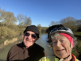
selfie near Wakerley

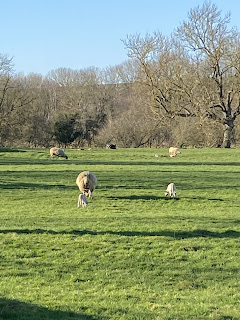
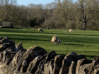
Lambs


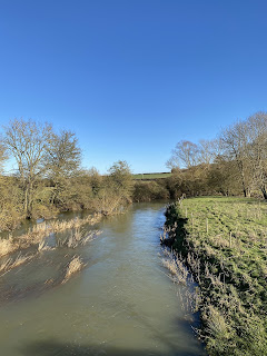
River Welland is quite full

From Barrowden to Wakerley, then Harringworth and just the final hill to go. Much better from the point of view of low sun this way round. 

Tuesday, November 23, 2021


Sunday 7th November, with Harry.

Afternoon , cold and bright. We cycled to Harringworth, Wakerley and Barrowden and back via valley road and Mill Road - approx 10 miles, I guess. Quite hard work, and a bit windy. 

Photo by Harry.


Tuesday, October 12, 2021

BY bike from Gretton to Rutland Water

 Tuesday 12 October 2021. With Harry 20 miles. The weather promised to be sunny, or so we thought as we drank coffee in the garden.

Out ward route via Harringworth, Wakerley,  Barrowden and the Luffenhams. Return via Lyndon, Wing, Seaton and Harringworth.

A pair of swans on the Welland near Wakerley.

A murky Rutland Water from Normanton car park as the drizzle persisted.

Approaching Wing

Coffee break over…


Penultimate hill climbed - only the hill between Harringworth and Gretton remains


3 hours, 20 miles, 1160 feet of ascent. 

Sunday, June 21, 2020

Another ride around the Welland Valley

Gretton - Lyddington - Seaton - Barrowden - Wakerley- Harringworth - Gretton.
the elderflowers have gone. Plenty of meadow cranesbioll and some mallow. Wild roses, another umbellifer (ie not cow parsley), knapweed, honeysuckle. The river looked peaceful at Wakerley Bridge.  Looked as though the pub was open in Barrowden - people picknicking on the green, near the duckpond.
Three hills - up from  Lyddington, up to Barrowden turn on Morcott Road, and finally Harringworth Hill.
oh yes,  the road between Wakerley and Harringworth is bad, but not as bad as the one past Kirby Hall!

No photos today. About 14 miles I think.

Sunday, June 2, 2019

Gretton to Fineshade

Sunday 02 June 2019, with Harry.  From Gretton, we cycled down the hill to Harringworth, along to Wakerley, then turned right and went past the woods. Across the A43, and along to the road up to Fineshade. 

Quick stop to buy a drink, then we cycled through the woods and down to Kings Cliffe,  returning along the road to Blatherwycke.  We passed the lake with its two black swans, and a little further on the alpacas.  
The next village was Bulwick. Instead of turning into the village, we turned left towards the A43, which we crossed to reach Deene, and then came back via the road past Kirby Hall. The bone shaking surface could do with smoothing over for cycling. From there we turned right and cycled back to Gretton.
Around 18 miles in all.

Tuesday, April 4, 2017

Wakerley, Laxton Hall, Barrowden

Monday 27 March. led by Tommy, with Norma, Maureen, Ken and me. 
6.5 miles, in decent weather.

Unfortunately I switched the GPS on part way round!


We set off from the car park in Wakerley Woods, and walked through following the Jurassic Way signs until we reached the next barrier after the edge of the woods, when we  turned right to take the path behind Laxton Hall.


After that we followed the newly made path which replaces the right of way through the land which is being quarried, then used for landfill. The new path is clear and generally good, but I suspect the walk will be dusty and noisy once work starts in earnest.

The seagulls follow the tractor . . .


We took the road between Harringworth and Wakerley, walking for about a quarter of a mile, then turning left along the footpath, keeping to the edge of the recently ploughed field and walking alongside the dip left by old workings, with the lime kilns in the background.
We took the Jurassic Way again from Wakerley to Barrowden, crossing the Welland.


We took the footpath on the west o Barrowden which emerges near where the road crosses the Welland, a the old station building.  t the junction we picked up the Jurassic Way footpath near the house which used to be the pub. It goes behind the church and comes out on the road. At present they are building an access road to the quarry near the corner.
We followed the road and picked up the Jurassic Way footpath back to the car park.
We're almost back
 Lunch at Barrowden Community shop.

Wednesday, December 7, 2016

Harringworth, Shotley, Wakerley, Barrowden, Harringworth.

With Marta on a murky day - we saw the sun, veiled by mist, briefly! This is the same walk as on October 31st 2016, but in reverse, checking a few details of the route. For some reason it seems to have been over 8 miles this time.

We had a sandwich in the Community Shop at Barrowden.
Yes, it's definitely a red kite.

The vegetation around Barrowden Mill pond has been cleared

A duck with a topknot? A doodle?

Harringworth- Barrowden-Wakerley- Shotley- H'worth

Monday 5 December 9.20 am. With Harry, Maureen, Gordon and Eddie. The walk covered mostly the same ground as the walk on November 8th 2016. 7.3 miles. Fine though not as clear as last time. A frosty start but some fields were muddy later. 

Lots of fieldfares in evidence, as well as a heron and red kites. 

We started the walk by turning left from the road past the stables, and crossing the field full of horses.
The path continues by the Welland, crossing Turtle Bridge, and later the disused railway line, before tackling the drag up the fields to Barrowden.


We rewarded ourselves with cake and coffee at the table near Barrowden duckpond. The ducks had a little ice free area to swim in.

We went along Mill Lane and followed the Jurassic Way path past the pond, before crossing the footbridge over the Welland.


The path crosses the field, and then there's a bridge under the disused railway. The track leads to the main road through Wakerley.
We turn right and follow the road round until we reach a metal gate with a stile next to it after the last farmhouse. We take this path, with a minor diversion to avoid a very muddy field where sheep are feeing on the remains of the crop. At the road we turn right and walk for a short distance before turning left along a bridleway - it's the first surfaced track, though the bridleway sign is no longer clear since it was chopped with the hedge cutter.

We continue to the bridleway above Shotley with views of the viaduct, and follow the Jurassic Way down hill into Shotley and then Harringworth.


Tuesday, November 8, 2016

Barrowden, Wakerley, Shotley, Harringworth

Monday 7th November, with Harry.  Seven and a half miles. fine cold morning, though there was some mud underfoot after yesterday's rain.

Pretty much as the walk a week ago.
There's still plenty of colour on Barrowden village green.

The leaves are falling now.

We walked past the old mill pond .  . .

across the field and under the disused railway . . .
through Wakerley with views of the lime kilns and Morcot windmill.
From the path above the Welland valley, the view of the viaduct and Harringworth is clearer today. We saw several red kites, a few buzzards and a couple of jays.

Back down in the valley, we walked through Shotley and Harringworth, and took the footpath just before the stables. We crossed Turtle Bridge and followed the footpath back to Barrowden.


Thursday, November 3, 2016

Barrowden, Wakerley, Shotley and Harringworth

Barrowden to Wakerley, Shotley and Harringworth.

Monday 31 October 2016. 7.75 miles. Led by Tommy, with Gordon, Norma and me.

From Barrowden village green, near the Marquis of Exeter pub, we walked east along Main Street, turning slightly right opposite Kings Lane, and joining Mill Street. We had a small delay while the owner of a bounty of apples insited on giving us one each, and provided us with a bag of windfalls to take home after our walk.


Mill Lane becomes a narrow path past the old mill and the millpond, then through a wooded area. Shortly afterwards a footbridge crosses the Welland - this path is part of both the Jurassic Way and the Rutland Round long distance walks.  

This path lead across the fields, under the disused railway, and into Wakerley. We turned right along the road, and soon came out of the village. We took the footpath where the road bends.
This has a good view of the old lime kilns and Barrowden church behind. 
Our path cuts off the corner of the fields and rejoins the road again. We turned right here.

There was a couple of hundred yards of road walking before we took the first bridleway (sign missing) heading more or less south towards the woods. It crosses a disused airfield and leads into Wood Hollow, which is at the south west end of Wakerley Woods.  There is a fairly wide path where we turned right (west). This leads out of the woodland and towards an open field. We turned slightly left, now heading northwest. We crossed a track, then more fields, turning left along the edge of a field, before the dip of the old quarry.

We passed some bales of straw, and paused for a snack, sitting on an old trailer. From here the path took us west and then slightly north, joining the Jurassic Way as it descends into Shotley.  On this section of the route there are superb views of the valley, featuring the viaduct and the windmill at Morcott . 

I must go back on a clearer day! 
 From Shotley we followed the path and then the road towards Harringworth village centre, turning right at the footpath just before the road to the stables.  This led us through a field of horses and to the Welland, which was on our left all the way to Turtle Bridge. The river was clear and calm today.


Up to the left along the track for a short distance, then before the old railway we turned right again keeping the trees on our left. After a few fields we crossed the old railway and carried on with it on our right for a short distance. The path then heads diagonally across the field and continues until it reaches the road with new houses.  We carried on to the crossroads and followed the road into Barrowden and back to the green. We stopped for lunch at the Community shop and Café.

This is a remarkably pleasant scenic route, and the climbs are pretty gentle.
Monday, October 27, 2014

Barrowden - Wakerley - Woods -Laxton Hall - Turtle Bridge - Barrowden

Mon, 2014 Oct 27 9:31 AM GMT
Led by Tommy. With Gordon, Barrie E, Terry, Kate, Marion, Chris, Phil, Eddie and me. Map trace incomplete due to human error - I forgot to restart track after a switch-off and on! In all just over 7 miles. Fine, warm, sunny morning.

This is the route we walked in August 2012, but in reverse.  The map may be more useful than today's!

We met at Barrowden, and headed east along Main Street, then turned right and south along Mill Lane. 

Our path takes us past the Mill Pond, and downhill to the footbridge over the Welland.
 We cross a large field of grazing sheep, and come out on Main Street Wakerley. We turn left, and walk for a short distance along the road.
We take the footpath to our right soon after the road junction, beside a large house which used to be a pub.  This passes behind the church and emerges on to the narrow road just before Wakerley Woods. A good way after the bend we turn into the woods. It is possible to continue to the main entrance, and take that route. We make our way past the (closed) toilets and parking areas to the track, where we turn right, heading south. We follow the Jurassic Way, though signs are not very obvious, turning left from the main track and along muddier paths.
We leave the Jurassic Way paths and make for Laxton Hall, now a nursing home.
 From here we head pretty well due west along a long track through the woods again. We turn northwest and meet the dip that used to be a quarry - now with a new surfaced road/footpath.  We disturb a couple of red kites who have found some delicious carrion.

Nice new footpath.
 The footpath meets the Harringworth to Wakerley Road just opposite the wide bridleway.
A fine view of the viaduct

Going down the bridleway

Shaggy inkcaps

The Welland at Turtle Bridge
The bridleway takes us gently down to Turtle Bridge, where we rejoin the Jurassic Way, and follow it uphill slightly, then turn right and walk with a hedge on our left.  We go through a gate, following the waymarkers, and make our way gradually into Barrowden.
This is the correct route for the footpath
We enter Barrowden from the Morcott Road, deboot ourselves and grab a lunch in the Community shop. 
Barrowden duckpond.
Once again, thank you, Tommy for a fine walk.
Map and details (incomplete)