and occasionally rides a bike.
A word of warning. The walk descriptions are not detailed enough to guide you - please take a map. The batteries never run out, and you always have a signal. Oh, And don't take left or right as gospel!

Showing posts with label Brampton Ash. Show all posts

Tuesday, March 22, 2016

Stoke Albany, Ashley,Brampton Ash,Desborough

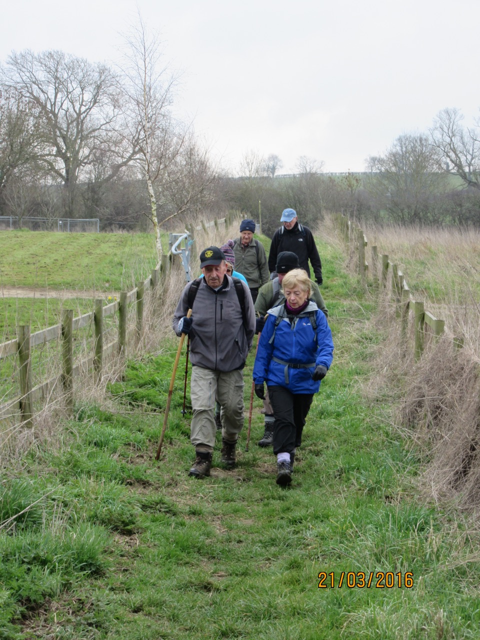
9.33 am, Monday 21 March 2016. Led by Tommy, with me, Maureen, Gordon, Marian, Chris, Terry. Dry, but not sunny. fields are drying out. 9.5 miles, and around 660 feet of climbing, though none of the hills were very long, and the views were good, in spite of some mist.

We parked at the village hall, near the church in Stoke Albany, and took the footpath heading north west by the church. it turns more or less north, past Lower Lodge farm, and under a row of pylons, joins a path from Wilbarston and heads north west again.  
A hardy band walks along the corridor in the fields
  On the outskirts of Ashley, we take a path east, cross a minor road and climb steadily up across field paths to the finger post where six paths join.
Six ways finger post to Stoke Albany (x2), Brampton Ash, Sutton Bassett, (hidden away at the back), Weston by Welland and Ashley
 We join the Midshires and Macmillan Way and follow the footpath towards Brampton Ash. We have a break - fairly high up, but sheltered between two rows of trees.
Renewed enthusiasm after a break - and we found a spot out of the wind.
 We cross the Harborough Road, and walk across a field near Brampton Ash church to reach Hermitage Road. A turn to the right and a short section on the road takes us to another footpath, on our left,leading to Red Hovel, and then alongside Brampton Wood. This is on our left.
Brampton Ash church, and lots of new lambs.

More new life
 Our route takes us through an industrial estate on the outskirts of Desborough, and along a public footpath over a locked gate, then across a field with a few horses, before following the other side of the wood - it is now on our left again as we walk north. We skirt Stoke Wood, and reach the minor road between Desborough and Stoke Albany. A mile or so and we arrive back at the church, and the cars. 
Back to Stoke Albany church
Map and details

Monday, November 2, 2015

Brampton Ash, Braybrooke, Dingley circular.


Mon, 2015 Nov 2 9:38 AM GMT
Led by Mel, with Norma, Tommy, Gordon and me. Very misty, quite muddy, some navigation problems, partly due to mist - and some of us tearing ahead too fast. . .?  One railway crossing now closed. just over 8 miles.
A huge contrast with the weather on Saturday and Sunday!  This walk turned out to be more demanding than expected - mainly because of the weather and muddy conditions. Most of us ended up with soggy socks.

We started from Brampton Ash St Mary's church, and walked east along the main road to Braybrooke Road. 

Leaving Braybrooke


Cows in the mist in the next field
 We turned off following the Midshires Way/Macmillan Way until it joined the Jurassic Way. At that point we turned right and followed the Jurassic Way/Macmillan Way/Midshires Way with Hermitage Wood on our right until we rejoined the road at Hermitage Cottages.
Here we go

Leaves have fallen
 We walked along a path close to the A6 then crossed at the roundabout.
Down the rabbit hole?
 We went under the railway bridge and headed for Braybrooke.
The site of Braybrooke Castle

Braybrooke Millenium monument


November cobwebs

Snack break over

Yep - the river Jordan

Neither deep nor wide

 The next section proved tricky, as we missed the proper turning for the Midshires Way, and took a diverging footpath instead. We found our way back to it whn we realised what had happened. We came out on the road towards Dingley, crossed the A6 again and walked along the quiet road uphill to Dingley. 
A left turn along the old A427 tooke us to a footpath heading north, which soon turned east towards Brampton Ash. Back across the road to pick up a footpath through a field and out behind the church to our starting point.
Brampton Ash church

Between Brampton Ash and Braybrooke, and then Dingley and Brampton Ash the route is very similar to this one from 2011.  Our route from Braybrooke to Dingley goes further to the east, though.
Thursday, August 4, 2011

Braybrooke - Dingley - Brampton Ash - Braybrooke

Just under 8 miles. With Barry, Gordon and Maureen.  Quite wet, long spells of persistence, with drier spells at start and finish.  Walking through thigh-high fields of beans is a guaranteed recipe to soak trousers. Plenty of stiles, some slippery in the wet.  


We left Braybrooke from the road opposite the church.  We parked on the grass at side, just by a footpath sign, which takes you over a stile on the left.  We crossed the meadow diagonally, disturbing some of the cows which were lying down, to a point where we crossed the railway line. We continued to climb gradually crossing several arable fields, some with corn, and some which had been harvested recently, then more steeply to reach the A6.  We had to walk along this road for about half a mile. First we were welcomed by a sign into Leicestershire, the heart of rural England.  Soon afterwards we walked along the verge to a lay-by, full of trucks and a snack bar, and the smell of bacon butties. 


Shortly after the old Kettering Road from Harborough joins the road from the left, we turned right on another footpath. We followed this down hill and to the right along the side of a hill, just touching the edge of Dingley Warren wood, before making uphill for Dingley Lodge Hotel, on the main Corby-Harborough Road. 


Mud sticks to boots
Trust you to take a photograph now!

You can see from the photographs that the view would be pretty good on a clearer day,  but those fields were hard work, as our boots grew heavier with every step.


We walked up to the road, and followed it to the right into Dingley. After a short distance we turned left on to a small residential road which leads to Dingley Park.  A short way along this we turned right, past some stables and a dressage area, then continued through fields and short paths through hedge boundaries until we crossed a wheat field with a clear wide path, which took us to the Corby- Harborough Road again.   


The weather was starting to look even less friendly by now, so we had our snack break, before walking a short distance towards Brampton Ash, and taking a footpath to the right.  


So . . . behind the church, and Grange Farm, which now has a picture window extension with views over the valley, and out to the quiet road downhill.
The road turns to the right and a little further on we took a footpath to the left, leading down to farm outbuildings called 'Red Hovel' on the map. A quick google shows that 'hovel' can mean an open outbuilding for storage or for the use of cattle.


Next we climbed up to the ridge, where we turned right aiming for the edge of Hermitage Wood.  If there was a hermit, he was keeping himself very much to himself today - well out of the rain, I imagine.


We rejoined the minor road at a settlement called Hermitage Cottages, close to a roundabout on the A6.  We followed the footpath (Jurassic Way, Mid-shires Way, and Macmillan Way),through two large fields of wet beans to Braybrooke Lodge - another farm with several horses and foals and a dressage area.  Across the minor road, over stiles and underneath the railway line before making our way across the fields and back into Braybrooke, past bumps in the fields which are the remains of a castle, which was built in 1304, was the home of the Latymers and Griffins, but was destroyed by fire in the 1500s.
Braybrooke's Millenium Monument

We learnt something of the history of Braybrooke from the Millenium Monument and the information board near by.


Map and details