and occasionally rides a bike.
A word of warning. The walk descriptions are not detailed enough to guide you - please take a map. The batteries never run out, and you always have a signal. Oh, And don't take left or right as gospel!

Showing posts with label Thorpe Satchville. Show all posts

Monday, August 3, 2015

Twyford, Ashby Folville, Thorpe Satchville, Burrough on the Hill

Mon, 2015 Aug 3 9:30 AM BST
With Maureen and Gordon. Fine dry weather, undulating terrain, good views. 8 miles or so.

We set off from the church in Twyford, taking the path at the end of Church Lane. We walk behind houses along a leafy path, with Jack-in-the-pulpit sitting in the hedge bottom. 

Then we cross the main road, B 6047, and take Ashby Road directly opposite. After a short distance we pass the bench honouring Tom Holland's hundred years in the village in 2005, and our footpath leaves on the left near this. As usual Leicestershire's yellow way marker posts are helpful, though there are plenty of stiles along this part of the walk.
We walk through a pasture with a pony and a sheep, who clearly has no fear of humans. A man nearby tells us to slap her on the nose if she causes any trouble. She doesn't.
The route with stiles takes us between fences and round a large house. All of the time we have Gaddesby Brook somewhere on our left.
After the house we cross three fields and walk under a line of electricity pylons. The path continues northwest over four fields, then meets the road into Ashby Folville. 
We look round the village, including the gravestone to Sarah Smalley, near the church door.
Here lies
Sarah Smalley
who was a faithful
servant to
William Smtih
of Barsby
who departed this life
December 6th 1859
aged 83 years.
The weary wheels of life
stood still at last.

She may have her reward in heaven, but her earthly life was surely hard work.
Pargeting on cottages in Ashby Folville.

Beams can be seen on the house near the church.
We go back past the white cottages, and pick up the footpath. It looks as though it goes through a private garden, but the yellow signs reassure us, and we boldly go on. We cross a field with a few cows and arrive at a cornfield. We miss the exact path, and make our way round the edge of the field. It has been walked before, but is quite overgrown with grass and goose grass.  No matter, we rejoin the path - unfortunately a lot of the yellow posts are not visible until we are on top of them. Clearly designed for people walking the other way round! 

The path led us downhill and under the disused railway bridge.
In the next field we could see no yellow post.  Our route was through a gate partly hidden by two fine horses.
From here it was way marked to Thorpe Satchville church. Four miles in, and time for a break.
Our path towards Burrough on the Hill began opposite Thorpe Satchville Garage, and went through a playground area, and a pasture with cows before hitting the dreaded golden oats, wheat and barley oh. Here paths were mostly ok, though not easy.
As we approached Burrough we looked back for fine views of the Charnwood Hills.

A short section of road, then we took a path on the left which soon joined a bridleway. Easy walking, and wide views made this very enjoyable. We took a footpath to the right which led us gently uphill. A pause for water and some oranges, then downhill into Twyford via Hollands Lane.
Thistle seed heads

Ah, it feels like summer again!


Friday, June 7, 2013

Leics Round 9 - Rearsby to Burrough Hill


Wed, 2013 Jun 5 10:19 AM Western European Time 
I think the garmin went a bit nuts in Gaddesby church - so I'll say somewhere over 14 miles. With Marta. Quite hilly. 989 ft of ascent. The forecast sun didn't appear!

We meet at Burrough Hill, and drive to Rearsby to start the walk.  We cross the pack horse bridge into Church Lane.

The path winds round to the right of the church past a slightly dodgy-looking wall.
We come out on to Church Leys Avenue, and turn left between two houses after number 22.  The path is clearly marked as it crosses grassland and comes out behind the convent.
We walk past splendid flowering horse chestnut trees in grassland.  Then we cross the road, and turn left at no. 7 Wreake Drive.  There's a double stile, and we cross the ridged and furrowed field to the railway crossing.  We carry on in the same direction towards the old mill.
 
Part of the old mill house - a lot of work being done.

We follow the waymarkers, turning right from the drive to the mill, and making for Lodge Farm and Hoby church spire.
These trees may belong to Brooksby Agricultural College.

We walk through this bumpy field - and I know there's a bench ideal for a break here.


We wander through Hoby churchyard, with its stump cross and sundial on top. 
a little the worse for wear with bird droppings.
Almost opposite the church we turn down Back Lane, and  the left behind a row of cottages. The path we want turns right and downhill through trees.  We cross various small bridges, where a mill used to be, and a long footbridge over the Wreake.

We head towards Rotherby and cross the railway line again.  Just before we reach the village, we turn left to the north east, and walk through three fields, then come to a T junction on the minor road. We walk parallel to the road to Frisby on the Wreake for a little distance, then move slightly left, past a bumpy pasture with horses.
We can see Frisby's church spire, and the waymarkers are clear. We emerge between houses close to the market cross.
 The Bell Inn is opposite,  and we're beginning to think it could be lunchtime.  Ah ha!
Unfortunately the pub's just changed hands, and won't be open until July.  Maybe they should hide the blackboard better.  We drop into the post office, but they haven't got much in the way of food. On to Gaddesby it is - another two and a half miles.  Well, it's only 12.30 now.
 A lot of houses in Frisby are pretty old and being restored.
. . . or repaired.  We head out and turn left just past these houses. The path in the fields climbs quite steeply.  We decide we'll have a banana to keep us going, but we'll get to the top first.    When the land flattens out we reach the Leicester to Melton Road and another stump cross.


so little colour in the sky !
We cross the road and walk through the clear paths in the fields,  some pasture, some arable.
Some sheep are nosy

Distant blue mountains of Charnwood
The local tribe must favour spring fires

The way ahead is clear - not this way anyhow
We turn into the village for a well-earned lunch at the Cheney Arms in Gaddesby - baguette, salad and crisps and a J20 for £7.50.  It's filling too.

The church caught our eyes as we arrived, so we take a little time to look around and inside.
There seem to be two or three different styles on the outside


The archway leads to Gaddesby Hall next door - a huge building with beautiful gardens


This is a statue of Colonel Cheney who fought at Waterloo. Four horses died under him, and he rode away on a fifth.  The statue was moved to the church from Gaddesby Hall when it was sold in 1917, and is claimed to be the only equestrian statue in an English church.
We return to the Leics Round route, turning left as we come out of the churchyard. When we reach the blocked gate we turn right and cross a field down to a stream, then cross the Midshires Way, and see Mill farm with its disused windmill - no sails - on our right.  We have no problems with map or waymarkers and pass Pool House. We cross the road and leave Ashby Folville on our right, though the church is visible through the trees. 
A mile or so later we go under the bridge where the dismantled railway ran, and turn uphill to Thorpe Satchville, behind the Hall, with its low haha wall.  The church, with its bench,  offers another convenient coffee stop. Not far to go now.  We've done about 12 miles. (Note - my garmin says 13, but it went a bit wild in Gaddesby church. It doesn't like the thick walls.)
If it looks so weathered after 13 years, I wonder what state it will be in after a thousand.  The South Pole is 9845 miles away, and the North Pole a mere 2585.

From here the way is very straight forward, about three quarters of a mile along a small road called Bakers Lane. When we reach a crossing of four ways we take the right hand path and follow it downhill to Melton Lane. Burrough Hill is in sight.
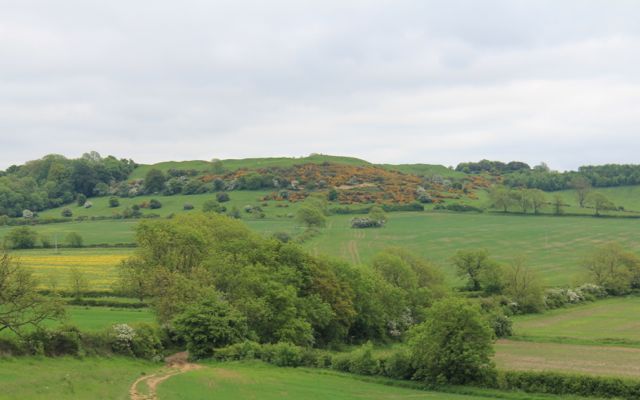
Iron Age hill fort, with the toposcope just visible.
We continue in the same direction climbing gently on this very rutted track, then more steeply through gorse bushes to the top with its great views.
Almost there
The view's a bit hazy, and the sun hasn't emerged. It keeps half-appearing, but it's almost 5pm when we arrive.  The toposcope is 690 feet high.   We have to bag the trig point at 210 m as well.  An online converter tells me this is 689 feet. 

A satisfying end to one of our longer days!  Now it's downhill to the car.


Monday, April 8, 2013

Twyford - Thorpe Satchville - Ashby Folville - Twyford


Mon, 2013 Apr 8 9:39 AM Western European Time 
Led by Barry, with Maureen, Gordon , Eddie and me. Fine, no sun, coldish, not very hilly, dry underfoot. Just over 6 miles.

We park near the church in Twyford and take advantage of the benches in the porch to get booted up for the walk. We take Hollands Lane out of the village, following a clearly marked footpath, through some trees, across a field or two and a disused railway line. We have a few minutes diversion rescuing a lamb which had wrapped its leg in fencing wire.  It hobbles off and joins its mother.  Fingers crossed, we hope it recovers.  
Then we continue along the path until we meet a bridleway - this isn't hugely clear, but there are signs on the marker post. We turn sharp left - the bridleway goes diagonally across a large field, but we walk down the hedge until we can see the waymarker. We walk across a couple of fields with the stream below us to our right. 
A 'lion' in wait
The bridleway takes us to a point where the road and disused railway meet. We take a path on the opposite side of the road and slightly to our right.  This climbs up towards the village of Thorpe Satchville, which sits on the ridge.
Thorpe Satchville
The photos from now on look as though we've travelled back in time - I forgot to change the setting when I switched from "auto". 
One of the few slopes in today's walk.
Eddie waits by the gate
Here they are.

We make a short detour to say hello to Thorpe Satchville church
then walk past a large house with a mini-haha.  At this point we're following the Leicestershire Round for a mile or so, towards Ashby Folville.   This goes under the disused railway, and clearly marked over several fields.

We leave the Leicestershire Round  shortly before the village to take a lower path to the road. 
The church is to our right.
Ashby Folville church
 We turn left along the road towards Twyford, and turn off to the right at a farm road and bridge over the Gaddesby Brook. This is part of the Midshires Way.   We take a break here, before leaving the Midshires Way, and instead we walk along the public footpath to Twyford.  Again it's clearly marked and easy walking, although at one point there were seven or eight stiles in quick succession - not quite a hurdles course. 
Then a pair of sheepdogs come out to greet us, and decide they're not obliged to herd us after all. They disappear after scent-marking a gatepost, and looking at us - challengingly?
We emerge next to the farm, and find a convenient bench, dedicated to Thomas Holland's 100 years in Twyford in 2005.  He died in 2009 - we later spotted his grave in the churchyard.
Not long before we're back at our starting point - a very pleasant six miles and a whisker.