and occasionally rides a bike.
A word of warning. The walk descriptions are not detailed enough to guide you - please take a map. The batteries never run out, and you always have a signal. Oh, And don't take left or right as gospel!

Showing posts with label Saddington. Show all posts

Wednesday, August 11, 2021

Gumley, Saddington, Smeeton Westerby, Foxton Locks

 Thursday 05 August, with Eddie. 7.5 miles, 450 feet of up and downery.


Met Eddie at 9.30 at Gumley. We walked uphill through the village, past their free library phone booth with its window box,

then past St. Helens church,

keeping Gumley Wood on our right, to cross a minor road. Through this unusual stile

and on through the fields following the Leicestershire Round to the high point with a memorial seat with a fine view.


It was downhill briefly, past Saddington Reservoir,

and up the steepish slope to Saddington village. We continued on the LR past Loafabout Cottage, with its inviting seat. 
Then our route took us through a flowery ginnel, jitty or snicket.


We left the LR at this point, turning right by a farm with lots of old vehicles, claiming to do property repairs… The footpath took us through a field where the two sheep seemed like hand-reared pets.

Their reaction to humans was “Let’s see if they have something for us.”  
For a few hundred yards we walked on the Smeeton Road, crossing the canal bridge, then taking a footpath to our left, climbing gradually to a track marked as Mill Lane and into Smeeton Westerby (once two separate villages). 
We turned right down Debdale Lane, a surfaced track, which leads past Bridge 67 Farm and also promises a cafe (Carma’s Cafe - a pop-up mobile one, not open until Saturday) This track goes to the Grand Union Canal, slightly north of Debdale Wharf. 


We turned right and followed the towpath to Foxton Locks - coffee or beer and a cake.  
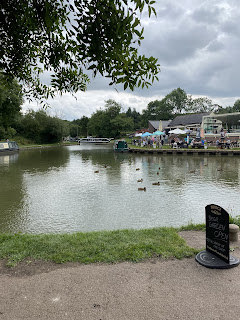
Then we just had to walk to our right over the bridge above the bottom lock and follow the footpath to Foxton Road, where we turned right and did a final climb back to Gumley. 

Thursday, October 18, 2012

Gumley circular

Led by Barry - with Gordon, Maureen and me. Fine and sunny, very wet underfoot in places. Very rolling - great views. 7.6 miles.  

Covering some of the ground of this walk on 21 Nov 2011, but this time we could see the views.
Some overlap with this walk on 8 October 2012   as well.


We set off from Gumley, and took the footpath opposite the telephone box.  This path heads south-west.  Just before Gumley Lodge we turned  west crossing several fields before arriving at a small road close to Laughton.  We crossed the road and followed the footpath into the village.  A token sit on the bench - to check the map - and then through the village and past the church.
Laughton church and 'cob'  wall
Crook House (cruck house?)
We followed the path to the west after the church, downhill towards Mowsley, over a brook, and up hill, across a lane and into the village by the church and the old school.
Mowsley church
At a bend in the road we took a path between buildings, and when it reached a field we took the right hand footpath. This led downhill, crossed another field and a stream.  and headed north along field boundaries, clearly marked.  We found a sheltered spot, with trees,  where the ground was not too boggy and had our first break of the day. 
The track led more or less north until we reached a junction near Saddington Lodge Farm.  Here we turned right and headed north east towards Saddington village.
They took the longer route - I went direct. Luckily the boots proved fairly watertight.
In Saddington we went past the church, the riding school and the pub.
View of Saddington Reservoir from the pub
A little further along we turned right along the Leicestershire Round path - 1 and 3/4 miles to Gumley. Through the long thin field where there is usually one horse, then over the three bridges and up the hill where cows were grazing today.

At the top the views of the reservoir were excellent with no crops to block them.
Saddington Reservoir
Not the memorial seat . . .
The flat high level path is one of my favourites in the area.  We continued to the memorial seat to Mary Hodgkin -the  ideal spot for a second break.
Views to the north east - maybe Church Langton? And Charnwood hills in the distance.
From the seat at the high point of the path we carried on along the Leicestershire Round path, across Debdale Lane and into Gumley past the church. 
A shortish walk, but quite hard going - hills and mud underfoot.


Map and details

Monday, October 8, 2012

Foxton - Gumley - Saddington - Laughton - Foxton


Led by me, with Barry and Gordon. Weather dry but grey - some mud underfoot. Views a bit hazy. 8.7 miles.

We parked at Foxton Locks long-stay car park, and began our walk by following the path to the Locks, this time visiting the inclined plane on the way down.
The grey shape is a heron making its getaway.
Info about the boat lift
 "An effective means of transport from all centres to the sea" Richard Baldwin
Grid reference SP 896693
Height above sea-level 125m/410ft
Figures below place names indicate number of locks 
on route and travelling time by boat.

The inclined plane

CAUTION - do not climb on this boat.
"I can remember the big wheels with wires around them, and the big chimney with smoke coming out of the top.  I thought that when we went down the tank would tip and the water splash out. I  think mother was afraid too, but we went gently down, the other tank passing us halfway; it took just over five minutes."

Mrs Daisy Dainty talking about when she went on the Inclined Plane Boat Lift in 1909.

From the bottom lock we crossed over Bridge 62, and walked along the tow-path as far as the footbridge. We turned east towards Gumley and followed the same route as here, all the way to Saddington.


There were wide, though hazy views today - hence no landscape photos.  When we reached Saddington, we turned left along Main Street past the pub, and turned left into the Riding School, just before the church.  

We joined a track/driveway and followed this as far as the Mowsley Road.  We crossed and took the footpath opposite.  The hedgerow was well-supplied with blackberries.  Our path headed south and took us into the valley where we crossed Saddington Brook via a footbridge, and then walked with Mowsley Brook on our right.
A couple of hundred yards or so along, we took a clearly marked footpath uphill to our left, and used a redundant stile as a seat for our snack break, before walking the few extra yards to the Mowsley Road which goes along the top of the ridge.  A right turn and a short distance took us to a bridleway on the left of the road.
The path turned almost due south and was clearly way-marked most of the way, though we strayed slightly joining a track which took us up hill to the village of Laughton (pronounced Lawton). 
The view from the bench

Time to move, guys!
We continued a short distance along the road, and found the turning on the left.  Our path veered off to the left from the track, through a stile in a hedge, and past a pond near the Mill Mound.  We had no problem following the route as it took us to the highest point of the walk, at 168 m (562 ft) just by a T junction.  We crossed the road and took a footpath which heads north east, quite steeply downhill before swinging a little more to the east and quite steeply downhill towards Gumley Lodge.  Just past the house we turned right, hugging the hedgerow, then up gently to meet a small road towards Theddingworth.  We turned left for a few yards, then took a footpath which cuts off the corner and took us to the Foxton Road. We turned right and followed this for another half mile or so back to the car park. 


Map and details

Thursday, August 16, 2012

Saddington - Arnesby - Bruntingthorpe - Shearsby - Saddington

Just outside Saddington - not on our intended route

Saddington church


Arnesby village
Arnesby church (St Peter)

rolling the straw?
between Bruntingthorpe and Shearsby


Shearsby
So . . . write up to follow.

Map and details

Monday, November 21, 2011

Laughton - Gumley - S. Westerby -Saddington - Mowsley - Laughton

Barry led. With Gordon, Maureen, Eddie.  9.4 miles.  Misty, not too cold. 49 stiles.


A pause while we regroup, just after Debdale Grange . . .


The Grand Union Canal


you can just make out Saddington Reservoir from the churchyard.


Eddie breaks the 'world record' as he climbs the 30th stile of the walk.


Applause as a new record is set - it now stands at 49! 


We can climb stiles as well.


the sun almost came out.


There are not many recognisable views here. The mist lifted a bit as we left Laughton. 


Map and details 

Thursday, July 28, 2011

Saddington - Smeeton - Debdale round

With Maureen, Barry and Gordon. 8.5 miles approx.  Three and a half hours including pauses. Weather sunny and warm. 


We started from Saddington, and walked along the Smeeton Road to Bridge 72. I intended to take a footpath for part of the way, but we didn't notice it as we passed it.  Then along the canal and over Saddington Tunnel, 
North western end of Saddington Tunnel


descending to the tow path on the left of the canal.  We left the tow path at Fleckney Bridge, where we used the two hand gates and crossed the bridge, taking the path through Mill Field Wood at right angles to the canal here. 


By the Mill Field Wood millenium stone


Past the MM stone and across the fields to the Kibworth-Saddington Road, and over into the mud and gravel track which becomes Mill Lane just before entering Smeeton Westerby. 
We turned right into the village centre, then left at Debdale Lane.  We followed this past Bridge Farm and Bridge 67 cookery school. 
This ad was on an old container-cum-shed near the cookery school. I googled and it seems it has now gone out of production to the chagrin of many cooks.


 Through a farm gate and we followed the track uphill until we reached the canal. Just before the gate and stile we found an inviting patch of shade for a snack and water break.


At the canal we turned left toward Foxton, passing the large narrowboat yard at Debdale Wharf, under a couple of bridges. 


Fine display in a boat garden.


 We crossed the first footbridge over the canal.  We took the path along the right-hand edge of the field, and across another, past some farm buildings and uphill thorugh a field where they may or may not have been a bull - there was certainly a herd of creamy and white cows, along with a lone horse.


The path led uphill with Gumley Wood on our left, across rolling countryside - the hilliest and most scenic part of the walk was saved until the later stages.  We crossed the small road from Gumley to Debdale, a little way short of the junction. A brief walk through thistle and butterfly country cut off a corner, and we crossed the road from Gumley to Smeeton.


Thistle and butterfly country


The path is a track between two hedges, then turns right to follow the edges of fields, clearly marked and climbing gradually, until, just before Smeeton Gorse, the Leicestershire Round path from Gumley joins our path. A short steep climb over grass leads to the highest point, with good views and a strategically placed bench.  (To the right of this is HIll Farm, Smeeton Hill, according to the map.) We followed the Leicestershire Round path along the 'ridge' then downhill , crossing two footbridges and going through a number of stiles before climbing to Saddington where we emerged along an enclosed path into the village, directly opposite the well-hidden footpath sign I missed at the start of the walk.


Map and details