and occasionally rides a bike.
A word of warning. The walk descriptions are not detailed enough to guide you - please take a map. The batteries never run out, and you always have a signal. Oh, And don't take left or right as gospel!

Showing posts with label Noseley. Show all posts

Thursday, October 3, 2019

Goadby, Cranoe, Glooston, Stonton Wyville, Noseley

Thursday 26 September, with Harry and Eddie. A slightly more rolling terrain than of late, but the highest point is no more than 520 feet above sea level. Just over 9 miles. 

We walked out of Goadby along the road to Cranoe and Glooston, turning off to the left just after Pine Tree Stud, and walking along a rougher track going uphill towards Hallaton.

At the high point we turned right along the Midshires Way (and Leicestershire Round) and reached the road a couple of hundred yards outside Cranoe. We turned away from the village and took the quiet road to Glooston.
At the crossroads we went straight on, passing the pub and the church, hidden away among the trees close to the village hall. 

Then it was across the fields to Stonton Wyville.  We missed the turning here, but found our way back on to the minor road. 
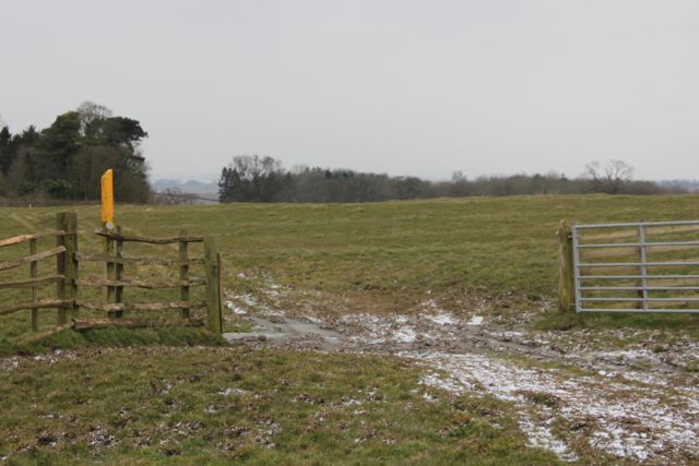
Too late with the photo, but this was how we reached the road.
The road becomes a track, then footpath, then bridleway. When we met the bridleway we turned left heading downhill to a stream, then up (over a large and luckily dry, ploughed field) towards the edge of Noseley Wood.


Through some parkland and fields, and along a farm road past Noseley Hall, which is secluded and hidden by trees, and we eventually arrived at The Avenue, the road which goes down gently past the entrance to the hall, then Nether Cottages. We stayed on the road until we came to Goadby Hill, where we turned right and climbed up to the village. We made a small detour to visit the church, one of several in the area with an open bell tower.

An impressive carved chair in Goadby church.

Tuesday, April 4, 2017

Skeffington, Rolleston, Noseley

With Maureen. Thursday 23 March, 10.20 am. 7.4 miles.  Followed the same route as we walked on March 6th with Norma.Weather good, but there's still a wind.


The horse chestnuts are about to produce leaves and flowers.

Lambs in plastic coats against the cold. 
Ready for the rest of the walk!

A thatched human on the roof

fox among the  . . .


Monday, March 6, 2017

Skeffington, Rolleston, Noseley

Monday 06 March 2017.  With Norma.  About 7 1/2 miles. Muddy paths to begin with and a couple of recently planted fields, but could have been much worse. Weather was fine with some sun, and some wind.

We parked on a quiet avenue parallel to the A47, and walked a hundred yards or so down a   cul-de-sac, before taking a footpath on our right, then leading south past a very large house and into fields. 
Snowdrops are still in bloom in shaded areas.
 The path continued south towards Skeffington Vale, then turned slightly west, crossing a stream and a couple more fields, where the yellow waymarker posts were very helpful, before coming out at Rolleston Hall, close to an area where horses were being trained.

When we reached the estate road we turned left and followed it past the lake and along a bridleway heading toward the road between Goadby and Noseley.  Most of the way the path was easy to follow, over fields and then into a wooded area. After this the bridleway became rather muddy as it led down to the road.

 We took a right turn on the road, and walked for about a mile, passing the entrance to Noseley Hall, and then going up slightly to Top Lodge. We had a short break in the sun here, before taking a turning to the right, heading northwest. 
This clump of trees is called Millfield Clump - a house, a sacred grove? Who knows?
A little further on there is a small wooded area on the right, as the road bends to the left, heading almost due west.
When we reached the B6047, at the entrance gates to the Rolleston Estate, we turned sharply right (northeast now), and followed the avenue of trees. Some of these horse chestnuts are just beginning to show signs of life.
We saw a fair amount of damage - I guess Doris is to blame again.
 As we approached Rolleston Hall itself this fine carriage and four gleaming high-stepping horses drove by, with a small Jack Russell leading the way.
 We followed signs to the gated road to Skeffington and followed this route back to the start.
Dramatic lighting over the old stable block
 A straightforward walk from here, with snowdrops along the way.  the carriage and four passed us again, with the dog still gamely trotting ahead.

the occasional watery reflection

and some rather fine gardens in the village, including the crocus display above.


Glad to have had a walk in this part of Leicestershire again, and in such agreeable weather too.

Monday, March 3, 2014

Skeffington - Rolleston - Noseley - Skeffington

Mon, 2014 Mar 3 9:26 AM GMT
Led by Barry, with me and Gordon. Mostly road walking as ground is still wet, and bridleways are hoof-battered in places. About 8 miles in fine sunny weather. Warm in places too! 642 feet of climbing.


We walk through Skeffington and past the church to the village green with the circular seat. Here we turn left along the Gated road to Rolleston.  The road heads south downhill past Vale Cottages, further down and across a bridge over a stream.  The second gate we meet takes us into the Rolleston Estate, with its posts along the road verges, and recently planted trees to form an avenue.  Lots of horses and horse jumps - we see a four horse carriage practising on a nearby field.


We carry on towards the hall, taking the road signed to New Inn. Just before we meet the bigger public road our route turns sharply to the left, still within the Estate.  We follow this to Top Lodge, where we turn left along the Avenue, past the entrance to Noseley Hall to our right, past Nether Cottages (with the date 1937) on our left, and then past the turning to Goadby on our right.  


Soon after this our path leaves the road and makes its way uphill between two hedges on our left. As the bridleway has been very much used by horses we walk up on the other side of the hedge and manage to regain our correct route nearer the top. Through a muddy gate and we're in open country - not bad underfoot, and a good view.
Sunny and sheltered - time for coffee and cake? 

We head downhill to the yellow marker post, then cross a bridge and follow the bridleway which turns into farm track and takes us without much trouble back to Rolleston. This time we pass the lake.
There's a path to Tugby off to the right. Not ours. We stick with the Estate road until it bends round to the left. Our original plan is to take the footpath off to the right - but we turn back after a short distance, put off by yet more muddy fields. 

Instead we follow the gated road back to Skeffington, retracing the beginning of the walk. Although inevitably this goes uphill,  the ending is less strenuous than Thursday's walk.

Map and details

Thursday, April 4, 2013

Goadby - fig of 8 via Noseley and Rolleston


Thu, 2013 Apr 4 9:32 AM Western European Time 
Led by me, with Maureen, Barry, Gordon and Eddie. Chilly - even some light snow at the start. One glimpse of the sun in the last half-mile. Underfoot mainly firm, but with muddy patches. Just about 9 miles in all.

We take the minor road towards Glooston and follow it as far as Glooston Lodge Farm with it sign warning of "free range children and animals".   we turn right next to a big barn where a farmer is transporting bales of hay to feed the cows which are still indoors this year.

The path is clear, for a while, then goes uphill across a field, where we aim for the pylons, and then the waymarker to our right.  At this point we find ourselves a little too far over to the left , and have to retrace our steps along the stream to find the footbridge. 

After this it's more or less a case of following the waymarkers,  through the edge of Noseley Wood,  and then through fields to a metalled track, and across a couple more fields to the road.   There's still snow around, and mud or water under a covering of ice at many of the gates.


 When we reach the road we turn right and pass the fine gates and drive to Noseley Hall - there's a sign to the cookery school which is run there.


 We follow the road past the right turn to Goadby, and turn left along a footpath between hedges leading uphill.  The wind's pretty fierce, but we cross another field into some more woodland and find a sheltered spot for a break.  Our path continues until we meet a clear track which takes us past Rolleston Lake.

We carry on for another quarter of a mile or so to Rolleston Hall and church.


Back along the same route, past Goldsmith's cottage, until we meet the footpath to Tugby.  This goes alongside Pop's spinney, through a field where the farmer has just brought some sheep and lambs.  We follow the yellow posts towards Tugby, but turn right before we reach the village.  Our way lies past Lake House Farm, and out to the road from Tugby.  We take the road directly opposite the footpath, which leads us along a gentle flat half mile or so back to Goadby.
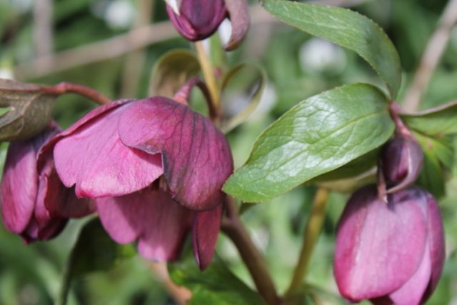
Hellebore flowering by the roadside in Goadby