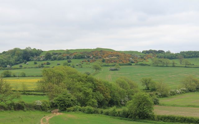
We meet at Burrough Hill, and drive to Rearsby to start the walk. We cross the pack horse bridge into Church Lane.
The path winds round to the right of the church past a slightly dodgy-looking wall.
We come out on to Church Leys Avenue, and turn left between two houses after number 22. The path is clearly marked as it crosses grassland and comes out behind the convent.
We walk past splendid flowering horse chestnut trees in grassland. Then we cross the road, and turn left at no. 7 Wreake Drive. There's a double stile, and we cross the ridged and furrowed field to the railway crossing. We carry on in the same direction towards the old mill.

 |
| Part of the old mill house - a lot of work being done. |
We follow the waymarkers, turning right from the drive to the mill, and making for Lodge Farm and Hoby church spire.
 |
| These trees may belong to Brooksby Agricultural College. |
 |
| We walk through this bumpy field - and I know there's a bench ideal for a break here. |
We wander through Hoby churchyard, with its stump cross and sundial on top.
 |
| a little the worse for wear with bird droppings. |
Almost opposite the church we turn down Back Lane, and the left behind a row of cottages. The path we want turns right and downhill through trees. We cross various small bridges, where a mill used to be, and a long footbridge over the Wreake.
We head towards Rotherby and cross the railway line again. Just before we reach the village, we turn left to the north east, and walk through three fields, then come to a T junction on the minor road. We walk parallel to the road to Frisby on the Wreake for a little distance, then move slightly left, past a bumpy pasture with horses.
We can see Frisby's church spire, and the waymarkers are clear. We emerge between houses close to the market cross.
The Bell Inn is opposite, and we're beginning to think it could be lunchtime. Ah ha!
Unfortunately the pub's just changed hands, and won't be open until July. Maybe they should hide the blackboard better. We drop into the post office, but they haven't got much in the way of food. On to Gaddesby it is - another two and a half miles. Well, it's only 12.30 now.
A lot of houses in Frisby are pretty old and being restored.
. . .
or repaired. We head out and turn left just past these houses. The path in the fields climbs quite steeply. We decide we'll have a banana to keep us going, but we'll get to the top first. When the land flattens out we reach the Leicester to Melton Road and another stump cross.
 |
| so little colour in the sky ! |
We cross the road and walk through the clear paths in the fields, some pasture, some arable.
 |
| Some sheep are nosy |
 |
| Distant blue mountains of Charnwood |
 |
| The local tribe must favour spring fires |
 |
| The way ahead is clear - not this way anyhow |
We turn into the village for a well-earned lunch at the Cheney Arms in Gaddesby - baguette, salad and crisps and a J20 for £7.50. It's filling too.
The church caught our eyes as we arrived, so we take a little time to look around and inside.
 |
| There seem to be two or three different styles on the outside |
 |
| The archway leads to Gaddesby Hall next door - a huge building with beautiful gardens |
 |
| This is a statue of Colonel Cheney who fought at Waterloo. Four horses died under him, and he rode away on a fifth. The statue was moved to the church from Gaddesby Hall when it was sold in 1917, and is claimed to be the only equestrian statue in an English church. |
We return to the Leics Round route, turning left as we come out of the churchyard. When we reach the blocked gate we turn right and cross a field down to a stream, then cross the Midshires Way, and see Mill farm with its disused windmill - no sails - on our right. We have no problems with map or waymarkers and pass Pool House. We cross the road and leave Ashby Folville on our right, though the church is visible through the trees.
A mile or so later we go under the bridge where the dismantled railway ran, and turn uphill to Thorpe Satchville, behind the Hall, with its low haha wall. The church, with its bench, offers another convenient coffee stop. Not far to go now. We've done about 12 miles. (Note - my garmin says 13, but it went a bit wild in Gaddesby church. It doesn't like the thick walls.)
 |
| If it looks so weathered after 13 years, I wonder what state it will be in after a thousand. The South Pole is 9845 miles away, and the North Pole a mere 2585. |
From here the way is very straight forward, about three quarters of a mile along a small road called Bakers Lane. When we reach a crossing of four ways we take the right hand path and follow it downhill to Melton Lane. Burrough Hill is in sight.
 |
| Iron Age hill fort, with the toposcope just visible. |
We continue in the same direction climbing gently on this very rutted track, then more steeply through gorse bushes to the top with its great views.
 |
| Almost there |
The view's a bit hazy, and the sun hasn't emerged. It keeps half-appearing, but it's almost 5pm when we arrive. The toposcope is 690 feet high. We have to bag the trig point at 210 m as well. An online converter tells me this is 689 feet.
A satisfying end to one of our longer days! Now it's downhill to the car.