and occasionally rides a bike.
A word of warning. The walk descriptions are not detailed enough to guide you - please take a map. The batteries never run out, and you always have a signal. Oh, And don't take left or right as gospel!

Friday, November 10, 2017

Sywell Reservoir and Country Park

Tuesday 07 November 2017.
With Marta, 3 miles. 
I had to finish a Scrabble game, so we didn't meet until 10 am! The weather promised rain later, and I was happy to do a short stroll after yesterday. 
Sywell Country Park is near Sywell and Mears Ashby. 

We had a coffee before starting, then walked along the reservoir path anti-clockwise. There is a lot of conservation work, and cutting back of vegetation in progress just now. The text below talks about how beavers used to maintain wetland - "Sadly the Rangers and volunteers won't be able to chew through trees ..." But they're doing their best in other ways.

Plenty of wildfowl

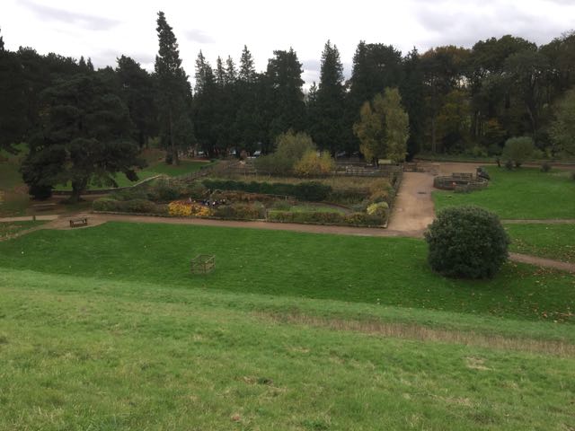
This is a butterfly and insect garden

On the way round we chatted to a man aged 90, who was out for his daily walk. An example to us all.

Wednesday, November 8, 2017

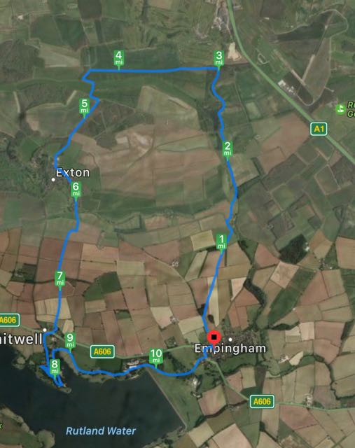
Empingham, Fort Henry, Exton, Whitwell

Monday 06 November, 9.30 am.  With Maureen and Eddie.  Beautiful weather today., after the early frost had melted.  10.78 miles.
Same route as last Thursday.

Along Exton Road, opposite Church Street.  Take second footpath on the right, by a bench.
Keep the woodland on your left, then cut across the field to a stile, and diagonally across the next field. Continue in the same direction and go downhill towards Horn Spinney. There's a stile with a gap beside it, then walk through the spinney and over a real stile.

 The path climbs the shoulder of the hill then down and over a ladder-style stile to the road opposite Horn Mill. Turn left and walk up to the next footpath which goes off to the right.  As we pass the trout hatchery we see the trees of Pug's Park Spinney to the right.
The autumn leaves are still holding on.

A bit of extra exercise
 Follow the path, and climb the stile, head for the bridge over North Brook, walk with Pug's Park Spinney on your right, the gradually downhill toward Lower Lake and Fort Henry Lake.
The sheep on the right is wearing a crow as a hat

Fort Henry
 Take the path to the right of this lake and follow it through woodland and alongside arable land until you reach a flight of steps.
A flight of steps before we turn left
Turn left along an estate road. When the road bends to the left, your path continues straight ahead. After about a mile it meets the Viking Way at a T-junction. Turn left and head south west (with a few dog-legs) , following the Viking Way alongside Tunneley Wood, past the private RC Cemetery and into Exton village.

This may be the Old Pump House. The building in the background is the old school. 
Today we took the road on the left which goes past the present school (Exton and Greetham), then turns into a footpath which takes a slightly roundabout route to the junction with the road to Empingham.


Cross the road on to the well-marked footpath to Whitwell. This comes out in the car park behind the Noel Arms. Cross the A606 and take the footpath up past cottages and the church, then follow the road to Whitwell car park on Rutland Water.
A  better day for photos!

Whitwell church in the sun!
View from the cafe
Worth a coffee stop!  Then we followed the waterside path round to Sykes Lane, pausing to admire The Great Tower, which I always want to call Symphony in C, probably because of the words on the plaque! Hmm.
 The great tower
by Alexander 1980

Mankind is capable of an awareness 
that is outside the range of everyday life.
My monumental sculptures are created 
to communicate with that awareness
in a way similar to classical music
just as most symphonies are not intended
to be descriptive so these works do not 
represent figures or objects

Alexander
It's big - 31 feet high.
We had a look at the beach - not very sandy, or very tempting in the cold weather though.
Then we followed the footpath from the near end of the dam alongside the fence, across a field and through the wood back into the village of Empingham.

Thursday, November 2, 2017

Empingham, Fort Henry, Exton, Whitwell

Thursday 02 November 2017. With Maureen, as a recce for next week.  Just under 11 miles. Grey, but dry, and not cold for walking.


From Empingham, we took Exton Road, across the main road from Church Street. 
Ignore the first footpath sign to the right and continue up the gentle hill to the second footpath, also on the right, where there is a bench.  A well marked footpath heads slightly east of north with a wooded area on the left. At the end of the woodland the path cuts across the next field, through the hedge and diagonally over another field. Look for the stiles and waymarkers here - if the field has been ploughed you could go round the field edge. The path continues in the same direction and soon goes gently downhill towards Horn Mill Spinney. A short walk through the spinney, and the path climbs the shoulder of a small hill before going down to Horn Mill itself. The trout hatchery here attracts visiting ospreys in spring and summer, and I think it's possible for a fee to take photographs of them fishing.

At the road turn left and walk uphill for a short distance, then take the first footpath to the right and follow it over a bridge across North Brook, then alongside a wooded area called Pug's Park Spinney. the path leads you to Lower Lake and over an estate road to Fort Henry Lake.
Swans, coots, and noisy Canada geese


We continued along the footpath beside the lake (heading to Greetham), but turned left at an estate road just after a flight of steps.
Trees are still dressed in autumn colours
We followed this path for around a mile, to a T-junction where it meets the Viking Way. We turned left here, and spotted a suitable tree to lean our backs against while we had a break and devoured a couple of sandwiches.
Silly photograph time.


Then it was a question of following the Viking Way into Exton, via the estate yard.


We went through the village to the junction with the road to Empingham, crossed this road to the Viking Way footpath just opposite the junction and followed the footpath south, then round the edge of the field ( a right turn to the west) before heading south to Whitwell. The path emerges in the car park of the Noel Arms.


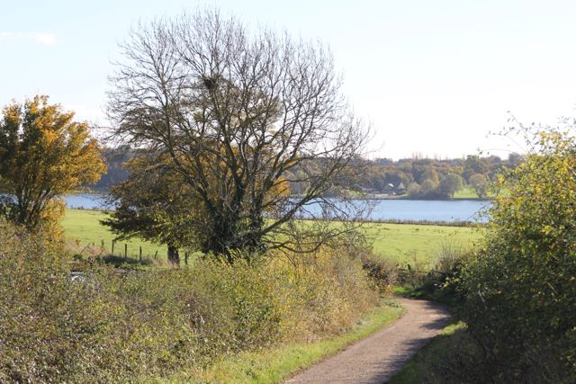
We crossed the A606 and made our way past the church towards Whitwell car park, where we had a coffee in the Crafty Fox cafe, before following the waterside track to Sykes Lane and then the Rutland Round track over the fields and through the woodland and into Empingham.


Tuesday, October 31, 2017

Hambleton peninsula - anticlockwise

Monday 30 October. With Maureen, Marion, Norma and Eddie.  Just over 5 miles. Decent weather.

We walked the northern side of the peninsula first this time.  There are more benches on the other side - just the job for a scone and drink break.

Wot? Another photo call?


She's still looking out for someone? something?


Eddie has been calculating the ages of the people named on the benches!


Lunch at Wellies.

Afternoon wander - Burghley Park and Stamford

Sunday 29 October.  With Harry - around 3.5 miles. 
We wanted to be out in the sun, and hoped we might collect some chestnuts. Other scavengers had been there before us.
This parkland around Burghley House is within easy reach of Stamford on foot, and well used by walkers, cyclists and people wanting a breath of air.


Reflections in the Welland at Stamford

Lion Bridge


Monday, October 30, 2017

Hambleton peninsula clockwise

Friday 27 October 2017

With Harry, on foot. Almost 6 miles.


Hambleton peninsula, along the waterside track clockwise. This meant walking the flatter part first.
The weather was beautiful and there were quite a few people out, walking or cycling. Lovely to see family groups with young children tackling the ride.