and occasionally rides a bike.
A word of warning. The walk descriptions are not detailed enough to guide you - please take a map. The batteries never run out, and you always have a signal. Oh, And don't take left or right as gospel!

Monday, October 8, 2012

Foxton - Gumley - Saddington - Laughton - Foxton


Led by me, with Barry and Gordon. Weather dry but grey - some mud underfoot. Views a bit hazy. 8.7 miles.

We parked at Foxton Locks long-stay car park, and began our walk by following the path to the Locks, this time visiting the inclined plane on the way down.
The grey shape is a heron making its getaway.
Info about the boat lift
 "An effective means of transport from all centres to the sea" Richard Baldwin
Grid reference SP 896693
Height above sea-level 125m/410ft
Figures below place names indicate number of locks 
on route and travelling time by boat.

The inclined plane

CAUTION - do not climb on this boat.
"I can remember the big wheels with wires around them, and the big chimney with smoke coming out of the top.  I thought that when we went down the tank would tip and the water splash out. I  think mother was afraid too, but we went gently down, the other tank passing us halfway; it took just over five minutes."

Mrs Daisy Dainty talking about when she went on the Inclined Plane Boat Lift in 1909.

From the bottom lock we crossed over Bridge 62, and walked along the tow-path as far as the footbridge. We turned east towards Gumley and followed the same route as here, all the way to Saddington.


There were wide, though hazy views today - hence no landscape photos.  When we reached Saddington, we turned left along Main Street past the pub, and turned left into the Riding School, just before the church.  

We joined a track/driveway and followed this as far as the Mowsley Road.  We crossed and took the footpath opposite.  The hedgerow was well-supplied with blackberries.  Our path headed south and took us into the valley where we crossed Saddington Brook via a footbridge, and then walked with Mowsley Brook on our right.
A couple of hundred yards or so along, we took a clearly marked footpath uphill to our left, and used a redundant stile as a seat for our snack break, before walking the few extra yards to the Mowsley Road which goes along the top of the ridge.  A right turn and a short distance took us to a bridleway on the left of the road.
The path turned almost due south and was clearly way-marked most of the way, though we strayed slightly joining a track which took us up hill to the village of Laughton (pronounced Lawton). 
The view from the bench

Time to move, guys!
We continued a short distance along the road, and found the turning on the left.  Our path veered off to the left from the track, through a stile in a hedge, and past a pond near the Mill Mound.  We had no problem following the route as it took us to the highest point of the walk, at 168 m (562 ft) just by a T junction.  We crossed the road and took a footpath which heads north east, quite steeply downhill before swinging a little more to the east and quite steeply downhill towards Gumley Lodge.  Just past the house we turned right, hugging the hedgerow, then up gently to meet a small road towards Theddingworth.  We turned left for a few yards, then took a footpath which cuts off the corner and took us to the Foxton Road. We turned right and followed this for another half mile or so back to the car park. 


Map and details

Friday, October 5, 2012

Leics Round 1 - Foxton to Bruntingthorpe

With Marta. Grey, but no rain. Chilly wind. Muddy in places. Lunch at Fleckney. Almost 10.5 miles.
Lock Keeper's Cottage Café Foxton
A great start to the day was coffee and a slice of fruit cake at Foxton Top Lock before we walked down to the canal towpath at the bottom of the flight of locks,  and our official starting point for the Leicestershire Round.


We walked over Bridge 61 and turned along the tow-path north, away from the Locks area.  After a few hundred yards we crossed the footbridge, with its Leicestershire Round waymark and headed across the fields towards Gumley with  the church spire and the tower of Tower House visible in the woods.
The path climbs up to the village and leads on to the Main Street, where we turned right and walked up past Tower House and St Helen's Church.


We took the path by the church and near the wood, across a couple of fields to Debdale Lane. 

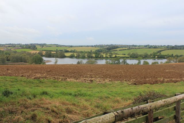
We crossed this small road, going downhill quite steeply, then up again by a small wood called Smeeton Gorse.  We arrived at the top of Smeeton Hill, where there is a bench.  Today the views of Saddington reservoir were much clearer than in summer.  The reservoir and channels were built to feed the canal.


A little grey, but lovely rolling countryside around Saddington.   And yes, we had to go up to the village.

After going through Saddington we mad our usual mistake and ended up a little too far  north, coming out near where the road forks to Fleckney on the left and Kibworth on the right. We walked a little way back to pick up the Leicestershire Round across afield to a gate part way along the hedge.  From here you can see a clump of trees, hiding a pond.  We made for the left hand side and then for the corner of the houses on the edge of Fleckney.

We decided it was lunch time, and walked an extra mile and a half or so to the Crown in Fleckney.  

We returned and picked up the track we needed which turns southwest at the corner of the housing, and heads upwards.  Once we joined the hedge we walked with this on our right for a while, and then on our left as far as the next road.

We crossed the road and walked straight ahead on a minor road for a short distance before turning on to the footpath to the left.  For most of the way ahead the path is fairly clearly marked, and took us through various fields with cows and horses, before climbing up past New Inn Farm, and on to the A5199.  We crossed this and walked along for a short distance to the road into Shearsby.
Shearsby church seen from the A 5199

perched on a hill
At Shearsby we took time for a mini-break, and a chat to a couple who have walked the Round before. There are convenient benches on the wide roadside verge.
We walked through the village, along Back Lane and Mill Lane and past some cottages which look like the model for a jigsaw puzzle.
Just outside the village the Leicestershire Round path turns right into a field.  We kept close to the hedge - it is the route, and kept us from disturbing the cows too. The path here was fairly muddy.   In the next field we kept the hedge on our right, and turned slightly left when we came to a small wooded area.  After this spinney, we crossed the hedge, which was now on our left. We went gradually downhill, and passed more trees on the left, before crossing a very big field - the line is marked by the signs.  In the next field, the path follows the hedge and joins a clear farm track alongside another two fields, before curving to the left and leading into Bruntingthorpe via Little End.  
1716 Tithe Barn in Bruntingthorpe


Next leg's starting point.


Map and details

Thursday, October 4, 2012

Sawtry- Steeple Gidding - Little Gidding - Sawtry

Led by Barry. With me and Gordon. Weather sunny, strongish W wind. One point where I'd switched off Garmin. Just over 10 miles.

We parked at the end of St Judith's Road, at the bottom of a grassy hill where several dogs were being exercised.  We set off upwards - it's not too high - I notice our maximum elevation was 225 feet, but, as we were on the edge of the fens, this is a mountain.
High enough to offer wide views of the countryside.
yup - going up!
The wind was chill, but we soon warmed up. A couple of butterflies seemed to be enjoying the sun too.


We walked alongside Aversley Wood and turned right at the top, along the Bullock Road track. 

 A dog-walker had recommended that we should look among the trees for a "star pond", a pond specially built so that bullocks being driven to market all had access to drinking water.  No water there now, but the shape of the channels can be seen near the corner of the wood.

We returned to the Bullock Road and followed this north-west for about half a mile, turning left, south-west past some farm buildings.  The way zig-zags a little, before heading uphill, still south-westwards, then diagonally across a field. We headed to the left of a group of trees to a gap in the hedge, leading on to a T junction.
Gap in the hedge and signposts for T-junction.
Our way was straight ahead along the minor road to The Giddings
Where the road bent to the right we turned left along a footpath, following the waymarks round three sides of a square, past a pond and the evidence of old buildings on the ground - the remains of the medieval village.
Plan of Steeple Gidding on display in the church.
The path came out on the road a short distance away from the church of St Andrew, now cared for by the Redundant Churches Fund.
St Andrews, Steeple Gidding


Inside the church
View from the bench in the churchyard
After a snack break we continued west towards Little Gidding, turning right from the main track at the side of a small wood, which led us to the settlement, originally founded by Nicholas Ferrar in the 17th Century.  There is now a tea shop, as well as a pilgrimage and retreat house.  The church is very small and hidden away.
Little Gidding Church

 T S Eliot called one of his Four Quartets after this place, and there is a copy of his selected poems in the church.  There is an interesting extra link about his connection with Little Gidding in the link above.

A quotation I rather like:

We shall not cease from exploration

 And the end of all our exploring
Will be to arrive where we started
And know the place for the first time.

The next section is where the Garmin was switched off - the path is clear on the OS map and on the ground. From here we took a path downhill and south west.  This crossed to the opposite corner of the field, then round the hedges and over a footbridge, where we turned right and headed more or less north west. The path gradually swung round to the north east, follwing field boundaries until we came to a small road. We turned left and very shortly right on to another path, still heading more or less north east, along the right hand side of Cow Pasture Gorse, turning left to follow the edge of the wood, parallel to a line of electricity pylons.   A short distance after the end of the wood we turned right and headed slightly uphill to the left hand side of another wood - Cow Pasture Plantation. 
Looking along a track into the plantation

This path took us through a narrow field, with a house at the other end, and then through a gate and back on to the Bullock Road.
We turned right and walked  southeast, with Cow Pasture Plantation on our right.
Shaggy inkcap by the Bullock Road
We followed the Bullock Road for a good mile, passing Lodge Farm on our left,  before the track joined a minor road.  Another break in the warm sunshine seemed a good plan at this point.

When a path crossed the road we took the left hand turn north east towards Woodfield Farm and then  due east and gradually downhill towards Sawtry.  The path was easy to follow and took us behind some housing and back to our starting point.


Map and details

Monday, October 1, 2012

Whitwell - Exton - Empingham - Whitwell

Led by Mel. With Norma, Eddie, Shirley, Chris, Barry, Gordon and me. Beautiful weather, sunny, cool breeze. Not muddy. 9 miles.

We did this walk in reverse  , with one minor variation, on June 20th 2011.
It's beginning to look like autumn - Fort Henry Lake
From Whitwell car park, we walked through part of the village and crossed the A 606 to the Noel Arms.  The path goes through the outdoor seating and climbs up and through fields. It is clearly marked.  It descends slightly to the Exton Road. 
From the fields to the road into Exton.
We followed Stamford Road into the village, then Top Street. We  carried on until we met Pudding Bag Lane, where we turned right into West End and past the farm buildings of the Exton Estate.  The road then becomes private for traffic, and we walked along the main track, past the private cemetery, where various Earls of Gainsborough, members of the Noel family, and owners of the Exton Estate,  are buried. This includes the most recent death at the end of 2009.  The track bends left and later right following the edge of Tunneley Wood.  After a mile and a half or so we reached the lakes and Fort Henry at the bottom of the dip. 

It was warm enough for a pleasant snack break at this point.  

Then we headed off to the right beyond Lower Lake, in a southerly direction.  Again the path is clearly marked and easy to follow. It goes over fields, crosses a bridge, and goes through more fields, before coming out near the trout hatchery at Horn Mill.

We crossed the road here, into a field - there's a stile with steps, but the gate was usable today.   The path goes over to the corner - more stiles, through a spinney and along a field edge, then across a couple more fields - clearly waymarked all along.  Finally it runs along to the left of Warren Spinney, then meets the road into Empingham.  At this point there is a convenient bench.


The road runs downhill to the main street of Empingham,  meeting it just opposite Church Street.  We turned right and walked past the White Horse before crossing the A 606 into the Nook.  

We followed the path along a grassy track between houses, then over fields and through another wooded area.   Then it was uphill to the dam, along through the Sykes Lane parking area, and round the reservoir track to Whitwell.


Map and details

Friday, September 28, 2012

Rutland Round 7 - Whissendine to Braunston

With Marta. Started grey and drizzly, but after Langham (11 am) it cleared up for the rest of the day. Still some mud underfoot, views good. 11.7 miles approx. A few hilly bits.

We set off from Whissendine around 9 30, and walked up past the church,  turning right on to Foxhills, and following the road round as far as Number 21.  The footpath runs alongside this house to a field, where we turned left.  There's a gateway on to the the road, but the path turns right and follows the hedge for a short distance before joining the road at a stile. We turned right along the road as far as a left hand bend.  At this point we continued straight ahead, on a bridleway leading to Langham.

By now we were both wearing waterproofs as the drizzle persisted. The hedge was on our left for a while, but at the summit of the track it changed to being on our right.  The views here are said to be excellent, but the mizzle made them a little hazy today.  We used John Williams' book and the OS map and found the path without problem. At one or two points along the way the waymarks have faded or become overgrown.

There is a junction of bridleways at the end of the field, and here we turned right, with the hedge on our left.  In the next field the path goes over a stile after a gap in the hedge on the lef. We followed the path alongside a deep ditch on our left.  We crossed a plank bridge and then turned right when a hedge blocked the way, turning left over a briidge in a short while cutting off the corner of a field before following the hedge and waymarkers to reach Manor Lane in Langham, via a stile.

We turned right then left into Orchard Road, then at the end of Orchard Road, right then left into Bridge Street.  Just after the bridge we turned right before the Noel Arms. 
5 stars for the welcome coffee!


Well, to be truthful we were delighted to be able to buy an early coffee in the pub - the landlord took pity on our drowned rat appearance.


Ms Wet Anorak 2012?


The rain gods smiled on us and by the time we left twenty minutes later the rain had stopped.


At the end of Church Street we crossed the main road, turned right for a short distance before taking the bridleway towards Braunston, which leads off to the left.  The path climbs up hill following the left hand hedge and turning right to walk around the small wood near  Mill Hill.

At the end of the wood we turned slightly right and continued up to Manor Lane, a small road which leads into Barleythorpe.
Rutland Water in the distance
We walked down into Barleythorpe, and to the road, then turned right, along a pavement until a stile led into a playing field on our right. After this we walked along the edge of Catmose College, and through Rutland Care Village, before coming out close to the level crossing near Oakham Station.

We had our lunch stop at the Castle Café in Oakham - a very good broccoli and stilton soup.  It was still a little cool and damp for sitting out, so we went inside.
Outside the Castle Café, Oakham
We left Oakham on the road towards Uppingham and Kettering.
Floral peacock
Swooning Bridge, from where you would once have seen the gallows at the top of the hill.
Shortly after the bridge our path turned off to the left towards Egleton, crossing muddy fields which could have been a lot worse!  Of course, since the 2000 edition of the booklet, and the publication of my OS map, the bypass has been built.  It's on the newer maps, and doesn't complicate the route.

Through Egleton, we turned right along the road to the A 6003.  We crossed over the road and then the railway line to a path which leads up hill with a hedge on the left.

 At the second gateway we cut across the field slightly, joining a track past Brooke Covert East.  Soon after this the track bears right, but we took the route through a gate to the left.  The path goes downhill over a small bridge and past Bridge Farm into Brooke. 
Brooke Church
We walked through Brooke, turning right at the junction.  We passed some earthworks on our right, and a dovecote in the grounds of Brooke Priory - a house on the site of a 12th century priory.
Earthworks at Brooke
The dovecote
We took a footpath in the field opposite the priory, and walked alongside the stream, the Gwash.   After a few hundred yards the path crosses a footbridge to a bridleway.  We went across the bridleway through a gateway and over a field diagonally tot he left hand hedge. The path is clearly marked into Braunston. 
The last few steps of the Rutland Round

with a little more decorum

and a sense of achievement.
And here is Braunston Church again 

65 miles of very enjoyable walking, done on seven separate days. 


Map and details

A couple of pics from a walk in the same area in April 2009