and occasionally rides a bike.
A word of warning. The walk descriptions are not detailed enough to guide you - please take a map. The batteries never run out, and you always have a signal. Oh, And don't take left or right as gospel!

Tuesday, October 18, 2011

Duddington - Tixover - Wakerley


Just over 6 miles.  Straight through Duddington to Tixover and along the path (Rutland Round mainly). I turned back when it met the road from Wakerley.  Very windy, but mostly sunny.


I didn't visit Tixover church on this occasion.


Duddington church

This also marks the boundary between Northants and Rutland - in the middle of the bridge over the Welland

Looking down at the river Welland, just after walking through Welland Spinney


The view of Wakerley church and the house that was once Wakerley station
Tixover Church

Sheep's wool caught on barbed wire


A family of swans paddling in the Welland


Duddington bridge and water mill house from the Jurassic Way footpath.


Monday, October 17, 2011

Fineshade - Blatherwycke - Fineshade

5.5 miles. With Sue, Kate, Norma, Jill,Maureen, Steph, Terry, Barrie, Barry, Phil, Gordon. A much cooler day, we almost saw the sun, and had shadows for a few minutes. Most of the photos were taken on Saturday.


From Top Lodge car park, we walked back down the road towards the A43, turning left just after the bridge to take the path across a cultivated field, downhill then up towards the woodland.


Down through the woods, then follow the path across grassland, then through a stile and between fences to another stile above Fineshade Abbey stables and the house with a lake.


There's a fine statue of a magnificent stag,  and a (live) flock of Jacob's sheep.
We took the path downhill, and just before the bridge we turned left and uphill through a field with woodland on the left.
After another field or two you come to a gap in the hedge and the path leads across a cultivated field diagonally to the right.
From here there are views of Blatherwycke Lake
The only photo taken on Monday - note greyer sky.
The path continues downhill and over a stile to a minor road junction.  Follow the road round into Blatherwycke village, and across the Bridge, past the entrance to a private road.  Just as the road makes a right hand turn to the right, there is a footpath sign to the left. Follow this track which passes behind the church.  On the hill, just after a second private track goes left you can see the statue of Apollo Belvedere. 
Ripe for a caption competition?


The path continues past the lake, which you can glimpse through trees.  Before long, you come to a gap in the hedge where you have a choice of two directions.  On this walk we took the left-hand alternative, downhill to a footbridge over the Willow Brook.
Looking back to the gap in the hedge (where's the sky gone?)

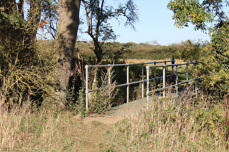
Footbridge over the Willow Brook
The path goes through some strips of maize plants - left as shelter for the pheasants -
- and then across grassland to a gate in the hedge, where we turned right towards Blatherwyck.  After a couple of hundred yards there is a bridleway sign, between agricultural buildings
shortly before the restored watermill house.
From here there is a wide track leading up towards the woods.
You follow this until it enters the wood, turning slightly left and leading down towards a field gate.  From the gate you can see the top of Fineshade Abbey buildings. 


It is possible to cross the field without losing any height, arriving at the stile above the stables, from where you follow the narrow path between fences, cross a field, and walk back uphill through a section of woodland, before crossing the cultivated field where we began this walk.


Map and details

Saturday, October 15, 2011

Fineshade recce part of walk.

Just over 5 miles.  Beautiful sunny afternoon. Lots of red kites around above field not far from Blatherwycke Lake.


If we find ourselves walking past this fellow - we've wandered off track!

Thursday, October 13, 2011

Gretton - Deene - Bulwick - Gretton

Just over 10 miles. With Barry, Eddie, Gordon, Maureen.  Weather dull, but fine.  We did the route from last week in reverse. No garmin track - I hadn't charged it up.

From the village hall, take Southfield Rd and the unsurfaced Fullen Lane track to the gate then down the hill to the four stiles, diagonally uphill to the right to the broken stile above Kirby Hall. Down through the gate next to the shop and entrance to the Hall, then along the road, over the cattle grid, past the car park and up to the entrance gate on Kirby Lane.  Cross the road - go through the deer-proof gate, and follow the path downhill until another path crosses at right angles. Turn left along this path and follow the signs a fair way above the brook.  There is another deer-proof gate. Go through this and cross a narrow band of trees - the path is visible across the field, no need to go too close to the wood called the Rookery. 
The path leads to the corner of an outbuilding of Home Farm.
Join the farm road and walk through the gate, past some metal sheep pens, and out on to the village street. Follow this as far as the old school - now part house, part village hall.


Over a stile and up across the field towards the 'tea-pot' (Aladdin's Lamp?) monument. (I'm told the man to whom this monument is dedicated loved his cups of tea!)   After this you cross a couple of fields with stiles, and come to a boggy section with a small building near by.  The path leads through trees and over three footbridges to the A43.


Cross the A43 and a very short walk to the right (towards Corby) brings you to the somewhat hidden footpath sign.
Looking back to where the Willow Brook goes under the A43.
The path follows the edge of the field, by the woods, and then over a stile to some pasture with trees.  Don't be tempted (as we were last Thursday), by the gate and bridge.
The path continues through the field, where there are a lot of bumps, which are probably the remains of a settlement deserted by the eighteenth century. [DMV = Deserted Medieval Villages. The DMV we passed on the way into Bulwick was called Henwick and is one of the 75 DMV' s in Northampton.  Pronounced Henick it is a farm/land where hens were kept. Bulwick, (yes you guessed it correctly) was where bulls were kept.  Info from Peter Hill, via Barry - many thanks!]
The path emerges into Bulwick over a stile between some houses and the Queens Head pub.
We took a break at the church - the village shop which sells food and coffee is almost opposite.


From the church we turned downhill past the old school, past the Mill House, and turned left into Red Lodge Road. We followed this across the bridge over the A43, and then turned right along a bridleway.  This climbs gradually, then turns left. At a hedge it runs right again, climbing a little more.  Laxton church spire comes into view ahead. The path runs left and crosses a couple of fields to meet the road from Deene to Spanhoe. Cross the road and continue bearing very slightly to the right.  After crossing two fields you arrive at the lake at Harringworth Lodge.  We saw plenty of birdlife today, including two or three herons. 
From here the path follows a track alongside woods, past a field of cows. The track turns right, but the path continues along the grass. Just after the end of the woods you turn right to join a track by what appears to be a disused railway cutting.
This turns right, and you go through a gate and across a large field.  The path passes through two gates in the corner of the next field, and then across two arable fields, through gates. Finally you cut across the corner of another field, near some agricultural buidlings, before turning right along a track which leads to Gretton's Kirby Road. Turn left here and continue to the village hall.


Map and details (in reverse)

Monday, October 10, 2011

Helpston Circular

Led by Barry.  With Eddie, Gordon and Maureen. A flat walk,not quite fenland, in fine, warm but windy weather. Around 7 and a half miles.  


Helpston is the birthplace of John Clare, known as the Northamptonshire peasant poet.  In his lifetime the village was in the Soke of Peterborough, part of the County of Northamptonshire. Now it is in Cambridgeshire.  There is masses of info and photographs of the village on this site.

Ready to go - outside the John Clare Cottage in Helpston, now a museum with a café. 
Almost opposite the John Clare Museum, the path leads east out of the village, and alongside a field before turning right (south) along the hedge.  We followed the field boundary, through a gap in the hedge and to the left before crossing a ploughed field ( dry, luckily) diagonally to the left, emerging at College Cottage.  We walked almost due south again before turning quite sharply to the right (west). We followed the field boundary again, almost parallel to a line of pylons.  When we met the Torpel Way we turned left and made for the edge of some woodland.  We walked along by the wood until we reached a road (Stamford Road).  Instead of walking along the road, we turned left towards more woodland, then slightly to the right towards the road again.  


Unfortunately the sweetest juiciest blackberries come with the scratchiest sharpest thorns.

At the road we turned left and very soon took the path to the right.  You don't go through the trees which are ahead, but turn right and follow the wide grassy track through the fields. It skirts another wooded area, then goes gently uphill to the Stamford Road again.  
We had a snack break here, then walked along the road as far as the farm shop (not open on Mondays), before turning right.
The path goes past an area which has been landfill - lots of meters for measuring methane. There is also a Nature reserve at Swaddywell Pit. (Swordy Well in a John Clare poem).
The former quarry and landfill site has had the topsoil replaced, and is now rich in limestone wildflowers such as bee orchid and wild carrot. There are many butterflies, and moths, as well as skylarks and buzzards.


A blowy day

We walked along the left hand side of another wooded area and then came to part of Heath Road.  There is a Roman villa underground 
though we saw no evidence of it.

We reached a track turning right from the road, just before Rice Wood, and followed it, then turned left to walk with Rice Wood on our right.
The path comes out in Helpston, and we made our way past the Almshouses 


to West Street with its memorial to John Clare and the Butter Cross. [Butter Cross at Helpston was where a weekly market took place. Customers had the added protection of knowing that traders were selling their wares by the Cross. This meant that everything was above board and the integrity of those traders was guaranteed. Who would dare sell dodgy goods under the protection of the Almighty?  Info from Peter Hill, via Barry - many thanks! ]

then had a look round St Botolph's church with its octagonal tower
before going into the café next to John Clare's cottage.


Map and details

Friday, October 7, 2011

Jurassic Way 1 - Banbury to Chipping Warden

Theoretically 11 miles, nearer 12.5 ( the garmin took a little while to pick up the satellites in this new area).   We should have set off earlier in the day to give ourselves more time to explore Middleton Cheney and Wardington.  Weather mostly fine, coolish, a couple of showers - the heaviest of them while we were having lunch.  With Marta.


From the car park in Banbury, via the shopping centre for a quick coffee, and a visit to the Tourist Information Centre to pick up another map, we made our way south along the canal, from Banbury Lock, in the direction of the water's fall, past various narrowboats and a few sculptures.
the canal
Long John Silver or Captain Hook?  I shoulda blurred out the background. 


The start of a new adventure - with Banbury Lock in the background, the Jurassic Way starts - though we couldn't find a sign for it.


 Someone's made a real effort with this waterside garden.
We're on the correct path. Just as well.


At this bridge the Jurassic Way leaves the canal and turns left, north-east heading towards the Cherwell, and the M40.  The bridge crossing the Cherwell has a plaque.

Just after crossing the bridge the path goes alongside the river and under the motorway.
 We could hear the noise clearly for quite some distance afterwards, as we walked across fields, over a railway bridge and past some agricultural buildings.


We're still on the right track
At a minor road we turned right, then left towards Warkworth.  In Warkworth, we turned left to a footpath opposite Manor Farm.  The path took us towards Overthorpe, passing a church at some distance on our right, then skirting Overthorpe along a tree lined path from which we could glimpse some splendid gardens.  We then turned right towards Middleton Cheney across fields and past allotments, down to  cross a stream and up into the large village.


We turned left and went across the by-pass ( A442) and into the High Street where we found the Take Thyme cafe and conveniently by-passed the worst shower of the day while we had our lunch.  There is a heritage trail, but we had no time to follow it today.
I hadn't realised Middleton Cheney was big enough to have a secondary school, or so many small shops. According to the village website, there are plenty of ghosts in the village as well.


From the cafe we went along Church Lane, and found the footpath between houses.  Soon after leaving the village, we crossed a field before walking alongside another one with llamas and sheep, and a tree surrounded by fallen apples which from a distance looked like unseasonal yellow flowers.
Onward and across the B4525,  over more fields, where the way is pretty clearly marked, then through a wooded area. The map was useful to check where to cross a narrow section of wood before turning right along the edge and past Chacombe House before arriving at the village itself.  The path climbs up into Chacombe through some woodland where signs are very clear.  You leave the village from the junction of Silver Street with Silver Street North.  You can see the church across the field, and there's a picnic area and a large stone.


From here the route as far as Wardington was straightforward, leading under the railway then uphill and across fields.
under the railway
some curious sheep


We had a small problem finding the way very close to Wardington,  and came out about fifty yards too far along Thorpe Road, but it was plain from then on, as the path led us round the village, but at one point (in the Close) there was a sign simply saying footpath.  We asked a local resident, who almost sent us back round the village, but finally showed us the nearest path, between some houses, and luckily the Jurassic Way was signposted at that point.  Then there was one occasion when a sign was actually pointing ahead instead of left as it should have done. This made us walk all of an extra couple of hundred yards, but finally the route to Edgecote was clear.  if we'd looked at the map instead of blithely following signs, we'd have been fine.
We met the road where there are a couple of cottages, then took the road to the right and followed it until it turned to the left into the village of Edgecote, just after the church.
From here we took a track, through a gate downhill to cross the Cherwell ( very small here), then up a gentle slope and into Chipping Warden.

Rain on lens again! 
Map and details

pdf fromNorthants C C - Banbury to Ashby St Ledgers
A video of this section - by voxley19  from August 2008 covering many of the same landmarks.